
Beeliar, Western Australia facts for kids
Quick facts for kids BeeliarPerth, Western Australia |
|||||||||||||||
|---|---|---|---|---|---|---|---|---|---|---|---|---|---|---|---|

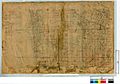
Thomsons Lake, Beeliar
|
|||||||||||||||
| Postcode(s) | 6164 | ||||||||||||||
| Area | 11.4 km2 (4.4 sq mi) | ||||||||||||||
| LGA(s) | City of Cockburn | ||||||||||||||
| State electorate(s) | Cockburn | ||||||||||||||
| Federal Division(s) | Fremantle | ||||||||||||||
|
|||||||||||||||
Beeliar is a suburb in Perth, Western Australia. It is part of the City of Cockburn. The name "Beeliar" comes from the Beeliar people, an Aboriginal group. They have a deep connection to the land in the southern part of Perth.
The word "Beeliar" is from the Noongar language. It means "river" or "water running through". An early European settler, Robert Menli Lyon, recorded this name. He interacted with the local Aboriginal people in the 1800s. Before Europeans arrived, the Beeliar area was home to the Beeliar group. They are part of the Whadjuk nation, which is a larger Noongar language group.
The Noongar people have Dreaming stories about how the landforms in Beeliar were created. They also had traditional laws for caring for the land. Old stories and archaeology show that the Beeliar-Noongar people have lived in Beeliar and nearby areas for a very long time.
Beeliar was also part of the Swan River Colony. This was the first colony in Australia not started for convicts. Later, Beeliar saw conflicts known as the Australian frontier wars. Important Aboriginal leaders like Yagan and his father, Midjegoorong, lived in this area during that time.
Since the 1900s, the borders of Beeliar have changed. During World War Two, the Australian Women's Army Service had a station near Bibra Lake, which was then part of Beeliar. After the war, Beeliar grew into a modern suburb. In the 1990s, some of Beeliar's land became a new suburb called Yangebup.
Today, protecting the environment and Aboriginal land rights are important local issues. People in Beeliar care about their natural features, especially the wetlands like Thomsons Lake.
Contents
What "Beeliar" Means
The name "Beeliar" has had different meanings over time. The early settler Robert Menli Lyon used "Beeliar" in two ways. He used it to describe a "district" or area. He also used it to refer to the language of the local Aboriginal group. Older records called the Beeliar region "Yagan territory". This area was much larger than the Beeliar suburb we know today.
Many people translate "Beeliar" as "river". "Beeliar Noongar" often means the "river peoples" of the Beeliar district. "Boodjar" is another Noongar word meaning "land". Some historians believe that most of the City of Cockburn was once "Beeliar Boodjar". This means it was the land of the Beeliar-Noongar people.
Noongar Dreaming and Creation Stories
The Dreaming of the Noongar people tells how the Waakal, or Rainbow Serpent, shaped the land. This includes the water features (called "bilya" or "beeliar"), plants, and animals in south-west Western Australia. Stories say the Waakal moved and twisted to create the hills and wetlands from Fremantle south to Mandurah. This explains how the Beeliar Wetlands were formed.
For Aboriginal people, Beeliar has always been important. It has spiritual, economic, and medicinal value. This is because the wetlands have rich soil, which helps many plants and animals grow. These resources were vital for the local Aboriginal communities.
History of Beeliar
Before European Contact
Historians believe that Beeliar and its surrounding areas were the lands of the Noongar people. This is based on oral history and early written records. Radiocarbon dating shows that Noongar people have lived here for at least 28,000 years. Archaeologists found ancient tools in the Beeliar Wetlands. This suggests people lived there often during the mid-Holocene period.
The Beeliar Aboriginal group spoke the Noongar language. They belong to the Whadjuk nation. Scholars think Noongar people have lived in the Whadjuk region, including Beeliar, for over 40,000 years. The Noongar language has different dialects across its wide region. Beeliar is considered one "clan" or group within the Whadjuk nation.

The Beeliar area was a major site for traditional Noongar ceremonies. It was also a popular meeting place. There were "long-established trails" connecting freshwater wetlands. These paths helped different Noongar groups meet for ceremonies, trade, and to gather bush medicine. Noongar groups would travel far, even to Uluru, to trade items like stones and ochres.
In the past, heavy winter rains would create a huge swamp called Yoordgoorading. This swamp might have connected to Lake Thomson and Lake Poulett. In hot, dry seasons, the land would dry out. This allowed the Noongar people to use low-intensity burning. This practice cleared dead plants, helped birds find water, and made the soil richer for food plants. The Aboriginal groups carefully managed the land in Beeliar.
After European Contact
Early European Settlement

In 1829, Captain James Stirling established the Swan River Colony. This colony included the future city of Perth and the Beeliar area. It was the first colony in Australia not set up for convicts. Stirling was the governor for several years. During this time, the number of Aboriginal people in the region was not consistently recorded.
Frontier Conflicts
The period after European settlement saw conflicts, often called the Australian frontier wars. These conflicts happened across Australia, including in Beeliar. In May 1833, a Beeliar man named Midjegoorong died during this time. Later, Midjegoorong's son, Yagan, was also killed in August 1833. Yagan was a well-known Aboriginal warrior.

Growth and Development
After Stirling left in 1838, more British convicts and settlers arrived. This led to new roads, buildings, and suburbs, including Beeliar. In 1833, Robert Menli Lyon described the Beeliar region as "the district of Midjegoorong". He said it stretched from the Swan and Canning Rivers south to Mangles Bay, and from the sea east to the Darling Scarp.

By the 1840s, British settlers officially occupied Beeliar as a suburb. They needed to grow food for the growing population in Perth. The Beeliar Wetlands became important for farming. Bibra Lake, part of the wetlands, was used for dairy farming and market gardens.
Late 1800s
In the 1890s, the Beeliar district was divided into new suburbs. The area southeast of Bibra Lake became Jandakot. Beeliar continued to exist north, west, and south of Bibra Lake. Markets were popular near "Thomsons and Kogolup Lakes".
1900s to Today
By 1913, the state government installed drains between water features in the Beeliar Wetlands and Thomsons Lake. Some older residents remember the wetlands being "different" before these drains, saying they led to the wetlands becoming "semi-dry".
From 1930 to 1945, an Australian Women's Army Service station was set up near Bibra Lake. After World War Two, Bibra Lake saw more public developments. These included a water park, ice rink, and skateboarding park. Many Aboriginal people also moved to the region for work. Beeliar and nearby suburbs were among the first in the state to have housing programs for Aboriginal people.

In 1967, most people in the Division of Fremantle, which includes Beeliar, voted "Yes" in a referendum. This allowed Aboriginal people to be included in the national population count.
In the 1980s, the Wetlands Education Centre of Cockburn was created. It uses the Beeliar Wetlands and Thomsons Lake for research and education. Noongar people continued to camp and hold ceremonies in the Beeliar area into the 1980s. The state government also started developing Beeliar Regional Park in the 1980s.

The name "Beeliar" for the suburb was officially approved in 1993. However, its borders kept changing. In 1995, part of Beeliar became a new suburb called Yangebup. Beeliar Drive now marks the boundary between Beeliar and Yangebup. This means only a part of Beeliar Regional Park is still within the suburb of Beeliar.
Geographic Features
Nature and Environment
Since the 1990s, the Beeliar Regional Park and Beeliar Wetlands are shared between Beeliar and its neighbours, Yangebup (to the north) and Wattleup (to the south). Beeliar Drive divides Beeliar from Yangebup. Russell Road marks the boundary between Beeliar and Wattleup.
The parts of Beeliar Regional Park and Beeliar Wetlands within Beeliar include Kogolup Lake and Thomsons Lake. Thomsons Lake Nature Reserve is the largest part of the Wetlands in Beeliar.
Smaller nature reserves in Beeliar are Habitat Reserve, Hakea Reserve, Owgan Reserve, and Luttrell Gardens.
Environmental Concerns
The Department of Parks and Wildlife has identified several threats to Beeliar's wetlands. These include drainage, digging, filling, pollution, changes in water levels, and saltiness. They also noted issues with weeds and insect control. Four main areas are being focused on for protection: drainage, pollution, water levels, and saltiness.
The Department reported that 406 types of native plants are found in Beeliar's natural areas. Thomsons Lake and Koholup Lake are also recognized as important Aboriginal sites under the Aboriginal Heritage Act 1972.
Urban Features
Parks and Play Areas
One of the main parks in Beeliar is Radonich Park. It has barbeque areas, exercise equipment, and a playground. Dogs are not allowed here. The park also has sports goalposts, but they are not permanent. You can rent the grounds, changing rooms, and toilets from the council. Bus route 530 goes to this park.
Another major park is Beeliar Reserve. It offers barbeque areas, a playground, and toilets. Unlike Radonich Park, it does not have exercise equipment. However, it has a cricket pitch and floodlights for sports. The Beeliar Community Centre is next to this park. There are also several walking tracks. Bus routes 530 and 531 serve Beeliar Reserve.
Smaller parks in Beeliar include Garbin Park, Systena Park, Formosa Park, Wanarie Park, Meve Park, Touchell Park, Costa Park, Diedrich Park, Mariposa Park, Wearne Park, and Peregrine Park.
Community Centre
The Beeliar Community Centre is located next to Beeliar Reserve. It has a main room that can hold 150 people and a meeting room for 50 people. Both rooms have kitchen facilities. The centre hosts events like the Beeliar Hub, a social meeting for parents with children.
Schools
Beeliar has two public schools:
- Beeliar Primary School
- South Coogee Primary School
Drive Thru Art Gallery
Beeliar is home to three artworks from the Cockburn Drive Thru Art Gallery. There are two murals and one sculpture.
- At the Beeliar Community Centre, you can see street art by Lesley King and local young people.
- Another mural is on the Beeliar Railway Abutment Bridge. It was created by Chandy Pendergrast and Aran Cummins Devereaux, with help from local groups.
- The sculpture is a metal artwork showing crops in a market garden. It was made by Dawn and Phillip Gamblen and is located at Spearwood Avenue.
Transport
Bus Services
Beeliar is served by several bus routes, connecting it to nearby areas and train stations:
- 530 and 532: Connect Cockburn Central Station to Fremantle Station, serving Beeliar Drive.
- 531: Connects Cockburn Central Station to Fremantle Station, serving Beeliar Drive and other local streets.
- 534: Connects Aubin Grove Station to Wattleup, serving Russell Road.
- 549: Connects Fremantle Station to Rockingham Station, serving Stock Road and Rockingham Road.
Demographics
According to the 2016 Census, 7,454 people live in Beeliar. About 1.7% of residents identify as Indigenous Australians. The average age in Beeliar is 33.
Most residents (62.4%) were born in Australia. Other countries of birth include England, the Philippines, New Zealand, South Africa, and Portugal. About 25.3% of Beeliar's residents say they have English ancestry.
Nearly 35% of Beeliar's residents are Catholic, which is higher than the average for Western Australia.
Most people aged 15 or over in Beeliar are married (52.2%). Many families have one parent working full-time and the other working part-time (26.3%). On average, households have 2.1 vehicles.
The majority of Beeliar's population aged 15 or over work full-time (59.6%). Popular jobs are in hospitals, primary education, supermarkets, aged care, and iron ore mining.
The average household income in Beeliar is $2045 per week. The average monthly mortgage repayments are $2167, and the average weekly rent is $400.
Images for kids
-
Districts of Cockburn's suburbs c. 1923

