Atwell, Western Australia facts for kids
Quick facts for kids AtwellPerth, Western Australia |
|||||||||||||||
|---|---|---|---|---|---|---|---|---|---|---|---|---|---|---|---|
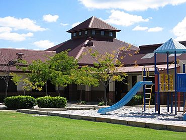
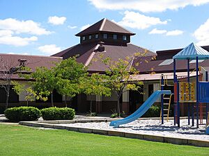
Community centre in Atwell
|
|||||||||||||||
| Postcode(s) | 6164 | ||||||||||||||
| Area | 3.5 km2 (1.4 sq mi) | ||||||||||||||
| LGA(s) | City of Cockburn, East Ward | ||||||||||||||
| State electorate(s) | Cockburn | ||||||||||||||
| Federal Division(s) | Fremantle | ||||||||||||||
|
|||||||||||||||
Atwell is a suburb located in Perth, Western Australia. It's about 21 kilometers (13 miles) south of Perth City. Atwell is part of the City of Cockburn area.
Contents
Exploring Atwell's Geography
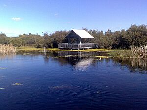
Atwell sits on the Swan Coastal Plain, which is a flat area between the coast and the Darling Scarp (a line of hills). The land here is mostly flat. You'll find many small natural and man-made wetlands (areas of land covered with water) around.
Atwell is on the edge of the Jandakot groundwater protection area. This means that new suburban developments (new housing areas) are not allowed to the east. The suburb is bordered by Armadale Road to the north and the Kwinana Freeway to the west. Tapper Road is to the east, and Gibbs Road is to the south.
Atwell's Past: A Look at History
The Whadjuk Nyungar Aboriginal people were the first people to live in this area. They have been here for about 40,000 years. The many lakes and wetlands were very important to them for food and spiritual reasons.
After Europeans settled in the Perth area in 1829, much of the land where Atwell now stands was given to G Dunnage. Later, a large part of this land became a dairy farm. It was owned by Ernest Atwell for many years. He first bought the land in the 1920s to rest horses from his livery stable business in Fremantle.
His farm grew into one of the biggest dairies in the Perth region. Over time, much of the land was sold off. However, the dairy kept running until the late 1950s. The original house and worker's cottage were later taken down when the area was cleared for new buildings.
New housing areas in Atwell started to be built in the early 1990s. Examples include the housing estates like Beeliar Parklands. The suburb has continued to grow with new estates like Atwell Waters and Harvest Lakes. Most of the land in Atwell is now used for homes, parks, roads, and some shops.
Atwell in Numbers: Quick Facts
Here are some interesting facts about Atwell, based on information from the 2016 census:
- Total Population: Atwell had 9,063 people living there.
- Median Age: The average age of people in Atwell was 33 years old. This is younger than the average for Perth (36) and Australia (38).
- Average Household Size: An average household in Atwell had 3.2 people. This is larger than the average for Perth and Australia (both 2.6).
- Australian Born: About 63.4% of people in Atwell were born in Australia.
- Median Household Income: The average household income per week was $2201. This is higher than the average for Perth ($1643) and Australia ($1438).
- Median Rent: The average weekly rent was $430.
- Median Housing Loan Repayment: The average monthly home loan payment was $2100.
Community Services in Atwell
Community Hubs
Atwell has two community centres. One is the Atwell Community Centre on Reynardson Avenue. The other is the Harvest Lakes Community Centre, which is located at Harmony Primary School.
Learning and Education
There are two primary schools in Atwell. Atwell Primary School opened in 1998 and had 773 students in 2020. Harmony Primary School opened in 2004 and had 550 students in 2020.
For older students, Atwell College is the local high school. It opened in 2008 and had 1421 students in 2020. Atwell College also has the Kim Beazley Learning Community. This program helps students with disabilities get the best education. There are also two child care centres for younger children.
Shopping and Retail
Atwell has three main shopping areas. A small centre on Lydon Boulevard opened in the late 1990s. It has a delicatessen and a Chinese restaurant. A larger centre opened on Reynardson Avenue in the early 2000s. This one has a supermarket and other food and service shops.
A third shopping centre was finished in June 2014 in Harvest Lakes. It includes a Woolworths supermarket, a cafe, Chinese and Italian restaurants, and other stores.
Fun and Recreation in Atwell
Parks and Leisure
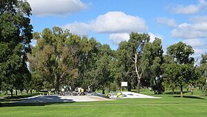
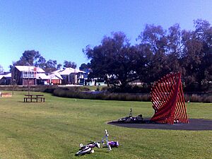
Atwell has many parks and reserves. The two biggest parks are Atwell Reserve and Harvest Lakes Park. Atwell Reserve has a lake, playgrounds, a skate park, and barbecue areas. Harvest Lakes Park also has a lake and playgrounds.
Sports and Activities
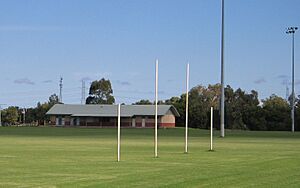
Atwell Oval is the main sports ground. It has two fields used for Football in winter and Cricket in summer. There's a clubhouse and change rooms for the Jandakot Jets Junior Football Club] (who play Australian rules football) and the Jandakot Lakes Junior Cricket Club]. You can also play Softball and Tee ball here. The sports ovals at Atwell and Harmony Primary Schools are also open to the public and have cricket pitches and nets.
Getting Around Atwell: Transport
Public Transport
Atwell has good public transport options. Regular bus services (like route 527) go north to Cockburn Central railway station and the Gateways shopping centre in Success. They also go south to Aubin Grove and Honeywood estate in Wandi.
Train services connect to Perth and Mandurah. The Aubin Grove train station opened in April 2017. It is located right between Atwell and Success.
Bus Routes
- 233: From Cockburn Central Station to Gosnells Station. This bus uses Beeliar Drive and Armadale Road.
- 518: From Cockburn Central Station to Murdoch TAFE. This bus also uses Beeliar Drive and Armadale Road.
- 523: From Cockburn Central Station to Treeby. This bus uses Beeliar Drive and Armadale Road.
- 527: From Cockburn Central Station to Aubin Grove Station. This route covers Beeliar Drive, Armadale Road, Tapper Road, Lydon Boulevard, Waters Avenue, Brenchley Drive, Beenyup Road, Harmony Avenue, Harvest Lakes Boulevard, and Lyon Road.
Train Lines
- Mandurah Line: You can catch the train from Aubin Grove Station.
Road Connections
Atwell is well-connected by roads. It's near a major transport hub for Perth's southern areas. You can get to Perth in the north and Rockingham / Mandurah in the south using the Kwinana Freeway. You can get onto the freeway from interchanges at Armadale Road and Gibbs Road. To go east to Armadale, use Armadale Road. To go west to Fremantle, use Beeliar Drive and North Lake Road.
Walking and Cycling Paths
You'll find footpaths and dual-use cycle paths on all the main roads in Atwell. A special path on Armadale Road connects to the Kwinana Freeway dual-use path. This path links to over 750 kilometers (466 miles) of cycle routes across the whole Perth Region.
 | Aaron Henry |
 | T. R. M. Howard |
 | Jesse Jackson |


