Bessemer, Alabama facts for kids
Quick facts for kids
Bessemer, Alabama
|
|||
|---|---|---|---|
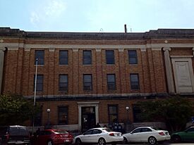
Jefferson County Courthouse in Bessemer
|
|||
|
|||
| Nickname(s):
The Marvel City
|
|||
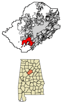
Location of Bessemer in Jefferson County, Alabama
|
|||
| Country | United States | ||
| State | Alabama | ||
| County | Jefferson | ||
| Incorporated | August 27, 1887 | ||
| Area | |||
| • Total | 40.74 sq mi (105.51 km2) | ||
| • Land | 40.53 sq mi (104.96 km2) | ||
| • Water | 0.21 sq mi (0.55 km2) | ||
| Elevation | 509 ft (155 m) | ||
| Population
(2020)
|
|||
| • Total | 26,019 | ||
| • Estimate
(2022)
|
25,264 | ||
| • Density | 626.0/sq mi (241.7/km2) | ||
| Time zone | UTC−6 (Central (CST)) | ||
| • Summer (DST) | UTC−5 (CDT) | ||
| ZIP Codes |
35020, 35021, 35022, 35023, 35111
|
||
| Area code(s) | 205 and 659 | ||
| FIPS code | 01-05980 | ||
| GNIS feature ID | 2403864 | ||
| Sales tax | 10.0% | ||
Bessemer is a city in Jefferson County, Alabama, United States. It is a suburb located southwest of Birmingham. In 2020, about 26,019 people lived there. Bessemer is part of the larger Birmingham-Hoover metropolitan area. The city grew very quickly as an industrial hub in the late 1800s and early 1900s.
Contents
History of Bessemer
The city of Bessemer was started in 1887. It was named after Henry Bessemer, who invented a way to make steel. A man named Henry F. DeBardeleben owned the company that founded the town. He hoped Bessemer would become a very important city, even more so than Birmingham.
Bessemer became a major center for making steel. This was because the area had lots of iron ore, coal, and limestone. These three things are all needed to make steel. Many people moved to Bessemer for jobs, including people from nearby farms and immigrants from Europe. By the 1950s, most of the people living in the city were African American.
Later in the 1900s, the steel industry changed a lot. Many jobs left the area. Today, steel is no longer made right in Bessemer.
Geography of Bessemer
Bessemer is about 16 miles (26 km) southwest of Birmingham.
The city covers about 40.74 square miles (105.51 km2). Most of this area is land, and a small part is water.
Bessemer is in an area rich with iron ore and limestone. These are found in the southern part of Jones Valley. Coal was also mined nearby. All these materials were important for making steel. This is why Bessemer became a big steel center from the 1890s through the 1900s. While steel is not made in Bessemer anymore, it is still made in the nearby city of Fairfield.
Bessemer's Climate
Bessemer has hot, humid summers. Its winters are usually mild to cool. This type of weather is called a humid subtropical climate.
| Climate data for Bessemer, Alabama (1991–2020 normals, extremes 1977–present) | |||||||||||||
|---|---|---|---|---|---|---|---|---|---|---|---|---|---|
| Month | Jan | Feb | Mar | Apr | May | Jun | Jul | Aug | Sep | Oct | Nov | Dec | Year |
| Record high °F (°C) | 79 (26) |
89 (32) |
90 (32) |
98 (37) |
102 (39) |
105 (41) |
108 (42) |
109 (43) |
103 (39) |
102 (39) |
90 (32) |
88 (31) |
109 (43) |
| Mean maximum °F (°C) | 72.4 (22.4) |
76.2 (24.6) |
82.4 (28.0) |
86.4 (30.2) |
91.9 (33.3) |
96.8 (36.0) |
98.1 (36.7) |
98.8 (37.1) |
95.6 (35.3) |
89.1 (31.7) |
80.3 (26.8) |
73.2 (22.9) |
100.2 (37.9) |
| Mean daily maximum °F (°C) | 55.7 (13.2) |
60.6 (15.9) |
68.3 (20.2) |
76.0 (24.4) |
83.0 (28.3) |
89.1 (31.7) |
91.8 (33.2) |
91.7 (33.2) |
87.1 (30.6) |
77.1 (25.1) |
66.0 (18.9) |
57.9 (14.4) |
75.4 (24.1) |
| Daily mean °F (°C) | 44.8 (7.1) |
48.8 (9.3) |
55.8 (13.2) |
63.1 (17.3) |
71.2 (21.8) |
77.9 (25.5) |
81.2 (27.3) |
80.6 (27.0) |
75.4 (24.1) |
64.8 (18.2) |
53.8 (12.1) |
47.3 (8.5) |
63.7 (17.6) |
| Mean daily minimum °F (°C) | 33.8 (1.0) |
37.0 (2.8) |
43.3 (6.3) |
50.1 (10.1) |
59.4 (15.2) |
66.7 (19.3) |
70.5 (21.4) |
69.6 (20.9) |
63.8 (17.7) |
52.6 (11.4) |
41.5 (5.3) |
36.7 (2.6) |
52.1 (11.2) |
| Mean minimum °F (°C) | 15.7 (−9.1) |
19.7 (−6.8) |
25.2 (−3.8) |
33.5 (0.8) |
43.5 (6.4) |
55.0 (12.8) |
61.4 (16.3) |
59.6 (15.3) |
47.9 (8.8) |
34.3 (1.3) |
24.4 (−4.2) |
20.8 (−6.2) |
13.5 (−10.3) |
| Record low °F (°C) | −6 (−21) |
3 (−16) |
6 (−14) |
15 (−9) |
36 (2) |
43 (6) |
52 (11) |
47 (8) |
37 (3) |
21 (−6) |
16 (−9) |
−1 (−18) |
−6 (−21) |
| Average precipitation inches (mm) | 5.40 (137) |
5.38 (137) |
5.42 (138) |
5.11 (130) |
4.55 (116) |
4.53 (115) |
4.76 (121) |
3.98 (101) |
3.45 (88) |
3.26 (83) |
4.45 (113) |
5.20 (132) |
55.49 (1,409) |
| Average snowfall inches (cm) | 0.4 (1.0) |
0.0 (0.0) |
0.7 (1.8) |
0.0 (0.0) |
0.0 (0.0) |
0.0 (0.0) |
0.0 (0.0) |
0.0 (0.0) |
0.0 (0.0) |
0.0 (0.0) |
0.0 (0.0) |
0.1 (0.25) |
1.2 (3.0) |
| Average precipitation days (≥ 0.01 in) | 10.4 | 10.7 | 10.9 | 9.3 | 8.5 | 10.5 | 10.9 | 9.9 | 6.4 | 6.7 | 8.2 | 10.8 | 113.2 |
| Average snowy days (≥ 0.1 in) | 0.1 | 0.0 | 0.1 | 0.0 | 0.0 | 0.0 | 0.0 | 0.0 | 0.0 | 0.0 | 0.0 | 0.0 | 0.2 |
| Source: NOAA | |||||||||||||
People in Bessemer (Demographics)
| Historical population | |||
|---|---|---|---|
| Census | Pop. | %± | |
| 1890 | 4,544 | — | |
| 1900 | 6,358 | 39.9% | |
| 1910 | 10,864 | 70.9% | |
| 1920 | 18,674 | 71.9% | |
| 1930 | 20,721 | 11.0% | |
| 1940 | 22,826 | 10.2% | |
| 1950 | 28,445 | 24.6% | |
| 1960 | 33,054 | 16.2% | |
| 1970 | 33,663 | 1.8% | |
| 1980 | 31,729 | −5.7% | |
| 1990 | 33,497 | 5.6% | |
| 2000 | 29,672 | −11.4% | |
| 2010 | 27,456 | −7.5% | |
| 2020 | 26,019 | −5.2% | |
| 2022 (est.) | 25,264 | −8.0% | |
| U.S. Decennial Census 2020 Census |
|||
How Many People Live Here?
In 2020, the city of Bessemer had 26,019 people. There were 10,492 households and 6,378 families living in the city.
Different Groups in Bessemer (2020 Census)
This table shows the different racial groups in Bessemer according to the 2020 census:
| Race | Number | Percent |
|---|---|---|
| White (non-Hispanic) | 4,877 | 18.74% |
| Black or African American (non-Hispanic) | 18,107 | 69.59% |
| Native American | 48 | 0.18% |
| Asian | 68 | 0.26% |
| Pacific Islander | 5 | 0.02% |
| Other/Mixed | 609 | 2.34% |
| Hispanic or Latino | 2,305 | 8.86% |
Bessemer's Economy
Around 1900, Bessemer was an important city in Alabama. It had a lot of money invested in factories and made many products. The main industries were mining iron ore, making iron, and producing coke. Farming was also important.
Many people, both Black and White, moved to Bessemer from rural areas to find work. African Americans slowly got jobs in factories. These jobs helped many working families earn good incomes.
Today, iron ore mining has stopped because the supply ran out. However, manufacturing is still important. For example, U.S. Pipe and Foundry makes large pipes. In 2007, U.S. Pipe decided to build a new factory there. It is the biggest maker of Ductile Iron pipes in the country.
Bessemer also used to have a large factory that made railroad cars. It was run by Pullman Standard for many years. But as the railroad industry changed, this factory closed most of its operations in the 1990s. In 2012, a company called BLOX LLC moved into the old factory. They make parts for hospitals.
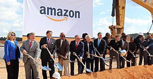
When mining and steelmaking jobs left, Bessemer lost many jobs. The city's population has gone down since 1970. In the 1980s, many people were out of work. Since then, the city has worked hard to bring in new types of businesses. For example, in 2018, Amazon announced it would build a large fulfillment center in Bessemer. This created 1,500 new jobs.
Arts and Culture in Bessemer
The Bessemer Civic Center is a place where people can enjoy music and theater performances.
Education in Bessemer
Public Schools
Bessemer has its own school system, separate from Jefferson County schools. It is called the Bessemer City School District. The schools include:
- Hard Elementary
- Jonesboro Elementary
- Greenwood Elementary
- Abrams Elementary
- Westhills Elementary
- Bessemer City Middle
- Bessemer City High School (formerly Jess Lanier)
The school board also runs the Quitman Mitchell Opportunity Center. This center has an adult learning center and a child care center.
Private Schools
Some private schools in Bessemer for students from kindergarten to 12th grade are Rock Christian School and Bessemer Academy.
Community College
Lawson State Community College has a campus in Bessemer. It used to be Bessemer Technical College. The two schools joined together in 2005.
Media in Bessemer
The Western Star is a weekly newspaper that covers news in Bessemer and nearby towns.
The Birmingham News is published three days a week. It also has a special section each week about news from Bessemer.
There is one radio station in the city, WZGX (1450 AM). It plays some Spanish-language music and programs for the growing Mexican-American community. It also broadcasts high school football games on Friday nights. You can also hear radio stations from Birmingham and Tuscaloosa in Bessemer.
Television station WDBB (channel 17) is licensed to Bessemer. It broadcasts from studios in Birmingham. You can watch all of Birmingham's TV stations in Bessemer.
Transportation in Bessemer
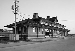
In 1911, five different railroad lines served Bessemer. Over time, fewer people traveled by train as cars became more popular. Also, the railroad industry changed a lot.
By 2006, many of these railroad companies had combined. Now, CSX Transportation and the Norfolk Southern Railway have lines that go through Bessemer. The Birmingham Southern Railroad is still in service. An important railroad feature is the "High Line." This was built to move iron ore from mines to steel factories. Even though the mines are closed, part of the High Line is still used by the Birmingham Southern.
Buses are available through the Birmingham-Jefferson County Transit Authority, which runs Max Transit bus service.
Bessemer has a small airport called Bessemer Airport. For bigger flights, people use the Birmingham-Shuttlesworth International Airport. It is about 21 miles (34 km) away.
Major highways that go through Bessemer include I-20/59, I-459, U.S. Route 11, and State Route 150. State Route 150 connects Bessemer to Hoover.
Famous People from Bessemer
- David Bonnett, NASCAR driver
- Neil Bonnett, NASCAR driver
- McKinley Boykin, professional football player
- Alex Bradford, composer, singer, arranger, and choir director
- Mildred Brown, journalist
- David L. DeJarnette, archaeologist, known as the "Father of Alabama Archaeology"
- Thornton Dial, African-American folk artist
- Nelsan Ellis, actor and playwright
- Anthony Henton, former NFL linebacker
- Mike Hill, Broadcaster for ESPN/Fox Sports
- Virginia Hill, actress and mob courier
- Andre Holland, actor
- Frank House, major league baseball player
- Bo Jackson, Heisman Trophy winner, NFL and MLB player
- Lamar Johnson, former MLB first baseman
- Eddie LeVert, singer
- Gucci Mane, rapper
- Reese McCall, former NFL tight end
- David McCampbell, naval aviator and Medal of Honor winner
- Edward McClain, Alabama state legislator
- Deborah E. McDowell, English professor and author
- Elijah Nevett, NFL player
- Kerry Rhodes, NFL player
- Curtis Rowe, professional basketball player
- DeMeco Ryans, NFL player and head coach
- Glenn Shadix, actor
- John Paul Thomas, artist, educator and scholar
- Ontario Tillman, member of the Alabama House of Representatives
- Olanda Truitt, NFL player
- Larry Watkins, former NFL running back
- Jack Whitten, abstract painter
- Andre Williams, singer and producer
- Gran Wilson, opera singer
- Rod Windsor, NFL player
- Jameis Winston, Heisman Trophy winner, quarterback for the Cleveland Browns
Notable Animal
- Matilda (chicken), a chicken who held a Guinness World Record.
See also
 In Spanish: Bessemer (Alabama) para niños
 | Bessie Coleman |
 | Spann Watson |
 | Jill E. Brown |
 | Sherman W. White |


