Calama, Chile facts for kids
Quick facts for kids
Calama
|
||||||
|---|---|---|---|---|---|---|
|
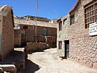
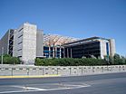
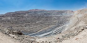
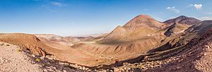
From left to right: Norte Grande, Historical town of Ayquina, Codelco corporate building, Church of San Francisco de Chiu Chiu, El Tatio and Chuquicamata
|
||||||
|
||||||
| Country | ||||||
| Region | ||||||
| Province | El Loa | |||||
| Government | ||||||
| • Type | Municipality | |||||
| Area | ||||||
| • Total | 15,596.9 km2 (6,022.0 sq mi) | |||||
| Elevation | 2,260 m (7,410 ft) | |||||
| Population
(2012)
|
||||||
| • Total | 147,886 | |||||
| • Density | 9.48176/km2 (24.55764/sq mi) | |||||
| • Urban | 136,600 | |||||
| • Rural | 1,802 | |||||
| Demonym(s) | Calamenian | |||||
| Sex | ||||||
| • Male | 70,832 | |||||
| • Female | 67,570 | |||||
| Time zone | UTC−4 (CLT) | |||||
| • Summer (DST) | UTC−3 (CLST) | |||||
| Postal code |
1399001
|
|||||
| Climate | BWk | |||||
| Website | Official website: http://www.municipalidadcalama.cl/ | |||||
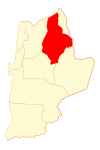
Calama is a city and a commune located in the Atacama Desert in northern Chile. It is the main city of El Loa Province, which is part of the Antofagasta Region. Calama is known as one of the driest cities in the world. It gets very little rain, only about 5 mm (0.20 in) each year.
The River Loa, which is the longest river in Chile, flows right through the city. In 2012, Calama had a population of 147,886 people. The commune of Calama also includes several communities of native people. These include the Quechua people in places like Estación San Pedro, Toconce, and Cupo. It also includes the Lickan-antay communities in Taira, Conchi Viejo, Lasana, San Francisco de Chiu Chiu, Aiquina-Turi, and Caspana.
Near Calama, there used to be a town called Chuquicamata. It was famous for having the largest open-pit copper mine in the world. In 2003, the town was closed down. This was due to environmental reasons and the mine needing more space to expand. The people who lived in Chuquicamata then moved to Calama to find new homes.
Contents
What Does the Name Calama Mean?
There are different ideas about where the name "Calama" comes from. The two most popular ideas suggest it comes from the Kunza language. This language was spoken by the Lickan-antay people, who live in the El Loa Province.
One idea, from Hector Pumarino Soto, says "Calama" comes from the Kunza words "Ckara-ama." This means "town in the middle of the water." This makes sense because, until the mid-1900s, Calama and its surrounding oasis were surrounded by the River Loa and fertile plains. It looked like an island in the middle of the desert.
Another idea, from Emilio Vaïsse, suggests "Calama" comes from "Ckolama." This means "place where partridges are plentiful." This points to a time when many partridge birds lived in the swampy areas to the west of the city.
A Look Back: Calama's History
Ancient Times
We know a lot about Calama's ancient history from different findings. These include petroglyphs (rock carvings) and caves in Yalquincha. There are also ancient burial sites called chullpas in Topáter. The famous Copper Mummy and other items found in Chuquicamata also tell us about the past.
Calama was a very important stop on the Inca Road. This was where the main Inca road met other paths that crossed the desert and mountains. It became a key resting place in the Atacama Desert. The area had large fields for growing corn and alfalfa. This meant it could provide a lot of food for Inca travelers and armies. When Diego de Almagro, a Spanish explorer, passed through Calama, the local people gave him copper horseshoes. These were made using a special Inca technique that is still a mystery today. This shows how strong the Inca influence was in Calama long ago.
Spanish Rule
When the Spanish arrived, they brought changes to the area. However, the harsh desert climate made it hard for them to control everything. The Spanish mainly focused on controlling the trade routes that crossed the desert. These routes connected the port of Cobija with the silver mines of Potosí and cattle farms in Salta and Tucumán. Calama continued to be a vital supply point for these trade routes. In the 1700s, Calama was shown on maps of the Captaincy General of Chile. It was under the control of the city of Copiapó.
Bolivian Era
After Bolivia became independent in 1825, Calama's administration changed. It became part of the Departamento de Litoral in 1829. Calama was an important town in the Atacama Province. Weekly mail traveled through Calama between Cobija and Salta-Potosí starting in 1832. In 1840, Calama became the capital of the province, which made it even more important for communication.
There were arguments between Chile and Bolivia over their borders. However, these disputes mostly focused on the central plains and the coast. This was where rich deposits of silver, saltpeter, and guano were found. The situation became very tense. On February 14, 1879, Chilean troops invaded the port of Antofagasta. Bolivia then declared war on Chile on March 1.
Chilean Era
After the war, Calama became part of Chile. Its administrative role changed, but it slowly gained importance again. In 1888, under President José Manuel Balmaceda, Calama became a municipality. This meant it had its own local government starting on October 13. Before that, in 1886, Calama was chosen as a station for the Antofagasta-Bolivia Railway. This railway helped speed up trade and travel through Calama even more.
Calama's Location and Weather
Calama is located in a unique area with two main features: the desert and the Andes Mountains. The city sits at an elevation between 2,000 and 3,000 m (6,562 and 9,843 ft). It has a desert climate (BWk), which means it's very dry. The total rainfall each year is usually less than 35 millimetres (1.4 in).
The average temperature in Calama is about 11.2 °C (52.2 °F) throughout the year. However, there are big temperature changes between day and night. During the day, temperatures can be over 20 °C (68 °F). But at night, especially in winter, they can drop below 0 °C (32 °F). In summer, temperatures can even go above 30 °C (86 °F). Light winds usually blow from the east in the mornings, and stronger winds from the west come in the afternoons.
| Climate data for Calama (1991–2020, extremes 1966–present) | |||||||||||||
|---|---|---|---|---|---|---|---|---|---|---|---|---|---|
| Month | Jan | Feb | Mar | Apr | May | Jun | Jul | Aug | Sep | Oct | Nov | Dec | Year |
| Record high °C (°F) | 31.2 (88.2) |
30.4 (86.7) |
29.8 (85.6) |
29.6 (85.3) |
28.8 (83.8) |
30.6 (87.1) |
30.6 (87.1) |
30.3 (86.5) |
29.8 (85.6) |
30.4 (86.7) |
30.0 (86.0) |
30.3 (86.5) |
31.2 (88.2) |
| Mean daily maximum °C (°F) | 24.8 (76.6) |
24.7 (76.5) |
24.3 (75.7) |
23.6 (74.5) |
22.3 (72.1) |
21.4 (70.5) |
21.1 (70.0) |
22.4 (72.3) |
23.4 (74.1) |
24.3 (75.7) |
24.8 (76.6) |
25.0 (77.0) |
23.5 (74.3) |
| Daily mean °C (°F) | 15.8 (60.4) |
15.9 (60.6) |
15.1 (59.2) |
13.6 (56.5) |
11.9 (53.4) |
10.9 (51.6) |
10.3 (50.5) |
11.4 (52.5) |
12.3 (54.1) |
13.3 (55.9) |
14.0 (57.2) |
15.0 (59.0) |
13.3 (55.9) |
| Mean daily minimum °C (°F) | 6.8 (44.2) |
7.1 (44.8) |
6.0 (42.8) |
3.7 (38.7) |
1.6 (34.9) |
0.3 (32.5) |
−0.4 (31.3) |
0.4 (32.7) |
1.2 (34.2) |
2.3 (36.1) |
3.2 (37.8) |
4.9 (40.8) |
3.1 (37.6) |
| Record low °C (°F) | −3.0 (26.6) |
−4.0 (24.8) |
−3.0 (26.6) |
−9.5 (14.9) |
−7.6 (18.3) |
−9.1 (15.6) |
−9.6 (14.7) |
−12.5 (9.5) |
−7.0 (19.4) |
−7.5 (18.5) |
−6.0 (21.2) |
−2.2 (28.0) |
−12.5 (9.5) |
| Average precipitation mm (inches) | 0.4 (0.02) |
1.4 (0.06) |
0.8 (0.03) |
0.2 (0.01) |
1.3 (0.05) |
0.6 (0.02) |
1.0 (0.04) |
0.8 (0.03) |
0.1 (0.00) |
0.0 (0.0) |
0.0 (0.0) |
0.0 (0.0) |
6.6 (0.26) |
| Average precipitation days (≥ 1.0 mm) | 0.2 | 0.3 | 0.2 | 0.1 | 0.2 | 0.2 | 0.2 | 0.2 | 0.0 | 0.0 | 0.0 | 0.0 | 1.5 |
| Average relative humidity (%) | 42 | 47 | 47 | 39 | 34 | 34 | 33 | 31 | 32 | 32 | 31 | 36 | 37 |
| Mean monthly sunshine hours | 353.4 | 305.1 | 319.3 | 312.0 | 306.9 | 297.0 | 310.0 | 316.2 | 321.0 | 356.5 | 363.0 | 365.8 | 3,926.2 |
| Mean daily sunshine hours | 11.4 | 10.8 | 10.3 | 10.4 | 9.9 | 9.9 | 10.0 | 10.2 | 10.7 | 11.5 | 12.1 | 11.8 | 10.8 |
| Source 1: Dirección Meteorológica de Chile | |||||||||||||
| Source 2: NOAA (precipitation days 1991–2020), Universidad de Chile (sunshine hours) | |||||||||||||
Mountains and Land Around Calama
The western side of Calama is marked by mountain peaks. These are part of the foothills of the Loa River. North of Calama, these mountains have different names, like Sierra Moreno, Cerros Chuquicamata, and Cerros de Montecristo. The highest point is Cerro Poquis, which is 4,589 metres (15,056 ft) tall and located north of Chuquicamata.
South of Cerro Poquis, the foothills of the Cordillera de Domeyko begin. These mountains also form the southern border of the district. They are known as Sierra de Limón Verde and Cordon Barros Arana. The Loa River flows from east to west, creating a flat area. This is where the city of Calama and its oasis are located.
How Many People Live in Calama?
According to a 2002 census by the National Statistics Institute, Calama covers an area of 15,596.9 km (9,691 mi). At that time, it had 138,402 residents. This included 70,832 men and 67,570 women. Most of these people, about 136,600 (98.7%), lived in urban areas (cities). Only 1,802 people (1.3%) lived in rural areas (the countryside). Between 1992 and 2002, the population of Calama grew by 3.6%, which means 16,595 more people moved there.
How Calama is Governed
As a commune, Calama is a local administrative area in Chile. It is managed by a municipal council. This council is led by an alcalde, which is like a mayor. The alcalde is chosen directly by the people every four years. From 2008 to 2012, the alcalde was Esteban Velásquez Núñez.
Calama is also part of Chile's electoral system. It is represented in the Chamber of Deputies (one of Chile's law-making bodies) by Marcos Espinosa and Felipe Ward. These representatives are part of the 3rd electoral district, which also includes Tocopilla, María Elena, Ollagüe, and San Pedro de Atacama. In the Senate (the other law-making body), Calama is represented by Carlos Cantero Ojeda and José Antonio Gómez Urrutia. They represent the 2nd senatorial area, which is the entire Antofagasta Region.
Getting Around Calama
Calama has its own airport, called El Loa Airport. This airport helps people travel to and from the city.
See also
 In Spanish: Calama para niños
 | Frances Mary Albrier |
 | Whitney Young |
 | Muhammad Ali |


