
Carnmoney facts for kids
Quick facts for kids Carnmoney
|
|
|---|---|

Carnmoney
|
|
| Population | 2,775 (2001 Census) |
| • Belfast | 6.3 miles (10.1 km) |
| District |
|
| County | |
| Country | Northern Ireland |
| Sovereign state | United Kingdom |
| Post town | NEWTOWNABBEY |
| Postcode district | BT36 |
| Dialling code | 028 |
| EU Parliament | Northern Ireland |
| UK Parliament |
|
| NI Assembly |
|
Carnmoney is a place in County Antrim, Northern Ireland. Its name comes from the Irish words Carn Monaidh, which mean "cairn of the bog". A cairn is a pile of stones, often used as a landmark.
Carnmoney is part of the larger area called Newtownabbey. It's about 7 kilometers (4.3 miles) from the center of Belfast. One of the most famous spots in Carnmoney is its large graveyard. This graveyard is located on the side of Carnmoney Hill, which is a big landmark in the area. Carnmoney Hill also has a special woodland nature reserve.
Contents
A Look Back in Time

Carnmoney started as a small settlement. It grew up around a special holy well (which you can still see today), a river called Glas-na-bradan, and Carnmoney Hill. Long ago, this area was a Norman town known as Coole or Le Coule. Sadly, this town was destroyed many times during battles between the English, Irish, and Scots, so nothing is left of it today.
Bits of an old road, called the Old Irish Highway, can still be seen. This road used to connect Carrick to Antrim and passed through the old Norman town. The name Carnmoney now refers to what was once known as Ballyduff village.
Carnmoney Presbyterian Church
Carnmoney Presbyterian Church is one of the oldest Presbyterian churches in all of Ireland. It was built in 1657. Before that, there was another meeting house on the same spot, dating back to 1622.
Learning in Carnmoney
There are several schools in Carnmoney, all for primary school-aged children. They are managed by the Education Authority.
- Ashgrove Primary School
- Carnmoney Primary School
- St Bernard's Primary School (also managed by the Council for Catholic Maintained Schools)
- St Mary's on the Hill (also managed by the Council for Catholic Maintained Schools)
- St. McNissis Primary School (also managed by the Council for Catholic Maintained Schools)
- Mossley Primary School
- HillCroft Special Needs School
- EarlView Primary School
Who Lives in Carnmoney?
According to the 2001 UK census, Carnmoney had a population of 2,765 people. However, the number of people living there has grown a lot since then.
- About 18% of the people were under 16 years old.
- About 22% of the people were over 60 years old.
- Slightly more than half of the population (52.5%) were female, and 47.5% were male.
- Most people (83.3%) were from a Protestant or other Christian background, while 13% were from a Roman Catholic background.
- The average age in Carnmoney was 40 years old.
Exploring Carnmoney's Land
Carnmoney Hill

Carnmoney Hill is a tall hill that rises 232 meters (761 feet) above Newtownabbey. You can see it from many places, including Belfast Lough and the M2 and M5 motorways. The eastern side of the hill is mostly covered by old woodlands, with grassy areas and other natural spaces mixed in. The very top of the hill has a volcanic cap, but the slopes are made of limestone and flint.

The Woodland Trust and Antrim and Newtownabbey Borough Council own a large part of the eastern side of the hill. The rest of the hill, including the top, is privately owned. Even though some parts are private, there are many paths that people often use to walk to the top.
An old fort called Dunanney Ráth stands proudly overlooking Carnmoney Cemetery. This ráth (which is a type of circular fort) might be from Celtic times, around 500 BC. Long ago, fairs and festivals were held here. In 1556, a leader named the Earl of Sussex met with Irish chieftains at Dunanney. The name Dunanney can mean "The Fort of the Assemblies" or "The Fort of the Watery Place." There's another ráth to the east of Dunanney.
While Dunanney Ráth is on private land, the part of Carnmoney Hill owned by the Woodland Trust is open to the public all year round.
An amazing event happened here in 1910! A woman named Lilian Bland built and flew her own aircraft from Carnmoney Hill. It was the first biplane ever built in Ireland.
The hill is home to many different types of plants and animals. You can find meadows full of flowers, wet areas, shrub land, old hedgerows, and different kinds of woods.
From Carnmoney Hill, you can get great views of Belfast city, Cave Hill, Newtownabbey, Carrickfergus, and Bangor. On a clear day, you can even see the Mourne Mountains, Slemish Mountain, and the western coast of Scotland!
Carnmoney Cemetery
Carnmoney Cemetery is very well known in Belfast. It's a large cemetery divided into two main parts. A special Cross of Sacrifice was put up in the cemetery after the First World War to remember those who died. There are 46 Commonwealth burials from the First World War and 44 from the Second World War here.

Local Areas in Carnmoney Parish
The civil parish of Carnmoney includes several smaller areas called townlands.
B
- Ballycraigy
- Ballyduff
- Ballygolan
- Ballyhenry
- Ballyhowne
- Ballyvesey
C
- Carnmoney
- Carnmoney Bog
- Carnmoney Glebe
- Collinward
- Croghfern
D
- Drumnadrough
- Dunanney
G
- Glengormley
J
- Jordanstown
M
W
- White Abbey
- White House
Images for kids
-
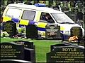
Police patrol Carnmoney cemetery
