Carrickmore facts for kids
Quick facts for kids Carrickmore
|
|
|---|---|
 |
|
| Population | 612 (2011) |
| Irish grid reference | H630574 |
| • Belfast | 52 mi (84 km) |
| District |
|
| County | |
| Country | Northern Ireland |
| Sovereign state | United Kingdom |
| Postcode district | BT79 |
| Dialling code | 028 |
| EU Parliament | Northern Ireland |
| UK Parliament |
|
| NI Assembly |
|
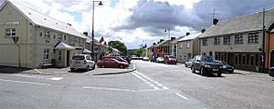
Carrickmore is a village in County Tyrone, Northern Ireland. Its name comes from the Irish words An Charraig Mhór, which means "the big rock". The village is located in the middle of the county on a raised area often called "Carmen". It sits between the towns of Cookstown, Dungannon, and Omagh. Another name for Carrickmore is Termon Rock, because it's part of the Termonmaguirk parish and is built on a rocky hill. In 2011, about 2,330 people lived in the Termon Ward, which includes Carrickmore.
Contents
Discovering Carrickmore's Past
Carrickmore has a very long history, going back thousands of years before Christianity. The area is full of old stories and legends, especially those linked to Saint Colmcille. You can still find places like the saint's well, chair, and bed here today! Many ancient monuments are found around Carrickmore, including stone circles, standing stones, and old forts called raths.
Important People and Events
- Dean Brian Maguirc College: This school is named after Dean Brian McGurk. He was an important church leader who helped Saint Oliver Plunkett during a tough time for Catholics called the Penal Times. Dean McGurk died at 91 years old in Armagh Gaol.
- Remembering History: Carrickmore holds an annual event to remember the 1916 Easter Rising. This was a very important moment in Irish history. They also have a ceremony to remember people who died during The Troubles since 1969.
- Famous Locals: Two important historical figures, Joseph McGarrity and Patrick McCartan, came from the Carrickmore area. Joseph McGarrity even helped pay for the 1916 Easter Rising.
- Kurt Cobain's Roots: Did you know that Kurt Cobain, the lead singer of the famous band Nirvana, has family roots in Carrickmore? His ancestors, Samuel and Letitia Cobain, left the area in the 1800s and moved to America. Kurt Cobain was a fifth-generation descendant from these emigrants.
Places to Explore in Carrickmore
Carrickmore has many interesting spots to visit, each with its own story!
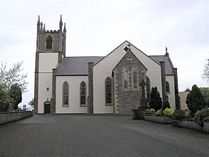
- Mullinalap Monastic Settlement: This was an early Christian settlement built on an even older Celtic site. People from all over Ireland and Europe used to come here. They believed water from a well at this site had healing powers. Saint Colmcille started a monastery here in 550 AD. You can find it on the hill next to St Colmcille's Roman Catholic Church.
- Dunmisk Fort: This ancient site is thought to be one of Ireland's first industrial centers from prehistoric times. During an archaeological dig in the 1980s, experts found proof that glass was made here! This shows that not all glass was brought in from other places. They also found a large monastic settlement and a cemetery with over 400 graves. You can reach it from the main Galbally to Carrickmore Road.
- Creggandevesky Court Tomb: This ancient tomb was built between 5,000 and 6,000 years ago during the late Stone Age. It was a burial chamber, and the courtyard was used for special ceremonies. People back then often buried objects with the dead because they believed in life after death. It's about four miles from Carrickmore, off the Loughmallon road.
- Patrician Hall: This is a lively community center in the middle of the village. It hosts arts, culture, and many other events. In the 1960s and 70s, it was famous across Ireland for its live music shows. Many famous people have appeared here, including Van Morrison, Roy Orbison, Liam Neeson, and Seamus Heaney. It also hosts the annual Mid-Ulster Drama Festival every March.
- The National Graves Monument: This monument remembers republicans who died during the Anglo-Irish conflict. It's located near the town center, at the junction of Drumnakilly Road and Mullanmore Road.
- Bernish Glen: This beautiful natural area is a striking landmark. It's named after a famous local highwayman, Shane Bernagh Donnelly. The area is well-known for its wild blueberries, called 'blaeberries' or 'fraughan' by locals. People used to pick them every year at the Blaeberry Sunday festival in late July.
- Tree of Fortune (Crann na deis): This old tree is located below the Mullinalap Monastic Settlement. Local stories say it's a portal to another world, like Mag Mell. One legend tells of a "Fear Dubh" (dark man) who would play a betting game with people. If they won, their wishes came true; if they lost, their souls were his forever. The Tuatha Dé Danann, led by Lugh, eventually banished the spirit and sealed the portal by planting this tree. The area was then declared a sanctuary, which is how it got the name Termon. It's believed the tree is now guarded by the Aos Sí, who are descendants of the Tuatha Dé Danann.
- High Cross: This tall stone cross was built to celebrate the Jubilee 2000, a special Roman Catholic event. It stands 24 feet high and features carvings of scenes from the lives of Irish saints. It also shows a modern image of Pope John Paul II placing a prayer in the Western Wall in Jerusalem in 2000. Other carvings include the Nativity, the Crucifixion, and the three patron saints of Ireland: Ss. Patrick, Brigid, and Columcille.
- Quinns Corner: This elevated spot in the village center was once a hotel and then a pub. It became famous as a place where many important political figures gave speeches, including Michael Davitt, Roger Casement, and Éamon de Valera. It's also where local sports teams celebrate their victories!
- The Nally Stand: When the GAA headquarters in Dublin (Croke Park) was rebuilt, one of its stands was moved to Carrickmore! Now, spectators can sit in this famous stand at the local GAA ground to watch a match.
- Carrickmore Airfield: This small airfield on the edge of Carrickmore offers flying lessons and fun flights over the countryside. The local C-More Flying Club runs it and hosts annual community fun days. These events include "Fly-In's" where planes from all over Ireland and Britain, even the Irish Coast Guard Helicopter, come to visit!
Getting Around Carrickmore
Carrickmore is served by Ulsterbus route 86. This bus travels between Dungannon and Omagh, passing through towns like Donaghmore and Pomeroy.
Carrickmore also used to have a railway station. It opened in 1861 but closed in 1959. The railway line itself closed a few years later in 1965.
Carrickmore's Location
The area of Carrickmore is made up of several townlands. These townlands share borders with other parishes like Ballygawley, Beragh, and Kildress. Carrickmore also shares the Termonmagurk parish with Loughmacrory and Creggan. Interestingly, Carrickmore is home to the smallest townland in Ireland, called Old Church Yard.
Sports in Carrickmore
Sports are a big part of life in Carrickmore! The two main sports clubs in the village are Carrickmore St. Colmcille's, a Gaelic Football club, and Éire Óg Hurling and Camogie Club. Carrickmore also has a strong history in boxing, with many champions coming from the area. There are also local clubs for walking, running, cycling, and sports for people with special needs.
Jobs in Carrickmore
The main types of jobs in Carrickmore are in engineering, construction, quarrying (working with stone), information technology (IT), and farming. The larger towns nearby, like Cookstown, Dungannon, and Omagh, also offer many other job opportunities.
Carrickmore Townland History
The townland of Carrickmore is located in the historic barony of Omagh East and the civil parish of Termonmaguirk. It covers an area of 915 acres.
The number of people living in the townland decreased during the 1800s:
| Year | 1841 | 1851 | 1861 | 1871 | 1881 | 1891 |
|---|---|---|---|---|---|---|
| Population | 258 | 234 | 240 | 230 | 219 | 178 |
| Houses | 54 | 47 | 44 | 43 | 40 | 38 |
In 1891, the village of Carrickmore (which used to be called Termon Rock) was part of the Carrickmore townland. It covered about 11 acres.
The townland also contains two important historical sites: Graveyard: Relignaman or Relicknaman and Graveyard: Relignalaniv.
See also
In Spanish: Carrickmore para niños
 | James Van Der Zee |
 | Alma Thomas |
 | Ellis Wilson |
 | Margaret Taylor-Burroughs |


