
Colima (city) facts for kids
Quick facts for kids
Colima
|
||
|---|---|---|
      From top left: Basílica Menor, Madero Street, Precious Blood of Christ Parish, Libertad Garden, Hotel Ceballos, and panoramic of the city
|
||
|
||

Colima
Location in Colima

Colima
Location in Mexico
|
||
| Country | Mexico | |
| State | Colima | |
| Municipality | Colima | |
| Founded | January 20, 1523 | |
| Elevation | 1,000–1,804 ft (305–550 m) | |
| Population
(2020)
|
||
| • Seat | 146,965 | |
| Metro area GDP (PPP, constant 2015 values) | ||
| • Year | 2023 | |
| • Total | $9.9 billion | |
| • Per capita | $22,900 | |
| Time zone | UTC−6 (CST) | |
| • Summer (DST) | UTC−5 (CDT) | |
| Postal code |
28000
|
|
| Area code(s) | 312 | |
| Website | www.colima.gob.mx | |

Colima (Spanish pronunciation: [koˈlima]) is an important city in central-western Mexico. It is the capital of the state that shares its name. Colima is also the main city of the municipality of Colima. It is located close to the Colima volcano, which marks the border between the state of Colima and Jalisco. Colima is the second largest city in its state by population, after Manzanillo.
In 2011, a study by FDI Intelligence, part of the Financial Times, ranked Colima as the best small city to live in Mexico. It was also ranked tenth in Latin America. This ranking looked at things like its economy, human resources, cost of living, quality of life, and how good it was for businesses.
Contents
- Exploring Colima: Fun Places to Visit
- Colima Municipality: How the City and Area Work Together
- Colima's Economy: How People Make a Living
- Colima's Rich History
- Colima's Geography: Mountains, Rivers, and Climate
- Colima's Delicious Food
- Ancient Sites: Archaeology in Colima
- Education: Learning in Colima
- Transportation: Getting Around Colima
- International Connections
- Images for kids
- See also
Exploring Colima: Fun Places to Visit
The heart of Colima is a beautiful square called Jardín Libertad, or Liberty Garden. In the middle, you'll find a kiosk that came all the way from Belgium in 1891! The garden is full of palm trees and other green plants. On weekends, you can often enjoy live music here.
Hotel Ceballos and Local Treats
Right by Jardín Libertad is the famous Hotel Ceballos. It has cool arches and outdoor dining areas. When you visit, you can try delicious local foods like atole (a warm drink with milk), white pozole (a hearty soup), tatemado (pork dish), mole pipián (a special sauce), and sopes (thick tortillas with toppings).
Next to the hotel is Andador Constitución, a street just for walking. Here, you can find old-fashioned shops, like the Joven Don Manuelito ice cream shop, which has been open since 1944! You might also see street musicians and artists. At the end of this street, there's a large shop run by a government agency called DIF. It sells amazing handicrafts from the state, including traditional clothes and ceramic figures of the Mexican hairless dog, also known as the Xolo.
Colima's Cathedral and Government Palace
The main church in Colima is the Basílica Menor Catedral de Colima. The building you see today was built in 1894. It has been repaired many times, especially after earthquakes. It's built in a Neoclassical style with two towers and a dome.
Next to the cathedral is the old state government palace. This two-story building also has a French Neoclassical design and was finished in 1904. On its front, there's a bell, which is a copy of the one Miguel Hidalgo y Costilla rang to start the Mexican War of Independence. There's also a clock from Germany! Inside, you'll find a lovely courtyard and a main staircase with a mural painted by local artist Jorge Chávez Carrillo in 1953.
Behind the cathedral is Jardin Gregorio Torres Quintero park. It has mango, tabachin, and palm trees. You can find stands selling handicrafts, souvenirs, and food. Try the local drink called "bate," made from toasted chia seeds and honey. Another popular drink is "tuba," made from a palm tree flower with apple, cucumber, and peanuts.
Museums and Parks
On one side of Jardín Libertad is the Museo Regional de Historia, or the regional history museum. This building was a private home in 1848 before becoming a hotel and then a museum in 1988. The first floor shows ancient artifacts and a replica of a shaft tomb, which is a special type of burial from this area. It shows how people were buried with their belongings and even their Xolo dogs, who they believed would guide them to the next world. The upper floor tells the history of the state from the Spanish Conquest to the Mexican Revolution.
A short walk from Jardín Libertad is Jardín Hidalgo, a park dedicated to Miguel Hidalgo y Costilla. It has an accurate equatorial sundial with explanations in different languages. Nearby is the Temple of San Felipe de Jesús church and the simple Del Carmen Chapel.
Also close by is the Pinacoteca Universitaria Alfonso Michel. This museum focuses on the history of art in Colima. It's named after Alfonso Michel, a famous 20th-century artist from Colima known for his cubist and impressionist paintings. The museum building itself is traditional, with arched corridors. It has a permanent collection and also shows works by local artists.
The Piedra Lisa Park is named after a huge, smooth stone that was thrown there by the Colima Volcano long ago. A local story says that if you slide down the stone three times, you'll either stay in Colima or come back someday! This park also has an interactive science museum called the Xoloescuintle.
The Conjunto de la Secretaría de Cultura (Secretary of Culture Complex) is a group of buildings around a central plaza. In the plaza, you'll see a sculpture called "El Toro" by Juan Soriano. The complex includes buildings for art workshops, a cultural center with art exhibitions, and the María Ahumada de Gómez Museum of Western Cultures. This museum has a large collection of ancient artifacts from the region, showing the history and daily life of pre-Hispanic cultures.
The Palacio Legislativa y de Justicia (Legislative and Justice Palace) is a modern building designed by Xavier Yarto and Alberto Yarza. Inside, you can see a mural called "La Universialidad de la Justicia" by Gabriel Portillo del Toro.
The Museo Universitario de Artes Populares María Teresa Pomar is dedicated to the region's handicrafts and folk art. It also shows exhibits about local festivals and traditions. You can see festival costumes, toys, masks, cooking tools, and many other handmade items.
Colima Municipality: How the City and Area Work Together

The city of Colima is the main government center for 145 smaller communities around it. The most important of these are Tepames, Piscila, El Chanal, and Los Asmoles. Colima city is the only urban area, meaning most people live there and work in shops, services, or some industries.
The municipality covers an area of 668.2 square kilometers. It shares borders with other municipalities like Cuauhtémoc, Ixtlahuacán, Tecomán, Coquimatlán, and Villa de Álvarez. To the east, it borders the state of Jalisco, and to the southeast, Michoacán. The local government is led by a municipal president, a síndico (another official), and eleven representatives called regidores.
About a quarter of the state's total population lives in this municipality. Most of these people (about 92%) live right in Colima city. In 2005, only a small number of people (574) spoke an indigenous language. Most of the population (over 95%) is Catholic. As of 2010, the municipality had a total population of 146,904.
The city has radio stations, two TV channels (5 and 11), cable TV, and eight newspapers. Major highways connect Colima to Manzanillo and Guadalajara. You can also travel by train on the Guadalajara-Colima-Manzanillo line, or by bus from the Central Camionera and Central Suburbana de Autobuses stations. The regional airport, Miguel de la Madrid Airport, also serves the city.
Colima's Economy: How People Make a Living


Colima city is the main economic hub for the entire state. In the smaller communities outside the city, farming is still the most important way to earn money. Colima has been recognized as a top small city for living in Mexico and Latin America. It's one of many urban areas in Mexico that contribute a lot to the country's economy.
Colima is known for its strong commerce (buying and selling goods) and services (like tourism and other helpful businesses). It also has a low unemployment rate, meaning many people have jobs. However, the city could improve its technology sector.
Farming and Industry
Farming happens mostly outside the city in rural areas. The municipality has about 70,000 hectares (that's like 173,000 acres) of land used for growing crops. The soil here is very fertile. Important crops include corn, rice, melons, sugar cane, and limes. Other crops are sorghum, tomatoes, beans, peanuts, mangoes, and bananas. People also raise animals like chickens, cattle, horses, and pigs. About nine percent of the population works in agriculture.
There aren't many valuable minerals to mine in the municipality, except for some limestone. Industry is mainly focused on processing and packaging food, especially rice. Some factories also make oils, soaps, and sweets. About twenty percent of the population works in these industries.
Commerce and Services
About 68 percent of the people in Colima work in commerce and services. Colima is a major center for trade in the state, distributing goods for local use. The city has five traditional markets, eight department stores, and many small shops.
Even though it's the capital, Colima isn't the state's biggest tourist spot. Places like Manzanillo and Comala are more popular for tourists because they have more famous cultural and historical sites. However, Colima is still a very important center for business and services.
Colima's Rich History
The Name of Colima
The name "Colima" comes from the Nahuatl word "Coliman." This word refers to the ancient area before the Spanish arrived. It's thought to mean "place conquered by our grandfathers" or "dominion of the old god or god of fire," referring to the nearby volcano.
The city's official seal was chosen in 1986. It has red colors to show the warm climate and local plants like bougainvillea and palm trees. Blue represents water, and you can see an image of King Collimán. Other symbols include an open book (for education), the two volcanoes of the state, and the famous Mexican hairless dogs (xolos).
Colima's nickname is "Ciudad de las Palmeras," which means "City of the Palms."
Colonial Times
The Spanish first settled Colima on July 15, 1523, in a place called Caxitlán, near modern-day Tecomán. This settlement was founded by Gonzalo de Sandoval under orders from Hernán Cortés to control the newly conquered lands. Because of diseases, the settlement was moved on January 20, 1527, to its current location. It was renamed Villa de San Sebastián Colima. This was the eighth settlement founded by the Spanish in New Spain. Hernán Cortés himself visited in 1535.
The 1800s: Independence and Growth
Miguel Hidalgo y Costilla, a key figure in Mexico's independence, was a priest in Colima in 1792. This led to a friendship with Father José Antonio Díaz, who became a leader in the area during the Mexican War of Independence. The city saw battles during this war. For example, in 1811, insurgents took control of the city. Later, when royalist troops took it back, many insurgents were executed.
After Mexico gained independence in 1821, Colima was part of the province of Guadalajara. The city worked hard to become its own separate state. This finally happened on October 4, 1824, when Colima separated from Jalisco. However, its independence wasn't always stable, and it sometimes went back and forth between being a state and a province of Jalisco. Still, the city always remained the center of government for the area.
In 1824, the town of Colima was officially recognized as a city. An annual city fair was approved in 1825, lasting for fifteen days in March.
The state and its capital were officially recognized in the 1857 Constitution. Benito Juárez, a famous Mexican president, even stayed in Colima in 1858. During the French Intervention, Colima was taken by forces loyal to Emperor Maximilian I. But in 1867, Mexican forces took the city back, helping to restore the Mexican Republic. The Manzanillo-Colima railroad opened in 1889, connecting the city to the coast.
From Revolution to Today
Francisco I. Madero, another important leader, visited Colima in 1909. When the Mexican Revolution began, his supporters entered the city in 1911. Between 1914 and 1916, forces under Juan José Ríos took control and started social and economic changes. Venustiano Carranza, another revolutionary leader, visited in 1916.
Since the Revolution, Colima has continued to grow. The city has faced challenges like managing traffic, keeping roads in good condition, and ensuring enough public transportation. It also works on proper waste management and protecting the environment. For example, the city generates a lot of garbage every day, and there are efforts to improve how it's handled. The city has also seen a lot of new buildings, especially in the north and south.
Colima's Geography: Mountains, Rivers, and Climate

Most of the Colima municipality is located in the Valley of Colima. About half of the area has rugged, mountainous terrain, mostly in the south and southeast. These mountains are part of the Colima Volcano area and the Cordillera Costera del Sur, which is part of the Sierra Madre del Sur. These mountains separate the region from the ocean.
In the north and northwest, there's a flat area called the Cerro de los Gallos. Some local mountain peaks include Los Mezcales, El Alcomún, and La Yerbabuena.
Important rivers in the municipality are the El Colima, Salado, and Naranjo (or Coahuayana) rivers. Smaller streams like El Zarco and Cardona flow into these rivers. During the rainy season, other streams like El Manrique also flow.
The climate in Colima is mostly semi-humid, with most rain falling in the summer. The average yearly temperature is between 24 and 26 °C (75 and 79 °F). Some areas near the Cuauhtémoc border are a bit cooler, and some communities like Estampilla are hotter and drier.
In the center, west, and southeast, the main type of natural plant life is low-growth rainforest. About three-quarters of these trees lose their leaves during the dry season. In the highest parts of the mountains, you can find some forests of holm oak trees.
The growth of the city has put some pressure on the local environment. New buildings sometimes clear tropical plants, and there are challenges with garbage and wastewater. For example, the Manrique River is known to have a lot of garbage. However, there are also successful programs to plant new trees in the municipality.
Climate: Warm and Rainy Summers
Colima has a tropical savanna climate. This means it's always warm, with very dry weather from November to May. Then, from June to October, there's heavy rainfall. Sometimes, the city can be affected by hurricanes, which bring a lot of rain.
| Climate data for Colima (1951–2010) | |||||||||||||
|---|---|---|---|---|---|---|---|---|---|---|---|---|---|
| Month | Jan | Feb | Mar | Apr | May | Jun | Jul | Aug | Sep | Oct | Nov | Dec | Year |
| Record high °C (°F) | 38.2 (100.8) |
39.2 (102.6) |
39.8 (103.6) |
42.5 (108.5) |
42.0 (107.6) |
41.0 (105.8) |
40.4 (104.7) |
39.0 (102.2) |
39.5 (103.1) |
41.0 (105.8) |
38.9 (102.0) |
40.5 (104.9) |
42.5 (108.5) |
| Mean daily maximum °C (°F) | 31.3 (88.3) |
31.9 (89.4) |
32.9 (91.2) |
34.0 (93.2) |
34.4 (93.9) |
33.6 (92.5) |
32.4 (90.3) |
32.4 (90.3) |
31.5 (88.7) |
32.1 (89.8) |
32.4 (90.3) |
31.6 (88.9) |
32.5 (90.5) |
| Daily mean °C (°F) | 23.4 (74.1) |
23.6 (74.5) |
24.3 (75.7) |
25.5 (77.9) |
26.8 (80.2) |
27.5 (81.5) |
26.8 (80.2) |
26.6 (79.9) |
26.2 (79.2) |
26.1 (79.0) |
25.2 (77.4) |
23.9 (75.0) |
25.5 (77.9) |
| Mean daily minimum °C (°F) | 15.5 (59.9) |
15.4 (59.7) |
15.7 (60.3) |
17.1 (62.8) |
19.3 (66.7) |
21.4 (70.5) |
21.1 (70.0) |
20.9 (69.6) |
20.9 (69.6) |
20.1 (68.2) |
18.1 (64.6) |
16.2 (61.2) |
18.5 (65.3) |
| Record low °C (°F) | 7.5 (45.5) |
8.0 (46.4) |
3.0 (37.4) |
7.0 (44.6) |
10.0 (50.0) |
14.0 (57.2) |
17.0 (62.6) |
15.0 (59.0) |
13.0 (55.4) |
13.0 (55.4) |
11.0 (51.8) |
9.0 (48.2) |
3.0 (37.4) |
| Average rainfall mm (inches) | 24.2 (0.95) |
6.2 (0.24) |
4.3 (0.17) |
2.1 (0.08) |
10.9 (0.43) |
128.3 (5.05) |
205.6 (8.09) |
191.9 (7.56) |
191.0 (7.52) |
92.0 (3.62) |
17.6 (0.69) |
11.3 (0.44) |
885.4 (34.86) |
| Average rainy days (≥ 0.1 mm) | 1.4 | 0.6 | 0.3 | 0.2 | 1.1 | 11.2 | 18.1 | 17.6 | 16.7 | 7.1 | 1.5 | 1.1 | 76.9 |
| Average relative humidity (%) | 56 | 53 | 51 | 50 | 51 | 59 | 66 | 64 | 69 | 65 | 57 | 52 | 58 |
| Mean monthly sunshine hours | 233 | 240 | 268 | 252 | 263 | 185 | 165 | 184 | 161 | 207 | 229 | 213 | 2,600 |
| Source 1: Servicio Meteorológico Nacional (humidity 1981–2000) | |||||||||||||
| Source 2: Deutscher Wetterdienst (sun, 1961–1990) | |||||||||||||
Colima's Delicious Food
The traditional foods of Colima are often made with corn, local fruits, pork, and seafood from nearby coasts. Here are some popular dishes:
- Sopitos: Small, deep-fried tortillas topped with ground beef, shredded cabbage, onion, and cheese, all soaked in flavorful meat juices.
- Sopes Gordos: Medium-sized, thick tortillas that are lightly fried. They are topped with refried beans and various meats like pork tenderloin, ribs, or shredded chicken.
- Tostadas: Larger, thin, deep-fried tortillas with the same toppings as Sopes Gordos. Both Sopes Gordos and Tostadas also have shredded cabbage, onions, fresh tomatoes, a thin meat sauce, and shredded cheese.
A local type of Pozole is also very popular for lunch or dinner. Colima's pozole is made with different pork meats and is usually served "dry" (without broth), though you can find versions with broth too.
Other tasty dishes include:
- Tatemado: Pork marinated in coconut vinegar and cooked with a thick, mild, and very flavorful chili sauce.
- Pepena: Cooked internal organs from cows or pigs.
- Coachala: Ground corn cooked with shredded chicken.
- Local Tamales: Like "Pata de Mula" (mule's feet), filled with spicy beans and wrapped in corn leaves. Or "tamales de elote," filled with sweet, tender corn. "Ceniza" tamales are similar to Pata de Mula but less spicy and larger.
The nearby town of Comala is famous for its many milk products and local fresh or dried cheeses. It's also known for making sweet breads and pastries.
Colima also has many great seafood restaurants. Some traditional seafood dishes are:
- Ceviche: Raw fish chopped and "cooked" in lime juice. It's garnished with shredded carrots, cilantro, onions, tomatoes, and jalapeño peppers, then served on a deep-fried tortilla.
- Pescado a la talla: A whole fish (often red snapper) cut open, covered with chopped vegetables, wrapped in a banana leaf, and grilled over hot coals.
Traditional Drinks and Sweets
Three drinks are very special to the region:
- Tejuino: A thick, refreshing drink made with corn masa and molasses. It's served with lots of ice, salt, and lime.
- Tuba: This drink came from the Philippines. It's the sap from a coconut tree, collected by making cuts at the top of the palm. It's usually topped with peanuts, almonds, or fresh chopped fruits.
- Bate: Made with chia seeds and served with molasses.
Ponche de Comala is the only traditional alcoholic drink made in the region, produced in Comala. You can find different kinds of Ponche, some made with water (like pomegranate or prune) and some with milk (like coffee or almond). It's made using local mezcal, known as "Tuxca."
The region is also known for its interesting sweets made from coconut, called "Cocadas" or "Alfajores." Sweets made from tamarind, pineapple, or guava, as well as dried plantain, are also very popular.
Ancient Sites: Archaeology in Colima
There are two main ancient sites in the municipality: La Campana and El Chanal.
- La Campana is about fifteen minutes outside the city. It's known for a mound shaped like a bell, which gives it its name. The site covers about fifty hectares, but only a small part has been explored. It's also famous for its building style, which uses rounded river stones, and for many ancient burials found there.
- El Chanal was a thriving city between 1,000 and 1,400 AD, covering 120 hectares. Evidence shows that people here used a lot of obsidian and metals like copper and gold. Buildings at the site include a Mesoamerican ballcourt, the Plaza of the Altars, the Plaza of Day and Night, and the Plaza of Time. Staircases on pyramid bases often have symbols similar to those found in central Mexico, which might have been used for a calendar.
Education: Learning in Colima
The average person in Colima has about 9.49 years of schooling, which is higher than the state average. People in the city tend to have more schooling (9.7 years) than those in rural areas (5.9 years).
The municipality has both public and private schools for all ages, from preschool to university. There are 77 preschools, 104 primary schools, 34 secondary schools, 14 high schools, and three technical schools.
For higher education, students can attend the University of Colima, ITESM-Colima, and UAP. There are also vocational training programs through CONALEP and CEDART.
About 3.5% of people in the city cannot read or write, while in rural areas, this number is higher at 11.6%. The average for the whole municipality is about five percent.
Transportation: Getting Around Colima
Lic. Miguel de la Madrid Airport serves the city. It's located 22 kilometers (about 14 miles) outside the capital, in the municipality of Cuauhtémoc. Most flights from Colima airport go to Mexico City.
Colima is connected to Guadalajara by a four-lane toll highway (Highway 54D).
Public transportation in the city is managed by two companies: SINTRA and SOCACOVA. There are also government-run taxi services.
For longer trips, there are two bus terminals. The Terminal de Transportes de Colima S.A. goes to major cities across the state and the country. There's also a rural bus terminal for trips to nearby towns.
International Connections
Sister City
Colima has a special connection with Norman, United States. They became sister cities in 2009.
Images for kids
-
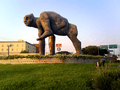
Figure Obscene Monument.

See also
 In Spanish: Colima (Colima) para niños
