
Columbia River Gorge facts for kids
Quick facts for kids Columbia River Gorge |
|
|---|---|

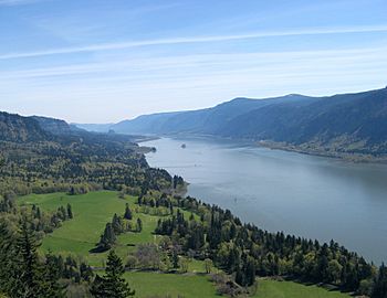
Looking east up the Columbia River Gorge from near Multnomah Falls.
|
|
 |
|
| Location | Pacific Northwest, United States |
| Established | 1986 |
The Columbia River Gorge is a huge canyon carved by the Columbia River in the Pacific Northwest of the United States. It's super deep, up to 4,000 feet (1,200 meters), and stretches for over 80 miles (130 kilometers). The river winds through the Cascade Range mountains, forming the border between Washington to the north and Oregon to the south.
This amazing water gap is the only easy way to travel through the Cascades. It connects the Columbia Plateau to the Pacific Ocean. Because of this, it's a busy route for Interstate 84, U.S. Route 30, Washington State Route 14, and railroad tracks.
The Columbia River Gorge is a very popular place for fun activities. It's even a special protected area called the Columbia Gorge National Scenic Area. The U.S. Forest Service helps manage it.
Contents
What Makes the Gorge Special?
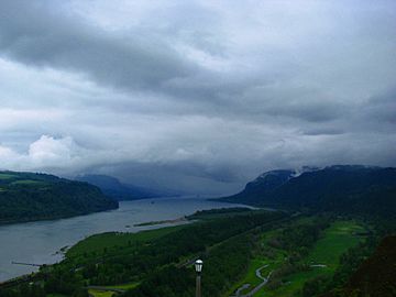
The Columbia River Gorge is unique because it connects the east side of the Cascade Range to the Pacific Ocean. This means it has a huge variety of landscapes and weather.
Different Landscapes and Weather
The gorge goes from sea level up to 4,000 feet (1,200 meters) high. It also changes from getting a lot of rain (100 inches or 2,500 mm) to very little rain (only 10 inches or 250 mm) in just 80 miles (130 km)!
This creates many different ecosystems:
- The western part is a temperate rainforest with lots of rain.
- The eastern part has dry grasslands.
- In between, there's a mix of dry woodlands.
Because of these different areas, many special plants and animals live here. Some of them, like 13 types of wildflowers, are found nowhere else in the world!
Plants and Trees You'll See
As you drive through the gorge, the scenery changes a lot.
- In the rainy western parts, you'll see big trees like bigleaf maples, Douglas fir, and western hemlocks. These trees are often covered in small plants called epiphytes.
- In the middle, you'll find Oregon white oak, ponderosa pine, and cottonwood trees.
- Towards the eastern end, the forests turn into wide open grasslands. You might still see some lodgepole and ponderosa pines.
Windy Fun and Waterfalls
The gorge acts like a giant wind tunnel! The air pressure differences on each side of the Cascades create strong winds, sometimes up to 35 miles per hour (56 km/h). This makes the gorge a perfect spot for windsurfing and kiteboarding.
The gorge is also famous for its many waterfalls. There are over 90 waterfalls just on the Oregon side! Many of them are along the Historic Columbia River Highway. One of the most famous is Multnomah Falls, which is 620 feet (189 meters) tall.
People love to visit the gorge for hiking, biking, sightseeing, fishing, and water sports. The Forest Service and many state parks help keep the trails and picnic areas nice.
How the Gorge Was Formed
The Columbia River Gorge started forming a very long time ago, about 17 to 12 million years ago. The Cascade Range mountains were growing during this time. This slowly moved the Columbia River's path north to where it is today.
While the river slowly carved the land, the biggest changes happened at the end of the last Ice Age. Huge floods, called the Missoula Floods, rushed through the area. These floods were so powerful that they carved out the steep, dramatic walls you see today. They also left many layers of volcanic rock exposed, which you can see in the cliffs.

History of the Gorge
People have lived in the Columbia River Gorge for over 13,000 years! Scientists have found signs of ancient people, like the Folsom and Marmes groups, who came from Asia. Near Celilo Falls, a few miles east of The Dalles, people have been fishing for salmon for more than 10,000 years.

The gorge has always been an important travel route. Native Americans used to travel through it to trade at Celilo Falls. In 1805, the famous Lewis and Clark Expedition used the gorge to reach the Pacific Ocean.
Later, European and American settlers built steamboat lines and railroads through the gorge. Today, freight trains still run on both sides of the river.
The Historic Columbia River Highway, built in the early 1900s, was the first major paved highway in the Pacific Northwest. Traveling by boat became much easier after the Bonneville Dam and The Dalles Dam were built. These dams covered up big rapids like Celilo Falls, which was a very important salmon fishing spot for local Native Americans until 1957.
In 1986, the U.S. Congress made the gorge the second U.S. National Scenic Area. This special title helps protect the area. It was chosen instead of becoming a national park so that towns and businesses along the river could stay.
In 2017, a large wildfire called the Eagle Creek Fire burned in the gorge for three months. It burned almost 50,000 acres (200 square kilometers) of land.
Gallery
-
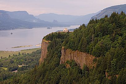
Crown Point in the Columbia River Gorge, looking upstream from Chanticleer Point
-
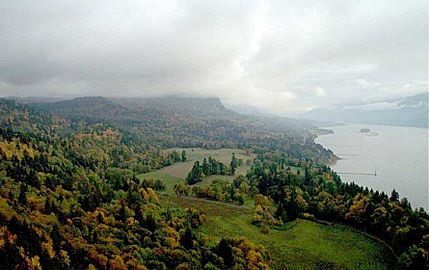
Columbia River Gorge, photographed from the southern edge of the Gifford Pinchot National Forest
-
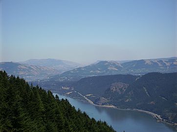
The view east towards The Dalles from Dog Mountain
-
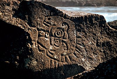
Native Indian petroglyphs in the Columbia River Gorge near The Dalles Dam
-
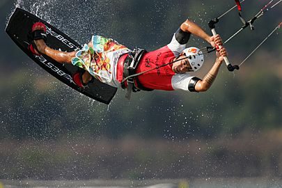
Kitesurfing on the Columbia River
-
View of Columbia River Gorge from Cape Horn Trail, looking east toward Beacon Rock
-
Columbia River Gorge, photographed from Crown Point.
-
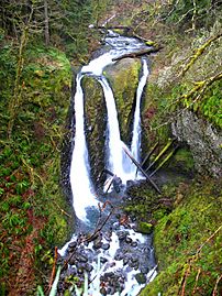
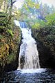
Triple Falls
-
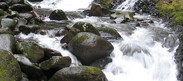
Oneonta Creek
-
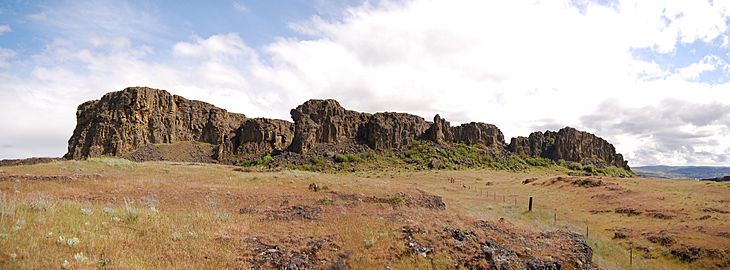
Horsethief Butte, near The Dalles


Images for kids
-
Bridal Veil Falls in Autumn
-
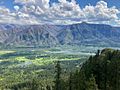
A view of the Oregon side of the Columbia River Gorge from Hamilton Mountain


See also
 In Spanish: Garganta del río Columbia para niños
