Crow Wing County, Minnesota facts for kids
Quick facts for kids
Crow Wing County
|
|
|---|---|

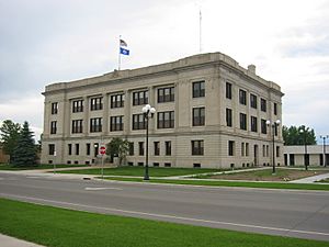
Historic Crow Wing County courthouse
|
|

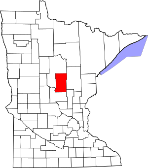
Location within the U.S. state of Minnesota
|
|
 Minnesota's location within the U.S. |
|
| Country | |
| State | |
| Founded | May 23, 1857 (created) March 3, 1870 (organized) |
| Named for | Crow Wing River |
| Seat | Brainerd |
| Largest city | Brainerd |
| Area | |
| • Total | 1,157 sq mi (3,000 km2) |
| • Land | 999 sq mi (2,590 km2) |
| • Water | 157 sq mi (410 km2) 14%% |
| Population
(2020)
|
|
| • Total | 66,123 |
| • Estimate
(2023)
|
68,304 |
| • Density | 66.2/sq mi (25.6/km2) |
| Time zone | UTC−6 (Central) |
| • Summer (DST) | UTC−5 (CDT) |
| Congressional district | 8th |
Crow Wing County is a county located in the central part of Minnesota, a state in the United States. In 2020, about 66,123 people lived here. The main city and county seat is Brainerd. The county was officially created in 1857 and started its government in 1870.
Crow Wing County is part of the Brainerd area, which is a group of towns and cities that are connected.
Contents
History of Crow Wing County
Long ago, the Ojibwe people and Dakota people lived in this area. European Americans set up a trading post here in 1837. This post was on the east side of the Mississippi River, across from where the Crow Wing River joins it.
The trading post, called Crow Wing, became a busy place for trading with Native Americans. It also had a general store for everyone. By 1866, about 600 people lived there. The county was created on May 23, 1857, and Crow Wing was chosen as its first county seat. The county government officially started on March 3, 1870. The county got its name from the Crow Wing River. The river was named after an island in it that looks like a crow's wing.
How Brainerd Became the County Seat
Brainerd was founded in 1870. This happened when the Northern Pacific Railroad chose the spot to build a bridge over the Mississippi River. Brainerd quickly grew with new buildings and more people. It soon became bigger than Crow Wing. Brainerd was then chosen as the new county seat. This caused many people and businesses to move from Crow Wing, which became known as a ghost town. Today, Crow Wing State Park covers much of the old village site.
Brainerd City became an official city on November 19, 1881. It was named after Lawrence Brainerd. He was the father-in-law of J. Gregory Smith, who was the first president of the Northern Pacific Railroad Company. The Northern Pacific Railroad started its first train service to Brainerd on March 11, 1871. Regular passenger trains began in September of that year.
In 1887, the Minnesota government added a part of Cass County to Crow Wing County. This change doubled the size of Crow Wing County.
Geography and Nature
Crow Wing County covers about 1,157 square miles (2,997 square kilometers). About 999 square miles (2,587 square kilometers) is land, and 157 square miles (407 square kilometers) is water. This means about 14% of the county is water.
Forests and Wildlife
Crow Wing County has two state forests: the Crow Wing State Forest and the Emily State Forest. The Cuyuna Lakes State Trail is in the Upper Mississippi River area. The land here is gently rolling or flat. It has many trees, lakes, and wet areas.
The county is home to lots of wildlife. You might see white-tailed deer, cottontail rabbits, snowshoe hares, raccoons, red foxes, gray foxes, coyotes, mink, muskrats, squirrels, and beavers. Sometimes, you might even spot an American black bear. Many birds live here too, like Bald eagles, osprey, and different kinds of waterfowl.
Lakes and Rivers
The main river in Crow Wing County is the Mississippi River. There are also many smaller streams. The county has about 417 known lakes! Here are the ten largest lakes by size:
- Gull Lake – 9,419 acres (38.12 km2)
- Pelican Lake – 8,254 acres (33.40 km2)
- Upper and Lower White Fish Lake – 7,372 acres (29.83 km2)
- North Long Lake – 5,997 acres (24.27 km2)
- Lake Edward – 2,576 acres (10.42 km2)
- Bay Lake – 2,393 acres (9.68 km2)
- Cross Lake – 1,752 acres (7.09 km2)
- Round Lake – 1,645 acres (6.66 km2)
- Big Trout Lake – 1,343 acres (5.43 km2)
- Lower South Long Lake – 1,312 acres (5.31 km2)
Major Roads
Neighboring Counties
- Aitkin County – to the northeast
- Mille Lacs County – to the southeast
- Morrison County – to the southwest
- Cass County – to the northwest and north
Protected Natural Areas
- Crow Wing State Forest
- Crow Wing State Park (part)
- Cuyuna Country State Recreation Area
- Cuyuna Lakes State Trail (inside Cuyuna Country SRA)
- Duck Lakes State Wildlife Management Area
- Emily State Forest
- Loerch State Wildlife Management Area
- Mille Lacs Moraine Scientific and Natural Area
- Safari North Wildlife Park
- Upper Dean State Wildlife Management Area
Environmental Cleanup Efforts
The growth of railroads in the county also brought some environmental challenges. Near Brainerd and Baxter, there's a place called the Burlington Northern (Brainerd/Baxter) EPA Superfund site. This is where a company used to treat wood for railroad ties. The water used in this process caused pollution in the soil and groundwater. Now, the EPA is working to clean up this area to protect the environment.
People of Crow Wing County (Demographics)
| Historical population | |||
|---|---|---|---|
| Census | Pop. | %± | |
| 1860 | 269 | — | |
| 1870 | 200 | −25.7% | |
| 1880 | 2,319 | 1,059.5% | |
| 1890 | 8,852 | 281.7% | |
| 1900 | 14,250 | 61.0% | |
| 1910 | 16,861 | 18.3% | |
| 1920 | 24,566 | 45.7% | |
| 1930 | 25,627 | 4.3% | |
| 1940 | 30,226 | 17.9% | |
| 1950 | 30,875 | 2.1% | |
| 1960 | 32,134 | 4.1% | |
| 1970 | 34,826 | 8.4% | |
| 1980 | 41,722 | 19.8% | |
| 1990 | 44,249 | 6.1% | |
| 2000 | 55,099 | 24.5% | |
| 2010 | 62,500 | 13.4% | |
| 2020 | 66,123 | 5.8% | |
| 2023 (est.) | 68,304 | 9.3% | |
| U.S. Decennial Census 1790–1960 1900–1990 1990–2000 2010–2020 |
|||
Population in 2020
| Race | Number of People | Percentage |
|---|---|---|
| White (not Hispanic) | 61,252 | 92.6% |
| Black or African American (not Hispanic) | 383 | 0.6% |
| Native American (not Hispanic) | 623 | 0.9% |
| Asian (not Hispanic) | 332 | 0.5% |
| Pacific Islander (not Hispanic) | 19 | 0.03% |
| Other/Mixed (not Hispanic) | 2,602 | 3.9% |
| Hispanic or Latino | 912 | 1.4% |
Communities in Crow Wing County
Cities
- Baxter
- Brainerd (county seat)
- Breezy Point
- Crosby
- Crosslake
- Cuyuna
- Deerwood
- Emily
- Fifty Lakes
- Fort Ripley
- Garrison
- Ironton
- Jenkins
- Manhattan Beach
- Nisswa
- Pequot Lakes
- Riverton
- Trommald
Census-Designated Place
Unincorporated Communities
These are smaller communities that are not officially cities or towns.
Townships
Townships are local government areas.
- Bay Lake Township
- Center Township
- Crow Wing Township
- Daggett Brook Township
- Deerwood Township
- Fairfield Township
- Fort Ripley Township
- Gail Lake Township
- Garrison Township
- Ideal Township
- Irondale Township
- Jenkins Township
- Lake Edwards Township
- Little Pine Township
- Long Lake Township
- Maple Grove Township
- Mission Township
- Nokay Lake Township
- Oak Lawn Township
- Pelican Township
- Perry Lake Township
- Platte Lake Township
- Rabbit Lake Township
- Roosevelt Township
- Ross Lake Township
- Saint Mathias Township
- Sibley Township (former)
- Timothy Township
- Wolford Township
Unorganized Territories
These are areas that do not have their own local government.
- Dean Lake
- West Crow Wing
Education
Here are the school districts that serve students in Crow Wing County:
- Aitkin Public School District
- Brainerd Public School District
- Crosby-Ironton Public School District
- Little Falls Public School District
- Onamia Public School District
- Pequot Lakes Public Schools
- Pierz Public School District
- Pine River-Backus Public School District
See also
 In Spanish: Condado de Crow Wing para niños
 | John T. Biggers |
 | Thomas Blackshear |
 | Mark Bradford |
 | Beverly Buchanan |


