Dera Ismail Khan facts for kids
Quick facts for kids
Dera Ismail Khan
ڈیره اسماعیل خان
دېره اسماعيل خان |
|
|---|---|
|
City
|
|
|
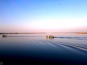
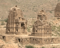
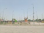
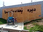
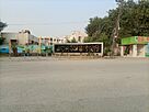
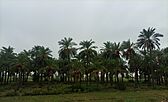
Clockwise from top: Indus River, Lal Mahra Tombs, Qureshi Morr, Kalma at Kachehri Chowk, Noll Bagh, Kalma Chowk, Kafir Kot ruins, State Life Building
|
|
| Country | |
| Province | |
| District | Dera Ismail Khan |
| Tehsil | Dera Ismail Khan |
| Government | |
| • Type | Mayor-council |
| Elevation | 165 m (541 ft) |
| Population
(2017)
|
|
| • City | 217,457 |
| • Rank | 37th, Pakistan; 5th, Khyber Pakhtunkhwa |
| Dera Ismail Khan Municipal Committee: 211,760 Dera Ismail Khan Cantonment: 5,697 |
|
| Time zone | UTC+5 (PKT) |
| Postal code |
29050
|
| Number of union councils | 47 |
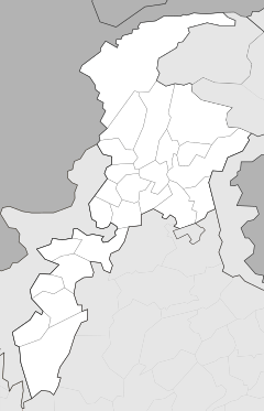
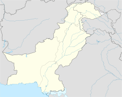
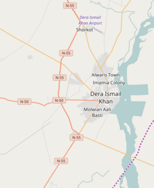
Dera Ismail Khan (also called D.I. Khan) is a city in Pakistan. It is the capital of the Dera Ismail Khan District. The city is located in the Khyber Pakhtunkhwa province. It is the 37th largest city in Pakistan by population. It is also the fifth largest city in its province. Dera Ismail Khan sits on the west bank of the Indus River. The Gomal River joins the Indus River nearby.
The city is about 300 kilometers (186 miles) south of Peshawar. Peshawar is the capital of the province. It is also about 230 kilometers (143 miles) northwest of Multan in Punjab.
Contents
What Does the Name Dera Ismail Khan Mean?
The word ḍerā in the local language means "tent" or "camp." You can find this word in other town names in the Indus Valley. These include Dera Ghazi Khan and Dera Bugti.
The city is named after a man called Ismail Khan. He was a mercenary from the Dodai tribe. Ismail Khan was the son of Malik Sohrab Dodai. He was the one who founded the town. So, "Dera Ismail Khan" means "Camp of Ismail Khan."
A Look Back: History of D.I. Khan
How D.I. Khan Started
Very Old Times
People have lived in the area around Dera Ismail Khan for thousands of years. We know this from a place called Rehman Dheri. This is an ancient site from before the Indus Valley civilisation. It dates back to 3300 BCE. In the 600s AD, the city had many Brahmins and Buddhists.
Medieval Period
D.I. Khan is in a historical area called Derajat. This region was created in the 1400s. At that time, Baloch people were asked to settle there. This was done by Shah Husayn of the Langah Sultanate from Multan.
Later, more people called Pashtuns settled in the area. They joined with the Baloch settlers. D.I. Khan became a busy trading center. This happened during the time of Nader Shah's invasion. Traders called Powindah nomads used the city.
Nine generations of Baloch leaders ruled D.I. Khan. They were all descendants of Ismail Khan. The last leader was Nusrat Khan. He lost power when Ahmad Shah Durrani captured the city in 1750. In 1794, the city was given to Nawab Muhammad Khan Sadozai.
Rebuilding the City
The original city was washed away by a big flood from the Indus River in 1823. The city we see today was built in 1825. Nawab Sher Muhammad Khan of the Saddozai clan founded it. It now stands about 6 kilometers (4 miles) from the river. It is built on a small plateau.
Architects from Punjab helped design the new city. Hindus lived in the south, and Muslims lived in the north. Four main markets were built, one in each direction. They all met in the center of the town, called the Chowgalla. The rebuilt city had a large market for Afghan traders. Trade through the Gomal Pass helped the city grow rich. An 8-foot-high mud wall with nine gates was also built around the city. Some of these gates, like Kaneran Wala and Sakki, are still there today. All buildings you see now are from the 1800s or later.
Sikh Rule (1821–1849)
D.I. Khan was ruled by the Sadozai family from Mankera. But in 1836, Maharaja Nau Nihal Singh of the Sikh Empire took control. The city suffered from high taxes. People often complained to the Sikh rulers in Lahore. This led to many changes in who governed the city.
British India Era
The British took over D.I. Khan in 1848. General Henry Charles Van Cortland was the first British officer in charge. In 1861, D.I. Khan became the main city of a new division. This was like a British county.
A local government was set up in 1867. A military area, called the Dera Ismail Khan Cantonment, was built in 1894. By 1881, the city had 22,164 people. The military had its winter base here. It had soldiers, cavalry, and infantry. A neighborhood called "Civil Lines" was built for British officials.
The city had a hospital and schools. One school was run by the Church Missionary Society. Another was run by the Bharatri Sabha. According to the 1901 census, Dera Ismail Khan had 31,737 people. Most were Muslims (18,662). There were also 11,486 Hindus and 1,420 Sikhs.
Most people in Dera Ismail Khan were Muslims. They supported the All-India Muslim League and the idea of Pakistan. When India and Pakistan became independent in 1947, many Hindus and Sikhs moved to India. Muslims from India then settled in Dera Ismail Khan.
After Pakistan's Independence (1947)
After the Soviet invasion of Afghanistan in 1979, many refugees came to D.I. Khan. The city's population tripled.
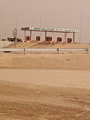
In 2015, a big project called the China-Pakistan Economic Corridor started. D.I. Khan was chosen as the end point for the Hakla–Dera Ismail Khan Motorway. This is a 280-kilometer (174-mile) highway. It connects D.I. Khan to Islamabad and is part of a larger economic route.
Geography and Climate
Climate of D.I. Khan
Dera Ismail Khan has a hot desert climate. This means it has very hot summers and warm winters. Most rain falls in two periods. One is in late winter and early spring (February to April). The other is during the monsoon season (July to September).
The city is located 177 meters (581 feet) above sea level.
| Climate data for Dera Ismail Khan | |||||||||||||
|---|---|---|---|---|---|---|---|---|---|---|---|---|---|
| Month | Jan | Feb | Mar | Apr | May | Jun | Jul | Aug | Sep | Oct | Nov | Dec | Year |
| Record high °C (°F) | 28.9 (84.0) |
30.6 (87.1) |
37.2 (99.0) |
43.3 (109.9) |
47.9 (118.2) |
51 (124) |
47.0 (116.6) |
44.5 (112.1) |
42.4 (108.3) |
40.5 (104.9) |
35.0 (95.0) |
30.6 (87.1) |
51 (124) |
| Mean daily maximum °C (°F) | 20.3 (68.5) |
22.1 (71.8) |
26.9 (80.4) |
33.5 (92.3) |
38.7 (101.7) |
41.5 (106.7) |
38.5 (101.3) |
37.4 (99.3) |
36.7 (98.1) |
33.4 (92.1) |
27.7 (81.9) |
21.9 (71.4) |
31.5 (88.8) |
| Daily mean °C (°F) | 12.2 (54.0) |
14.7 (58.5) |
19.9 (67.8) |
26.0 (78.8) |
30.9 (87.6) |
34.2 (93.6) |
32.7 (90.9) |
31.9 (89.4) |
30.2 (86.4) |
25.3 (77.5) |
19.1 (66.4) |
13.6 (56.5) |
24.2 (75.6) |
| Mean daily minimum °C (°F) | 4.2 (39.6) |
7.3 (45.1) |
12.9 (55.2) |
18.5 (65.3) |
23.1 (73.6) |
26.8 (80.2) |
26.9 (80.4) |
26.4 (79.5) |
23.8 (74.8) |
17.3 (63.1) |
10.5 (50.9) |
5.3 (41.5) |
16.9 (62.4) |
| Record low °C (°F) | −2.2 (28.0) |
−2.0 (28.4) |
4.0 (39.2) |
9.5 (49.1) |
14.4 (57.9) |
17.5 (63.5) |
18.6 (65.5) |
19.5 (67.1) |
15.8 (60.4) |
8.0 (46.4) |
2.2 (36.0) |
−2.8 (27.0) |
−2.8 (27.0) |
| Average rainfall mm (inches) | 10.0 (0.39) |
17.5 (0.69) |
34.8 (1.37) |
21.7 (0.85) |
17.2 (0.68) |
24.4 (0.96) |
69.8 (2.75) |
67.5 (2.66) |
37.6 (1.48) |
4.8 (0.19) |
2.1 (0.08) |
10.4 (0.41) |
317.8 (12.51) |
| Mean monthly sunshine hours | 222.2 | 206.8 | 234.3 | 259.2 | 290.1 | 247.7 | 241.3 | 261.1 | 271.1 | 283.2 | 249.7 | 220.4 | 2,987.1 |
| Source: NOAA (1961-1990) | |||||||||||||
| Climate data for Dera Ismail Khan (1991–2020) | |||||||||||||
|---|---|---|---|---|---|---|---|---|---|---|---|---|---|
| Month | Jan | Feb | Mar | Apr | May | Jun | Jul | Aug | Sep | Oct | Nov | Dec | Year |
| Mean daily maximum °C (°F) | 19.5 (67.1) |
22.6 (72.7) |
27.3 (81.1) |
34.0 (93.2) |
39.6 (103.3) |
41.0 (105.8) |
38.5 (101.3) |
37.5 (99.5) |
36.5 (97.7) |
33.5 (92.3) |
27.7 (81.9) |
22.4 (72.3) |
31.7 (89.1) |
| Daily mean °C (°F) | 12.1 (53.8) |
15.3 (59.5) |
20.3 (68.5) |
26.4 (79.5) |
31.6 (88.9) |
33.4 (92.1) |
32.5 (90.5) |
31.8 (89.2) |
30.1 (86.2) |
25.7 (78.3) |
19.4 (66.9) |
14.2 (57.6) |
24.4 (75.9) |
| Mean daily minimum °C (°F) | 4.6 (40.3) |
8.0 (46.4) |
13.4 (56.1) |
18.9 (66.0) |
23.7 (74.7) |
25.9 (78.6) |
26.5 (79.7) |
26.0 (78.8) |
23.8 (74.8) |
17.9 (64.2) |
11.1 (52.0) |
5.8 (42.4) |
17.1 (62.8) |
| Average precipitation mm (inches) | 12.6 (0.50) |
24.0 (0.94) |
37.4 (1.47) |
29.1 (1.15) |
9.1 (0.36) |
38.3 (1.51) |
71.5 (2.81) |
72.4 (2.85) |
37.8 (1.49) |
19.6 (0.77) |
3.4 (0.13) |
4.4 (0.17) |
369.6 (14.55) |
| Average precipitation days (≥ 1.0 mm) | 2.1 | 3.5 | 5.0 | 3.8 | 1.8 | 2.6 | 4.1 | 3.8 | 1.9 | 1.0 | 0.7 | 0.9 | 31.2 |
| Mean monthly sunshine hours | 193.4 | 196.5 | 229.3 | 265.8 | 279.1 | 265.5 | 247.7 | 260.5 | 262.7 | 263.4 | 215.5 | 218.3 | 2,897.7 |
| Source: NOAA | |||||||||||||
Who Lives in D.I. Khan?
The table below shows the different religious groups that have lived in Dera Ismail Khan City over the years.
| Religious group |
1881 | 1901 | 1911 | 1921 | 1931 | 1941 | 2017 | |||||||
|---|---|---|---|---|---|---|---|---|---|---|---|---|---|---|
| Pop. | % | Pop. | % | Pop. | % | Pop. | % | Pop. | % | Pop. | % | Pop. | % | |
| Islam |
12,440 | 56.13% | 18,662 | 58.8% | 21,759 | 61.94% | 21,056 | 53.52% | 22,321 | 55.34% | 26,424 | 51.5% | 215,348 | 98.78% |
| Hinduism |
8,862 | 39.98% | 11,486 | 36.19% | 11,716 | 33.35% | 17,077 | 43.41% | 16,761 | 41.56% | 22,815 | 44.47% | 438 | 0.2% |
| Sikhism |
680 | 3.07% | 1,420 | 4.47% | 1,331 | 3.79% | 724 | 1.84% | 708 | 1.76% | 1,412 | 2.75% | N/A | N/A |
| Jainism |
2 | 0.01% | 15 | 0.05% | 0 | 0% | 0 | 0% | 0 | 0% | N/A | N/A | N/A | N/A |
| Christianity |
N/A | N/A | 154 | 0.49% | 325 | 0.93% | 484 | 1.23% | 541 | 1.34% | 195 | 0.38% | 2,166 | 0.99% |
| Judaism |
N/A | N/A | 0 | 0% | 0 | 0% | 0 | 0% | 0 | 0% | 1 | 0% | N/A | N/A |
| Zoroastrianism |
N/A | N/A | 0 | 0% | 0 | 0% | 0 | 0% | 0 | 0% | 0 | 0% | N/A | N/A |
| Buddhism |
N/A | N/A | 0 | 0% | 0 | 0% | 0 | 0% | 0 | 0% | N/A | N/A | N/A | N/A |
| Ahmadiyya |
N/A | N/A | N/A | N/A | N/A | N/A | N/A | N/A | N/A | N/A | N/A | N/A | 32 | 0.01% |
| Others | 180 | 0.81% | 0 | 0% | 0 | 0% | 0 | 0% | 0 | 0% | 459 | 0.89% | 34 | 0.02% |
| Total population | 22,164 | 100% | 31,737 | 100% | 35,131 | 100% | 39,341 | 100% | 40,331 | 100% | 51,306 | 100% | 218,018 | 100% |
Getting Around D.I. Khan
Roads
.
D.I. Khan is connected to Bannu by a highway. This road then leads to Peshawar, the provincial capital. It goes through Kohat and Darra Adam Khel. Another road links D.I. Khan to Mianwali through the Chashma Barrage. There is also a road connecting the city to Zhob.
A third main road connects D.I. Khan to Bhakkar in Punjab. Bhakkar is on the east bank of the Indus River. A bridge over the Indus River was built in the early 1980s. Before that, people used a boat bridge to cross. Another road connects D.I. Khan to Tank. This road leads towards Jandola and Angoor Adda areas.
D.I. Khan is the end point of the Hakla–Dera Ismail Khan Motorway. This is a 280-kilometer (174-mile) highway with four lanes. It starts near Islamabad and is a key part of the economic corridor.
Air Travel
The city has an airport called Dera Ismail Khan Airport. However, there are no regular commercial flights operating from this airport.
See also
 In Spanish: Dera Ismail Khan para niños
 | Emma Amos |
 | Edward Mitchell Bannister |
 | Larry D. Alexander |
 | Ernie Barnes |


