Kohat facts for kids
Quick facts for kids
Kohat
|
|
|---|---|
|
City
|
|
|
|
| Country | |
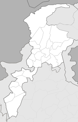
| Province | |
| Division | Kohat Division |
| District | Kohat District |
| Tehsil | Kohat Tehsil |
| Government | |
| • Type | Mayor-council |
| • Body | District Government |
| Elevation | 489 m (1,604 ft) |
| Population
(2017)
|
|
| • City | 228,779 |
| • Rank | 35th, Pakistan 4th, Khyber Pakhtunkhwa |
| Kohat Municipal Committee: 191,844 Kohat Cantonment: 36,935 |
|
| Time zone | UTC+05:00 (PKT) |
| Calling code | +92 922 |
| Highways | |
| Number of union councils | 31 |
Kohat (Pashto: کوهاټ; Urdu: کوہاٹ) is a city in Pakistan. It is the capital of the Kohat District in the Khyber Pakhtunkhwa province. Kohat is known as a main area for the Bangash tribe of Pashtuns. These people have lived there since the late 1400s.
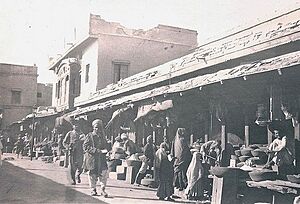
With over 220,000 people, Kohat is the fourth-largest city in Khyber Pakhtunkhwa. It is also the 35th-largest city in all of Pakistan. In the 1800s, there were often small battles between British forces and local tribes around Kohat. The city has an old fort from the British era, busy markets, and a military area called a cantonment. The main languages spoken in Kohat are Pashto and a local dialect of Hindko called Kohati.
Kohat is also the largest city in the Kohat Division. It is more than four times bigger than Karak, the second-largest city in the division.
Contents
Kohat's History
Early Days of Kohat

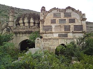
Not much is known about Kohat's very early history. Local stories say that an ancient Buddhist king named Raja Kohat founded the city. Another Buddhist king, Raja Adh, is thought to have ruled the northern part of the city. The ruins of a fort, possibly named Adh-e-Samut, mark where their kingdom was. This old fort still has weapons from the Buddhist period. The Buddhist kings also built roads that were used until the Mughal rule ended.
The Kohat region was first home to the Orakzai Pashtuns. Then, in the 14th and 15th centuries, the Bangash tribe moved in from the west. The Khattak tribe came from the south. By the late 1400s, the Bangash tribes likely controlled the Kohat area. This happened after a big battle near Alizai. After this, the Bangash tribes settled in the fertile valleys. They also welcomed the people already living there into their tribe. The Orakzai tribes moved to the nearby hills.
The first written record of Kohat is from the Baburnama. This is the autobiography of Mughal emperor Babur. In 1505, after taking Peshawar, Babur heard about great riches in Kohat. He invaded Kohat, but found that the stories of its wealth were not true. After capturing Kohat, Babur's army marched into Bangash country and defeated a group of tribesmen.
Kohat During the Durrani Empire
In the 1730s and 1740s, the Persian Empire invaded the Mughal Empire. Kohat was not destroyed because Emperor Nader Shah's forces went through the Peshawar Valley to the north. After the Persians left, Kohat became part of the Durrani Empire by 1747.
After Shah Shujah Durrani lost power in 1810, Kohat was controlled by the Durrani kingdom. This kingdom was based in Peshawar and Kabul. They allowed different chiefs to rule Kohat. Mirza Girani was the first chief, followed by Shakur Khan and Sultan Muhammad until 1818. In 1818, Kohat came under the control of Samad Khan. Later, Pir Muhammad influenced the city in 1827.
Kohat Under Sikh and British Rule
Ranjit Singh's armies reached Peshawar in 1819. In 1834, the Sikhs defeated Azim Khan. The chiefs of Peshawar then had to pay taxes to the Sikh Government. In 1839, Sikh governor Avtar Singh Sandhanwalia captured Kohat. It became part of Ranjit Singh's Sikh Empire. However, Pir Muhammad was still allowed to manage the area around Kohat.
In 1840, the Sikhs left Kohat, and Sultan Mohammed became its ruler. In 1848, during the Second Anglo-Sikh War, a British official named Colonel George Lawrence sought safety in Kohat. But he was captured and given to Sikh forces before being released. In 1849, Kohat and the rest of Punjab officially became part of the British Empire.
After the British won against the Sikhs in 1848, Kohat came under British rule in March 1849. Lieutenant Pollack was the first Assistant Commissioner of Kohat. The British started building the Kohat Pass road in 1849. They finished it by 1850, even though local tribes fought against it. The pass was closed for a short time in 1853 due to a fight among nearby tribes. The road connecting Kohat to Rawalpindi through Khushalgarh was much easier to build.
Kohat stayed mostly peaceful during the Sepoy Mutiny of 1857. Local Pashtun soldiers mostly ignored calls to rebel. The British built a cool mountain retreat called a Hill Station at Cherat in the 1860s. The Kohat Pass road was closed many times by the British because of tribal conflicts. This included a closure for over a year and a half in 1865. Small battles between British forces and Pashtun tribes continued on and off from the 1860s to the 1870s. The Kohat Cantonment, a military area, was set up by the British in 1874. Routes between Kohat and Bannu and Thall were often blocked by Wazir tribesmen by 1880. This led to big clashes between the British and the Wazirs.
In 1924, there were serious fights between different groups in Kohat. This event, known as the 1924 Kohat riots, led to Mohandas Gandhi, also known as Mahatma Gandhi, fasting for 21 days. He did this to ask for peace and unity. During the 1947 Kashmir War, Pashtun tribesmen gathered in Kohat. They then left for Kashmir, hoping to capture the area for Pakistan.
Kohat in Modern Times
Kohat faced several attacks between 2008 and 2014. These attacks were part of the War in North-West Pakistan and the War on Terror.
Kohat's Geography
Kohat's Landscape
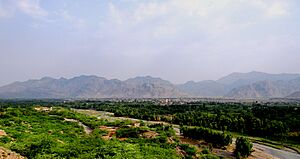
Kohat city is located at a height of 489 meters (1,604 feet) above sea level. The Kohat Pass is to the north. The city is on the left bank of the Toi river. The river flows east for about 50 miles before turning south. The total area of the Kohat district is 2,545 square kilometers (983 square miles).
Kohat's Climate
Kohat has a hot, semi-dry climate. This means it has hot summers and mild winters.
| Climate data for Kohat (1961-1990) | |||||||||||||
|---|---|---|---|---|---|---|---|---|---|---|---|---|---|
| Month | Jan | Feb | Mar | Apr | May | Jun | Jul | Aug | Sep | Oct | Nov | Dec | Year |
| Mean daily maximum °C (°F) | 17 (63) |
20 (68) |
25 (77) |
31 (88) |
36 (97) |
38 (100) |
35 (95) |
34 (93) |
33 (91) |
30 (86) |
23 (73) |
18 (64) |
28 (82) |
| Mean daily minimum °C (°F) | 4 (39) |
7 (45) |
11 (52) |
16 (61) |
21 (70) |
24 (75) |
24 (75) |
24 (75) |
21 (70) |
15 (59) |
8 (46) |
5 (41) |
15 (59) |
| Average rainfall mm (inches) | 25 (1.0) |
31 (1.2) |
31 (1.2) |
20 (0.8) |
36 (1.4) |
44 (1.7) |
114 (4.5) |
95 (3.7) |
44 (1.7) |
16 (0.6) |
9 (0.4) |
39 (1.5) |
504 (19.7) |
| Source: My Weather | |||||||||||||
Tanda Dam and Lake
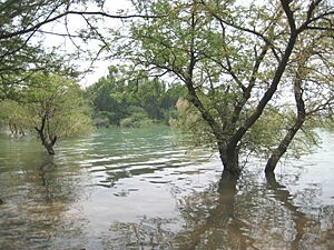
Kohat has a dam called Tanda Dam. It is located on Tanda Lake. This lake is a protected site under the Ramsar Convention, which protects important wetlands. The dam was finished in 1967. The lake was added to the Ramsar list on July 23, 1976.
Parks and Wildlife
Tanda Wildlife Park
Tanda Wildlife Park is close to Kohat city. It covers an area of 2,800 acres (11 square kilometers). The park includes the Tanda reservoir and the areas around it. This is the largest wildlife park in Khyber Pakhtunkhwa. It has a rich and varied landscape. Many mammals, birds (both migrating and local), and some reptiles live here. Kohat is also famous for its guavas.
Three villages, Bar, Kaghazi, and Tanda Banda, are next to the park. You can reach the park by the Hangu-Kaghazi gravel road or the Shahpur-Bar road, which is 18 km from Kohat. Local people are not allowed to graze animals, cut branches, or collect firewood in the park. This is because the provincial government owns the land. The park is a natural home for urial and chinkara. It also provides a good home for hog deer. Urials live in scrub forests with Olea and Accassia trees. They used to be common here but disappeared due to habitat loss. The natural homes of urial and chinkara are very close to human settlements.
Kotal Pheasantry
Kotal Pheasantry is a special place in Kotal wildlife park in Kohat. It covers about 1 Kanal (a unit of land). Its goal is to raise and provide a good breeding place for different types of pheasants. These include silver pheasant, golden pheasant, reeves pheasant, and pea-cock. Around 20-30 visitors, including students, come to the pheasantry daily. They come to learn and for fun. There are four types of pheasants here: ring-necked pheasant, silver pheasant, peacock pheasant, and white pheasant.
Kohat's Population
| Historical Population | ||
|---|---|---|
| Year | Pop. | ±% p.a. |
| 1941 | 44,977 | — |
| 1951 | 40,534 | −1.03% |
| 1961 | 49,854 | +2.09% |
| 1972 | 65,202 | +2.47% |
| 1981 | 77,604 | +1.95% |
| 1998 | 126,627 | +2.92% |
| 2017 | 228,779 | +3.16% |
| Religious group |
1881 | 1901 | 1911 | 1921 | 1931 | 1941 | 2017 | |||||||
|---|---|---|---|---|---|---|---|---|---|---|---|---|---|---|
| Pop. | % | Pop. | % | Pop. | % | Pop. | % | Pop. | % | Pop. | % | Pop. | % | |
| Islam |
13,752 | 75.65% | 19,818 | 64.42% | 15,930 | 70.32% | 18,898 | 67.85% | 24,388 | 71% | 32,111 | 71.39% | 224,520 | 98.23% |
| Hinduism |
2,798 | 15.39% | 7,833 | 25.46% | 4,850 | 21.41% | 5,796 | 20.81% | 6,709 | 19.53% | 8,250 | 18.34% | 978 | 0.43% |
| Sikhism |
1,562 | 8.59% | 2,832 | 9.21% | 1,693 | 7.47% | 2,139 | 7.68% | 2,152 | 6.26% | 3,562 | 7.92% | N/A | N/A |
| Jainism |
0 | 0% | 0 | 0% | 0 | 0% | 0 | 0% | 0 | 0% | N/A | N/A | N/A | N/A |
| Christianity |
N/A | N/A | 279 | 0.91% | 168 | 0.74% | 1,020 | 3.66% | 1,101 | 3.21% | 445 | 0.99% | 2,942 | 1.29% |
| Judaism |
N/A | N/A | 0 | 0% | 13 | 0.06% | 0 | 0% | 0 | 0% | 0 | 0% | N/A | N/A |
| Zoroastrianism |
N/A | N/A | 0 | 0% | 0 | 0% | 0 | 0% | 0 | 0% | 0 | 0% | N/A | N/A |
| Buddhism |
N/A | N/A | 0 | 0% | 0 | 0% | 0 | 0% | 0 | 0% | N/A | N/A | N/A | N/A |
| Ahmadiyya |
N/A | N/A | N/A | N/A | N/A | N/A | N/A | N/A | N/A | N/A | N/A | N/A | 51 | 0.02% |
| Others | 67 | 0.37% | 0 | 0% | 0 | 0% | 0 | 0% | 0 | 0% | 609 | 1.35% | 64 | 0.03% |
| Total population | 18,179 | 100% | 30,762 | 100% | 22,654 | 100% | 27,853 | 100% | 34,350 | 100% | 44,977 | 100% | 228,555 | 100% |
Getting Around Kohat
Rail Travel
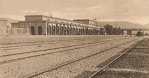
Building of the Kohat Tehsil railway station and its railway line began in 1897 and finished in 1902. The Kohat Cantonment railway station is the end point for the Khushalgarh–Kohat–Thal Railway. This narrow-gauge railway line (762 mm or 2 ft 6 in) stopped service to Thall in 1991. Kohat is also the final railway station for the Kohat-Jand railway line. There is a daily train service to Rawalpindi.
Air Travel
The closest airport with commercial flights is Bacha Khan International Airport in Peshawar. Kohat Airbase (IATA: OHT, ICAO: OPKT) is a Pakistan Air Force base. It started as a runway built by the British. PIA used to fly to Kohat using de Havilland Twin Otter planes. However, Kohat no longer has commercial flights.
Road Travel
Kohat is an important stop on the N-55 Indus Highway. This highway connects Peshawar to Karachi. It is also on the N-80 highway, which links Kohat to Islamabad. The 1.9-kilometer (1.2-mile) Kohat Tunnel was finished in 2004. It connects the southern districts of Khyber Pakhtunkhwa to Peshawar. This tunnel was built with help from Japan and greatly cut down travel times across the Kohat Pass.
Media in Kohat
- Radio Pakistan Kohat
- Kohat Press Club
Education in Kohat
Universities in Kohat
- University of Engineering and Technology Peshawar Kohat Campus
- Kohat University of Science & Technology
- Preston University in Kohat
Colleges in Kohat
- Khyber Medical College Peshawar Campus
- Cadet College Kohat
- Garrison Cadet College Kohat
- Government degree college kohat
Kohat's Military Importance
The Kohat Cantonment was set up during the British era. It is one of eight military areas in the Peshawar region. Kohat is also the main office for Pakistan's Inter Services Selection Board (ISSB). This board chooses officers for Pakistan's armed forces, including the Army, Navy, and Air Force.
Famous People from Kohat
- Ahmad Faraz – A famous Pakistani poet born in Kohat.
- Iftikhar Hussain Shah – A former Governor of the Khyber Pakhtunkhwa province.
- Malik Saad
- Afzal Bangash – A politician and co-founder of the Mazdoor Kisan Party.
- Shahid Afridi – A famous Pakistani international cricketer and former captain of the Pakistan national cricket team. He is also known as Boom Boom.
- Rohan Mustafa – A Pakistani-born cricketer who plays for the United Arab Emirates.
- Rashid Mansoor
 | Misty Copeland |
 | Raven Wilkinson |
 | Debra Austin |
 | Aesha Ash |


