
East Oakland, Oakland, California facts for kids
Quick facts for kids
East Oakland
|
|
|---|---|

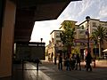
View of East Oakland from Maxwell Park
|
|
| Nickname(s):
"E.S.O."
|
|

East Oakland
Location in Oakland, California
|
|
| Country | |
| State | |
| County | |
| City | |
East Oakland is a large area in Oakland, California, located in the United States. It stretches from Lake Merritt in the northwest all the way to San Leandro in the southeast. This part of Oakland covers a big chunk of the city's land.
It's a very important area for the Black community in Northern California. More than half of the people living in East Oakland are Black. In the year 2000, a study showed that over 87,000 people lived in East Oakland.
Contents
Where is East Oakland?
East Oakland has a unique diagonal shape. It goes from Lake Merritt in the northwest to San Leandro in the southeast. The streets here are set up in a grid. You'll find numbered avenues (like 1st to 109th) that run northeast to southwest. There are also numbered streets (East 7th to East 34th) that go northwest to southeast.
Major highways like Interstate 580 and Interstate 880 also run through East Oakland. Important roads include East 14th Street, which was renamed International Blvd. in 1996. Other main roads are MacArthur Blvd., Foothill Blvd., Bancroft Avenue, and San Leandro Street.
East Oakland is home to several well-known places. These include Holy Names University and Mills College. You can also visit the Oakland Zoo here. Sports fans might know the Oakland Coliseum and the Oracle Arena.
_Commanding_Officer,_Cmdr._Mike_Boyle,_and_his_wife_(center)_lead_a_painting_crew_at_the_East_Oakland_Youth_Development_Center.jpg)
A Look Back in Time
In the 1800s, what is now International Blvd. was called the Oakland-San Leandro Road. It was a county road connecting Oakland and San Leandro. Small towns like Melrose, Elmhurst, and Fitchburg grew up along this road. After the 1906 San Francisco Earthquake, Oakland took over these towns. The road was then renamed East 14th Street. Later, it became International Blvd.
Two other important roads, Foothill Boulevard and MacArthur Boulevard, were part of the Lincoln Highway. This was America's first highway that crossed the entire country, from 1913 to 1927. MacArthur Blvd. used to be the main way to get to San Francisco. Later, the MacArthur Freeway (580) took its place.
During World War II, many Black families moved to Oakland from the southeastern U.S. to work in war industries. This changed the area known as Brooklyn, which was once mostly white. Over time, more white families moved to suburbs outside the city. In recent years, more Latino and Asian families have moved into East Oakland. This includes people from Cambodia, Laos, and China.
Today, Fruitvale is a central area for Oakland's Latino community. Many diverse Asian groups live closer to downtown, from Chinatown to San Antonio. Even with these changes, Black residents still make up the largest group in East Oakland. They represent over 54% of the population. The "deep east side" has an even higher concentration of Black residents.
Who Lives Here?
East Oakland is a diverse place with many different cultures. The Latino community has grown a lot, especially in Fruitvale. Between 1990 and 2000, the number of Latino residents in East Oakland increased by 132%. Today, Latinos make up 38% of the population.
There's also a mix of Asian groups, including Chinese, Vietnamese, and Lao people. They mostly live in the area closer to downtown, from Chinatown to San Antonio. Asian residents make up about 4% of the population.
Even though the number of Black residents decreased slightly between 1990 and 2000, they are still the largest group. Over 54% of East Oakland's residents are African American. The Foothill Square neighborhood has the highest number of African American residents, at 75.4%.
The number of households in East Oakland grew by 3.4% between 1990 and 2000. People in East Oakland work in many different jobs. These include service, sales, transportation, construction, and even management roles.
Music and Culture
East Oakland, along with West Oakland and parts of North Oakland, is a major center for the African American community in Northern California. It's also famous for its Hip hop culture. People in the hip hop world sometimes call Oakland "Oaktown," "O-Town," or "The Town."
Many famous rappers and singers from the Bay Area started in East Oakland. Some well-known names include Raphael Saadiq, Keak da Sneak, Too Short, Digital Underground, MC Hammer, Luniz, Keyshia Cole, and Bobby Brackins.
Too Short was one of the first rap artists to sell his music on his own. He helped create the independent hip hop scene in Northern California. This showed other artists they could succeed without big record companies. The music style here was different from East Coast hip hop. It mixed funk and blues with synthesizers and drum machines. This unique sound became known as Mobb music, a key part of Bay Area hip hop. Today, this sound still influences mainstream hip-hop music.
Neighborhoods to Explore
East Oakland is made up of many different neighborhoods, each with its own story.
Elmhurst
Elmhurst used to be its own town. Oakland took it over in 1909. It was once a neighborhood for white working-class families. After World War II, it became mostly African American. Now, about half of Elmhurst's population is Latino. Elmhurst was also home to a large car barn for the Key System streetcars. Chevrolet opened a car factory here in 1915, which closed in the 1960s.
Brookfield Village
Brookfield Village is located close to the Oakland International Airport. The main streets are 98th Avenue and Edes Avenue. Many homes were built here during World War II for workers in war industries.
Fruitvale
Fruitvale is a lively area and a central part of Oakland's Latino community. It includes smaller districts like:
- Dimond District
- Laurel
- Peralta Hacienda
- Jingle Town
Lower Hills District
This area includes several neighborhoods located in the hills:
- Crocker Highlands
- Glenview
- Grass Valley
- Lakeshore
- Lincoln Highlands
- Tuxedo
- Redwood Heights
- Crestmont
Central/Deep East Oakland
This large area has many neighborhoods, including:
- Arcadia Park
- Arroyo Viejo
- Blandon/Glenly/Fontaine
- Canyon Oaks
- Castlemont
- Castlewood/Flintridge
- Coliseum
- Columbia Gardens
- Cox
- Durant Square
- Eastmont, home to the Eastmont Town Center. This center now has offices for doctors, grocery stores, and a CVS.
- Eastmont Hills
- Fairfax District, known for its businesses around Fairfax Avenue and Foothill Boulevard.
- Fitchburg
- Foothill Square
- Frick
- The Gate
- Greenridge Drive
- Havenscourt
- Hegenberger
- Highland
- Iveywood
- Las Palmas
- Malcolm Heights
- Maxwell Park
- Melrose
- Mills Gardens
- Millsmont
- Monte Vista Villas
- Lockwood Gardens
- North Stonehurst
- Oak Knoll
- Ridgemont
- San Antonio, which has smaller areas like The Twomps and Jingletown.
- Seminary. This neighborhood is where Mills College is located.
- Seneca Toler
- Sequoyah
- Sequoyah Heights, part of the larger Oak Knoll neighborhood
- Sobrante Park
- South Stonehurst
- Toler Heights
- Woodland
Access to Healthy Food
Some parts of East Oakland are considered a food desert. This means it can be hard for people to find affordable, healthy, and fresh food nearby. Studies have shown that getting enough food is a top concern for residents, sometimes even more important than the nutrition of the food. People want to make sure they don't go hungry.
Over time, many larger grocery stores and businesses left East Oakland. This made it harder for people to buy fresh food. The smaller stores that stayed often had to raise their prices. They also focused more on selling packaged snacks and drinks. This meant fewer healthy options were available.
A group called YPAR (Youth Participatory Action Research) 2.0 did a study. Young people in the community researched the problem. They found that chips, soda, and candy were the easiest foods to find. These foods are cheap and available, but they don't offer much nutrition. Eating too many of them can lead to health problems like diabetes and obesity.
The YPAR 2.0 group worked to address this issue. They encouraged local stores to offer fresh fruits and vegetables. As a result, some stores started selling fresh produce from local farmers. They now get fresh deliveries twice a week. This helps community members have better access to healthy food.
Notable Residents
Many talented people have lived or currently live in East Oakland:
- Natalia Anciso, artist
- A-Plus, rapper from hip-hop group Souls of Mischief
- Jesus Barraza, artist
- Sway Calloway journalist and radio personality
- Keyshia Cole, singer
- Mark Curry, actor, comedian, and host
- Mabel Craft Deering, journalist
- Sheila E., award-winning singer, drummer and percussionist
- MC Hammer, award-winning Rap singer and dance artist
- Kamaiyah, rapper
- Keak da Sneak, rapper
- Kreayshawn, rapper
- Damian Lillard, professional basketball player
- Numskull, rapper from hip-hop duo, The Luniz
- Phesto, rapper from hip-hop group Souls of Mischief
- Philthy Rich, rapper
- Favianna Rodriguez, artist
- Raphael Saadiq, singer/songwriter and member of Tony! Toni! Toné!
- D'Andre Sams, rapper
- Tajai, rapper from hip-hop group Souls of Mischief
- Too $hort, rapper
- Lateef the Truthspeaker, rapper
- V-Nasty, rapper
- William S. Rice, early 20th-century block print artist
- D'wayne Wiggins, musician and member of Tony! Toni! Toné!
- Yukmouth, rapper from hip-hop duo, The Luniz
- Baba Zumbi, rapper from hip-hop duo, Zion I
- Emilio Castillo, musician and founding member of Tower Of Power
- Stephen "Doc" Kupka, musician and founding member of Tower Of Power
- David Garibaldi (musician), musician and member of Tower Of Power
- Mike Clark (drummer), musician and member of The Headhunters
- Paul Jackson (bassist), musician and member of The Headhunters
- Rose Ann Dimalanta, musician
Images for kids
-
Fruitvale Village by the Fruitvale BART Station

