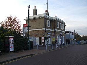
Erith facts for kids
Quick facts for kids Erith |
|
|---|---|
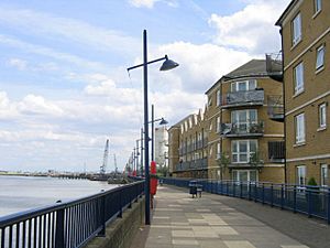
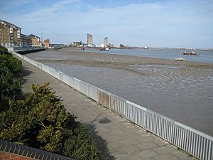 William Cory Promenade along the River Thames frontage and Riverside Gardens |
|
| Population | 45,345 (2011 Census) |
| OS grid reference | TQ505775 |
| • Charing Cross | 13.3 mi (21.4 km) WNW |
| London borough | |
| Ceremonial county | Greater London |
| Region | |
| Country | England |
| Sovereign state | United Kingdom |
| Post town | ERITH |
| Postcode district | DA8, DA18 |
| Dialling code | 01322 |
| Police | Metropolitan |
| Fire | London |
| Ambulance | London |
| EU Parliament | London |
| UK Parliament |
|
| London Assembly |
|
Erith (![]() i/ˈɪərɪθ/) is a town in south-east London, England. It's about 13 miles (21 km) east of central London. Before 1965, Erith was part of Kent county. Now, it's part of the London Borough of Bexley. It sits on the south bank of the River Thames, north-east of Bexleyheath and north-west of Dartford.
i/ˈɪərɪθ/) is a town in south-east London, England. It's about 13 miles (21 km) east of central London. Before 1965, Erith was part of Kent county. Now, it's part of the London Borough of Bexley. It sits on the south bank of the River Thames, north-east of Bexleyheath and north-west of Dartford.
Erith's town centre has been updated since the 1960s. Its main street curves along the river and has some historic buildings. Most of Erith has suburban homes. You can get to central London by train. Erith also has London's longest pier and some natural marsh areas near industrial sites.
Contents
History of Erith

Ancient Times
Archaeologists found that Erith was once a thick forest of oak and yew trees. This was during the Neolithic Period (New Stone Age). By the Bronze Age, some of the forest had become marshland.
Later, during the 1st century CE, people lived or farmed near what is now Belmont Road. This shows that Erith has been home to communities for a very long time.
Anglo-Saxon Era
After the Roman Empire ended in Britain, people from northern Europe called Anglo-Saxons arrived. In 457, they won a battle near Crayford and soon took over all of Kent.
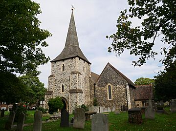
The Anglo-Saxons lived in villages. Erith was one of these villages. Its name, Ærre hyðe, means "old haven" in their language. There was likely a church where St John the Baptist's Church stands today. The first settlement was probably around this church, west of the current town centre.
Medieval Period
The first written mention of Erith was in 695. It was a grant of land by a bishop. The area around Erith was called Lesnes or Lessness. This name appears in the Domesday Book of 1086.
In 1315, Erith was allowed to hold a market every Thursday. However, this market stopped long ago.
Erith grew because of the River Thames. Until the 1850s, it was a small port. King Henry VIII even opened a naval dockyard here. His famous warship, the Henri Grace à Dieu, was prepared in Erith in 1515.
Erith remained a popular place for ships to stop. Ships would often unload some cargo here. This made them lighter before sailing further up the river where the water was shallower.
Industrial Growth
In 1797, Erith was described as "one small street of houses" leading to the river. It also had annual fairs. By 1831, Erith had 1,533 people.
Around 1849, Erith became a popular place for day trips. People came by boat or train to enjoy the pier and hotel. An arboretum (a garden with many trees) was also opened to attract visitors.
In 1894, Erith became an Urban District. In 1938, it became the Municipal Borough of Erith. This included areas like Northumberland Heath and Belvedere.
The Erith Iron Works opened in 1864. It was built by William Anderson on the riverside. On October 1, 1864, a large gunpowder explosion happened. It blew a hole in the river wall, causing a risk of flooding. Workers and soldiers quickly fixed the gap.
From 1881, a cable factory was built in Erith. It became a large company called British Insulated Callender's Cables (BICC). Later, it was taken over by Pirelli and then Prysmian.
20th Century Changes
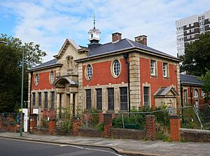
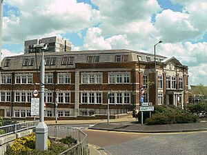
Erith's first library opened in 1906. It was designed by a local architect and funded by Andrew Carnegie, a famous helper of communities.
Engineering became a key industry in Erith. Factories made guns and cables. Vickers was a major employer, linked to the Royal Arsenal nearby.
During the First World War, Erith was important for making weapons. In the Second World War, the town was heavily bombed. This was because of its location near the river and the Royal Arsenal.
The bomb damage and a decline in trade led to big changes in the 1960s. Erith was redeveloped with new shops and homes. Some new buildings, like the tall apartment blocks, were built in a style called brutalism. This was a common way to build affordable housing at the time.
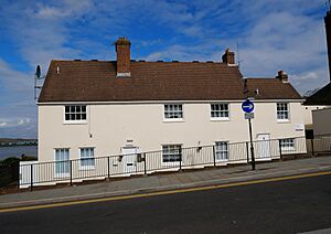
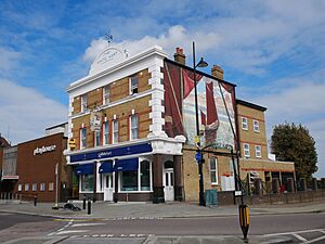
In 1965, Erith became part of the London Borough of Bexley. Demolition of the old town centre began in 1966 and continued until 1980. Many old Victorian buildings were lost. However, some historic parts remain, like the White Hart pub and St John's Church.
Modern Regeneration
Since the late 1990s, Erith has been changing a lot. This is part of the Thames Gateway project, which aims to improve areas along the River Thames. Bexley Council sees Erith as a key focus.
Many new flats have been built by the river. The Erith Western Gateway project plans to build more riverside flats. It also aims to improve a large area of the town centre. This will include new shops and over 500 new homes.
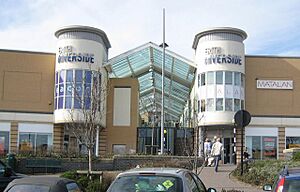
In 2020, local people helped get money to restore the old library building. It will become new community facilities.
Population of Erith
In 2011, about 62% of Erith's population was White British. This was down from 82% in 2001. The second largest group was Black African, at 14%.
In 2014, the average house price in Erith was £181,000. This was one of the lowest prices in Greater London.
Local Representation
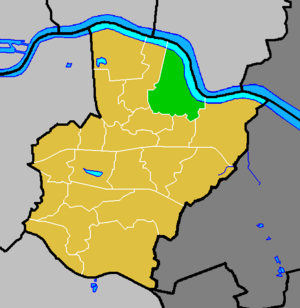
Most of Erith is in the Erith ward of the London Borough of Bexley. The local councillors are Joe Ferreira and Nicola Taylor, both from the Labour party. Parts of Erith are also in the North End and Colyers wards.
Most of Erith is in the Erith and Thamesmead area for the UK Parliament. The current Member of Parliament (MP) is Abena Oppong-Asare (Labour). The eastern part of Erith is in the Bexleyheath and Crayford area. Its MP is David Evennett (Conservative).
Erith is also part of the Bexley and Bromley London Assembly area. It is represented on the London Assembly by Gareth Bacon (Conservative).
Amenities in Erith
- Erith Leisure Centre, which has swimming pools, opened in 2005.
- The David Ives Stadium, also known as Erith Stadium, is home to Bexley Athletic Club.
- The Erith Playhouse Theatre is the biggest theatre in Bexley.
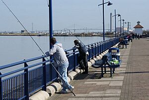
- Erith has the longest pier in Greater London.
- Erith Rowing Club is on the waterfront. Erith Yacht Club is a bit further downstream.
- There are two senior football clubs named for Erith. Only Erith Town is based in the town. Erith & Belvedere play in Welling.
Festivals
The annual Erith Riverside Festival takes place in Riverside Gardens. Erith is a starting point for the London Outer Orbital Path (LOOP). It's also a starting point for the Green Chain Walk. The Thames Path National Trail, which follows the River Thames, starts nearby.
Notable People from Erith
Many interesting people have connections to Erith:
- Philip Absolon (b. 1960), an artist, was born in Erith.
- Ronnie Aldrich (1916–1993), a jazz pianist, was born here.
- Patrick Young Alexander (1867–1943), an early aviation pioneer, was born in Belvedere, Erith.
- William Auld (1924–2006), a Scottish poet and Esperantist, was born in Erith.
- Sir William Anderson (1834–1898), an engineer and helper of the community, lived in Erith for many years.
- Tony Brise (1952–1975), a motor-racing driver, was born in Erith.
- Wendy Cope (b. 1945), a poet, was born here.
- John Downton (1906–1991), an artist, poet, and philosopher, was born in Erith.
- Kevin Horlock (b. 1972), a footballer for Northern Ireland, was born in Erith.
- Bill Jaques (1888–1925), a footballer, was born here.
- James Leasor (1923–2007), a journalist and author.
- Dave Martin (b. 1985), a footballer, was born in Erith.
- Douglas McWhirter (1886–1966), an amateur footballer who won a gold medal at the 1912 Summer Olympics, was born here.
- Percy Hilder Miles (1878–1922), a professor, violinist, and composer, lived in Erith.
- Alan Morton (b. 1950), a footballer, was born in Erith.
- Anthony Reckenzaun (1850–1893), an engineer, worked at the Erith Ironworks.
- Steve Rutter (b. 1968), a footballer, was born in Erith.
- Sam Saunders (b. 1983), a footballer, was born in Erith.
- James Stephanie Sterling (b. 1984), a video game journalist, was born and grew up in Erith.
- Denis Thatcher, husband of Prime Minister Margaret Thatcher, led a company in Erith until 1965.
- Henry Wheatley (1777–1852), who managed money for King William IV and Queen Victoria, was born and grew up near Erith.
Culture
A fun rhyme by William Cosmo Monkhouse about Erith: "There are men in the village of Erith that nobody seeth or heareth, and there looms on the marge of the river a barge, that nobody roweth or steereth".
Places of Worship
- Barnehurst Methodist Church
- Christ Church, Victoria Road
- Christadelphian Hall, Lesney Park Road
- Northend Baptist Church, Larner Road
- Northumberland Road Baptist Church, Belmont Road
- Our Lady of the Angels Catholic Church, Carlton Road
- Queen Street Baptist Church
- St Augustines Church (Slade Green), Slade Green Road
- St Johns the Baptist Church, West Street
- St Paul's Church, Mill Road
Transport in Erith
Buses
Erith is served by several bus routes run by Transport for London (TFL):
- 99 to Bexleyheath or Woolwich
- 180 to North Greenwich
- 229 to Sidcup or Thamesmead
- 428 to Bluewater
- 469 to Woolwich Common
- B12 to Joydens Wood
- N89 to Charing Cross (a night service)
Rail
The main train station is Erith. Trains run by Southeastern go towards Dartford, Gillingham, Gravesend, London Cannon Street and London Charing Cross. Slade Green railway station is also nearby and serves the eastern part of town.
Road
The A2016 road is a dual carriageway that goes through Erith Marshes.
Geography of Erith
Erith is a post town in the DA postcode area, which includes DA8 and DA18. It is bordered by the River Thames to the north. To the east and south-east is Slade Green. To the south and south-west is Northumberland Heath. To the west and north-west is Belvedere.
 |
Belvedere | Coldharbour (across the River Thames) | Rainham (across the River Thames) |  |
| Lessness Heath | Darent Industrial Park & Dartford Salt Marshes | |||
| Northumberland Heath | North End | Slade Green |
 | Victor J. Glover |
 | Yvonne Cagle |
 | Jeanette Epps |
 | Bernard A. Harris Jr. |


