Fort Irwin National Training Center facts for kids
Quick facts for kids Fort Irwin National Training Center |
|
|---|---|
| San Bernardino County, California | |
NTC's shoulder sleeve insignia
|
|
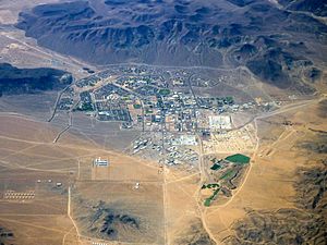
Aerial view of Fort Irwin
|
|
|
Position in California
|
|
| Coordinates | 35°14′47″N 116°40′55″W / 35.24639°N 116.68194°W |
| Type | Training center |
| Site information | |
| Owner | United States Army |
| Controlled by | US Army Forces Command |
| Condition | In use |
| Site history | |
| Built | 1940 |
| In use | 1940–1942; 1951–1972; 1980–present. |
| Garrison information | |
| Current commander |
BG Curtis Taylor (Commanding General) COL Jason Clarke (Garrison Commander) |
| Occupants | Blackhorse Operations Group: Ghost Team (Information Advantage) Bronco Team (Brigade Trainers) Scorpions (the Green Team, America’s First O/C team) Cobras (the Blue Team, the Cavalry Trainers) The Mighty Goldminer Team |
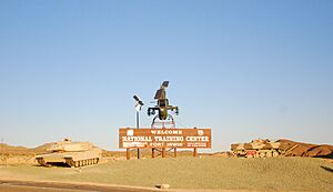
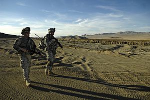
Fort Irwin National Training Center (also called Fort Irwin NTC) is a very important place where the United States military trains. It's located in the Mojave Desert in northern San Bernardino County, California. Fort Irwin is about 2,454 feet (748 m) above sea level. It's about 37 miles (60 km) northeast of Barstow, in the Calico Mountains.
The National Training Center is part of the US Army Forces Command (FORSCOM). A special group called the 11th Armored Cavalry Regiment, also known as the Blackhorse Cavalry, is based here. Their job is to act as the "enemy" force for other units that come to Fort Irwin for training. In 2017, a new hospital opened at Fort Irwin to help people living there.
Fort Irwin also works within a special air traffic area called the R-2502 Special Use Airspace Complex.
Contents
History of Fort Irwin
The area around Fort Irwin has a long history, going back almost 15,000 years. It's believed that Native Americans lived here during the Lake Mojave Period. The first time Europeans recorded seeing Native American settlements was in 1776. This was when a Spanish missionary named Padre Francisco Garces traveled the Mohave Trail with Mohave Indian guides.
Later, in 1826, Jedediah Smith, a fur trapper, was likely the first European American to explore this area. Other pioneers soon followed him, using the Old Spanish Trail. This trail crossed the eastern part of what is now Fort Irwin. It was a path between Santa Fe and Los Angeles.
In 1844, Captain John C. Fremont and Kit Carson were the first members of the US Army to visit the Fort Irwin area. Captain Fremont set up a camp near Bitter Springs. This camp became an important place for travelers to get water and let their animals graze. This was especially true during California's settlement and the gold rush.
The California Gold Rush brought more people and trade, but also some problems. As more travelers used the Mormon Road (which followed parts of the Old Spanish Trail), horse stealing became an issue. In 1847, the Army's Mormon Battalion patrolled the area to stop this. By 1855, it was a main route for wagons carrying goods between Los Angeles and Salt Lake City. In 1860, the Army built Camp Bitter Springs, a small stone fort, to help control the area.
In the 1880s, the area became very busy when borax was discovered nearby in Death Valley. Mining grew, and soon railroads, workers, and businesses led to the growth of the nearby town of Barstow.
Militarily, things were quiet for a while after the Indian Wars. In 1940, President Franklin D. Roosevelt created the Mojave Anti-Aircraft Range. This was a large military area of about 1,000 square miles (3,000 km2). In 1942, it was renamed Camp Irwin, honoring Major General George LeRoy Irwin. It became part of the Desert Training Center. However, two years later, Camp Irwin was closed down.
Camp Irwin reopened in 1951 as the Armored Combat Training Area. It was used to train combat units during the Korean War. On August 1, 1961, it became a permanent base and was renamed Fort Irwin. During the Vietnam War, many units trained and left for deployment from Fort Irwin.
In 1971, the base was closed again. From 1972 to 1980, the California National Guard mainly used Fort Irwin for training.
The National Training Center is Born
On August 9, 1979, the Army announced that Fort Irwin would become the National Training Center (NTC). It was a perfect spot because it was isolated, had over 1,000 square miles (2,600 km2) for training, and clear airspace. The NTC officially started on October 16, 1980. Fort Irwin then became an active base again for the Regular Army.
The NTC was special because it used new ways to train. It used a system to track soldiers in real-time and lasers to pretend that weapons were firing. It also used computers to show what would happen with other types of weapons. This allowed trainers to review what happened in battles with videos and maps.
Since it opened, the NTC has seen many "firsts." Early units trained against the "Opposing Force" (OPFOR) using new systems like the Multiple Integrated Laser Engagement System (MILES). In 1985, M1 Abrams tanks and M2 Bradley fighting vehicles were first used on the NTC battlefield. The first training for light infantry units happened in 1985. The first training in Military Operations in Urban Terrain (MOUT) (fighting in cities) happened in 1993.
After the September 11, 2001 attacks, the NTC changed its training to focus on fighting against rebel groups, especially in desert areas. More recently, after the US left Afghanistan and the war in Ukraine started, the NTC began training soldiers for possible future fights against large, powerful armies.
What Fort Irwin Does
Fort Irwin has two main parts: the Fort Irwin garrison and the National Training Center.
The Fort Irwin garrison provides all the daily services for the base, like:
- Emergency services (fire, police)
- Housing and financial help
- Medical and veterinary services
- Religious support and social services
- Environmental and safety offices
The National Training Center part includes these important groups:
- The 11th Armored Cavalry Regiment (Blackhorse): These soldiers act as the 'enemy' for all the visiting units that come to train.
- The 916th Support Brigade: They help keep the base running and support the visiting units.
- The National Training Center (NTC) Operations Group: They are in charge of all the live training exercises.
- The Joint Center of Excellence: This group helps train soldiers to deal with IEDs (homemade bombs) and develops new ways to fight them.
- The Mission and Installation Contracting Command: They handle the maintenance and supplies for all parts of Fort Irwin.
- The Reserve Component Operations Plans and Training (RCOPT): They help integrate reserve military units into the training and advise the NTC leadership on reserve matters.
The NTC at Fort Irwin is still one of the most important training centers for the US Army. All parts of the US military, other government groups, and even some foreign military units train here. A fun tradition for visiting units is to paint their unit's sign on one of the rock formations near the main gate.
Training at the NTC is very tough. The exercises involve complex situations where units face strong enemy forces and rebel groups at the same time. They also have to help local people in the mock towns and villages.
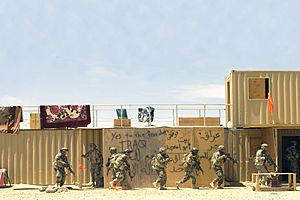
One cool feature of the NTC is its 12 fake "villages." These are used to train troops in Military Operations in Urban Terrain (MOUT) before they go to real-world missions. These villages have things like religious sites, hotels, and traffic circles. They are filled with actors who pretend to be local people, police, or even rebels. These actors speak Arabic and create all sorts of daily problems for the soldiers to solve.
The two biggest villages are called Razish and Ujen. The largest village has 585 buildings and is big enough for an entire brigade combat team to train in. The training uses both real and fake Unmanned Aircraft Systems (UAS), the Multiple Integrated Laser Engagement System (MILES), and includes forces from different countries, plus social media actions.
Special trainers called Observer, Controller, and Trainers (OCTs) work with the training units. Some villages have cameras and other equipment to help the OCTs give feedback to the soldiers after their training.
Geography and Climate

Fort Irwin covers a huge area of about 2,579.77 km2 (996.05 sq mi). Only a very small part of this is water. The main residential area, called a census-designated place (CDP), covers about 7.1 square miles (18 km2).
On its western side, you'll find the Goldstone Deep Space Communications Complex. This is a very important facility for communicating with spacecraft in deep space.
Climate
Fort Irwin has a cold desert climate. This means it's usually dry and can have big temperature changes between day and night.
| Climate data for Bicycle Lake AAF Elev: 2,350ft (1982,1986,1991-1998,2006,2010-2014 normals) | |||||||||||||
|---|---|---|---|---|---|---|---|---|---|---|---|---|---|
| Month | Jan | Feb | Mar | Apr | May | Jun | Jul | Aug | Sep | Oct | Nov | Dec | Year |
| Record high °F (°C) | 77 (25) |
86 (30) |
91 (33) |
96 (36) |
107 (42) |
113 (45) |
113 (45) |
114 (46) |
106 (41) |
102 (39) |
86 (30) |
74 (23) |
114 (46) |
| Mean daily maximum °F (°C) | 58 (14) |
62 (17) |
69 (21) |
76 (24) |
83 (28) |
95 (35) |
100 (38) |
99 (37) |
93 (34) |
79 (26) |
65 (18) |
57 (14) |
78 (26) |
| Mean daily minimum °F (°C) | 42 (6) |
43 (6) |
49 (9) |
53 (12) |
59 (15) |
69 (21) |
76 (24) |
76 (24) |
71 (22) |
59 (15) |
49 (9) |
42 (6) |
58 (14) |
| Record low °F (°C) | 20 (−7) |
18 (−8) |
30 (−1) |
35 (2) |
42 (6) |
46 (8) |
46 (8) |
46 (8) |
44 (7) |
31 (−1) |
7 (−14) |
18 (−8) |
7 (−14) |
| Source: AFCCC (extremes 1982,1986,1991-1998,2006,2010-2014) | |||||||||||||
People Living at Fort Irwin
|
Fort Irwin
|
|
|---|---|
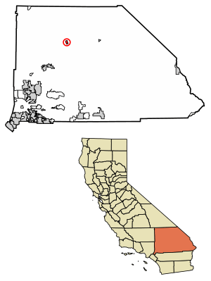
Location of Fort Irwin in San Bernardino County, California.
|
|
| Country | United States |
| State | California |
| County | San Bernardino |
| Elevation | 2,464 ft (751 m) |
| Population
(2020)
|
|
| • Total | 8,096 |
| Time zone | UTC-8 (Pacific) |
| • Summer (DST) | UTC-7 (PDT) |
| ZIP Code |
92310
|
| Area codes | 442/760 |
| GNIS feature ID | 2628733 |
The United States Census Bureau counts the people living at Fort Irwin as a separate place. In 2020, the population was 8,096 people.
Most people living at Fort Irwin are part of military families. In 2010, about 85% of the population lived in households, and many of these had children under 18. The community is diverse, with people from many different backgrounds living and working together.
Energy and Education
Fort Irwin Solar Project
The Fort Irwin Solar Project started in 2009. It's planned to be the biggest renewable energy project in the Department of Defense's history. The goal is to produce over 500 megawatts of clean solar power each year by 2022. This helps the base use less fossil fuels.
Education
Children living at Fort Irwin go to schools in the Silver Valley Unified School District.
Points of Interest
- You can find the remains of the Epsom Salts Monorail nearby. This was an old monorail used to transport minerals.
See also
 In Spanish: Reserva Militar Fort Irwin para niños


