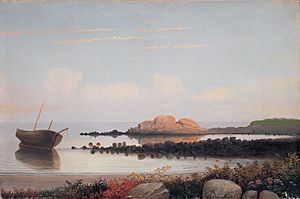
Gloucester, Massachusetts facts for kids
Quick facts for kids
Gloucester, Massachusetts
|
||
|---|---|---|
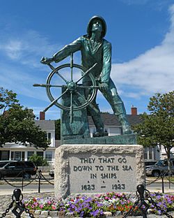
Man at the Wheel, Fisherman's Memorial Cenotaph
|
||
|
||
| Nickname(s):
"The Place To Be In The Summer"
|
||
| Motto(s):
"America's Oldest Seaport"
|
||
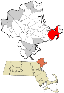
Location in Essex County and Massachusetts.
|
||
| Country | United States | |
| State | Massachusetts | |
| County | Essex | |
| Settled | 1623 | |
| Incorporated (town) | 1642 | |
| Incorporated (city) | 1873 | |
| Named for | Gloucester, England | |
| Government | ||
| • Type | Mayor-council city | |
| Area | ||
| • Total | 41.51 sq mi (107.51 km2) | |
| • Land | 26.19 sq mi (67.84 km2) | |
| • Water | 15.32 sq mi (39.68 km2) | |
| Elevation | 50 ft (15 m) | |
| Population
(2020)
|
||
| • Total | 29,729 | |
| • Density | 1,135.00/sq mi (438.23/km2) | |
| Time zone | UTC−5 (Eastern) | |
| • Summer (DST) | UTC−4 (Eastern) | |
| ZIP code |
01930
|
|
| Area code(s) | 351 / 978 | |
| FIPS code | 25-26150 | |
| GNIS feature ID | 0615084 | |
Gloucester (pronounced GLOST-ər) is a city in Essex County, Massachusetts, United States. It is located on Cape Ann and is part of Massachusetts's North Shore. In 2020, about 29,729 people lived there.
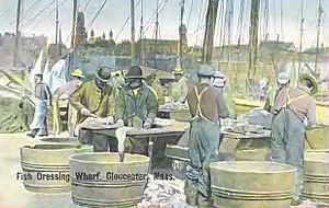
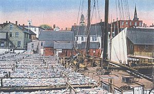
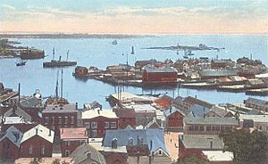
Gloucester is a very important place for the fishing industry. It's also a popular spot for summer visitors. The city has a main downtown area near the harbor, plus several smaller neighborhoods like Annisquam, Magnolia, and East Gloucester.
Contents
- Gloucester's Past: A Look at History
- Gloucester's Location and Getting Around
- People and Population in Gloucester
- Learning in Gloucester: Schools
- Gloucester's Economy
- Gloucester and the Sea: A Deep Connection
- Arts and Culture in Gloucester
- Fun Places to Visit in Gloucester
- Famous People from Gloucester
- See also
Gloucester's Past: A Look at History
Gloucester's original area included the town of Rockport, which was known as "Sandy Bay." Rockport officially became its own town in 1840. Later, in 1873, Gloucester became a city.
Early Native American and European Encounters
For thousands of years before Europeans arrived, Native Americans lived in what is now northeastern Massachusetts. When Europeans first came, the Agawam people lived here, led by their chief, Masconomet. There's even evidence of a Native American village on Pole's Hill in the Riverdale area.
In 1606, Samuel de Champlain explored Gloucester's harbor. He made the first known map of the harbor, calling it le Beau port (which means "the beautiful port"). This map shows that many Native Americans lived along the harbor's shores. In 1614, John Smith also explored the area and called the local people Aggawom.
In 1623, people from the Dorchester Company set up a permanent fishing outpost here. This Cape Ann settlement created a legal government, which eventually led to the Massachusetts Bay Colony. Roger Conant was the governor of this early settlement, making him the first governor of Massachusetts.
Life was very hard in this first settlement, and it didn't last long. Around 1626, the settlers moved to Naumkeag (now Salem, Massachusetts), where the soil was better for farming. They even took their meetinghouse and governor's house apart and moved them!
The Second English Settlement and Growth
After a few years, English colonists slowly began to resettle the area. The town was officially recognized in 1642 and was named "Gloucester." It was likely named after the city of Gloucester in England, which was a strong supporter of Parliament during a war there.
This new permanent settlement was built around the Town Green. This area was an inlet in the marshes near the Annisquam River. Today, it's a large traffic circle called Grant Circle. The first settlers built a meeting house here, and for nearly 100 years, this "Island" was the center of their community. Unlike other early towns, Gloucester didn't start around the harbor. People settled inland first, which is why the Town Green is almost two miles from the harbor.
The first school was also built at the Town Green. By law in the Massachusetts Bay Colony, any town with 100 or more families had to have a public school. Gloucester met this rule in 1698, and Thomas Riggs became the town's first schoolmaster.
In 1700, Gloucester's leaders recognized the land claim of Samuel English, who was the grandson of Chief Masconomet. They paid him seven pounds (a good amount of money back then) for the land.
The White-Ellery House was built in 1710 on the Town Green. It was made for Gloucester's first minister, Reverend John White.
Early jobs included farming and logging. Cape Ann's rocky land wasn't great for large farms, so families mostly grew enough food for themselves. Fishing was limited to areas close to shore. Gloucester fishermen didn't start fishing in the rich Grand Banks until the mid-1700s.
Early Gloucester settlers cut down many trees on Cape Ann for farms and pastures. They even used the timber to build structures as far away as Boston. The rocky areas of Gloucester stayed clear of trees for 200 years until forests grew back in the 20th century. The inland part of the island became known as the "Commons" or "Dogtown." Small, simple homes were scattered among the rocks and swamps there. Today, only the stone foundations of these homes and some walls remain visible along the trails.
Town Expansion and Granite Industry
As the town grew, colonists began living on the other side of the Annisquam River. Since church attendance was required by law, it was a long walk or row to church on Sundays. In 1718, settlers on the other side of the river formed "Second Parish." They built their own meetinghouse and burial ground.
Other parts of town followed. Third Parish was founded in northern Gloucester in 1728. Fourth Parish split off in 1742. Finally, in 1754, the people of Sandy Bay (now Rockport) formed Fifth Parish. All these church groups still exist today, except for Fourth Parish.
Gloucester once had a busy granite industry. An English writer named Harriet Martineau visited Gloucester in the 1830s and noticed how much granite there was. She wrote that the houses looked "squeezed in among the rocks" and that granite was everywhere. Blasting rocks to make room for houses was so common that people weren't even scared when pieces fell through roofs!
Gloucester's Location and Getting Around
Gloucester is located at 42°37′26″N 70°40′32″W. The city covers about 107.5 square kilometers (41.5 square miles). About 67.8 square kilometers (26.2 square miles) is land, and 39.6 square kilometers (15.3 square miles) is water.
Gloucester takes up most of the eastern part of Cape Ann, except for the very tip, which is the town of Rockport. The Annisquam River divides the city in half, flowing north into Ipswich Bay. At its southern end, the Blynman Canal connects it to Gloucester Harbor. The land along the river's northwestern shore is marshy, with several small islands. Gloucester Harbor has smaller coves, including the Western Harbor (where the Fisherman's Memorial is) and the Inner Harbor (home to the fishing boats). Eastern Point extends about 2 miles out, separating the eastern side of Gloucester Harbor from the rest of Massachusetts Bay.
Gloucester has several parks, like Ravenswood Park, Stage Fort Park, and Mount Ann Park.
The city is bordered by Rockport to the east and by Ipswich, Essex, and Manchester-by-the-Sea to the west. Gloucester is about 16 miles east-northeast of Salem and 31 miles northeast of Boston.
Route 128 ends in Gloucester. Route 127 and Route 133 also pass through the city. There are only three ways to cross between the eastern and western parts of town: the bridge over the Blynman Canal, the A. Piatt Andrew Memorial Bridge (carrying Route 128), and the Boston & Maine Railroad Bridge.
Gloucester has its own transportation system, the Cape Ann Transportation Authority, which serves the city and nearby towns. You can also take the MBTA Commuter Rail from two stops in Gloucester (West Gloucester and downtown) to Boston's North Station. For air travel, the closest airport is Beverly Municipal Airport. For national and international flights, Logan International Airport in Boston is the nearest option.
| Climate data for Gloucester, Massachusetts | |||||||||||||
|---|---|---|---|---|---|---|---|---|---|---|---|---|---|
| Month | Jan | Feb | Mar | Apr | May | Jun | Jul | Aug | Sep | Oct | Nov | Dec | Year |
| Record high °F (°C) | 68 (20) |
65 (18) |
86 (30) |
88 (31) |
95 (35) |
98 (37) |
100 (38) |
100 (38) |
97 (36) |
87 (31) |
76 (24) |
74 (23) |
100 (38) |
| Mean daily maximum °F (°C) | 35.3 (1.8) |
38.0 (3.3) |
45.0 (7.2) |
55.4 (13.0) |
65.4 (18.6) |
74.4 (23.6) |
79.9 (26.6) |
78.6 (25.9) |
71.2 (21.8) |
60.5 (15.8) |
50.7 (10.4) |
40.3 (4.6) |
57.9 (14.4) |
| Mean daily minimum °F (°C) | 18.1 (−7.7) |
20.3 (−6.5) |
27.0 (−2.8) |
35.9 (2.2) |
45.5 (7.5) |
55.1 (12.8) |
60.6 (15.9) |
59.8 (15.4) |
52.3 (11.3) |
41.0 (5.0) |
33.2 (0.7) |
23.7 (−4.6) |
39.4 (4.1) |
| Record low °F (°C) | −12 (−24) |
−12 (−24) |
−2 (−19) |
12 (−11) |
30 (−1) |
31 (−1) |
— | 43 (6) |
33 (1) |
20 (−7) |
10 (−12) |
−15 (−26) |
−15 (−26) |
| Average precipitation inches (mm) | 4.22 (107) |
3.54 (90) |
4.25 (108) |
4.34 (110) |
3.55 (90) |
3.63 (92) |
3.46 (88) |
3.40 (86) |
3.87 (98) |
4.22 (107) |
4.69 (119) |
4.27 (108) |
47.44 (1,205) |
| Average snowfall inches (cm) | 12.6 (32) |
12.7 (32) |
7.7 (20) |
1.4 (3.6) |
0 (0) |
0 (0) |
0 (0) |
0 (0) |
0 (0) |
0 (0) |
0.6 (1.5) |
7.2 (18) |
42.2 (107) |
| Jan | Feb | Mar | Apr | May | Jun | Jul | Aug | Sep | Oct | Nov | Dec | Year |
|---|---|---|---|---|---|---|---|---|---|---|---|---|
| 42.3 °F (5.7 °C) | 39.4 °F (4.1 °C) | 39.4 °F (4.1 °C) | 42.8 °F (6.0 °C) | 50.4 °F (10.2 °C) | 57.9 °F (14.4 °C) | 65.5 °F (18.6 °C) | 66.9 °F (19.4 °C) | 63.5 °F (17.5 °C) | 57.4 °F (14.1 °C) | 50.7 °F (10.4 °C) | 46.0 °F (7.8 °C) | 51.9 °F (11.1 °C) |
People and Population in Gloucester
In 2000, Gloucester had 30,273 people living there. There were about 12,592 households and 7,895 families. The population density was about 1,166 people per square mile.
Most people in Gloucester (96.99%) were White. Other groups included African American (0.61%), Asian (0.72%), and Native American (0.12%). About 1.48% of the population was Hispanic or Latino. Many people in Gloucester have Italian (22.6%), Irish (16.2%), English (11.1%), or Portuguese (8.5%) backgrounds.
About 27.6% of households had children under 18. The average household had 2.38 people, and the average family had 3.00 people.
The population was spread out by age: 22.0% were under 18, 6.5% were 18 to 24, 29.9% were 25 to 44, 26.1% were 45 to 64, and 15.6% were 65 or older. The average age was 40 years.
In 2007, the average income for a household in Gloucester was about $58,568. For families, it was about $80,970. About 8.8% of the population lived below the poverty line.
Learning in Gloucester: Schools
Gloucester has several schools that are part of the Gloucester Public Schools District:
- Gloucester High School (for grades 9–12)
- O'Maley Innovation Middle School (for grades 6–8)
- East Veterans Elementary School (for grades K-5)
- Plum Cove Elementary School (for grades K–5)
- Beeman Elementary School (for grades K–5)
- West Parish Elementary School (for grades K–5), which has a Science Park
- Gloucester Preschool
Gloucester's Economy
Many companies are based in Gloucester. Some well-known ones include Gorton's of Gloucester, Mighty Mac, Gloucester Engineering, Good Harbor Consulting, Para Research, Aid-Pack, Cyrk, and Varian Semiconductor.
Gloucester and the Sea: A Deep Connection
Gloucester was an important place for shipbuilding. The first schooner (a type of sailing ship) was supposedly built here in 1713. The community grew into a major fishing port because it was close to rich fishing areas like Georges Bank and other fishing banks off Nova Scotia and Newfoundland.
Gloucester's most famous seafood company is Gorton's of Gloucester. It started in 1849 as John Pew & Sons. The famous "Gorton's Fisherman" image is known all over the country. Besides catching and processing seafood, Gloucester is also a center for studying marine life and protecting the ocean. Ocean Alliance has its main office in the city.
In the late 1800s, many Portuguese and Italian immigrants came to Gloucester. They were looking for work in the busy fishing industry and a better life in America. Many of today's fishermen in Gloucester are descendants of these early immigrants. You can see the strong Portuguese and Italian influence in the many festivals held throughout the year.
During the Catholic celebration of St. Peter's Fiesta, relatives of fishermen carry oars to represent the many fishing boats that call Gloucester home. Saint Peter is the patron saint of fishermen. Gloucester is still an active fishing port. In 2013, it ranked 21st in the United States for the amount of fish caught, bringing in about $42 million from 62 million pounds of fish.
Arts and Culture in Gloucester
Painting and Printmaking
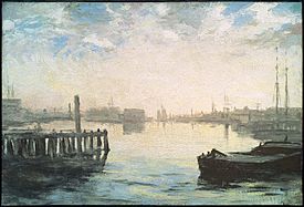
Gloucester's beautiful scenery, active fishing industry, and art community have attracted painters since the early 1800s. The first famous painter from Gloucester was Fitz Henry Lane, whose home is still on the waterfront. The Cape Ann Museum has a large collection of his paintings and drawings.
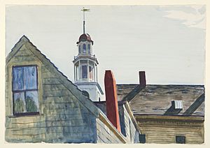
Many other famous painters were also drawn to Gloucester, including William Morris Hunt, Winslow Homer, Childe Hassam, Edward Hopper, John Sloan, and Mark Rothko.
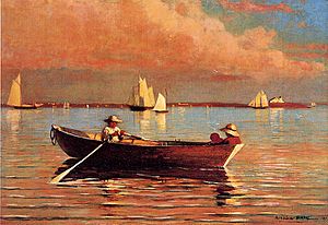
Smith Cove is home to the Rocky Neck Art Colony, which is the oldest art colony in the country. Folly Cove was where the Folly Cove Designers worked. They were very important for print design and techniques.
Sculpture
Several important sculptors have lived and worked in Gloucester, including Anna Hyatt Huntington, Paul Manship, and Walker Hancock.
Literature: Books and Poems
- Captains Courageous (1897) by Rudyard Kipling is a famous book set in Gloucester. It was even made into a movie in 1937.
- T. S. Eliot (1888–1965), a famous poet, spent his summers in Gloucester when he was young. He found a lot of inspiration here. One of his poems, The Dry Salvages, is named after rocks off the coast of Gloucester.
- Charles Olson (1910–1970), another poet, wrote a long poem called The Maximus Poems that was all about Gloucester.
- The fictional town of Innsmouth in horror writer H. P. Lovecraft's story The Shadow Over Innsmouth is thought to be partly based on Cape Ann and Gloucester.
- The book The Perfect Storm tells the true story of a huge storm in 1991 and features people from Gloucester. Parts of the movie based on the book were filmed here.
- Ten Hours Until Dawn by Michael J. Tougias is about the loss of a pilot boat during the blizzard of 1978, with Gloucester's coast guard station as a main setting.
- Novels like Gloucesterbook by Jonathan Bayliss are set in a fictional version of Gloucester called "Dogtown."
- Anita Diamant has also set two novels, The Last Days of Dogtown and Good Harbor, in Gloucester.
Comics
Gloucester is the birthplace of Dane Whitman, a Marvel superhero known as the Black Knight.
Film and Television
Many movies and TV shows have been filmed or set in Gloucester:
- Author! Author! had scenes shot on Good Harbor Beach.
- The Good Son was filmed in Gloucester.
- Manchester by the Sea was largely filmed here.
- Mermaids had scenes in the Magnolia area.
- Moonlight Mile was almost entirely filmed in Gloucester.
- The Perfect Storm was filmed and set in Gloucester.
- The 2021 film CODA was based and shot in Gloucester.
- The National Geographic Channel films its reality show Wicked Tuna in Gloucester, which is about commercial tuna fishermen.
- Episodes of Route 66, Bewitched, and Spenser: For Hire have also been set or filmed in Gloucester.
Theater
The Gloucester Stage Company puts on plays each season, mostly in the summer. It's located right on the water overlooking Smith's Cove. It was started in 1979 to support playwrights and new plays. Many plays developed here have become very successful.
Architecture
Gloucester has many important buildings. These range from houses built before the American Revolution to the City Hall, built in the 1870s, which stands on a hilltop overlooking the town. There are also unique waterfront homes that are now museums, like Beauport. This house was built between 1907 and 1934 by designer Henry Davis Sleeper.
Another interesting building is Hammond Castle, built from 1926 to 1929 by inventor John Hays Hammond, Jr.. He built it to display his collection of ancient Roman, medieval, and Renaissance artifacts.
Gloucester was also home to Judith Sargent Murray, a feminist writer, and John Murray, who founded the first Universalist Church in America. Their house is now the Sargent House Museum. Other museums in the downtown area include the Cape Ann Museum and Maritime Gloucester, which is also an aquarium.
Fun Places to Visit in Gloucester
- The schooner Adventure
- Annisquam
- Cape Ann Museum
- Dogtown Common
- Norman's Woe, known for shipwrecks
- Ravenswood Park
- Rocky Neck Art Colony, the oldest working art colony in America
- Sargent House Museum
- Stage Fort Park
- White-Ellery House
Gloucester's most famous landmark is the Man at the Wheel statue, also called the "Gloucester Fisherman's Memorial Cenotaph." It honors "They that go down to the sea in ships," a quote from the Bible.
Gloucester's biggest yearly event is St. Peter's Fiesta. The local Italian-American community organizes it on the last weekend of June. The festival includes a blessing of the fleet and a fun greasy pole contest.
Famous People from Gloucester
- Sylvester Ahola, a jazz trumpeter
- Willie Alexander, a singer and keyboard player
- A. Piatt Andrew, a congressman and Harvard professor
- Roger Babson, who founded Babson College
- Thomas P. Barnett, a painter
- Jonathan Bayliss, a novelist
- Cecilia Beaux, a painter
- Howard Blackburn, a fisherman and adventurer
- Nell Blaine, a painter
- Clarence Birdseye, who started the modern frozen food industry
- Kyle Bochniak, an MMA Fighter
- Phil Bolger, a boat designer
- Hugo Burnham, drummer for the band Gang of Four
- Virginia Lee Burton, a children's book author (The Little House)
- Roger Conant, the first governor of the Cape Ann colony
- Carleton S. Coon, an anthropologist
- Roger Cressey, a former member of the U.S. National Security Council
- Thomas Dalton, an abolitionist leader
- Aristides Demetrios, a sculptor
- James Elliot, an author and U.S. Representative
- Henry Ferrini, a filmmaker
- Vincent Ferrini, Gloucester's first Poet Laureate
- Thomas Gardner, an early colonist
- Gregory Gibson, an author
- Raymond Greenleaf, an actor
- Emil Gruppe, a painter
- John Hays Hammond, Jr., an inventor who built Hammond Castle
- Halfdan M. Hanson, an architect
- Walker Hancock, a sculptor
- Sterling Hayden, an actor and writer
- Helen Hayes, an actor
- Winslow Homer, a famous painter
- Israel Horovitz, a playwright
- Alpheus Hyatt, a naturalist
- Anna Hyatt Huntington, a sculptor
- Elliott Jaques, a social scientist
- Alfred "Centennial" Johnson, the first person to cross the Atlantic Ocean alone
- Hilton Kramer, an art critic
- Fitz Henry Lane, a famous painter born in Gloucester
- Paul Manship, a sculptor
- Stuffy McInnis, a Major League Baseball player
- Tony Millionaire, an artist and animator
- Shawn Milne, a Cyclist
- William Monahan, an Academy Award-winning screenwriter
- Sun Myung Moon, a religious leader
- Richard Murphy, a schooner captain
- John Murray, who founded the Universalist denomination
- Judith Sargent Murray, a feminist writer
- Laura Nyro, a singer and songwriter
- Charles Olson, a poet
- Kris Osborn, a news commentator
- Mark Parisi, author of the comic strip Off the Mark
- Cy Perkins, a Major League Baseball catcher
- Herb Pomeroy, a jazz musician
- Jessie Ralph, an actress
- Marc Randazza, a lawyer and columnist
- Russ Russo, an actor
- Daniel Sargent, a merchant and politician
- Epes Sargent, an editor and poet
- Henry Sargent, a painter
- Paul Dudley Sargent, a Revolutionary War hero
- Winthrop Sargent, a patriot and governor
- Ben Smith, an Olympic ice hockey coach
- Benjamin A. Smith II, a U.S. senator and Mayor of Gloucester
- William Stacy, a Revolutionary War officer
- Vermin Supreme, a performance artist and politician
- Martin Weitzman, an economist
- Martin Welch, a schooner captain
- Philip Saltonstall Weld, a famous sailor
- Anna Maria Wells, a poet and writer for children
- Alfred J. Wiggin, a painter
- Charles Brenton Fisk, an organbuilder
See also
 In Spanish: Gloucester (Massachusetts) para niños


