Harting facts for kids
Quick facts for kids Harting |
|
|---|---|
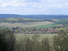
 South Harting seen from Harting Down |
|
| Area | 32.16 km2 (12.42 sq mi) |
| Population | 1,451 (2011) |
| • Density | 44/km2 (110/sq mi) |
| OS grid reference | SU786215 |
| • London | 48 miles (77 km) NE |
| Civil parish |
|
| District |
|
| Shire county | |
| Region | |
| Country | England |
| Sovereign state | United Kingdom |
| Post town | PETERSFIELD |
| Postcode district | GU31 |
| Dialling code | 01730 |
| Police | Sussex |
| Fire | West Sussex |
| Ambulance | South East Coast |
| EU Parliament | South East England |
| UK Parliament |
|
| Website | Parish Council |
Harting is a lovely area in West Sussex, England. It is found on the northern side of the South Downs. Harting includes the main village of South Harting and smaller areas called East Harting, West Harting, and Nyewood. It is about 3.5 miles (5.6 km) southeast of Petersfield in Hampshire.
The total area of Harting is about 32.16 square kilometres (12.42 sq mi). In 2011, about 1,451 people lived here. This was a small increase from 1,407 people in 2001.
Contents
A Glimpse into Harting's Past
Harting has a very old history! It was even mentioned in the Domesday Book in 1086. The Domesday Book was like a big survey ordered by King William the Conqueror. It listed all the lands and properties in England. Harting was called Hertinges back then.
It was a large manor with 196 households. These included villagers, small farmers, and even slaves. The area had lots of land for farming, meadows, woods, and nine mills. It was very valuable to the lords who owned it.
For a long time, the King owned the manor of Harting. But in 1610, it was given to the Caryll family. Later, in 1746, the Featherstonhaugh family bought the manor. They still own it today.
Exploring Harting Down
The villages of Harting are overlooked by Harting Down. This is a large common area, about 550 acres (2.2 km²) in size. The National Trust owns it. It is also part of the Sussex Downs Area of Outstanding Natural Beauty.
Harting Down rises to 229 metres (751 ft) high. From the top, you can see amazing views. You can look north over the Weald or south towards the English Channel and the Isle of Wight.
Ancient History on the Down
People have lived on Harting Down for a very long time. Evidence suggests that the area was first used about 5,000 years ago. Nearby Beacon Hill has an old hillfort from the Iron Age. This fort was built around 500 BC. It was likely used as a safe place for animals and people.
Around the same time, a cross ridge dyke was built. This was a ditch and bank system. It might have helped control how people and animals moved along the ridgeway.
Telegraph Station and a Unique School
Because it is so high up, Beacon Hill was once home to a special station. From 1796 to 1816, it had a shutter telegraph chain station. This system sent messages using big shutters. It connected the navy in Portsmouth to London.
Later, in 1822, a different type of semaphore station opened. It worked until 1847. Much later, in 1927, a famous thinker named Bertrand Russell and his wife Dora started an experimental school here. It was called Beacon Hill School.
The Vandalian Tower
West of Beacon Hill is Tower Hill. On top of this hill, you can find the Vandalian Tower. This tower is a "folly," which means it was built for fun, not for a real purpose. It dates back to the 1700s.
The tower was built to celebrate the founding of an American colony called Vandalia in 1774. However, the American Revolution meant the colony never really started. The tower is now in ruins and you cannot go inside. But you can still see it from the outside.
Nature on Harting Down
A large part of Harting Down has never been used for modern farming. This makes it a very important place for nature. It has chalk grassland, which used to cover much of the downs. You can find special plants here like quaking grass and the common spotted orchid.
The down is also home to many animals. You might see adders, skylarks, and different kinds of butterflies. It is a great place to see local wildlife.
How Harting is Governed
Harting is part of an electoral ward. An electoral ward is an area that elects people to represent it in local government. This ward includes Harting and the nearby areas of Elsted and Treyford and Trotton with Chithurst. In 2011, about 2,026 people lived in this ward.
 | Emma Amos |
 | Edward Mitchell Bannister |
 | Larry D. Alexander |
 | Ernie Barnes |


