
Hualālai facts for kids
Quick facts for kids Hualālai |
|
|---|---|

View of Hualālai over 1800 lava flow
|
|
| Highest point | |
| Elevation | 8,271 ft (2,521 m) |
| Prominence | 3,071 ft (936 m) |
| Naming | |
| Language of name | Hawaiian language |
| Geography | |

Hualālai
Location in Hawaii
|
|
| Location | Hawaiʻi, U.S. |
| Parent range | Hawaiian Islands |
| Topo map | USGS Hualālai |
| Geology | |
| Age of rock | Oldest-dated rock: 128,000 BP Estimated: over 300,000 years |
| Mountain type | Shield volcano |
| Volcanic arc/belt | Hawaiian-Emperor seamount chain |
| Last eruption | 1800 to 1801 |
| Climbing | |
| Easiest route | Multiple trails exist. |
Hualālai is an active volcano on the island of Hawaiʻi in the Hawaiian Islands. It is the third-youngest and third-most active of the five volcanoes that make up Hawaiʻi. Its peak is about 8,271 feet (2,521 meters) above sea level. Scientists believe Hualālai first appeared above the ocean around 300,000 years ago.
Even though Hualālai has been very quiet since its last eruption in 1801, it is still considered active. Experts expect it to erupt again within the next 100 years. Because the area has been so calm, many people have built homes and resorts nearby. This means a future eruption could have a big impact.
People have lived near Hualālai for many centuries. The coast west of the volcano was once home to several royal Hawaiian areas. Hualālai is also important for nature. It has many rare plants and animals, and several nature reserves near its top. Today, the coast is a popular spot for vacation resorts. Some of these resorts are built right on old lava flows.
Contents
What is Hualālai?
How Hualālai was formed

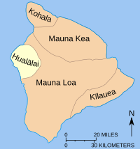
Hualālai is a shield volcano. This means it has gentle slopes, like a warrior's shield lying on the ground. It stands 8,271 feet (2,521 meters) tall. Hualālai is the westernmost of the five main volcanoes that form the island of Hawaiʻi.
The volcano has three main areas where lava tends to break through, called rift zones. These are like cracks in the volcano's side. Along these rift zones, you can find over 100 small hills made of volcanic rock, called cinder and spatter cones. Hualālai does not have a large caldera (a big bowl-shaped crater at the top). Instead, it has a smaller collapse crater at its summit.
Much of the southern side of the volcano is covered by old lava flows. These flows are topped with a layer of volcanic ash that is about 4 to 40 inches (10 to 100 cm) thick. Hualālai is the third tallest, third youngest, and third most active volcano on the island. It makes up about 7% of the island's land.
Puʻu Waʻawaʻa: A unique part of Hualālai
A special feature of Hualālai is Puʻu Waʻawaʻa. This Hawaiian name means "many-furrowed hill." It is a large volcanic cone that stands 1,220 feet (372 meters) tall. It is made of a type of lava called trachyte. This kind of lava is found nowhere else on Hawaiʻi. Trachyte lava moves much slower than the usual "runny" Hawaiian lavas. This is because it has a lot more silica (over 62%) compared to typical basalt lava (about 50% silica).
Scientists think Puʻu Waʻawaʻa first formed during a pumice eruption over 100,000 years ago. It has continued to grow since then.
Underwater features
The side of Hualālai that faces west goes deep into the ocean. This area forms a large underwater slump called the North Kona slump. This slump covers about 386 square miles (1,000 km²). It has many beaches and steep underwater cliffs. These features are found 6,500 to 14,700 feet (2,000 to 4,500 meters) below the ocean surface.
In 2001, a project by Japan and the United States explored this area. They used a special underwater robot called ROV Kaikō. The information they gathered showed that the lava flows here came from shallow water, about 1,600 to 3,300 feet (500 to 1,000 meters) deep. Unlike other similar underwater slumps, the one at Hualālai formed slowly over time.
Hualālai is also known for bringing up special rocks called xenoliths. These are pieces of rock from the Earth's mantle, deep inside the Earth. Many old lava flows, including those from the 1801 eruption, contain many large xenoliths.
Hualālai's Eruption History
Hualālai is the third most active volcano on the island of Hawaiʻi. It is less active than Kīlauea and Mauna Loa. While those two volcanoes have erupted over 150 times in the last 1,000 years, Hualālai has only erupted 3 times. It seems to erupt about every 200 to 300 years.
Because Hualālai has been quiet for a long time, many homes, businesses, and resorts have been built on its sides. The last big activity at the volcano was in 1929. At that time, a strong series of earthquakes shook Hualālai. This was probably caused by magma moving deep inside the volcano. Even though it has been quiet, Hualālai is still active and is expected to erupt again within the next 100 years.
The 1800–1801 eruption

Hualālai's last eruption happened in 1800–1801. This eruption sent very runny lava flows into the ocean on the western side of Hawaiʻi island. Five different vents (openings) on the volcano were active. However, only two of them produced lava flows that reached the ocean. The total amount of lava that came out was huge, about 300 million cubic meters.
One of these vents, high on the volcano's slope, created a large lava flow called the Kaʻūpūlehu flow. This flow reached the ocean in two separate streams. On its way down, it covered a village and a valuable fishing pond. There is a local legend that the flow finally stopped when King Kamehameha I threw a lock of his own hair into the fire. The Kaʻūpūlehu flow is also famous for the large number of xenoliths it carried up from deep inside the Earth.
The other major lava flow from this eruption reached the sea south of Kiholo Bay. This 1801 flow, called the Huʻehuʻe flow, created Keahole Point. Today, Kona International Airport is located on this point, about 11 miles (18 km) north of Kailua-Kona. The eruption at Hualālai happened at the same time as an eruption at nearby Mauna Loa. Scientists think that Hualālai has erupted at the same time as Mauna Loa and Kīlauea in the past.
Future monitoring of Hualālai

Hualālai is expected to erupt again soon. Its usual quiet period of 200 to 300 years is ending. This is a real danger for the towns around it. For example, if an eruption like the 1801 event happened again, the town of Kailua-Kona, which is 15 miles (24 km) from the volcano's top, could be covered in lava in just a few hours.
The United States Geological Survey (USGS) ranks lava flow hazards from 1 to 9. Hualālai is listed as threat level 4. For comparison, most of Kīlauea and Mauna Loa are levels 1 to 3, meaning they are more dangerous. The sides of Hualālai are just as dangerous as the areas near the rift zones. This is because the distance to towns is short and the slopes are steep.
Since 1991, the Hawaiian Volcano Observatory (HVO) has had a station near Hualālai's summit to watch the volcano. So far, there have been no signs of magma moving, like earthquake swarms or harmonic tremors. While Hualālai does have a few magnitude-4 earthquakes each year, these come from deep under the ocean and are not linked to magma movement. The USGS is improving its monitoring equipment. They plan to add more sensors to help watch the volcano. The HVO also uses GPS to measure tiny changes in Hualālai's shape. These changes could show magma moving. They have done surveys every two years since 1986, but as of 2010, no changes have been seen.
Human History Around Hualālai

Native Hawaiian people have lived around Hualālai for a very long time. Centuries ago, the Ahu A Umi Heiau (a sacred temple) was built on the dry land east of the mountain. The Kaloko-Honokōhau National Historical Park is on the coast west of Hualālai. It covers the site of an ancient Hawaiian village. Even though the area was called "lands without water," the rocky volcanic coast attracted a lot of sea life, making it a good place to live.
The park has two main attractions. One is the Kaloko fishpond, which is a fishpond built with interlocking rocks across a natural bay. The other is Honokōhau, which was once a large settlement on the park's south side.
"Outside the (royal) enclosure, by the edge of the sea, was a spring called Ki'ope ... It was a gathering place for those who went swimming and a place where the surf rolled in and dashed on land when it was rough. It was deep enough there for boats to land when the tide was high".
Places like Kamakahonu, Holualoa Bay, and Keauhou Bay were favorite spots for Hawaiian royalty. King Kamehameha I rested here after uniting the Hawaiian islands. After he died in 1819, there was a lot of social change. The Mokuaikaua Church, built in 1837 for missionaries using lava rock and crushed coral, is still standing today. The Huliheʻe Palace, where many of Hawaii's last kings stayed, has been a museum since 1927.
Today, the coast west of Hualālai is popular for vacation resorts. The mountain's rain shadow means this area gets many sunny days. The first resort, Kona Village, was built in 1961. Since then, the Four Seasons Resort and the Kūkiʻo golf course have also been built on the 1800 lava flow. Both the Kona Village Resort and the Four Seasons Resort were damaged by the tsunami from the 2011 Sendai earthquake.
Much of the famous Kona coffee grows on Hualālai's western slope, near the town of Holualoa. The family of an early coffee merchant, Henry Nicholas Greenwell, owned a large ranch on the volcano's western side. A road from Kailua-Kona up Hualālai's slopes is named for Frank "Palani" Greenwell.
Nature and Environment on Hualālai

While some parts of Hualālai are bare volcanic rock, most of it is covered with plants. Bushes, ferns, and grass are common. Even some ōhiʻa lehua trees grow near the summit. Many of the collapse craters have plants inside, and some even have small "vertical forests" with eucalyptus trees. The volcano is home to many birds and animals. The coast attracts many fish and sea animals, like the green sea turtle and the black-winged stilt. Hualālai gets about 18 inches (46 cm) of rain each year. The summit gets more rain than the coast and is often covered in clouds and volcanic haze (vog).
Several nature reserves are located on Hualālai's sides. The Puʻu Waʻa Waʻa forest sanctuary was created in 1992. It is a place for long-term research on Hawaiian moist forest and dry forest areas. It is located about a mile from the volcano's summit on its northwestern side. The elevation here ranges from sea level to 6,300 feet (1,920 meters) near the top. The southern part of this reserve, closest to the summit, has been made into a bird sanctuary.
The Honuaula forest reserve is on the southwestern side of the volcano. It protects a large forest of koa trees. There are also smaller Naio and Māmane trees, with ʻĀkala and various ferns growing underneath. This reserve covers 655 acres (2.65 km²) and protects an ecosystem that has mostly been cut down in the surrounding areas. The Wai Aha spring reserve, on the lower slopes, is a bit swampy. It is home to the flowering evergreen ōhiʻa, the woody climber ʻIeʻie, and a thick growth of ʻAmaʻu ferns.
Images for kids

See also
 In Spanish: Hualalai para niños
