Razzakov facts for kids
Quick facts for kids
Isfana / Razzakov
Kyrgyz: Исфана / Раззаков
|
|
|---|---|
|
Town
|
|
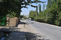
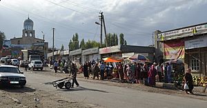
One of the streets of Razzakov
|
|
| Country | |
| Region | Batken |
| District | Leylek |
| City status | 2001 |
| Area | |
| • Town | 41.35 km2 (107 sq mi) |
| Elevation | 1,320 m (4,330 ft) |
| Population
(2021)
|
|
| • Town | 34,219 |
| • Density | 827.55/km2 (319.8/sq mi) |
| • Urban | 23,038 |
| Time zone | UTC+6 (KGT) |
| Postal code |
720400
|
| Area code(s) | +996 3656 |
| Website | isfana.kg |
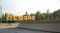
Razzakov (Kyrgyz: Раззаков; Uzbek: Razzoqov), once known as Isfana, is a small town in the far western part of Batken Region in southern Kyrgyzstan. It is located in the southern Fergana Valley. This area is surrounded on three sides by Tajikistan. On March 18, 2022, President Sadyr Japarov renamed the town to honor Iskhak Razzakov.
People have lived in Razzakov since at least the 9th century. The town changed a lot during the Soviet era. A local council, called a selsoviet, was set up in Isfana in 1937. This council became a village administration in 1996. In 2001, Askar Akayev, who was president at the time, issued a special order to make Isfana a town.
Razzakov is the main administrative center for Leylek District. Several nearby villages are also managed by the Razzakov Mayor's Office. These villages include Ak-Bosogo, Samat, Chimgen, Taylan, Ak-Bulak, and Golbo. As of 2021, the total population of Razzakov and these villages is 34,219 people. The town of Razzakov itself has a population of 23,038.
Contents
Understanding the Town's Name
The name "Isfana" is thought to come from an old language called Sogdian. The word asbanikat or aspanakent meant "the land of horses". A historian named Numon Negmatov believes that from the 1st to the 9th centuries, the town was called Asbanikat. From the 10th to the 12th centuries, it was known as Aspanikent. Over time, starting around the 12th or 13th century, the name slowly changed. It became Asbani, then Aspana, Asvona, Isvona, and finally, Isfana.
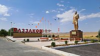
Since "Isfana" is not a Kyrgyz word, some Kyrgyz people wanted to rename the town. They suggested honoring Iskhak Razzakov, who was an important leader in the Kyrgyz Soviet Socialist Republic. In December 2021, President Sadyr Japarov announced that he would rename the town after Razzakov. This decision was made during a time of border tensions with neighboring Tajikistan. On March 16, 2022, the Supreme Council (Kyrgyzstan's parliament) passed a law to officially rename Isfana to Razzakov.
Exploring Razzakov's History
Early Beginnings
The history of Razzakov goes back to the 9th to 16th centuries. In 1957, an archeologist found items from the 14th to 16th centuries in the town. Historian Numon Negmatov believes that Razzakov is the same as the medieval town of Asbanikat. This town was first part of Osrushana. Later, it was taken over by the Samanids.
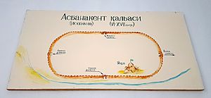
In 1221, the Mongol Empire attacked and conquered Isfana. The northwestern part of Razzakov, where the Mongols entered, is still called "conquered by the Mongols" in local languages. The old town of Isfana was located in the center of what is now Razzakov. It had a large fortress built in the 12th century. The last parts of this fortress were taken down in the 1970s.
18th and 19th Centuries
For many years, Razzakov was part of different states that ruled the area. From 1709 to 1876, Isfana was part of the Khanate of Kokand, which was an Uzbek state. In the mid-1800s, the Russian Empire began to take over areas in Central Asia. By the late 19th century, Russia had conquered all three main states in the region. The Kokand Khanate officially became part of the Russian Empire in 1876.
A Russian linguist named Mirsalikh Bekchurin wrote that in 1866, Isfana had about 500 households. However, an Uzbek historian, Temirboy Yoqubov, disagreed. He said that Isfana's residents had historically paid taxes for 1,000 households. Bekchurin also noted that Isfana was protected by 200 soldiers. These soldiers were armed mainly with spears and swords.
Soviet Era and Modern Times
Even though Razzakov was historically an Uzbek settlement, it became part of present-day Kyrgyzstan. When the Russians divided the Turkestan Autonomous Soviet Socialist Republic into smaller areas, Isfana became part of the Kara-Kirghiz Autonomous Oblast. This area later became the Kirghiz ASSR and then the Kirghiz SSR. After the Soviet Union broke apart, the Kirghiz SSR became Kyrgyzstan. So, Isfana, despite having many Uzbek residents, became part of Kyrgyzstan.
Some people believe that the Soviets drew borders in a way that mixed different ethnic groups. This was done to make people rely on the central government in Moscow. This strategy is sometimes called Joseph Stalin's "divide and rule" policy. Today, there are many traditionally Uzbek settlements in Kyrgyzstan. Many people in Central Asia think these places should belong to a different country. However, some experts say that during the Soviet border-drawing, many areas were already ethnically mixed. This made it hard to create clear boundaries based on ethnicity.
Razzakov changed a lot during the Soviet period. It went from being an undeveloped Muslim settlement to a typical Soviet village. The local council (selsoviet) was set up in 1937. During World War II, 571 people from the village went to fight, and 385 of them died. The Isfana selsoviet became a village administration in 1996. In 2001, President Askar Akayev ordered Isfana to become a town. The town was renamed Razzakov on March 16, 2022.
Geography of Razzakov
Razzakov is located in the western part of Batken Region. It sits at an elevation of 1,320 meters (about 4,330 feet) above sea level. The Isfana River, which is a branch of the Syr-Darya river, flows through Razzakov.
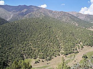
The town is surrounded by mountains on three sides, just a few kilometers away. The highest of these are the mountains of the Turkestan Range. This range is part of the larger Pamir-Alay mountain system.
Town Area
The total area of Razzakov is 41.35 square kilometers (about 107 square miles).
| Settlement | Area (km2) |
|---|---|
| Razzakov | 2.52 |
| Ak-Bosogo | 0.26 |
| Samat | 1.16 |
| Chimgen | 0.87 |
| Taylan | 0.49 |
| Ak-Bulak | 0.3 |
| Golbo | 0.28 |
Climate and Weather
Razzakov has a cold semi-arid climate. This means it has hot summers and cold winters. Spring and fall usually get a good amount of rainfall. However, the summers are very hot and dry. Many fields in the Razzakov area grow dryland wheat and barley. These crops rely on winter snow and spring rain to grow well.
Summers in Razzakov are long, usually lasting from May to September. The town can get extremely hot during these months. There is also very little rain in the summer, especially from June through September.
| Climate data for Razzakov (Isfana) 1991–2020 | |||||||||||||
|---|---|---|---|---|---|---|---|---|---|---|---|---|---|
| Month | Jan | Feb | Mar | Apr | May | Jun | Jul | Aug | Sep | Oct | Nov | Dec | Year |
| Daily mean °C (°F) | −2.0 (28.4) |
−0.5 (31.1) |
5.1 (41.2) |
10.8 (51.4) |
15.3 (59.5) |
19.6 (67.3) |
22.0 (71.6) |
21.0 (69.8) |
16.4 (61.5) |
10.4 (50.7) |
4.6 (40.3) |
0.1 (32.2) |
10.2 (50.4) |
| Source: NOAA | |||||||||||||
Population and People
As of 2021, the total population of Razzakov and its surrounding villages is estimated to be 34,219 people. The town of Razzakov itself has 23,038 residents.
According to the 2009 census, Razzakov had 18,244 people. The total for the town and its villages was 27,965. The 1999 census showed 15,910 people living in what was then the village of Isfana. Here are the populations for Razzakov and its villages as of 2021:
| Settlement | Population |
|---|---|
| Razzakov | 23,038 |
| Ak-Bosogo | 901 |
| Samat | 2,359 |
| Chimgen | 3,490 |
| Taylan | 1,616 |
| Ak-Bulak | 952 |
| Golbo | 1,810 |
| Historical population | ||
|---|---|---|
| Year | Pop. | ±% |
| 1979 | 9,629 | — |
| 1989 | 13,193 | +37.0% |
| 1999 | 15,910 | +20.6% |
| 2009 | 18,244 | +14.7% |
| 2021 | 23,038 | +26.3% |
Many people from Razzakov work in Russia as migrant workers. There are no official numbers for how many Razzakov residents work abroad.
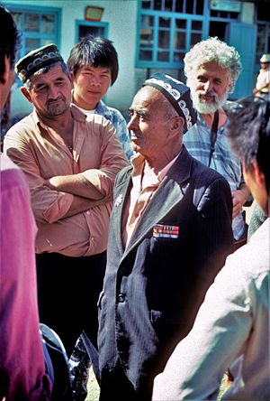
The town is home to many different ethnic groups. Uzbeks are the largest group within Razzakov itself. However, if you include the populations of the six nearby villages, the Kyrgyz become the largest ethnic group. In 2005, the ethnic makeup of Razzakov and its villages was: 50.2% Kyrgyz, 48.6% Uzbek, 0.3% Tatar, 0.3% Tajik, and a small percentage of other groups.
Razzakov has traditionally been a Muslim town. Most residents are Sunni Muslims. There are five mosques in the town. There are no large communities of other religious groups.
Economy and Jobs
During the Soviet era, Razzakov had some factories. There was also a large collective farm called a kolkhoz. Since Kyrgyzstan became independent in 1991, most of these factories have closed down.
Many people from Razzakov now go abroad to find work. The most common place to go is Russia. People also travel to nearby countries like Kazakhstan, Tajikistan, and Uzbekistan for jobs. There are no exact numbers on how many people from Razzakov work in other countries.
People who stay in the town often work in trade or agriculture. Raising animals, known as animal husbandry, is also common. Farmers mainly grow grains, fruits, vegetables, and plants used to make oil.
Razzakov has two large outdoor markets, called bazaars. Most sellers at these bazaars bring their goods from bigger markets in Osh, Kara-Suu, and Khujand. Razzakov also has a livestock market for animals, which is open on Thursdays and Fridays.
The economy of Razzakov, like many towns in Kyrgyzstan, relies a lot on small shops and kiosks. Much of the local buying and selling happens at these bazaars and small stands around town. A lot of this trade is not officially regulated. The town does not have a central sewage system or piped gas for homes.
Education in Razzakov
High Schools
Razzakov has many schools. There are two special schools called gymnasium schools: Gymnasium School No. 1 and the Uzbek Gymnasium. These schools are for students who are good at academics. There is also a boarding school for children from families who need extra support, called Ak Chyiyr Children's Education Center.
Razzakov has six secondary schools. In most of these schools, students are taught only in Uzbek. However, some schools have both Uzbek and Kyrgyz classes. The biggest secondary schools are Alisher Navoiy, Gagarin, and Isfana secondary schools. At Alisher Navoiy Secondary School, classes are taught in Uzbek, Kyrgyz, and Russian. Gagarin Secondary School mainly teaches in Russian, but also has Kyrgyz classes. Isfana Secondary School teaches only in Uzbek. Amir Temur and Toktogul secondary schools also teach only in Uzbek. Issyk Kul Secondary School is the smallest school and has both Kyrgyz and Uzbek classes.
English is taught as a foreign language in all Razzakov schools. Students also learn Kyrgyz and Russian, which are the two official languages of Kyrgyzstan. This means Uzbek students in Razzakov learn four languages, and Kyrgyz students learn three.
Colleges and Vocational Schools
There is a branch of the International Academy of Management, Law, Finance, and Business in Razzakov. The main campus of this academy is in Bishkek. Razzakov also has Vocational School No. 48. This school trains students to become seamstresses, carpenters, electricians, and drivers.
Culture and Community
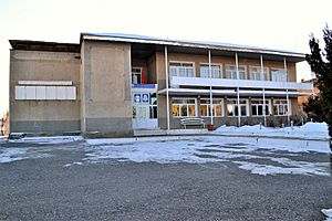
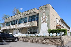
Razzakov has one public library, called the Leylek District Library. It also has a special section just for children. In 1979, this library became the main library for the Leylek District Library Network, which includes 28 libraries. The Leylek District Library is on the second floor of the Razzakov House of Culture. The children's library is in a separate building nearby.
The town has three museums: the Museum of History (opened in 1986), the Iskhak Razzakov Museum (opened in 1990), and the Museum of Fame (opened in 1990). Razzakov also has a children's music school. Here, kids can learn to sing, dance, and play different musical instruments like the accordion, komuz, and piano. Until 2014, they also had classes for the dayereh, dutar, and rubab. There is also an educational center for children. It offers courses in painting, dancing, sculpture, knitting, computing, and foreign languages.
Razzakov has only one park, called Samat Sadykov Park. There is a soccer stadium in the middle of the park where most public events happen. The stadium can hold up to 5,000 people. The town's main cinema has been closed since Kyrgyzstan became independent from the Soviet Union in the early 1990s.
There is an Uzbek culture center in Razzakov. It has not been very active since the ethnic clashes between Kyrgyz and Uzbek people in southern Kyrgyzstan in 2010. During those events, which happened from June 10 to June 14, the situation in Razzakov was tense. However, no major clashes occurred between the two ethnic groups in the town.
Transportation Around Razzakov
Razzakov is a landlocked town, meaning it has no direct access to the sea. The closest railway station is 45 kilometers (about 28 miles) away in Proletarsk, Tajikistan. Razzakov is 150 kilometers (about 93 miles) from Batken, which is the capital of Batken Region. It is also 16 kilometers (about 10 miles) from the coal mining town of Sülüktü.
Land Travel
Public transportation in Razzakov is not very developed. Public vans, known as marshrutkas in Russian, travel through the town. Private taxi cabs can be found along the main roads. Razzakov has only one bus station. From this station, buses, minibuses, and taxis go to many parts of Kyrgyzstan.
Only a small part of the roads in Razzakov are covered with asphalt. The roads are not well kept and need a lot of repair. Razzakov is connected to other towns in Kyrgyzstan by highways. The road linking Razzakov with Batken and Osh was not maintained after Kyrgyzstan became independent in the early 1990s. The country has received money from organizations like the World Bank and the European Bank for Reconstruction and Development to fix this road. Driving non-stop from Razzakov to the capital city of Bishkek is a long trip, about 960 kilometers (nearly 600 miles), and takes around 20 hours.
Air Travel
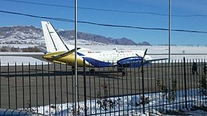
Razzakov is served by Isfana Airport, which was built during the Soviet period. Currently, it only offers flights to Bishkek. Isfana Airport began operating in the 1940s as a simple landing strip near the town. When Kalacha Airport, which served Sülüktü, closed, Isfana Airport also started serving the residents of Sülüktü. The airport's current runway and terminal were built in 1974. In the late 1980s, Isfana Airport stopped working due to technical issues. It remained closed for twenty years. In 2007, after repairs to the terminal and runway, the airport reopened. It was temporarily closed again in early 2014 but reopened later that year.
Isfana Airport is a regional airport. Its runway has a weight limit of 22 tons. It does not have special equipment for landing in bad weather and only operates during daylight hours. Even though Isfana Airport is close to the border with Tajikistan, it does not have customs or border control checks. It only handles flights within Kyrgyzstan.
See also
 In Spanish: Isfana (Kirguistán) para niños


