
Lehigh, Kansas facts for kids
Quick facts for kids
Lehigh, Kansas
|
|
|---|---|

Skyline of Lehigh (2010)
|
|

Location within Marion County and Kansas
|
|

|
|
| Country | United States |
| State | Kansas |
| County | Marion |
| Township | Lehigh |
| Platted | 1881 |
| Incorporated | 1901 |
| Government | |
| • Type | Mayor–Council |
| Area | |
| • Total | 0.32 sq mi (0.83 km2) |
| • Land | 0.32 sq mi (0.83 km2) |
| • Water | 0.00 sq mi (0.00 km2) |
| Elevation | 1,532 ft (467 m) |
| Population
(2020)
|
|
| • Total | 161 |
| • Density | 503/sq mi (194.0/km2) |
| Time zone | UTC-6 (CST) |
| • Summer (DST) | UTC-5 (CDT) |
| ZIP code |
67073
|
| Area code | 620 |
| FIPS code | 20-39225 |
| GNIS ID | 2395672 |
Lehigh is a small city in Marion County, Kansas, United States. In 2020, about 161 people lived there. It is located between the cities of Hillsboro and Canton, just north of U.S. Route 56.
History

Early Times
For thousands of years, the Great Plains of North America were home to nomadic Native American tribes. These groups moved around to hunt and find food.
From the 1500s to the 1700s, France claimed a large part of North America. In 1762, after a war, France secretly gave this land to Spain.
The 1800s
In 1802, Spain returned most of the land to France. Then, in 1803, the United States bought a huge area, including what is now Kansas, from France. This was called the Louisiana Purchase. It was a very big deal!
In 1854, the Kansas Territory was created. Kansas officially became the 34th U.S. state in 1861. Marion County, where Lehigh is, was formed in 1855.
The name "Lehigh" has a few stories. One idea is that the city was "lay high" above the flat prairie. Another story says it was named by people from Lehigh County, Pennsylvania, who thought about settling here in the late 1800s.
Just north of Lehigh, two famous old trails met: the Santa Fe Trail and the Chisolm Trail. The Santa Fe Trail was used from 1821 to 1866 for trade. The Chisholm Trail was used from 1867 to 1871 to move cattle.
In the late 1800s, railroads were very important. A railway line was built through Lehigh in 1881. This line connected many towns, helping them grow. The old Lehigh train station was later moved to Walton, Kansas.
Lehigh got its own post office on April 23, 1880. The city was officially planned out, or platted, in 1881.
The 1900s
Lehigh became an official city in 1901. By 1910, it had 385 people. At one time, Lehigh had a bank, several stores, and even a German newspaper called Das Echo.
The National Old Trails Road, a famous highway that went from one side of the country to the other, was created in 1912. It passed right through Lehigh.
Geography
Lehigh is located in the beautiful Flint Hills and Great Plains regions of Kansas. The city covers about 0.30 square miles (0.83 square kilometers), and all of it is land. The North and South Cottonwood River begin a few miles northwest of Lehigh.
Area Events
- Lehigh Antique Tractor & Engine Show: This fun event happens every Memorial Day.
Area Attractions
- Santa Fe Trail
- Santa Fe Trail / Chisholm Trail Marker: You can find this marker about 3.5 miles west of Lehigh, next to U.S. Route 56.
- Santa Fe Trail Markers: There are many historical markers in the area.
- Santa Fe Trail Self-Guided Auto Tour: You can take a driving tour to see important spots along the trail.
- Marion Reservoir: This large lake is about 10 miles east of Lehigh, great for outdoor activities.
Population Information
| Historical population | |||
|---|---|---|---|
| Census | Pop. | %± | |
| 1910 | 385 | — | |
| 1920 | 570 | 48.1% | |
| 1930 | 315 | −44.7% | |
| 1940 | 296 | −6.0% | |
| 1950 | 240 | −18.9% | |
| 1960 | 178 | −25.8% | |
| 1970 | 168 | −5.6% | |
| 1980 | 189 | 12.5% | |
| 1990 | 180 | −4.8% | |
| 2000 | 215 | 19.4% | |
| 2010 | 175 | −18.6% | |
| 2020 | 161 | −8.0% | |
| U.S. Decennial Census | |||
2020 Census
In 2020, the city of Lehigh had 161 people living there. There were 64 households, which are groups of people living together. Most residents (about 90%) were white. About 21% of the population was under 18 years old. The average age was about 37.8 years.
2010 Census
In 2010, Lehigh had 175 people. There were 70 households. About 96% of the people were white. Around 30% of the residents were under 18 years old. The average age was about 32.8 years.
Education
Students in Lehigh go to schools in the Hillsboro USD 410 public school district. All students attend schools in Hillsboro.
Lehigh used to have its own high school, Lehigh Rural High School. Its mascot was the Lehigh Eagles. The high school closed in 1966.
Media
Local News
- Hillsboro Star-Journal: This is the local newspaper from Hillsboro.
- Hillsboro Free Press: This is a free newspaper for the wider Marion County area.
Radio and Television
Lehigh can receive many radio stations and digital TV channels from the nearby cities of Wichita and Hutchinson. People can also get cable TV and satellite TV.
Infrastructure
Transportation
U.S. Route 56 is a major highway located about half a mile south of the city.
Utilities
- Internet: You can get internet service through satellite providers like HughesNet and Dish Network.
- TV: Satellite TV is available from companies like DirecTV and Dish Network. You can also watch local digital TV channels.
- Electricity: Electricity for rural areas around Lehigh is provided by Flint Hills RECA.
- Water: The city of Lehigh provides water for its residents. Rural areas get water from Marion County RWD #4.
Images for kids
- Historic Images of Lehigh: You can find old photos of Lehigh in the Special Photo Collections at Wichita State University Library.
-
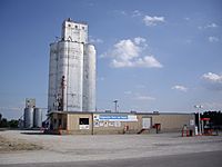
Cooperative Grain and Supply (2010)
-
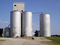
An old grain elevator (2010)
-
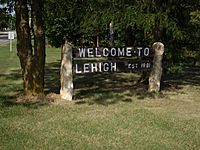
A greeting sign at the corner of Main Street and State Highway 168 (2010)
-
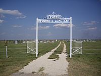
Lehigh Mennonite Cemetery, located half a mile south of Lehigh (2010)


See also
 In Spanish: Lehigh (Kansas) para niños
