List of National Natural Landmarks in Michigan facts for kids
The National Natural Landmarks in Michigan are 12 very special places in the state. They are part of a bigger group of almost 600 National Natural Landmarks (NNLs) across the United States. These landmarks are chosen because they have amazing natural features. This includes unique bogs, different kinds of forests, and homes for rare animals and plants.
These special spots are found in 12 of Michigan's 83 counties. Some counties even have two landmarks! The first one, Warren Woods State Park, was named in 1967. The newest one, the Porcupine Mountains, was added in 1984. These landmarks vary a lot in size, from small areas of about 24 acres to huge ones covering 11,600 acres. They are owned by different groups, like Michigan State University, private people, and state or federal government agencies.
What are National Natural Landmarks?
The National Natural Landmarks Program is run by the National Park Service. This is a part of the Department of the Interior, which takes care of America's natural and historical places. The National Park Service looks for places that fit certain rules to become an NNL. They suggest these places after talking to the owners.
The Secretary of the Interior then looks at these suggestions. Based on specific rules, they decide if a place should be an NNL. Both public lands (like state parks) and private lands can become NNLs. Owners can say no if they don't want their land to be named a landmark. Being an NNL helps protect these places in many ways. It can offer tax benefits, grants, and keep an eye on anything that might harm the area.
Michigan's Natural Treasures
Michigan is home to 12 amazing National Natural Landmarks. Each one protects a unique part of our natural world. Let's explore some of these special places!
Black Spruce Bog Natural Area
This landmark was named in 1976. It is located in Jackson County and is owned by the state. This area is a boreal bog forest with many black spruce trees. It shows the final stage of how a sphagnum bog ecosystem develops. Even though it's not far away, it's a wild place without marked trails. It is part of Waterloo State Recreation Area. 42°18′58.00″N 84°11′46.49″W / 42.3161111°N 84.1962472°W
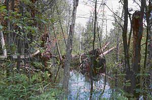
Dead Stream Swamp
Named in 1976, this swamp is found in Missaukee and Roscommon counties. It is owned by the state. This huge swamp is full of northern white cedar trees. It shows the very last stage of how a bog forest grows and changes. It is part of the Au Sable State Forest. 44°6′0″N 84°10′12″W / 44.10000°N 84.17000°W
Dukes Research Natural Area
This federal landmark in Marquette County was named in 1974. It is a swamp that has untouched stands of cedar and other conifer trees. It also has very old hardwood trees. This area is part of the Hiawatha National Forest. 46°21′0″N 87°10′0.01″W / 46.35000°N 87.1666694°W
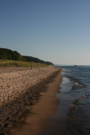
Grand Mere Lakes
Named in 1968, this landmark is in Berrien County. It is owned by both the state and private groups. This area has many low spots that were formed by ancient Lake Michigan. It shows how lakes can slowly change into dry land over time. It is also home to several rare plant and animal species. This landmark is part of Grand Mere State Park. 41°59′35″N 86°32′59″W / 41.99306°N 86.54972°W
Haven Hill State Natural Area
This state-owned area in Oakland County was named in 1976. Even though it's small, it has all the different types of forests found in southern Michigan. It is a popular spot for over 100 kinds of birds and 17 types of mammals. It is part of the Highland Recreation Area. 42°38′11″N 83°34′23″W / 42.63639°N 83.57306°W
Newton Woods
Named in 1976, Newton Woods is in Cass County and is owned by the state. This is one of the last remaining old-growth, mixed-oak hardwood forests in Michigan's Lower Peninsula. It is managed by Michigan State University as part of the Fred Russ Forest. 42°0′32.7594″N 85°58′16.32″W / 42.009099833°N 85.9712000°W
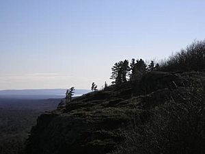
Porcupine Mountains
This landmark was named in 1984 and is in Gogebic and Ontonagon counties. It is owned by the state. It has huge areas of white pine and untouched northern hemlock trees. You can also see wave-cut beaches here, which show where ancient glacial lakes used to be. It is part of Porcupine Mountains Wilderness State Park. 46°46′N 89°45′W / 46.767°N 89.750°W
Roscommon Virgin Pine Stand
Named in 1980, this state-owned landmark is in Roscommon County. It is a large area of very old red pine trees. This forest has a long history of wildfires, with records going back to 1798. It is part of the Au Sable State Forest. 44°6′0″N 84°10′12″W / 44.10000°N 84.17000°W
Strangmoor Bog
This federal landmark in Schoolcraft County was named in 1973. It is a perfect example of a string bog, which is a rare type of bog with long, narrow ridges. This is one of the southernmost places where you can find this kind of bog. It is part of the Seney National Wildlife Refuge. 46°15′N 86°06′W / 46.250°N 86.100°W
Tobico Marsh
Named in 1976, Tobico Marsh is in Bay County and is owned by the state. It has a mix of untouched hardwood forest, open water, and marshland. Many migrating waterfowl (like ducks and geese) use this area as a resting spot. It is part of the Bay City Recreation Area. 43°41′51″N 83°56′11″W / 43.69750°N 83.93639°W
Toumey Woodlot
This state-owned landmark in Ingham County was named in 1976. It is one of the last untouched virgin beech-maple forests in southern Michigan. It is located right on the Michigan State University campus and is used for important ecological research. Michigan State University manages this special forest. 42°42′13.428″N 84°27′54.36″W / 42.70373000°N 84.4651000°W
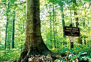
Warren Woods Natural Area
Named in 1967, this landmark in Berrien County is privately owned. It is another one of southern Michigan's last untouched virgin beech-maple forests. It also has very large individual beech, maple, and sycamore trees. It is part of Warren Woods State Park. 41°50′00″N 86°37′20″W / 41.83333°N 86.62222°W
 | Bayard Rustin |
 | Jeannette Carter |
 | Jeremiah A. Brown |


