kids encyclopedia robot

List of islands of Newfoundland and Labrador facts for kids

Kids Encyclopedia Facts
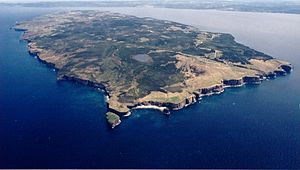
Carlb-fogo-newfoundland-2002
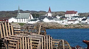
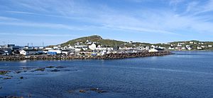
Village on Fogo Island
Keats Island 2007
Keats Island
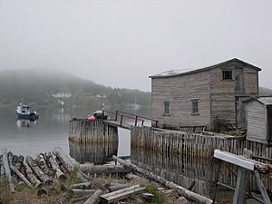
Little Bay Islands Dock
Dock on Little Bay Islands
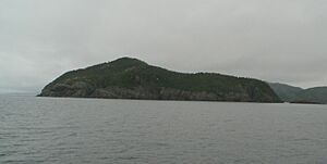
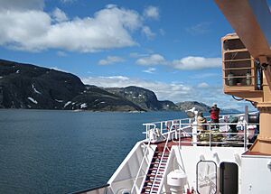
Paul Island from onboard the Northern Ranger
Coast of Paul's Island

The Canadian province of Newfoundland and Labrador is composed of mainland Labrador and the large island of Newfoundland. The coast of both the island and the Labrador Peninsula are lined with islands of various magnitudes.

List

Name Water body Area km² Location Remarks
Allan's Island Atlantic Ocean 46°51′2.8″N 55°48′9.7″W / 46.850778°N 55.802694°W / 46.850778; -55.802694 Part of the town of Lamaline
Baccalieu Conception Bay &&&&&&&&&&&&&&05.&&&&&05 48°07′49″N 52°48′05″W / 48.13028°N 52.80139°W / 48.13028; -52.80139 (Baccalieu Island) Uninhabited
Balcalhoa Notre Dame Bay &&&&&&&&&&&&&&02.2000002.2 49°41′37″N 54°32′47″W / 49.69369°N 54.54646°W / 49.69369; -54.54646 (Balcalhoa Island) Lighthouse
Bell Conception Bay &&&&&&&&&&&&&034.&&&&&034 47°39′N 52°56′W / 47.650°N 52.933°W / 47.650; -52.933 (Bell Island) Includes town of Wabana
Bell Atlantic Ocean &&&&&&&&&&&&&088.&&&&&088 50°44′N 55°34′W / 50.733°N 55.567°W / 50.733; -55.567 (Bell Island) One of the Grey Islands
Belle Isle Strait of Belle Isle &&&&&&&&&&&&&052.&&&&&052 51°55′44″N 55°21′33″W / 51.92889°N 55.35917°W / 51.92889; -55.35917 (Belle Isle) Uninhabited
Brunette Fortune Bay &&&&&&&&&&&&&020.&&&&&020 47°16′47″N 55°54′02″W / 47.27972°N 55.90056°W / 47.27972; -55.90056 (Brunette Island) Uninhabited
Bull, Cow and Calf Atlantic Ocean 46°46′33″N 54°05′56″W / 46.77583°N 54.09889°W / 46.77583; -54.09889 (Bull, Cow and Calf) Avalon Peninsula island cluster
Carbonear Conception Bay &&&&&&&&&&&&&&00.3000000.3 47°44′15″N 53°10′01″W / 47.73750°N 53.16694°W / 47.73750; -53.16694 (Carbonear Island) Uninhabited
Change Notre Dame Bay &&&&&&&&&&&&&024.40000024.4 49°40′19″N 54°24′28″W / 49.67194°N 54.40790°W / 49.67194; -54.40790 (Change Islands) Consists of South and North Island
Cod Labrador Sea &&&&&&&&&&&&0132.710000132.71 57°47′00″N 61°46′56″W / 57.783455°N 61.782345°W / 57.783455; -61.782345 (Cod Island) Uninhabited
Fogo Notre Dame Bay &&&&&&&&&&&&0254.&&&&&0254 49°40′N 54°10′W / 49.667°N 54.167°W / 49.667; -54.167 (Fogo Island) Population in 2006: 2,706
Funk Labrador Sea &&&&&&&&&&&&&&00.&240000.024 49°45′07″N 53°11′32″W / 49.75194°N 53.19222°W / 49.75194; -53.19222 (Funk Island)
Gannet Labrador Sea &&&&&&&&&&&&&&02.&&&&&02 53°56′02″N 56°30′18″W / 53.934°N 56.505°W / 53.934; -56.505 (Gannet Islands) Ecological reserve
Glover Grand Lake &&&&&&&&&&&&0190.&&&&&0190 48°47′49″N 57°39′29″W / 48.79694°N 57.65806°W / 48.79694; -57.65806 (Glover Island) 18th-largest lake island in the world by area
Granby White Bay &&&&&&&&&&&&&&00.5000000.5 52°34′18″N 55°46′04″W / 52.5716406°N 55.7677249°W / 52.5716406; -55.7677249 (Granby Island) Uninhabited
Green (Catalina) Atlantic Ocean &&&&&&&&&&&&&&00.6000000.6 48°30′17″N 53°02′46″W / 48.5047°N 53.0460°W / 48.5047; -53.0460 (Green Island) East of Bonavista Peninsula
Green (Fortune) Fortune Bay &&&&&&&&&&&&&&00.3000000.3 46°53′N 56°05′W / 46.883°N 56.083°W / 46.883; -56.083 (Green Island) West of Burin Peninsula
Grey Atlantic Ocean &&&&&&&&&&&&&088.&&&&&088 50°50′N 55°35′W / 50.833°N 55.583°W / 50.833; -55.583 (Grey Islands) Consists of Bell and Groais Islands
Groais Atlantic Ocean &&&&&&&&&&&&&041.&&&&&041 50°56′N 55°36′W / 50.933°N 55.600°W / 50.933; -55.600 (Groais Island) One of the Grey Islands
Hawke Island Labrador Sea &&&&&&&&&&&&&056.&&&&&056 53°03′N 55°50′W / 53.05°N 55.83°W / 53.05; -55.83 (Hawke Island) Former whaling station
Home Labrador Sea &&&&&&&&&&&&&012.&&&&&012 60°10′28″N 64°16′16″W / 60.17444°N 64.27111°W / 60.17444; -64.27111 (Home Island)
Horse Atlantic Ocean &&&&&&&&&&&&&025.&&&&&025 50°12′37″N 55°44′58″W / 50.21028°N 55.74944°W / 50.21028; -55.74944 (Horse Islands) North of Baie Verte Peninsula
Horse Chops Labrador Sea &&&&&&&&&&&&&&05.9000005.9 53°52′N 57°02′W / 53.86°N 57.04°W / 53.86; -57.04 (Horse Chops Islands)
Hunt's Island south west coast 47°35′58″N 57°36′41″W / 47.5994445°N 57.6113889°W / 47.5994445; -57.6113889 (Hunt's Island) Uninhabited
Island of Ponds Labrador Sea &&&&&&&&&&&&&091.&&&&&091 53°28′N 55°53′W / 53.46°N 55.89°W / 53.46; -55.89 (Island of Ponds) Includes settlement of Black Tickle
Keats Bonavista Bay &&&&&&&&&&&&&&00.7000000.7 48°39′10″N 53°38′50″W / 48.65278°N 53.64722°W / 48.65278; -53.64722 (Keats Island) Uninhabited
Kelly's Conception Bay &&&&&&&&&&&&&&01.9000001.9 47°32′39″N 53°00′41″W / 47.54417°N 53.01139°W / 47.54417; -53.01139 (Kelly's Island) Uninhabited
Killiniq Ungava Bay &&&&&&&&&&&&&024.&&&&&024 60°22′N 64°37′W / 60.367°N 64.617°W / 60.367; -64.617 (Killiniq Island) land border between Nunavut and Newfoundland (Newfoundland side)
Landsat Labrador Sea &&&&&&&&&&&&&&00.&&10000.001 60°10′37″N 64°02′30″W / 60.17694°N 64.04167°W / 60.17694; -64.04167 (Landsat Island)  Discovered using Landsat 1 satellite imagery; forms easternmost part of Canada; uninhabited
Little Bay Notre Dame Bay &&&&&&&&&&&&&&07.1000007.1 49°38′41″N 55°47′55″W / 49.64477°N 55.79853°W / 49.64477; -55.79853 (Little Bay Islands)
Long Island Hermitage Bay &&&&&&&&&&&&0100.&&&&&0100 47°38′45″N 55°58′54″W / 47.64583°N 55.98167°W / 47.64583; -55.98167 (Long Island) Includes town of Gaultois. Population in 2021: 100
Merasheen Placentia Bay 47°30′N 54°15′W / 47.5°N 54.25°W / 47.5; -54.25 (Merasheen Island)
Millers White Bay &&&&&&&&&&&&&&00.1000000.1 49°33′32″N 56°51′11″W / 49.558875°N 56.853083°W / 49.558875; -56.853083 (Millers Island) Uninhabited
New World Notre Dame Bay 49°34′34″N 56°51′42″E / 49.57614°N 56.8617406°E / 49.57614; 56.8617406 (New World Island) Includes the towns of Newville, Carter's Cove and Pike's Arm
Newfoundland Atlantic Ocean &&&&&&&&&0111390.&&&&&0111,390 49°N 56°W / 49°N 56°W / 49; -56 (Newfoundland) Most populous part of Newfoundland and Labrador
Newfoundland Labrador Sea 53°51′N 56°56′W / 53.85°N 56.94°W / 53.85; -56.94 (Newfoundland Island) A small island near Sandwich Bay
North Star Labrador Sea &&&&&&&&&&&&&&01.&&&&&01 60°22′02″N 64°24′13″W / 60.36722°N 64.40361°W / 60.36722; -64.40361 (North Star Island) The province's northernmost island, off the Labrador coast
Nunaksaluk Island Labrador Sea 55°48′N 60°18′W / 55.8°N 60.3°W / 55.8; -60.3 (North Star Island) Island off the Labrador coast
Oderin Placentia Bay &&&&&&&&&&&&&&01.7000001.7 47°17′36″N 54°48′16″W / 47.29322°N 54.80444°W / 47.29322; -54.80444 (Oderin Island)
Old Perlican Trinity Bay 48°05′12″N 53°01′18″W / 48.08667°N 53.02167°W / 48.08667; -53.02167 (Old Perlican Island)
Paul's Labrador Sea 56°31′N 61°30′W / 56.517°N 61.500°W / 56.517; -61.500 (Paul's Island) Off the Labrador coast; source of the mineral labradorite
Pouch Bonavista Bay &&&&&&&&&&&&&&00.2000000.2 49°09′58″N 53°28′29″W / 49.16601°N 53.47482°W / 49.16601; -53.47482 (Pouch Island)
Puffin Conception Bay 48°07′32.41″N 52°48′43.35″W / 48.1256694°N 52.8120417°W / 48.1256694; -52.8120417 (Puffin Island)
Quirpon Strait of Belle Isle &&&&&&&&&&&&&&09.5000009.5 51°36′N 55°26′W / 51.60°N 55.43°W / 51.60; -55.43 (Quirpon Island) Off the Great Northern Peninsula
Random Trinity Bay 255 48°7′N 53°44′W / 48.117°N 53.733°W / 48.117; -53.733 (Random Island) Surrounded by the Bonavista Peninsula
Sandy Point St. George's Bay &&&&&&&&&&&&&&03.&&&&&03 48°27′N 58°29′W / 48.450°N 58.483°W / 48.450; -58.483 (Sandy Point)
Silver Fox Bonavista Bay &&&&&&&&&&&&&&02.&&&&&02 49°01′06″N 53°41′02″W / 49.01842°N 53.68388°W / 49.01842; -53.68388 (Silver Fox Island)
South Aulatsivik Atlantic Ocean 56°45′51″N 61°30′59″W / 56.76417°N 61.51639°W / 56.76417; -61.51639 (South Aulatsivik Island)
South Wolf Labrador Sea 53°40′N 55°55′W / 53.667°N 55.917°W / 53.667; -55.917 (South Wolf Island) Uninhabited
Spotted Labrador Sea 53°31′N 55°47′W / 53.51°N 55.78°W / 53.51; -55.78 (Spotted Island) Former Pinetree Line site
Stony Labrador Sea 52°59′N 55°49′W / 52.99°N 55.81°W / 52.99; -55.81 (Stony Islands)
Square Labrador Sea 52°44′01″N 55°50′14″W / 52.73352°N 55.83715°W / 52.73352; -55.83715 (Square Islands) By White Bear Arm off the Labrador coast
Swain's Bonavista Bay 49°08′21″N 53°32′45″W / 49.13929°N 53.54579°W / 49.13929; -53.54579 (Swain's Island) Group of eight islands
Trump Islands (Newfoundland and Labrador) Notre Dame Bay 49°34′30″N 54°46′09″W / 49.57500°N 54.76917°W / 49.57500; -54.76917 Uninhabited
Twillingate Notre Dame Bay 49°39′N 54°45′W / 49.650°N 54.750°W / 49.650; -54.750 (Twillingate) From the French name, Toulinquet
Venison Labrador Sea &&&&&&&&&&&&&&01.&&&&&01 52°58′12″N 55°46′30″W / 52.970°N 55.775°W / 52.970; -55.775 (Venison Island) Former wireless telegraph station
Wadham Atlantic Ocean 49°35′30″N 53°45′49″W / 49.59178°N 53.76360°W / 49.59178; -53.76360 (Wadham Islands)
Woody Island Placentia Bay

Natural bays

  • Spread Eagle Bay
  • Ste. Genevieve Bay
  • St. Mein Bay

See also

  • Geography of Newfoundland and Labrador
kids search engine
List of islands of Newfoundland and Labrador Facts for Kids. Kiddle Encyclopedia.