Marsh Run facts for kids
Quick facts for kids Marsh Run |
|
|---|---|

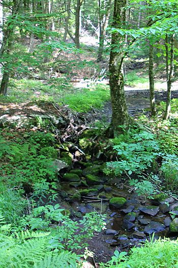
Marsh Run looking upstream at the Columbia County/Luzerne County line
|
|
| Physical characteristics | |
| Main source | small pond in western Fairmount Township, Luzerne County, Pennsylvania between 1,220 and 1,240 feet (370 and 380 m) |
| River mouth | Coles Creek in northeastern Sugarloaf Township, Columbia County, Pennsylvania 1,115 ft (340 m) 41°17′03″N 76°19′21″W / 41.2842°N 76.3224°W |
| Length | 1.0 mi (1.6 km) |
| Basin features | |
| Progression | Coles Creek → Fishing Creek → Susquehanna River → Chesapeake Bay |
| Basin size | 0.44 sq mi (1.1 km2) |
| Tributaries |
|
Marsh Run is a small stream located in Luzerne County and Columbia County, in Pennsylvania. It is a tributary of Coles Creek.
The stream is about one mile (1.6 km) long. It flows through Fairmount Township in Luzerne County and Sugarloaf Township in Columbia County. The area of land that drains into Marsh Run, called its watershed, is about 0.44 square miles (1.1 km2). Wild trout live and reproduce naturally in this stream. Marsh Run gets its name from the marshy areas found along its banks.
Contents
Where Marsh Run Flows
Marsh Run starts in a small pond in the western part of Fairmount Township, Luzerne County. It flows west for a short distance. Along its way, it passes through a wetland area and goes under Hynick Road.
Soon after crossing Hynick Road, Marsh Run leaves Luzerne County. It then enters Sugarloaf Township in Columbia County. The stream continues flowing west. A little further downstream, another small, unnamed stream joins Marsh Run from the right side. After this, Marsh Run soon meets up with Coles Creek.
Marsh Run joins Coles Creek about 4.48 miles (7.21 km) upstream from where Coles Creek itself ends.
Land and Rocks Around Marsh Run
The elevation near where Marsh Run meets Coles Creek is about 1,115 feet (340 m) above sea level. The stream's starting point is higher, between 1,220 and 1,240 feet (370 and 380 m) above sea level. Marsh Run is a relatively small stream, and you can find marshes along its sides.
For most of its path, Marsh Run flows over a type of glacial till called Wisconsinian Till. This is a mix of rock and soil left behind by glaciers. In the lower parts of the stream, you'll find alluvium and Wisconsinan Outwash. Alluvium is made of sand, silt, and gravel deposited by water. Wisconsinan Outwash is also sand and gravel, but it was carried by meltwater from glaciers. The area also has bedrock made of sandstone and shale. There is a wetland in the upper part of the stream.
Wildlife and the Watershed
The watershed of Marsh Run covers an area of about 0.44 square miles (1.1 km2). This entire area is located within the Red Rock quadrangle, which is a map section used by the United States Geological Survey. The stream is found in the northeastern part of Sugarloaf Township.
Wild trout naturally reproduce in Marsh Run. This means they lay their eggs and new trout are born throughout the stream, from its beginning to where it joins Coles Creek.
History of the Name
Marsh Run was officially added to the Geographic Names Information System on August 2, 1979. This system keeps track of names and locations of places in the United States.
The stream is called Marsh Run because there are many marshy areas located right along its banks.
 | Anna J. Cooper |
 | Mary McLeod Bethune |
 | Lillie Mae Bradford |

