
Houston Metro facts for kids
| Founded | January 1, 1979 (47 years ago) |
|---|---|
| Headquarters | 1900 Main St. Lee P. Brown Administration Building Downtown Houston, Texas |
| Locale | Houston, Texas, United States |
| Service area | Harris County, Texas |
| Service type | Bus, light rail, paratransit, express lanes |
| Routes | 83 local bus routes 31 commuter bus routes 3 light rail lines 1 community connector 1 bus rapid transit line |
| Stops | 9,050 |
| Destinations | Conroe Downtown Houston Uptown Houston Memorial City Greenspoint Westchase Energy Corridor Texas Medical Center Johnson Space Center University of Houston Texas Southern University Rice University University of Houston–Downtown University of St. Thomas Houston Baptist University Houston Community College Lone Star College San Jacinto College Bush Intercontinental Airport Hobby Airport NRG Park Greenspoint Mall Houston Galleria West Oaks Mall Sharpstown Mall Gulfgate Mall Memorial City Mall Willowbrook Mall Northline Mall Baybrook Mall Northwest Mall Almeda Mall |
| Hubs | 21 transit centers 27 park and rides |
| Stations | 44 (light rail) 12 (bus rapid transit) |
| Fleet | 1,233 (bus) 76 (light rail) |
| Fuel type | Diesel, CNG, Diesel-electric hybrid |
| Operator | METRO |
| Web site | http://www.ridemetro.org |
The Metropolitan Transit Authority of Harris County, usually called METRO, is a big public transportation group in Houston, Texas, United States. METRO helps people get around by running buses, light rail trains, and special services for people with disabilities called METROLift. They also manage special lanes on highways for buses and carpools. METRO serves most of Harris County and some nearby cities like Conroe.
Contents
History

The idea for local public transport groups started in Texas in 1973. In 1978, people in Houston voted to create METRO. They also agreed to add a small sales tax to help pay for it.
METRO officially started in January 1979. It took over the bus service that the City of Houston used to run, called HouTran. HouTran had old buses and didn't run very often. Its routes also didn't keep up with Houston's fast growth.
METRO's service area is about 1,285 square miles (3,328 square kilometers). It also offers vanpool services in an eight-county area. About 3,800 people work for METRO.
METRO's Leaders
Tom Lambert is the current President and CEO of METRO. He started in this role in 2014, after being the temporary CEO since 2013. Lambert joined METRO in 1979 as a security investigator. He later became the agency's police chief and then moved into higher management jobs.
The METRO Board has nine members. Five are chosen by the Mayor of Houston and approved by the City Council. Two are chosen by the Harris County Commissioners Court. The last two are chosen by the mayors of 14 smaller cities that are part of METRO.
METRO Bus Service


METRO has a very large and busy bus system. Local buses usually travel on city streets, stopping often. METRO's bus service is the most used in Texas and the Southwest.
METRO also has a system of special lanes (HOV/HOT lanes) and Park and Ride lots. Park and Ride stations are next to highways and are very busy during rush hour. Before the METRORail train system was built, METRO had the largest bus-only fleet in the United States.
In 2015, METRO changed its bus system. It removed routes that didn't have many riders. Instead, it focused on routes that are used a lot and run more often. This change happened without costing more money.
Types of Bus Service
- Local
Most METRO buses run on city streets. Many routes connect different parts of the city without going into downtown. These are often called "crosstown" routes. Some routes are "Express" local services. They make limited stops on major streets and serve important areas like Downtown or the Texas Medical Center.
- Express
Some routes, like the 102 or 108, offer express service to key places such as Downtown or Bush Intercontinental Airport. Unlike Park and Ride buses, they make limited stops on regular streets and travel non-stop on highway parts.
- Park and Ride (Commuter)
METRO has a popular Park and Ride service. It helps people who work downtown or in other busy areas get to work from their homes in the suburbs. Park and Ride lots are like transit centers. During busy times, each lot has its own bus route to avoid overcrowding. These buses often use special HOV lanes on highways.
- 402 Bellaire Quickline

This service started in 2009. Quickline is a special METRO service. The 402 Bellaire route was the first one. It uses newer buses, has fewer stops, and has more comfortable bus stops.
Bus Routes
METRO's bus routes have a numbering system. In 2015, METRO updated its entire bus network. Now, almost all local routes run seven days a week. For example, the 82 Westheimer Road route is very busy. During rush hour, a bus comes every 6 minutes because so many people use it.
METRO also offers free Greenlink shuttle services in Downtown Houston. These are routes 412 and 413.
Transit Centers
Transit centers are places where many bus routes meet, making it easy to switch buses.
- Acres Home
- Bellaire
- Burnett
- Downtown
- Eastwood
- Fannin South
- Fifth Ward
- Greenspoint
- Hiram Clarke
- Hobby
- Kashmere
- Magnolia
- Mesa
- Mission Bend
- Northline
- Northwest
- Tidwell
- Southeast
- Texas Medical Center
- West Loop
- Westpark/Lower Uptown
- Wheeler Station
Park and Ride Lots
METRO has 28 different Park and Ride locations. The buses used for these routes are very comfortable.
Katy Corridor
- Kingsland Park and Ride
- Addicks Park and Ride
- Grand Parkway Park and Ride (opened in 2017)
Southwest Corridor
- Westwood Park and Ride
- West Bellfort Park and Ride
- Hillcroft Park and Ride
Northwest Corridor
- West Little York Park and Ride
- Northwest Station Park and Ride
- Cypress Park and Ride
- Northwest Transit Center (also used as a Park and Ride)
Northeast Corridor
- Eastex Park and Ride
- Townsen Park and Ride
- Kingwood Park and Ride
North Corridor
- North Shepherd Park and Ride (mostly a transit center)
- Kuykendahl Park and Ride
- Spring Park and Ride
- Conroe Park and Ride
South Corridor
- Fannin South (now a Transit Center, also served by the Red Line train)
Gulf Corridor
- Monroe Park and Ride
- Fuqua Park and Ride
- South Point Park and Ride (reopened in 2010)
- Bay Area Park and Ride
- Eastwood Transit Center (also used as a Park and Ride)
- El Dorado Park and Ride
East Corridor
- Maxey Park and Ride
- Baytown Park and Ride
Westpark Corridor
- Gessner Park and Ride
- Westchase Park and Ride
- Westpark/Lower Uptown Transit Center (served by METRORapid Silver Line)
- Mission Bend Transit Center (served by the 151 Westpark Express)
- Hillcroft Park and Ride (used to be a transit center)
US 90 Corridor
- Missouri City Park and Ride
- Highway 6 Park and Ride
SH 249 Corridor
- Seton Lake Park and Ride
West Loop Corridor
- West Loop Park and Ride
Texas Medical Center Corridor
- TMC Transit Center (also used as a Park and Ride)
Advertising on Buses
For a long time, METRO did not allow ads on its buses. They thought it would make the buses look bad. But to get more money, METRO started to consider putting ads on buses and trains in 2010. For example, the Houston Zoo advertised on some light rail trains.
Fares
In 2006, METRO started changing how people pay for rides. They introduced special pre-paid cards called Q Cards. You can add money to these cards on buses or at METRO ticket machines. When you use your Q Card, you get a 4-hour pass. If you ride often, you can earn free rides!
Seniors (65-69) and people with disabilities get a lower price. Seniors over 70 and children under 5 (with an adult) ride for free. In 2008, local fares went up to $1.25.
| Service Type | Regular | Discounted |
|---|---|---|
| Local | $1.25 | $0.60 |
| Zone 1 | $2 | $1 |
| Zone 2 | $3.25 | $1.60 |
| Zone 3 | $3.75 | $1.85 |
| Zone 4 | $4.50 | $2.25 |
| Zone 5 | $8 | $4 |
| 24-Hour Pass (began 7 Oct. 2013) | $3 | $1.50 |
HOV System
METRO was one of the first to use special lanes for buses and carpools, called HOV lanes. These lanes are separated from regular traffic by barriers. They are used during busy times to help buses and carpools move faster.
HOV lanes connect Downtown Houston with the suburbs. You can find them on parts of major highways like the Katy Freeway and North Freeway. Some HOV lanes have special exits that lead directly to Park and Ride lots.
In 2011, METRO started changing some HOV lanes into HOT (High Occupancy Toll) lanes. This means that even cars with only one person can use these lanes if they pay a toll.
METROLift

METROLift provides transportation for people with disabilities who cannot use regular METRO buses. METROLift vehicles are shared, meaning they pick up multiple customers. METRO encourages people to use regular bus services when they can. METROLift uses special vans that are different from regular buses. In 2017, METROLift provided about 1.9 million rides to over 16,000 eligible riders.
METRORail
METRO's light rail train service is called METRORail.
METRO has a trip planner on its website. It helps riders plan their trips using both buses and trains. You enter where you want to start and where you want to go. The planner shows you the stops, times, and how long the trip will take.
Today, about 59,753 people ride METRORail on an average weekday. This adds up to 18.3 million rides each year. METRORail has set ridership records on special days:
- February 1, 2004: 64,005 passengers during Super Bowl XXXVIII.
- February 4, 2017: 109,417 passengers during pre-Super Bowl parties.
- November 3, 2017: 125,000 passengers during the Houston Astros World Series Championship Parade.
METRORail Lines

METRO currently has three light rail lines: the Red Line, Purple Line, and Green Line. The Red Line was the first, opening on January 1, 2004. It is now 12.8 miles long. It starts at the Northline Transit Center and goes south through Downtown Houston, the Museum District, Rice University, the Texas Medical Center, and the NRG Park Complex.
METRO opened two more light rail lines in 2015: the Purple (Southeast) and Green (East End) Lines. These new lines serve places like Texas Southern University, the University of Houston, and PNC Stadium. Together, these new lines added 9.9 miles of track. In total, METRO operates 22.7 miles of light rail service.
Future Expansion Plans
In 2003, voters approved plans to expand the METRORail system. This included adding more light rail and commuter rail lines.
In 2005, METRO announced a new plan. It included four new corridors that would use both light rail and bus rapid transit. The bus rapid transit lines could be changed to light rail later if more people started using them. In 2007, METRO decided to make all new lines light rail from the start.
The planned expansions are within Houston. They aim to reach both major Houston airports: George Bush Intercontinental Airport and William P. Hobby Airport. METRO also plans to connect with a future commuter rail system that would go from Fort Bend County to south of NRG Stadium.
The voter-approved plan included:
- About 64.8 miles (104.3 km) of new light rail.
- 28 miles (45 km) of commuter rail service.
- More ways to reach important activity centers.
- Train service to both airports.
- Over 50 new train stations.
- A 50% increase in bus service.
Some of these plans faced delays due to funding issues and other problems. However, the Red Line Extension opened in 2013, and the East End/Green Line opened in 2015.
The current plans include:
- The Red Line Extension: This line is 5.3 miles (8.5 km) long and goes from UH–Downtown to the Northline Transit Center.
- The East End/Green Line: This line extends 3.3 miles (5.3 km) east from Downtown Houston.
- The Southeast/Purple Line: This line is 6.1 miles (9.8 km) long. It goes from downtown to Palm Center.
- The University/Blue Line: This planned line would be 11.3 miles (18.2 km) long. It would connect the Hillcroft Transit Center to the Eastwood Transit Center.
- The Uptown/Gold Line: This planned line would run 4.4 miles (7.1 km) from Bellaire/South Rice Station through Uptown to the Northwest Transit Center.
METRO Solutions Plan
METRO Solutions is a big plan for transportation and infrastructure that aims to be finished by 2020. It includes:
- Nearly 30 miles (48 km) of Light Rail Transit: This includes the University Line, the Red Line extension, and the Southeast, East End, and Uptown lines.
- 28 miles (45 km) of Commuter Rail Transit (CRT): This would include lines along US-290 and US-90A.
- 40 miles (64 km) of Signature Bus Service/Suburban Bus Rapid Transit: This would be in areas like the Texas Medical Center and Uptown.
- 10 New Transit Facilities: This includes a large Northern Intermodal Facility, five Transit Centers, and four Park and Ride lots.
- HOV/HOT Conversion: Changing one-way HOV lanes to two-way HOT (toll) lanes.
METRO Headquarters

METRO's main office is in the Lee P. Brown Administration Building in Downtown Houston. This building cost $41 million and has over 400,000 square feet (37,161 square meters) of space. It also includes the Downtown Transit Center, a METRO store, and a Houston Police Department office.
The building was supposed to open in early 2004, when METRORail started. METRO said that owning the building would save them money compared to renting. The Federal Transit Administration paid 80% of the building costs, and METRO paid the other 20%.
Before this building, METRO's headquarters were in the Louisiana Place (now called the Total Plaza).
Who Rides METRO?
In 2017, a survey was done to learn more about METRO riders. Over 22,000 riders were asked questions. Most people surveyed used METRO's buses and trains.
The survey found that:
- 58% of riders use public transport to get to work.
- 20% use it for shopping or personal errands.
- About 10% use a bus or train to get to school.
- 88% of riders use public transport at least three days a week.
- Almost 50% of riders use it at least five days a week.
- 88% of all trips helped the region's economy.
The survey also showed that 78% of riders had jobs. Most of them worked full-time. The average household income for riders was $33,765, but people from all income levels use METRO.
Rider Income Levels
- 18.5% - Less than $16,000
- 14.2% - $16,000 - $23,999
- 14.1% - $24,000 - $31,999
- 12.1% - $32,000 - $39,999
- 13.7% - $40,000 - $53,999
- 12.4% - $54,000 - $80,999
- 4.8% - $81,000 - $99,999
- 10.1% - Over $100,000
Rider Ages
- 5% - More than 65 years old
- 15% - Between 51 and 64 years old
- 72% - Between 20 and 50 years old
- 8% - Less than 20 years old
Rider Race/Ethnicity
- 43% - African American
- 25% - Hispanic/Latino
- 22% - White
- 6% - Asian
- <1% - American Indian
- 3% - Mixed Race
Cities Served by METRO
METRO serves the main city of Houston and many other nearby cities.
Core city
Other cities
- Bellaire
- Bunker Hill Village
- Conroe
- El Lago
- Hedwig Village
- Hilshire Village
- Humble
- Hunters Creek Village
- Katy
- Missouri City
- Piney Point Village
- Spring Valley Village
- Southside Place
- Taylor Lake Village
- West University Place
METRO also serves many areas that are not part of any city.
Images for kids
-
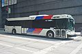
METRO bus in 2022
.jpg)
See also
 In Spanish: Autoridad Metropolitana de Tránsito del Condado de Harris para niños
