Mitchell County, Kansas facts for kids
Quick facts for kids
Mitchell County
|
|
|---|---|

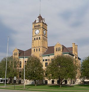
Mitchell County courthouse in Beloit (2014)
|
|

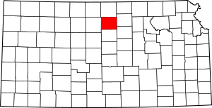
Location within the U.S. state of Kansas
|
|
 Kansas's location within the U.S. |
|
| Country | |
| State | |
| Founded | February 26, 1867 |
| Named for | William D. Mitchell |
| Seat | Beloit |
| Largest city | Beloit |
| Area | |
| • Total | 719 sq mi (1,860 km2) |
| • Land | 702 sq mi (1,820 km2) |
| • Water | 17 sq mi (40 km2) 2.4%% |
| Population
(2020)
|
|
| • Total | 5,796 |
| • Estimate
(2023)
|
5,719 |
| • Density | 8.3/sq mi (3.2/km2) |
| Time zone | UTC−6 (Central) |
| • Summer (DST) | UTC−5 (CDT) |
| Congressional district | 1st |
Mitchell County is a county located in the state of Kansas in the United States. A county is like a smaller region within a state, often with its own local government. The main town and biggest city in Mitchell County is Beloit.
In 2020, about 5,796 people lived in Mitchell County. The county was named after a person called William Mitchell.
Contents
History of Mitchell County
Early Times in Kansas
For thousands of years, the Great Plains of North America were home to nomadic Native American tribes. Nomadic means they moved around a lot, following animals and seasons.
From the 1500s to the 1700s, the country of France said they owned large parts of North America. After a big war called the French and Indian War in 1762, France secretly gave this land to Spain. This was part of a deal called the Treaty of Fontainebleau.
The 1800s and How Kansas Grew
In 1802, Spain gave most of the land back to France. Then, in 1803, the United States bought a huge amount of land from France. This famous deal was called the Louisiana Purchase. It included most of what is now Kansas. The U.S. paid a very small amount for each acre of land.
In 1854, the area became the Kansas Territory. This was a step before becoming a state. Finally, in 1861, Kansas officially became the 34th state in the U.S. Mitchell County itself was created a few years later, in 1867.
Geography of Mitchell County
Mitchell County covers a total area of about 719 square miles. Most of this area, about 702 square miles, is land. The rest, about 17 square miles, is water. This means about 2.4% of the county is covered by water.
Counties Nearby
Mitchell County shares borders with these other counties:
- To the north: Jewell County
- To the east: Cloud County
- To the southeast: Ottawa County
- To the south: Lincoln County
- To the west: Osborne County
People and Population
The number of people living in Mitchell County has changed over the years. Here's a quick look at the population counts from different years:
- 1870: 485 people
- 1880: 14,911 people
- 1900: 14,647 people
- 1920: 13,886 people
- 1940: 11,339 people
- 1960: 8,866 people
- 1980: 8,117 people
- 2000: 6,932 people
- 2010: 6,373 people
- 2020: 5,796 people
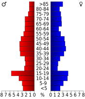
As of 2010, there were 6,373 people living in the county. Most people in Mitchell County are White (about 97.97%). A small number of people are from other racial backgrounds. About 1.14% of the population was Hispanic or Latino.
The average age of people in the county in 2010 was about 45.6 years old. About 21.44% of the population was under 18 years old.
Education in Mitchell County
Mitchell County has several places for learning, from colleges to local schools.
Colleges
- North Central Kansas Technical College in Beloit
School Districts
These are the public school districts that serve students in Mitchell County:
- Waconda USD 272
- Beloit USD 273
Private Schools
There are also private schools in the county:
- St. John's Catholic High School
- Tipton Catholic High School
Communities in Mitchell County
Mitchell County has several cities and smaller communities. Some communities might even have parts in a neighboring county.
Cities in Mitchell County
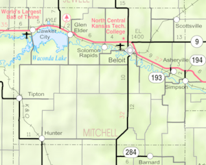
- Beloit (This is the county seat, meaning it's where the county government is located.)
- Cawker City
- Glen Elder
- Hunter
- Scottsville
- Simpson (Part of this city is in another county.)
- Tipton
Unincorporated Communities
These are smaller communities that are not officially organized as cities:
- Asherville (This is also a Census-Designated Place, which means the U.S. Census Bureau counts it as a specific area.)
- Solomon Rapids
Ghost Towns
Mitchell County also has some "ghost towns." These are places where people used to live, but now they are mostly empty or abandoned.
- Blue Hill
- Buel
- Coursens Grove
- Elmira
- Saltville
- Sunflower
- Victor
- Walnut Grove
- West Asher
See also
 In Spanish: Condado de Mitchell (Kansas) para niños
 | Selma Burke |
 | Pauline Powell Burns |
 | Frederick J. Brown |
 | Robert Blackburn |


