
Lincoln County, Kansas facts for kids
Quick facts for kids
Lincoln County
|
|
|---|---|

Lincoln County Courthouse in Lincoln (2005)
|
|

Location within the U.S. state of Kansas
|
|
 Kansas's location within the U.S. |
|
| Country | |
| State | |
| Founded | February 26, 1867 |
| Named for | Abraham Lincoln |
| Seat | Lincoln |
| Largest city | Lincoln |
| Area | |
| • Total | 720 sq mi (1,900 km2) |
| • Land | 719 sq mi (1,860 km2) |
| • Water | 1.1 sq mi (3 km2) 0.1%% |
| Population
(2020)
|
|
| • Total | 2,939 |
| • Estimate
(2023)
|
2,920 |
| • Density | 4.082/sq mi (1.576/km2) |
| Time zone | UTC−6 (Central) |
| • Summer (DST) | UTC−5 (CDT) |
| Congressional district | 1st |
Lincoln County is a special area called a county in the state of Kansas, USA. Its main town and largest city is Lincoln Center. In 2020, about 2,939 people lived there. The county got its name from Abraham Lincoln, who was the 16th president of the United States.
Contents
History of Lincoln County
For thousands of years, the wide-open spaces of the Great Plains in North America were home to nomadic Native American tribes. These groups moved around to hunt and gather food.
Between the 1500s and 1700s, the Kingdom of France said it owned huge parts of North America. But in 1762, after a big war called the French and Indian War, France secretly gave a lot of its land, known as New France, to Spain. This was part of a deal called the Treaty of Fontainebleau.
Later, in 1802, Spain gave most of that land back to France. Then, in 1803, the United States bought a massive amount of land from France. This huge purchase, called the Louisiana Purchase, included most of what is now Kansas. It was a great deal, costing only about 2.83 cents per acre!
In 1854, the area became the Kansas Territory. Then, in 1861, Kansas officially became the 34th U.S. state. Six years later, in 1867, Lincoln County was officially created.
Lincoln County is one of the areas in Kansas that has seen its population shrink over time. This is part of a larger trend called the depopulation of the Great Plains.
Geography of Lincoln County
Lincoln County covers a total area of about 720 square miles. Most of this is land (about 719 square miles), and a very small part (about 1.1 square miles) is water.
Neighboring Counties
Lincoln County shares its borders with several other counties:
- Mitchell County (to the north)
- Ottawa County (to the east)
- Saline County (to the southeast)
- Ellsworth County (to the south)
- Russell County (to the west)
- Osborne County (to the northwest)
People of Lincoln County

| Historical population | |||
|---|---|---|---|
| Census | Pop. | %± | |
| 1870 | 516 | — | |
| 1880 | 8,582 | 1,563.2% | |
| 1890 | 9,709 | 13.1% | |
| 1900 | 9,886 | 1.8% | |
| 1910 | 10,142 | 2.6% | |
| 1920 | 9,894 | −2.4% | |
| 1930 | 9,707 | −1.9% | |
| 1940 | 8,338 | −14.1% | |
| 1950 | 6,643 | −20.3% | |
| 1960 | 5,556 | −16.4% | |
| 1970 | 4,582 | −17.5% | |
| 1980 | 4,145 | −9.5% | |
| 1990 | 3,653 | −11.9% | |
| 2000 | 3,578 | −2.1% | |
| 2010 | 3,241 | −9.4% | |
| 2020 | 2,939 | −9.3% | |
| 2023 (est.) | 2,920 | −9.9% | |
| U.S. Decennial Census 1790-1960 1900-1990 1990-2000 2010-2020 |
|||
In 2000, there were 3,578 people living in Lincoln County. The county had about 5 people per square mile. Most people (98.30%) were White. A small number were Black or African American (0.11%), Native American (0.48%), or Asian (0.11%). About 1.03% of the population were Hispanic or Latino.
The average age of people in the county was 44 years old. About 23.50% of the population was under 18, and another 23.50% was 65 or older.
The average yearly income for a family in the county was about $36,538. About 9.70% of all people in the county lived below the poverty line. This included 11.70% of those under 18.
Education in Lincoln County
Students in Lincoln County attend schools that are part of two main school districts:
School Districts
- Lincoln USD 298
- Sylvan–Lucas USD 299
Communities in Lincoln County

Lincoln County has several towns and smaller communities. Some are official cities, while others are unincorporated, meaning they don't have their own local government. There are also some "ghost towns" that used to be active but are now mostly empty.
Cities
- Barnard
- Beverly
- Lincoln (This is the main town, also called the county seat)
- Sylvan Grove
Unincorporated Communities
These are smaller places without their own city government:
Ghost Towns
These places used to be towns but are now mostly abandoned:
- Bacon
- Bayne
- Cedron
- Herman
- Lone Walnut
- Milo
- Monroe
- Orbitello
- Orworth
- Paris
- Pinon
- Pleasant Valley
- Pottersburg
- Rosette
- Topsy
- Towerspring
- Union Valley
- Woodey
- Yorktown
Townships
Lincoln County is divided into twenty smaller areas called townships. These are like smaller local areas within the county. The cities mentioned above are part of these townships.
Images for kids
-
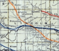
A railroad map of Lincoln County from 1915-1918.

See also
 In Spanish: Condado de Lincoln (Kansas) para niños
