National Register of Historic Places listings in Monongalia County, West Virginia facts for kids
Hey there! Did you know that all across the United States, there are special places that are super important because of their history or unique design? These places are listed on something called the National Register of Historic Places. It's like a special club for old buildings, cool bridges, and even ancient sites that tell us a lot about the past.
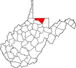
This page is all about the amazing historic places right here in Monongalia County, West Virginia. There are 44 of these cool spots in our county! One of them is even extra special and is called a National Historic Landmark, which means it's important to the whole country!
Let's explore some of these fantastic places and learn a bit about why they are so special.
|
Barbour - Berkeley - Boone - Braxton - Brooke - Cabell - Calhoun - Clay - Doddridge - Fayette - Gilmer - Grant - Greenbrier - Hampshire - Hancock - Hardy - Harrison - Jackson - Jefferson - Kanawha - Lewis - Lincoln - Logan - Marion - Marshall - Mason - McDowell - Mercer - Mineral - Mingo - Monongalia - Monroe - Morgan - Nicholas - Ohio - Pendleton - Pleasants - Pocahontas - Preston - Putnam - Raleigh - Randolph - Ritchie - Roane - Summers - Taylor - Tucker - Tyler - Upshur - Wayne - Webster - Wetzel - Wirt - Wood - Wyoming |
Discovering Monongalia County's Historic Treasures
Monongalia County is full of interesting history, and many of its important buildings and sites are protected. This means they are recognized for their value and efforts are made to keep them safe for future generations, like you!
What is the National Register of Historic Places?
The National Register of Historic Places is the official list of places in the United States that are worth saving. These can be buildings, structures, objects, sites, or even entire neighborhoods! They are chosen because they have played a big part in American history, architecture, archaeology, engineering, or culture. When a place is added to this list, it helps people understand its importance and encourages its preservation.
Cool Historic Spots in Monongalia County
Here's a look at some of the awesome places in Monongalia County that are on the National Register:
| Name on the Register | Image | Date listed | Location | City or town | Description | |
|---|---|---|---|---|---|---|
| 1 | D.I.B. Anderson Farm |
(#94000213) |
3333 Collins Ferry Rd. 39°39′36″N 79°58′27″W / 39.66°N 79.974167°W |
Morgantown | This farm is a great example of how farms used to look and operate in the area. | |
| 2 | Brown Building |
(#85001514) |
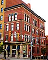
295 High St. 39°37′47″N 79°57′22″W / 39.629722°N 79.956111°W |
Morgantown | Located on High Street, this building is part of Morgantown's historic downtown. | |
| 3 | Camp Rhododendron |
(#91000545) |
Off Interstate 68 8 mi (13 km) east of Morgantown 39°38′18″N 79°48′56″W / 39.638333°N 79.815556°W |
Morgantown | This camp offers a glimpse into outdoor recreation and community life from the past. | |
| 4 | Chancery Hill Historic District |
(#99001401) |
Roughly bounded by S. High St., Oak Grove Cemetery, Waitman, Allison, and Simpson Sts. and 256 Prairie Ave. 39°37′20″N 79°57′43″W / 39.622222°N 79.961944°W |
Morgantown | This historic district includes many old and important buildings, like the Alexander Wade House. | |
| 5 | Judge Frank Cox House |
(#84003626) |
206 Spruce St. 39°37′27″N 79°57′20″W / 39.624167°N 79.955556°W |
Morgantown | The home of a former judge, showing the architecture of its time. | |
| 6 | Dents Run Covered Bridge |
(#81000604) |
County Route 43/4 near junction of County Route 43 crossing Dents Run 39°37′26″N 80°02′24″W / 39.623889°N 80.04°W |
Laurel Point | A beautiful old covered bridge, a classic sight from earlier times. | |
| 7 | Dering Building |
(#94001288) |
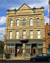
175-177 Walnut St. 39°37′49″N 79°57′25″W / 39.630278°N 79.956944°W |
Morgantown | An important building on Walnut Street in Morgantown. | |
| 8 | Downtown Morgantown Historic District |
(#96000441) |
Roughly bounded by Chestnut and Spruce Sts. between Foundry and Willey Sts. 39°37′47″N 79°57′26″W / 39.629722°N 79.957222°W |
Morgantown | This district covers a large part of Morgantown's city center with many old buildings. | |
| 9 | Easton Roller Mill |
(#78002806) |
Near Easton Hill on County Route 119/17 39°39′00″N 79°54′45″W / 39.65°N 79.9125°W |
Morgantown | An old mill that shows how grain was processed long ago. | |
| 10 | Ford House |
(#93001227) |
310 Ford St. 39°37′18″N 79°57′45″W / 39.621667°N 79.9625°W |
Morgantown | A historic house that tells a story about the people who lived there. | |
| 11 | Fourth Ward School |
(#04000914) |
287 Eureka Dr. 39°38′25″N 79°56′56″W / 39.640278°N 79.948889°W |
Morgantown | This old school building reminds us of how education used to be. | |
| 12 | Greenmont Historic District |
(#04001597) |
Roughly bounded by Arlington, Front, Conn, White Ave., Posten Ave., Kingwood St., and Decker Ave. 39°37′31″N 79°57′00″W / 39.625278°N 79.95°W |
Morgantown | A neighborhood with many historic homes and buildings. | |
| 13 | Hackney House |
(#99000789) |
89 Kingwood St. 39°37′39″N 79°57′08″W / 39.6275°N 79.952222°W |
Morgantown | Another important historic house in Morgantown. | |
| 14 | Hamilton Farm Petroglyphs |
(#74002015) |
Southeast of Ringgold on U.S. Route 119 39°33′34″N 79°56′16″W / 39.5594°N 79.9378°W |
Ringgold | These are ancient rock carvings, showing art from people who lived here long, long ago. | |
| 15 | Harmony Grove Meeting House |
(#83003245) |
Off Interstate 79 39°36′12″N 79°59′25″W / 39.603333°N 79.990278°W |
Harmony Grove | A historic meeting house, important for its role in community gatherings. | |
| 16 | Harner Homestead |
(#84003629) |
1818 Listravia St. 39°37′26″N 79°55′14″W / 39.623889°N 79.920556°W |
Morgantown | An old homestead that shows how families lived and worked in the past. | |
| 17 | Henry Clay Furnace |
(#70000658) |
Southeast of Cheat Neck in Coopers Rock State Forest 39°38′56″N 79°49′07″W / 39.648889°N 79.818611°W |
Cheat Neck | This old furnace was used to make iron, showing the early industries of the region. | |
| 18 | Kern's Fort |
(#93000225) |
305 Dewey St. 39°37′31″N 79°56′59″W / 39.625278°N 79.949722°W |
Morgantown | A historic fort that played a role in the area's early defense. | |
| 19 | Kincaid and Arnett Feed and Flour Building |
(#95000873) |
156 Clay St. 39°37′31″N 79°57′50″W / 39.625278°N 79.963889°W |
Morgantown | This building was once important for trade and supplies in the community. | |
| 20 | Lynch Chapel United Methodist Church |
(#06001046) |
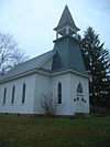
Junction of County Routes 32 and 41 39°37′23″N 80°05′05″W / 39.623056°N 80.084722°W |
Morgantown | A historic church that has served its community for many years. | |
| 21 | Mason and Dixon Survey Terminal Point |
(#73001922) |
2.25 mi (3.62 km) northeast of Pentress on County Route 39 39°43′16″N 80°07′07″W / 39.721111°N 80.118611°W |
Pentress | This point marks the end of the famous Mason-Dixon Line, which helped define state borders. It even extends into Pennsylvania! | |
| 22 | Men's Hall |
(#89002309) |
Prospect and High Sts. 39°37′59″N 79°57′10″W / 39.633056°N 79.952778°W |
Morgantown | An important building on the West Virginia University campus. | |
| 23 | Metropolitan Theatre |
(#84003631) |
371 S. High St. 39°37′51″N 79°57′20″W / 39.630833°N 79.955556°W |
Morgantown | This old theater has hosted many performances and events over the years. | |
| 24 | Monongalia County Courthouse |
(#85001525) |
243 High St. 39°37′47″N 79°57′26″W / 39.629722°N 79.957222°W |
Morgantown | The county courthouse is where important government and legal decisions happen. | |
| 25 | Elizabeth Moore Hall |
(#85003208) |
University Ave. 39°38′06″N 79°57′20″W / 39.635°N 79.955556°W |
Morgantown | Another historic building on the West Virginia University campus. | |
| 26 | Morgantown Wharf and Warehouse Historic District |
(#98001466) |
Roughly along the Monongahela River from Warren St. to Walnut St. 39°37′42″N 79°57′39″W / 39.628333°N 79.960833°W |
Morgantown | This area along the river was once a busy hub for trade and shipping. | |
| 27 | Oglebay Hall |
(#85003207) |
University Ave. 39°38′14″N 79°57′16″W / 39.637222°N 79.954444°W |
Morgantown | A significant building at West Virginia University. | |
| 28 | Old Morgantown Post Office |
(#79002593) |
107 High St. 39°37′41″N 79°57′29″W / 39.628056°N 79.958056°W |
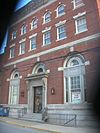
Morgantown | This building used to be the main post office for Morgantown. | |
| 29 | Old Stone House |
(#72001290) |
Chestnut St. 39°37′49″N 79°57′26″W / 39.630278°N 79.957222°W |
Morgantown | A very old stone house that shows early building styles. | |
| 30 | Old Watson Homestead House |
(#84003871) |
County Route 73 39°31′46″N 80°02′38″W / 39.529444°N 80.043889°W |
Smithtown | This homestead gives us a peek into rural life from long ago. | |
| 31 | Purinton House |
(#85003206) |
University Ave. 39°38′05″N 79°57′20″W / 39.634722°N 79.955556°W |
Morgantown | Another important building on the West Virginia University campus. | |
| 32 | Rogers House |
(#84000683) |
293 Willey St. 39°37′53″N 79°57′09″W / 39.631389°N 79.9525°W |
Morgantown | A historic house that is now used by the West Virginia University Campus Ministry Center. | |
| 33 | St. Mary's Orthodox Church |
(#87002525) |
W. Park and Holland Aves. 39°38′03″N 79°57′43″W / 39.634167°N 79.961944°W |
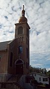
Westover | This church is a beautiful example of religious architecture. | |
| 34 | Second Ward Negro Elementary School |
(#92000896) |
Junction of White and Posten Aves. 39°37′17″N 79°56′57″W / 39.621389°N 79.949167°W |
Morgantown | This school building is important for understanding the history of education in the area. | |
| 35 | Seneca Glass Company Building |
(#85003214) |
709 Beechurst Ave. 39°38′28″N 79°57′44″W / 39.641111°N 79.962222°W |
Morgantown | This building was once home to a famous glass company, showing the region's industrial past. | |
| 36 | South Park Historic District |
(#90001054) |
Roughly bounded by Elgin St., Kingwood St., Cobun Ave., Prairie Ave., Jefferson St., Lincoln Ave., and Grand St. 39°37′21″N 79°57′08″W / 39.6225°N 79.952222°W |
Morgantown | A large historic neighborhood with many interesting homes. | |
| 37 | Stalnaker Hall |
(#85003205) |
Maiden Ln. 39°38′08″N 79°57′11″W / 39.635556°N 79.953056°W |
Morgantown | Another historic hall at West Virginia University. | |
| 38 | Stewart Hall |
(#80004034) |
West Virginia University campus 39°38′03″N 79°57′16″W / 39.634167°N 79.954444°W |
Morgantown | An important building on the West Virginia University campus. | |
| 39 | Vance Farmhouse |
(#91001731) |
1535 Mileground, West Virginia University 39°38′23″N 79°56′13″W / 39.639722°N 79.936944°W |
Morgantown | This farmhouse is part of the West Virginia University property and has a long history. | |
| 40 | Alexander Wade House |
(#66000752) |
256 Prairie St. 39°37′29″N 79°57′30″W / 39.624722°N 79.958333°W |
Morgantown | This house is a National Historic Landmark, meaning it's super important to the history of the entire United States! | |
| 41 | Walters House |
(#83003246) |
221 Willey St. 39°37′55″N 79°57′13″W / 39.631944°N 79.953611°W |
Morgantown | A historic house on Willey Street. | |
| 42 | Waitman T. Willey House |
(#82004327) |
128 Wagner Rd. 39°37′30″N 79°57′34″W / 39.625°N 79.959444°W |
Morgantown | The home of Waitman T. Willey, an important figure in West Virginia's history. | |
| 43 | Women's Christian Temperance Union Community Building |
(#85003406) |
160 Fayette St. 39°37′52″N 79°57′22″W / 39.631111°N 79.956111°W |
Morgantown | This building was used by a group that worked for social change and community improvement. | |
| 44 | Woodburn Circle |
(#74002014) |
University Ave., West Virginia University 39°38′09″N 79°57′35″W / 39.635833°N 79.959722°W |
Morgantown | A central and historic part of the West Virginia University campus. |


