
National Register of Historic Places listings in Morris County, New Jersey facts for kids

Morris County, New Jersey, is a place rich in history! Many of its old buildings, homes, and special areas are so important that they've been added to the National Register of Historic Places. This is a special list kept by the United States government to protect and celebrate places that tell us about America's past.
Think of it like a hall of fame for buildings and neighborhoods! When a place is on this list, it means it's recognized for its unique history, amazing architecture, or its role in important events. Let's explore some of these cool historic spots in Morris County!
Contents
- Historic Homes and Mansions
- Acorn Hall
- Alnwick Hall
- Martin Berry House
- Boisaubin Manor
- Dr. Jabez Campfield House
- Dr. Lewis Condict House
- General Nathan Cooper Mansion
- Craftsman Farms
- Cutler Homestead
- Davenport-Demarest House
- Decker-Kincaid Homestead
- Doremus House
- Dusenberry House
- Samuel Ford, Jr.'s, Hammock Farm
- Ford-Faesch House
- Fredericks House
- Gibbons Mansion
- Grimes Homestead
- Rev. John Hancock House, Cider Mill and Cemetery
- Benjamin Howell Homestead
- Joseph Jackson House
- Jenkins-Mead House
- Peter Kemble House
- Lindenwold
- Effingham Low House
- Timothy Mills House
- Mount Kemble Home
- Thomas Nast Home
- Oak Dell
- Johannes Parlaman House
- Parsonage of the Montville Reformed Dutch Church
- Joseph W. Revere House (Fosterfields)
- Silas Riggs House
- Alfred T. Ringling Manor
- Sayre House
- Seward Mansion
- Bridget Smith House
- John Smith House
- Spring Brook House
- Stephens Homestead
- David Thompson House
- Thorne and Eddy Estates
- Tuttle House
- James Van Duyne Farm House
- Martin Van Duyne House
- Simon Van Duyne House
- Van Duyne-Jacobus House
- Vanness – Linen House
- Nicholas Vreeland Outkitchen
- Whippany Farm
- Willow Hall
- Historic Districts and Areas
- Blackwell Street Historic District
- Boonton Historic District
- Bottle Hill Historic District
- Brookside Historic District
- Combs Hollow Historic District
- Fairmount Historic District
- German Valley Historic District
- Hanover Village Historic District
- Ledgewood Historic District
- Madison Civic Commercial District
- Mendham Historic District
- Middle Valley Historic District
- Morristown District
- Mount Arlington Historic District
- Mount Olive Village Historic District
- Mount Tabor Historic District
- Mountain Lakes Historic District
- Mott Hollow
- New Vernon Historic District
- Normandy Park
- Pottersville Village Historic District
- Pruddentown Historic District
- Ralston Historic District
- Schooley's Mountain Historic District
- Silver Lake Historic District
- Split Rock Furnace
- Tempe Wick Road-Washington Corners Historic District
- Washington Valley Historic District
- Other Historic Structures and Sites
- Baker Building
- Beverwyck Site
- Boonton Public Library
- Cary Station
- Chester House Inn
- The Church in the Glen (Stanhope United Methodist Church)
- Community of St John Baptist
- Nathan Cooper Gristmill
- Delaware, Lackawanna and Western Railroad Stations
- First Congregational Church
- First Presbyterian Church of Hanover
- First Reformed Church of Pompton Plains
- Flocktown Schoolhouse
- Friends Meetinghouse
- Glanville Blacksmith Shop
- Illumination Gas Plant of the New Jersey State Asylum for the Insane at Morris Plains
- King Store and Homestead
- Lake Hopatcong Yacht Club
- Little Red Schoolhouse
- Madison Masonic Lodge
- Madison Public Library and the James Building
- Madison Station
- Methodist Episcopal Church (Madison)
- Methodist Episcopal Church of Hibernia
- Millington Schoolhouse
- Millington Station
- Montville Schoolhouse
- Morris Canal
- Morris County Courthouse
- Morris Plains Station
- Morristown and Erie Railroad Whippany Water Tank
- Morristown National Historical Park
- Morristown-Beard School
- Mount Freedom Presbyterian Church
- Mount Hope Miners' Church
- New York Susquehanna & Western Railroad Station
- Our Lady of Mercy Chapel
- Palace Theatre
- Rockaway Valley Methodist Church
- Slater's Mill
- Speedwell Ironworks
- United States Army Steam Locomotive No. 4039
- Washington Valley Schoolhouse
- Whippany Burying Yard
- Images for kids
Historic Homes and Mansions
Morris County is home to many beautiful old houses, each with its own story.
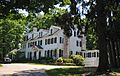
Acorn Hall

Located in Morristown, Acorn Hall is a grand old house built in 1853. It's a great example of Victorian architecture and gives us a peek into what life was like for wealthy families long ago. It was added to the list on April 3, 1973.
Alnwick Hall

This impressive building in Morris Township was built in 1904. It's known for its unique design and was listed on April 11, 1985.
Martin Berry House

Found in Pompton Plains, this house dates back to 1720! It's one of the oldest homes on the list and was recognized on June 19, 1973.
Boisaubin Manor

Southeast of Morristown, Boisaubin Manor was added to the Register on October 22, 1976. It's another example of the beautiful historic homes in the area.
Dr. Jabez Campfield House

This house in Morristown belonged to Dr. Jabez Campfield. It was listed on September 4, 2008, preserving a piece of Morristown's medical and social history.
Dr. Lewis Condict House

Also in Morristown, the Dr. Lewis Condict House, built around 1797, was listed on April 3, 1973. It's a classic example of early American architecture.
General Nathan Cooper Mansion

West of Mendham, in Chester Township, stands the General Nathan Cooper Mansion. This historic home was added to the list on December 29, 1978.
Craftsman Farms

This special place in Parsippany was the home of Gustav Stickley, a famous artist and designer from the early 1900s. It's a great example of the "Arts and Crafts Movement" style and was listed on April 10, 1989.
Cutler Homestead

The Cutler Homestead in Morristown, listed on March 10, 1975, is another historic home that helps tell the story of the area's past.
Davenport-Demarest House

This house in Montville is part of a group of "Dutch Stone Houses" that are important to the region's history. It was listed on January 17, 1992.
Decker-Kincaid Homestead

In Boonton, the Decker-Kincaid Homestead was added to the Register on March 9, 2005.
Doremus House

The Doremus House in Towaco, listed on October 31, 1972, is another example of the unique Dutch stone houses found in Montville Township.
Dusenberry House

This mid-19th century home in Chatham belonged to a local pastor. It was listed on November 1, 1979.
Samuel Ford, Jr.'s, Hammock Farm

Located in Florham Park, this farm was listed on December 23, 1974.
Ford-Faesch House

In Rockaway Township, the Ford-Faesch House was added to the Register on February 12, 1974.
Fredericks House

The Fredericks House in Fayson Lakes was listed on October 18, 1979.
Gibbons Mansion

This mansion in Madison was listed on August 10, 1977. It's a significant part of the area's grand estates.
Grimes Homestead

In Mountain Lakes, the Grimes Homestead was recognized on April 1, 1977.
Rev. John Hancock House, Cider Mill and Cemetery

This unique property in Florham Park includes a house, a cider mill, and a cemetery. It was listed on August 30, 1984.
Benjamin Howell Homestead

The Benjamin Howell Homestead in Parsippany was added to the Register on October 19, 1978.
Joseph Jackson House

In Rockaway, the Joseph Jackson House was listed on March 4, 1975.
Jenkins-Mead House

The Jenkins-Mead House in Morristown was recognized on March 10, 1997.
Peter Kemble House

The Peter Kemble House in Chatham was listed on August 26, 1980.
Lindenwold

This property in Morristown was listed on November 13, 1986, as part of the Morristown Multiple Resource Area.
Effingham Low House

In Pine Brook, the Effingham Low House is another Dutch stone house listed on January 17, 1992.
Timothy Mills House

The Timothy Mills House in Morristown was added to the Register on February 24, 1975.
Mount Kemble Home

The Mount Kemble Home in Morristown was listed on November 13, 1986.
Thomas Nast Home

This home in Morristown was where the famous political cartoonist Thomas Nast lived for much of his career. It was recognized as a National Historic Landmark on October 15, 1966.
Oak Dell

Oak Dell in Morristown was listed on November 13, 1986.
Johannes Parlaman House

Another Dutch stone house in Montville, the Johannes Parlaman House, was listed on January 17, 1992.
Parsonage of the Montville Reformed Dutch Church

This historic parsonage in Montville was listed on January 17, 1992, as part of the Dutch Stone Houses in Montville.
Joseph W. Revere House (Fosterfields)

Known as Fosterfields, this house in Morris Township was listed on September 20, 1973. It's now a living history farm!
Silas Riggs House

The Silas Riggs House in Ledgewood was listed on November 11, 1977.
Alfred T. Ringling Manor

South of Oak Ridge, this manor was listed on June 3, 1976.
Sayre House

The Sayre House in Madison was added to the Register on February 12, 1980.
Seward Mansion

Known as Seward Mansion, this historic home in Mount Olive Township was listed on December 24, 2013.
Bridget Smith House

The Bridget Smith House in Mine Hill Township was listed on February 27, 1998.
John Smith House

In Washington Valley, the John Smith House was recognized on January 1, 1976.
Spring Brook House

The Spring Brook House in Morristown was listed on November 13, 1986.
Stephens Homestead

The Stephens Homestead in Mount Olive Township was listed on January 14, 2013.
David Thompson House

In Mendham, the David Thompson House was listed on July 24, 1973.
Thorne and Eddy Estates

East of Morristown, these estates were listed on December 14, 1978.
Tuttle House

The Tuttle House in Whippany was added to the Register on October 5, 1977.
James Van Duyne Farm House

In Towaco, the James Van Duyne Farm House was listed on April 15, 1982.
Martin Van Duyne House

The Martin Van Duyne House in Montville was listed on January 17, 1992, as part of the Dutch Stone Houses in Montville.
Simon Van Duyne House

In Pine Brook, the Simon Van Duyne House is another Dutch stone house listed on January 17, 1992.
Van Duyne-Jacobus House

The Van Duyne-Jacobus House in Montville was listed on January 17, 1992, as part of the Dutch Stone Houses in Montville.
Vanness – Linen House

In Riverdale, the Vanness – Linen House was listed on July 14, 2011.
Nicholas Vreeland Outkitchen

This outkitchen in Towaco was listed on December 11, 2009, as part of the Dutch Stone Houses in Montville.
Whippany Farm

The Whippany Farm in Morristown was listed on September 22, 1977.
Willow Hall

Willow Hall in Morristown was added to the Register on January 18, 2011.
Historic Districts and Areas
Some places are important not just for one building, but for a whole group of buildings or an entire neighborhood! These are called Historic Districts.
Blackwell Street Historic District

This district in Dover includes Blackwell and Sussex Streets. It was listed on May 21, 1982, preserving the historic feel of this area.
Boonton Historic District

The Boonton Historic District, including Main, Church, Birch, Cornelia, and Cedar Streets, was listed on September 29, 1980.
Bottle Hill Historic District

In Madison, this district was listed on June 16, 2005.
Brookside Historic District

This district in Brookside was listed on February 16, 1996.
Combs Hollow Historic District

The Combs Hollow Historic District in Randolph was listed on February 16, 1996.
Fairmount Historic District

This district, mainly in Washington Township, was listed on December 20, 1996.
German Valley Historic District

In Long Valley, this district was listed on July 14, 1983.
Hanover Village Historic District

This district in East Hanover was listed on September 13, 1993.
Ledgewood Historic District

The Ledgewood Historic District was listed on April 18, 2013. It includes the King Store and Homestead and the Silas Riggs House.
Madison Civic Commercial District

This district in Madison, covering the downtown area, was listed on October 18, 1991. It shows what the town looked like in the late 1800s.
Mendham Historic District

The Mendham Historic District in Mendham was listed on April 18, 1985.
Middle Valley Historic District

This district in Middle Valley was listed on September 25, 1990.
Morristown District

The Morristown District, a large historic area in Morristown, was listed on October 30, 1973.
Mount Arlington Historic District

This district in Mount Arlington was listed on August 26, 1983.
Mount Olive Village Historic District

The Mount Olive Village Historic District was listed on August 3, 2015.
Mount Tabor Historic District

This district in Parsippany-Troy Hills was listed on March 3, 2015.
Mountain Lakes Historic District

The Mountain Lakes Historic District was listed on September 7, 2005.
Mott Hollow

This area in Randolph Township was listed on August 31, 1992.
New Vernon Historic District

In Harding, this district was listed on July 8, 1982.
Normandy Park

Normandy Park in Morris Township was listed on December 6, 1996.
Pottersville Village Historic District

This district in Pottersville was listed on September 18, 1990.
Pruddentown Historic District

In Morris Township, the Pruddentown Historic District was listed on February 12, 2003.
Ralston Historic District

West of Mendham, this district was listed on February 20, 1975.
Schooley's Mountain Historic District

This district in Washington Township was listed on June 14, 1991.
Silver Lake Historic District

In Harding, this district was listed on March 5, 1999.
Split Rock Furnace

Northwest of Boonton, this historic furnace area in Rockaway Township was listed on November 6, 1974.
Tempe Wick Road-Washington Corners Historic District

This district in Harding was listed on August 25, 2000.
Washington Valley Historic District

This district, spanning Morris Township and Mendham Township, was listed on November 12, 1992. It includes several important historic sites.
Other Historic Structures and Sites
Baker Building

The Baker Building in Dover was listed on July 1, 1981.
Beverwyck Site

Southeast of the junction of US 46 and S. Beverwyck Rd. in Parsippany-Troy Hills, this site was listed on May 14, 2004.
Boonton Public Library

The Boonton Public Library, located at 619 Main St. in Boonton, was listed on November 13, 1972.
Cary Station

This historic station in Ledgewood was listed on September 5, 1985.
Chester House Inn

The Chester House Inn in Chester was listed on July 18, 1974.
The Church in the Glen (Stanhope United Methodist Church)

Known as Stanhope United Methodist Church, this building in Netcong was listed on January 2, 2013.
Community of St John Baptist

This community in Mendham was listed on April 24, 2007.
Nathan Cooper Gristmill

West of Chester, the Nathan Cooper Gristmill in Chester Township was listed on November 21, 1976.
Delaware, Lackawanna and Western Railroad Stations
Morris County has several historic train stations from the Delaware, Lackawanna and Western Railroad:
- Morristown Station: This 1913 station is still in use! Some scenes from Cyndi Lauper's "Time After Time" music video were even filmed here. It was listed on March 11, 1980.
- Boonton Station: Listed on July 13, 1977.
- Dover Station: Listed on May 23, 1980.


First Congregational Church

This church in Chester was listed on August 10, 1977.
First Presbyterian Church of Hanover

Located in East Hanover, this church was listed on November 10, 1977.
First Reformed Church of Pompton Plains

This church in Pompton Plains was listed on December 12, 2012.
Flocktown Schoolhouse

The Flocktown Schoolhouse in Washington Township was listed on November 30, 1982.
Friends Meetinghouse

South of Dover, this meetinghouse was listed on June 4, 1973.
Glanville Blacksmith Shop

This historic blacksmith shop in Morristown was listed on March 25, 1987.
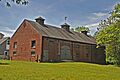
Illumination Gas Plant of the New Jersey State Asylum for the Insane at Morris Plains

This unique industrial building in Parsippany was listed on June 9, 2000.
King Store and Homestead

In Ledgewood, the King Store and Homestead was listed on April 29, 1994.
Lake Hopatcong Yacht Club

The Lake Hopatcong Yacht Club in Mount Arlington was listed on August 12, 1999.
Little Red Schoolhouse

This charming schoolhouse in Florham Park was listed on June 6, 1986.
Madison Masonic Lodge

The Madison Masonic Lodge in Madison was listed on January 17, 2008.
Madison Public Library and the James Building

This library and building in Madison were listed on February 8, 1980.
Madison Station

The Madison Station, a beautiful Gothic Revival stone building from 1916, was listed on June 22, 1984. It's still a working train station!
Methodist Episcopal Church (Madison)

This church in Madison was listed on May 2, 2008.
Methodist Episcopal Church of Hibernia

In Hibernia, this church was listed on July 14, 2011.
Millington Schoolhouse

The Millington Schoolhouse in Millington was listed on March 12, 2012.
Millington Station

The Millington Station was listed on June 22, 1984, and is part of the Operating Passenger Railroad Stations.
Montville Schoolhouse

The Montville Schoolhouse in Montville was listed on December 11, 2009.
Morris Canal

The Morris Canal, a long historic waterway that once stretched across New Jersey, was listed on October 1, 1974.
Morris County Courthouse

The Morris County Courthouse in Morristown was listed on August 19, 1977.
Morris Plains Station

The Morris Plains Station was listed on June 22, 1984.
Morristown and Erie Railroad Whippany Water Tank
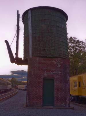
This water tank in Hanover Township was listed on September 6, 2006.
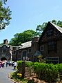
Morristown National Historical Park

This very important park in Morristown was listed as a National Historic Park on October 15, 1966. It includes famous sites like the Ford Mansion, Fort Nonsense, and Jockey Hollow, where George Washington's army camped during the Revolutionary War.
Morristown-Beard School

The Morristown School (now Morristown-Beard School) in Morris Township was listed on February 28, 1996.
Mount Freedom Presbyterian Church

This church in Mount Freedom was listed on October 11, 1991.
Mount Hope Miners' Church

The Mount Hope Miners' Church in Mount Hope was listed on August 20, 2012.
New York Susquehanna & Western Railroad Station

This station in Butler was listed on January 24, 2002.
Our Lady of Mercy Chapel

Our Lady of Mercy Chapel in Whippany was listed on September 18, 1978.
Palace Theatre

The Palace Theatre in Netcong was listed on May 24, 1996.
Rockaway Valley Methodist Church

Northwest of Boonton, this church was listed on November 11, 1977.
Slater's Mill

Slater's Mill in Riverdale was listed on June 18, 1975.
Speedwell Ironworks

The Speedwell Ironworks in Morristown was listed as a National Historic Landmark on September 13, 1974. This is where Samuel Morse and Alfred Vail perfected the telegraph!
United States Army Steam Locomotive No. 4039

This historic steam locomotive in Hanover Township was listed on March 4, 2002.
Washington Valley Schoolhouse

The Washington Valley Schoolhouse in Washington Valley was listed on October 15, 1973.
Whippany Burying Yard

The Whippany Burying Yard in Hanover was listed on December 11, 2009.
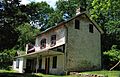
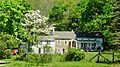
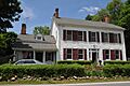
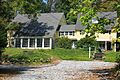
Images for kids
-
Anthony–Corwin Farm
-
Ayres' Farm
-
Bowers-Livingston-Osborn House
-
Bowlsby-Degelleke House
-
Lewis Carey Farmhouse
-
George Chamberlain House
-
Craft–Clausen House
-
James Dixon Farm
-
John Dod House and Tavern
-
Ellis Cook House
-
Flock-Stephens Farmstead
-
Miller-Rinehard Farmstead
-
Miller-Kingsland House
-
Jacob Wise Neighbor House
-
Leonard Neighbor Farmstead
-
Rarick-Kellihan House
-
Sharpenstine Farmstead
-
Trimmer-Dufford Farmstead
-
David Tuttle Cooperage
-
William Gibbons Stable and Farm
-
Glynallen
-
Hartley Farms


