Natural regions of Chile facts for kids
Chile is a very long and narrow country in South America. It stretches from close to the Tropic of Capricorn in the north all the way down to near the Antarctic Circle in the south. Because of this huge length, Chile has many different types of climates and landscapes!
In 1950, a group called CORFO helped define six main natural areas in Chile. Even though these areas aren't used for official government regions today, people still use them to talk about different parts of the country.
Contents
Chile's Five Natural Regions
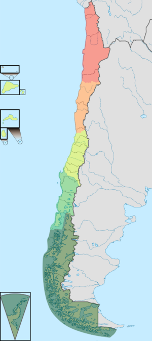
Chile is often divided into five main natural regions. These regions are arranged from north to south. Each one has its own special plants, animals, weather, and land features. Even though the Andes Mountains are always to the east and the Pacific Ocean to the west, each region feels very different.
| Natural Regions | What Makes Them Special |
|---|---|
| Norte Grande (Far North) | This area is mostly desert, with very dry parts. It has tall coastal cliffs and high mountains. You'll find salt flats and lots of copper and saltpeter here. Some eastern areas have grasslands with summer rain. |
| Copiapó River (27° S) | |
| Norte Chico (Near North) | This region has a semi-arid climate, meaning it's partly dry. The coastal mountains and the Andes join together here. Instead of a flat area in the middle, there are valleys that run from east to west. Farming happens in these narrow valleys. Sometimes, the desert here blooms with flowers after it rains! This area has important gold, copper, and iron deposits. |
| Aconcagua River (33° S) | |
| Zona Central (Central Chile) | This part of Chile has a Mediterranean climate, with warm, dry summers and mild, wet winters. The Andes Mountains are very tall and wide here. The coastal mountains and the Andes spread out more as you go south, creating a wide, fertile valley in the middle. This valley is Chile's main farming area. Rivers here get their water from melting glaciers and snow in the summer. |
| Bío-Bío River (37° S) | |
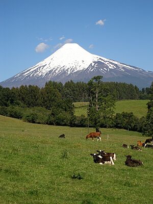
| Zona Sur (Southern Zone) | This region has a temperate oceanic climate, meaning it's cool and wet, with rainforests. The coastal mountains are lower here. The middle valley is close to sea level. You can see signs of past glaciers, like glacial lakes. There are many active volcanoes and hot springs in the Andes here. |
| Chacao Channel (42° S) | |
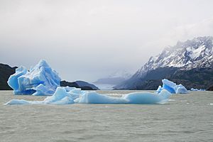
| Zona Austral (Austral Zone) | This is the southernmost part of Chile, including Chilean Patagonia. It has a subpolar oceanic climate, which is very cold and wet. You'll find Magellanic forests and Magellanic moorland in the west, and Patagonian grasslands in the east. Old glaciers have shaped the land, turning the coastal mountains into islands. There are many fjords and large ice fields in the Andes. |
Norte Grande (Far North)
Most of the Norte Grande is covered by the Atacama Desert, which is one of the driest places on Earth. The mountains along the coast can be over 2,000 meters (about 6,500 feet) high and end in steep cliffs at the ocean. Inside the country, there are huge, flat areas called salt flats in the valleys and the Andes. This region also has Chile's highest mountains, like Ojos del Salado, which is 6,891 meters (22,608 feet) tall. It also includes high plateaus called the Altiplano and puna.
Norte Chico (Near North)
The Norte Chico has a semi-arid climate. This means it's a transition zone between the very dry Atacama Desert and the wetter Mediterranean climate further south. In this area, the coastal mountains and the Andes Mountains come together. This leaves no wide, flat valley in the middle. Instead, there are several valleys that run from east to west. These valleys are important for farming. This region is also known for its gold, copper, and iron mines.
Zona Central (Central Chile)
Zona Central has a Mediterranean climate. This means it has hot, dry summers and mild, rainy winters. The plants here are often called Matorral, which are tough shrubs and small trees. The wide, fertile valley in the middle of Chile stretches south from the capital city, Santiago. This valley is known as the "agricultural heartland" of Chile because so much farming happens here. After some historical events in the late 1500s, most of Chile's main towns and cities were built in this central area.
Zona Sur (Southern Zone)
The Zona Sur has a temperate oceanic climate, which means it's generally cool and rainy. This climate supports lush Valdivian temperate rainforests. The coastal mountains here are lower than in the north, with no peaks over 1,500 meters (about 4,900 feet). The middle valley is very close to sea level. You can see many features left behind by the last ice age, like hills made of rock and dirt (moraines) and beautiful glacial lakes. The Andes Mountains in this region have a lot of volcanic activity, with many volcanoes and hot springs.
Zona Austral (Austral Zone)
The Zona Austral covers all of Chilean Patagonia and the Chiloé Archipelago. This region has a subpolar oceanic climate, which is very cold and often windy. In the west, you'll find Magellanic subpolar forests, while the east has wide Patagonian grasslands. Huge ancient ice sheets have carved out the land here. The coastal mountains have been worn down so much that they now form many islands. The middle valley is actually underwater in this region. Deep, narrow inlets called fjords cut into the Andes Mountains, where you can also find two large ice fields and several glacial lakes.
See also
 In Spanish: Regiones naturales de Chile para niños
- Climate of Chile
- Geography of Chile
- Geology of Chile
 | James B. Knighten |
 | Azellia White |
 | Willa Brown |


