
Neder-Betuwe facts for kids
Quick facts for kids
Neder-Betuwe
|
|||
|---|---|---|---|

Waal (river) near Ochten
|
|||
|
|||
.svg)
Location in Gelderland
|
|||
| Country | Netherlands | ||
| Province | Gelderland | ||
| Government | |||
| • Body | Municipal council | ||
| Area | |||
| • Total | 68.16 km2 (26.32 sq mi) | ||
| • Land | 60.64 km2 (23.41 sq mi) | ||
| • Water | 7.52 km2 (2.90 sq mi) | ||
| Elevation | 7 m (23 ft) | ||
| Population
(May 2014)
|
|||
| • Total | 22,607 | ||
| • Density | 373/km2 (970/sq mi) | ||
| Time zone | UTC+1 (CET) | ||
| • Summer (DST) | UTC+2 (CEST) | ||
| Postcode |
4040–4054, 6669
|
||
| Area code | 0344, 0488 | ||

Neder-Betuwe is a municipality in the Gelderland province, located in the eastern part of the Netherlands. It was given its current name on April 1, 2003. This happened after the municipality of Kesteren was reorganized. As of January 1, 2022, Neder-Betuwe was home to 25,042 people.
Contents
History of Neder-Betuwe
Early Settlements and Roman Times
Archaeologists have found old remains from the Stone Age and Iron Age in Neder-Betuwe. This shows that people lived here a very long time ago. However, we don't know if they stayed here permanently. The Neder-Betuwe area was also along the northern edge of the Roman empire, known as the limes. There is evidence that the Romans had a fort, called a castra, where the town of Kesteren is today.
Building Dikes and Religious Borders
Around the year 1300, the first dikes were built. These dikes helped protect the people and their farms from floods. Most churches in Neder-Betuwe are Reformed. There are no Catholic churches in this area. The eastern border of the municipality also marks a religious divide. To the east, many people are Catholic. This difference can be linked to a dike called the Spanjaardsdijk, or Spaniards Dike. It was built around the time of the Eighty Years' War. The local ruler was Protestant, while rulers to the east were Catholic.
World War II and Flood Evacuation
During World War II, there was a lot of fighting in Neder-Betuwe. In May 1940, the area was attacked during the German invasion. It was on the southern side of their attack towards the Grebbeberg. In September 1944, the area saw more fighting during and after Operation Market Garden. The narrowest part of the Betuwe region became a battle zone. The town of Opheusden was badly damaged due to constant fighting. British forces also heavily damaged Ochten using artillery and mortars.
In February 1995, Ochten gained international attention. A dike became weak after a long period of high water levels in the rivers. This situation led to 250,000 people in the region being evacuated. The river levels had been very high for almost two months. A large rescue effort helped stabilize the dike. Later, plans to strengthen the dike were carried out.
Geography and Landscape
Rivers and Land Features
The borders of Neder-Betuwe are mostly formed by rivers. The Waal River is to the south, and the Rhine River is to the north. The Amsterdam-Rhine Canal is to the west. Because it is located between these two rivers, the area is very narrow. Near Opheusden, it is only about 3 kilometers wide.
The area is mainly a polder. This means it is low-lying land protected by dikes. These dikes keep the former floodplain from flooding. Since it used to be a floodplain, the land is quite flat. The soil is mostly clay, with layers of sand and gravel underneath.
Topography of Neder-Betuwe

Towns and Villages
Neder-Betuwe includes several towns and villages:
- Dodewaard
- Echteld
- IJzendoorn
- Kesteren
- Ochten
- Opheusden
Transportation in Neder-Betuwe
The A15 highway runs through Neder-Betuwe from east to west. There is also a provincial road that crosses the Rhine River near Kesteren. Another provincial road crosses the Waal River near Echteld.
A railway line was built in 1882. It connects Geldermalsen and Amersfoort to Nijmegen. A new railway line, called the Betuweroute, opened on June 16, 2007. This line is specifically for freight trains. It connects the Port of Rotterdam to Germany and other places.
A ferry service operates across the Rhine River. It travels between Opheusden and Wageningen. In the summer, a small ferry carries people between Dodewaard and Druten. This ferry is mainly used by tourists. It helps them travel along various recreational bicycle routes across the Waal River.
Economy and Industry
The local economy in Neder-Betuwe mainly relies on agriculture. This includes fruit farms and tree nurseries. There are also some factories in the area. The economy grew a lot after the railway line was completed. This made it easier to transport fresh fruit to other places. Many people who live in Neder-Betuwe also work outside the municipality.
Dodewaard Nuclear Power Plant

In Dodewaard, there was a Dodewaard nuclear power plant. It used a boiling water reactor to produce electricity. The plant operated from 1968 to 1997. It could produce 58 megawatts of power.
In 2003, the last nuclear material was removed from the plant. Parts of the plant were taken down. The main building is now in a "safe enclosure" period. This means it will be kept safe for 40 years, from 2005 to 2045. After this time, it will be fully demolished.
Notable People from Neder-Betuwe
- Arie van Lent (born 1970 in Opheusden) – A former Dutch footballer who played in 436 club games.
- Renger van der Zande (born 1986 in Dodewaard) – A Dutch race-car driver.
- Navarone Foor (born 1992 in Opheusden) – A Dutch footballer with over 230 club games.
Gallery
-
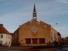
Opheusden, kerk
-
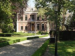
Dodewaard, voormalig gemeentehuis
-
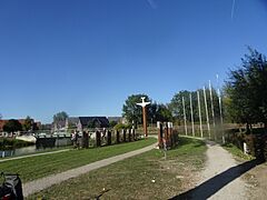
Vliegers-in-het-vuur overzicht
-
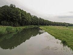
Bij Eldik, de Linge


See also
 In Spanish: Neder-Betuwe para niños
