Nobles Emigrant Trail facts for kids
Quick facts for kids |
|
|
Nobles Emigrant Trail
|
|

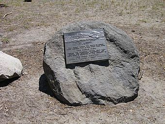
Plaque marking the site of the Nobles Emigrant Trail in Lassen Volcanic National Park
|
|
| Nearest city | Shingletown, California |
|---|---|
| Area | 582 acres (236 ha) |
| NRHP reference No. | 75000222 |
| Added to NRHP | October 3, 1975 |
The Nobles Emigrant Trail was an important path in California. It helped pioneers from the eastern United States reach northern California more easily. This trail was also known as the Fort Kearney, South Pass and Honey Lake Wagon Road.
In 1851, a man named William Nobles found a shorter way to travel. He discovered an easy shortcut between the Applegate Trail in Nevada and the Lassen Trail in California. People used the Nobles Emigrant Trail a lot until the 1870s. After that, railroads became popular and took its place.
Contents
Discovering the Trail
Before the Nobles Emigrant Trail, the main path to California was the California Trail. This trail followed the Humboldt River in Nevada and then the Truckee River. It crossed the Donner Pass in California.
In 1846, the Applegate brothers created a northern version of the trail. This route went further north and connected to places in Oregon. Later, Peter Lassen made his own path. It passed Lassen Peak on its way to the Sacramento area.
William Nobles' Journey
Peter Lassen and William H. Nobles explored the area around Honey Lake. They were looking for a legendary "Gold Lake." They didn't find it and then went their separate ways. Nobles continued traveling east. By accident, he found a shorter and easier trail than Lassen's.
William Nobles was born in New York in 1816. He moved to Minnesota in 1841. There, he worked as a carpenter and wagon-maker. By 1851, he had moved to California.
Promoting the New Route
When Nobles returned to California, he showed his new route to a group of businessmen. They paid him $2000 for the information. The businessmen agreed that the trail, which was about 300-mile (480 km) long, was very useful.
In 1853, Nobles went back to Minnesota to tell more people about the trail. He even got married in Illinois on his way. The Minnesota government asked Nobles to present his route to the United States Congress.
Nobles' efforts worked! Congress decided to spend $300,000 on an expedition to explore the route. Frederick W. Lander led this expedition. In February 1861, Lander wrote a positive report about the trail. After this, the route became known as the Fort Kearney, South Pass and Honey Lake Wagon Road.
William Nobles was later elected to the Minnesota Territorial Legislature. He passed away in St. Paul in 1876. For a short time, people even thought about using the trail for a railroad. The popularity of the Nobles Emigrant Trail helped in the founding of towns like Susanville and Redding.
A Historic Landmark
A 24-mile (39 km) part of the Nobles Emigrant Trail is inside Lassen Volcanic National Park. This section was added to the National Register of Historic Places on October 3, 1975. Today, this part of the trail is used as a hiking path for visitors.
The trail also has two special markers called California Historical Landmarks:
- Marker #675 shows a stopping place along the trail. William Nobles set up this spot near what is now Susanville.
- Marker #677 marks the place where Peter Lassen first saw Honey Lake. This happened on October 4, 1850, while he was looking for "Gold Lake."
Trail in Lassen Volcanic National Park
The Nobles Emigrant Trail enters Lassen Volcanic National Park in the northeast corner. It goes past the edge of the Cinder Cone and the Fantastic Lava Beds. Then, it skirts around Prospect Peak.
The trail crosses Badger Flats and goes through the Devastated Area. This area was changed by the eruption of Lassen Peak on May 21, 1915. The trail runs next to the Lassen Park Road. It then passes between the Chaos Crags and Table Mountain. It crosses Sunflower Flat and goes over Nobles Pass. The path follows the edge of the Chaos Jumbles. Finally, the trail leaves the northwest corner of the park near Manzanita Lake.
 | Shirley Ann Jackson |
 | Garett Morgan |
 | J. Ernest Wilkins Jr. |
 | Elijah McCoy |


