Orange, New Hampshire facts for kids
Quick facts for kids
Orange, New Hampshire
|
|
|---|---|
|
Town
|
|

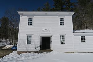
Orange Town House
|
|

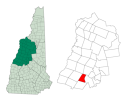
Location in Grafton County, New Hampshire
|
|
| Country | United States |
| State | New Hampshire |
| County | Grafton |
| Incorporated | 1790 |
| Area | |
| • Total | 23.1 sq mi (59.9 km2) |
| • Land | 23.1 sq mi (59.7 km2) |
| • Water | 0.08 sq mi (0.2 km2) 0.25% |
| Elevation | 1,216 ft (371 m) |
| Population
(2020)
|
|
| • Total | 277 |
| • Density | 12/sq mi (4.6/km2) |
| Time zone | UTC-5 (Eastern) |
| • Summer (DST) | UTC-4 (Eastern) |
| ZIP code |
03741
|
| Area code(s) | 603 |
| FIPS code | 33-58340 |
| GNIS feature ID | 0873692 |
Orange is a small town located in Grafton County, New Hampshire, United States. In 2020, about 277 people lived there. This was a bit less than the 331 people who lived there in 2010.
History of Orange
Orange was first given permission to become a town in 1769. It officially became a town in 1790. Its first name was "Cardigan." This name came from a person called George Brudenell, who was the fourth Earl of Cardigan. You can still find the name Cardigan in places like Mount Cardigan and Cardigan Mountain State Park.
After the American Revolution, people living in the town tried to change its name several times. They thought about names like "Bradford," "Middletown," and "Liscomb." Finally, they chose the name "Orange." It's thought that the town was named Orange because of the large amounts of yellow-orange ochre found in nearby Mount Cardigan. Ochre is a natural clay earth pigment.
Geography of Orange
Orange covers an area of about 59.9 square kilometers (about 23.1 square miles). Most of this area is land, with only a small part being water. The highest point in Orange is the top of Mount Cardigan. This mountain peak is about 3,155 feet (962 meters) above sea level.
Water flows from Orange in different directions. The western part of the town drains into the Indian River. This river eventually flows into the Connecticut River. The rest of the town's water flows into the Merrimack River system. For example, the South Branch of the Baker River starts here. Other brooks and rivers also carry water towards Newfound Lake or the Smith River. All these rivers eventually join the Pemigewasset River, which then forms the Merrimack River.
U.S. Route 4, a main road, passes through the southwestern part of Orange.
Population and People
| Historical population | |||
|---|---|---|---|
| Census | Pop. | %± | |
| 1790 | 131 | — | |
| 1800 | 203 | 55.0% | |
| 1810 | 229 | 12.8% | |
| 1820 | 293 | 27.9% | |
| 1830 | 405 | 38.2% | |
| 1840 | 463 | 14.3% | |
| 1850 | 451 | −2.6% | |
| 1860 | 382 | −15.3% | |
| 1870 | 340 | −11.0% | |
| 1880 | 335 | −1.5% | |
| 1890 | 245 | −26.9% | |
| 1900 | 213 | −13.1% | |
| 1910 | 176 | −17.4% | |
| 1920 | 166 | −5.7% | |
| 1930 | 99 | −40.4% | |
| 1940 | 109 | 10.1% | |
| 1950 | 82 | −24.8% | |
| 1960 | 83 | 1.2% | |
| 1970 | 103 | 24.1% | |
| 1980 | 197 | 91.3% | |
| 1990 | 237 | 20.3% | |
| 2000 | 299 | 26.2% | |
| 2010 | 331 | 10.7% | |
| 2020 | 277 | −16.3% | |
| U.S. Decennial Census | |||
In the year 2000, there were 299 people living in Orange. These people lived in 111 different homes, and 85 of these were families. Most of the people living in Orange were White (99.67%). A very small number (0.33%) were Asian. Also, 0.33% of the population identified as Hispanic or Latino.
About one-third of the homes (33.3%) had children under 18 living there. Most homes (59.5%) were married couples living together. The average home had about 2.69 people, and the average family had about 2.98 people.
The median age of people in Orange was 38 years old. This means half the people were younger than 38, and half were older. About a quarter of the population (25.1%) was under 18 years old.
The median income for a home in Orange was $41,250. This means half the homes earned more than this amount, and half earned less. For families, the median income was $40,625. A small number of families (6.3%) and people (6.6%) lived below the poverty line.
As of May 2016, there were 225 registered voters in Orange. These voters included 55 Republicans, 53 Democrats, and 117 people who did not choose a political party.
See also
 In Spanish: Orange (Nuevo Hampshire) para niños
 | Calvin Brent |
 | Walter T. Bailey |
 | Martha Cassell Thompson |
 | Alberta Jeannette Cassell |

