Oxford, Massachusetts facts for kids
Quick facts for kids
Oxford
|
||
|---|---|---|

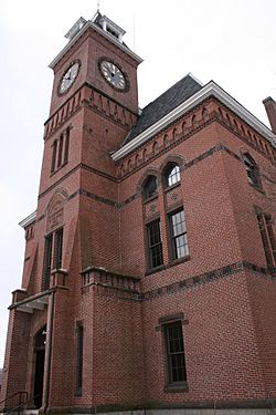
Oxford Town Hall
|
||
|
||

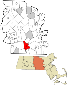
Location in Worcester County and the state of Massachusetts.
|
||
| Country | United States | |
| State | Massachusetts | |
| County | Worcester | |
| Settled | 1687 | |
| Incorporated | 1713 | |
| Government | ||
| • Type | Open town meeting | |
| Area | ||
| • Total | 27.5 sq mi (71.3 km2) | |
| • Land | 26.6 sq mi (69.0 km2) | |
| • Water | 0.9 sq mi (2.3 km2) | |
| Elevation | 508 ft (155 m) | |
| Population
(2020)
|
||
| • Total | 13,347 | |
| • Density | 485.3/sq mi (187.19/km2) | |
| Time zone | UTC−5 (Eastern) | |
| • Summer (DST) | UTC−4 (Eastern) | |
| ZIP Codes |
01537, 01540
|
|
| Area code(s) | 508/ 774 | |
| FIPS code | 25-51825 | |
| GNIS feature ID | 0618379 | |
| Website | www.oxfordma.us | |
Oxford is a town located in Worcester County, Massachusetts, in the United States. In 2020, about 13,347 people lived here.
Contents
- History of Oxford
- Geography of Oxford
- Population and People
- Oxford Public Library
- Education in Oxford
- Places to Visit in Oxford
- Notable People from Oxford
- See also
History of Oxford
Early Inhabitants: Before European Settlers Arrived
For thousands of years before Europeans came, the area where Oxford is now was home to many people. Archeologists have found tools and arrowheads from as far back as 12,000 years ago. One arrowhead found in Oxford is nearly 3,000 years old.
First Contact: Native Americans and Europeans
When English settlers arrived in the 1600s, the Nipmuc people lived in this area. A group of Nipmuc people called the Pegan subgroup lived here. The English tried to teach them Christianity.
Manchaug: A Praying Town
In the 1670s, a special town called Manchaug was created for Native Americans who converted to Christianity. This "praying town" included the land that is now Oxford. About 60 Native people lived in Manchaug in 1674.
King Philip's War and Its Impact
During King Philip's War, a big conflict between Native Americans and colonists, praying towns were often attacked. Many residents of Manchaug fled for safety. Even neutral towns were targeted. For example, 52 people were killed or captured in a nearby Nipmuc praying town.
After the war, a Nipmuc leader named Black James sold large areas of land, including Oxford, to English investors. This happened in 1681-1682.
Colonial Era: European Settlement and Challenges
Europeans first settled in Oxford in 1687. However, they had to leave several times because of wars with Native Americans and the French. Oxford officially became a town in 1713.
The Huguenot Settlers
In 1687, a group of 52 French Huguenots (French Protestants) came to settle the land. They had connected with an English investor named Robert Thompson in London. Their settlement grew to about 70 people. Native American families also continued to live in the area.
Building the Huguenot Fort
In 1694, the Huguenot colonists built the Huguenot Fort. They were worried about conflicts with local Native Americans. This was because of a war between the Massachusetts colony and Native American groups.
The Johnson Massacre and Abandonment
The original settlement was abandoned after four residents were killed in a fight with Native Americans. This sad event is called the "Johnson Massacre." You can find a memorial for it near the south end of Main Street. The remains of the Huguenot Fort can still be seen today.
The Huguenot settlers tried to return between 1699 and 1704. But they had to leave again during another war called Queen Anne's War.
New English Settlers Arrive
English investors kept trying to get new settlers to Oxford. By 1720, about 30 English families had started a new church in the town. The first town clerk of Oxford was John Town.
Famous Birthplace: Clara Barton
Oxford is the birthplace of Clara Barton. She was a famous nurse and humanitarian. She is best known for starting the American Red Cross.
Geography of Oxford
Oxford covers about 27.5 square miles (71.3 square kilometers). Most of this is land, with a small part being water. The town is in a valley. The French River flows through Oxford, and much of the town is in its flood plain.
Greenbriar Nature Preserve
The U.S. Army Corps of Engineers owns a large area north and west of Oxford Center. This land, called Greenbriar, helps control floods. It is also a beautiful nature preserve.
Roads and Connections
Several important roads run through Oxford. Route 20 goes east and west through North Oxford. Route 12, also called Main Street, runs north and south. Route 56 connects North Oxford to areas further north. Interstate 395 links Oxford to Worcester and eastern Connecticut.
Neighboring Towns
Oxford used to be much larger. Parts of its land were given to create the town of Webster. Other towns that border Oxford include Charlton to the west, Leicester and Auburn to the north, Millbury and Sutton to the east, and Douglas to the southeast.
Population and People
| Historical population | ||
|---|---|---|
| Year | Pop. | ±% |
| 1790 | 1,000 | — |
| 1800 | 1,273 | +27.3% |
| 1810 | 1,277 | +0.3% |
| 1820 | 1,562 | +22.3% |
| 1830 | 2,034 | +30.2% |
| 1840 | 1,742 | −14.4% |
| 1850 | 2,380 | +36.6% |
| 1860 | 3,034 | +27.5% |
| 1870 | 2,713 | −10.6% |
| 1880 | 2,604 | −4.0% |
| 1890 | 2,616 | +0.5% |
| 1900 | 2,677 | +2.3% |
| 1910 | 3,361 | +25.6% |
| 1920 | 3,820 | +13.7% |
| 1930 | 3,943 | +3.2% |
| 1940 | 4,623 | +17.2% |
| 1950 | 5,851 | +26.6% |
| 1960 | 9,282 | +58.6% |
| 1970 | 10,345 | +11.5% |
| 1980 | 11,680 | +12.9% |
| 1990 | 12,588 | +7.8% |
| 2000 | 13,352 | +6.1% |
| 2010 | 13,709 | +2.7% |
| 2020 | 13,347 | −2.6% |
| 2022* | 13,287 | −0.4% |
| * = population estimate Source: United States Census records and Population Estimates Program data. |
||
In 2000, Oxford had 13,352 people living in 5,058 households. About 34.6% of these households had children under 18. The average household had 2.62 people.
The population was spread out by age. About 26.1% were under 18, and 11.2% were 65 or older. The average age in Oxford was 37 years.
For more details on the specific census-designated place of Oxford, you can check the article Oxford (CDP), Massachusetts.
Oxford Public Library
The public library in Oxford was started in 1869. In 2008, the town spent about $468,609 on its library. This was about $34 for each person in town that year.
Education in Oxford
Oxford has its own public school system. There are two elementary schools, one middle school, and one high school.
Elementary Schools
The Alfred M. Chaffee School teaches students from kindergarten to 2nd grade. The Clara Barton School is for students in 3rd to 5th grade.
Middle and High School
The Oxford Middle School teaches students from 6th to 8th grade. Oxford High School is for grades 9 through 12. There is also a preschool located in the high school building.
High School Sports
Oxford High School offers many sports throughout the year. These include field hockey, cross country, football, soccer, basketball, baseball, softball, golf, and ultimate frisbee. They also have indoor and outdoor track teams.
Places to Visit in Oxford
- Bartlett's Bridge
- Barton Center for Diabetes Education, which includes the Clara Barton Camp for Diabetic Children and the Clara Barton National Historic Site
- Hodges Village Dam
- Hudson House
- Huguenot Fort
- Oxford High School
- Oxford Public Library
- North Oxford Mills
Notable People from Oxford
- Agnes Ballard, an educator and one of the first women elected to office in Florida.
- Clara Barton, a famous nurse and humanitarian who started the American Red Cross.
- Carla Berube, a college basketball player and coach.
- Nelson H. Davis, a brigadier general during the American Civil War.
- Tom Herrion, a college basketball coach.
- Elliott P. Joslin, a doctor who was a pioneer in diabetes research.
- Ebenezer Learned, a general in the American Revolution.
- Tony Reno, a college football coach.
- Matthew Sands, an educator.
- Aron Stevens, a wrestler and actor.
- Elvira Stone, a postmaster and genealogist.
See also
 In Spanish: Oxford (Massachusetts) para niños


