
Douglas, Massachusetts facts for kids
Quick facts for kids
Douglas, Massachusetts
|
|||
|---|---|---|---|

Second Congregational Church
|
|||
|
|||
| Nicknames:
D-town, The Big D
|
|||

Location in Worcester County and the state of Massachusetts.
|
|||
| Country | United States | ||
| State | Massachusetts | ||
| County | Worcester | ||
| Settled | 1721 | ||
| Incorporated | 1746 | ||
| Government | |||
| • Type | Open town meeting | ||
| Area | |||
| • Total | 37.7 sq mi (97.7 km2) | ||
| • Land | 36.4 sq mi (94.2 km2) | ||
| • Water | 1.3 sq mi (3.5 km2) | ||
| Elevation | 582 ft (177 m) | ||
| Population
(2020)
|
|||
| • Total | 8,983 | ||
| • Density | 238.3/sq mi (91.94/km2) | ||
| Time zone | UTC-5 (Eastern) | ||
| • Summer (DST) | UTC-4 (Eastern) | ||
| ZIP code |
01516
|
||
| Area code(s) | 508 / 774 | ||
| FIPS code | 25-17300 | ||
| GNIS feature ID | 0619479 | ||
| Website | |||


Douglas is a town in Massachusetts, located in the southern part of Worcester County. In 2020, about 8,983 people lived here. Douglas is home to the large Douglas State Forest, which is a great place for outdoor activities.
Contents
Douglas: A Look at Its Past

The area now known as Douglas was first settled by English people around 1715. It was called "New Sherborn Grant" because many early settlers came from the town of Sherborn. In 1746, the town got its current name, Douglas. This happened because a doctor from Boston, Dr. William Douglass, offered money to the town. He wanted to help set up free schools.
Douglas's thick forests led to a big woodcutting business. The town was also known for its axe company. A company that made wool products in East Douglas was also very important to the town's history. During the Revolutionary War, a French hero named General Lafayette stopped in Douglas. He was on his way to meet General Washington in Boston.
Long before English settlers arrived, Native American tribes lived in this area. The Nipmuc tribe was one of the main groups. The Blackstone River, which flows through the area, was once called the Nipmuc River. Much of Douglas is part of the Blackstone River Valley National Heritage Corridor, which protects the history and nature of the river valley.
The ground in Douglas has many rocks like quartz, feldspar, and mica. You can also find many large boulders around town. People have even found small amounts of gold and silver here. The town is also known for its granite quarries. This stone is used for building and decoration all over New England.
In 1946, Douglas celebrated its 300th anniversary. To welcome soldiers home from World War II, a special baseball game was held. The Boston Red Sox played against the New York Yankees at Soldiers Field. About 12,000 people watched the Yankees win the game 8-7.
The E. N. Jenckes Store Museum

The E.N. Jenckes Store Museum is on Main Street in East Douglas. This store first opened in the 1830s. It was a general store, selling many different things. The store changed owners a few times. Eventually, Edward L. Jenckes owned it. After he passed away, his daughters, E. Mialma and Helen R., kept the store running until 1964.
In 1972, the building was given to the Douglas Historical Society. They carefully restored it to look like a general store from 100 years ago. Today, it's a museum where you can see what stores were like in the past.
The New England Trunkline Trail
Many people in Douglas used to think that the New England Trunkline Trail was built for trains carrying people. But this is not true! The tracks were actually used to transport ice from Wallum Lake to other states. Today, you can hike along these trails. They go through both Massachusetts and Connecticut. The original plan for a railroad here was stopped when the person funding it died on the Titanic.
Geography of Douglas
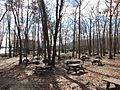
Douglas covers about 37.7 square miles (97.7 square kilometers). Most of this area is land, with about 1.3 square miles (3.5 square kilometers) being water. The town is home to the large Douglas State Forest. It also has several ponds and lakes, including Wallum Lake and Whitins Reservoir.
The highest points in Douglas include Bald Hill (711 feet), Wallum Pond Hill (778 feet), Mount Ashworth (713 feet), and Mount Daniel (735 feet). There are also several ponds. Wallum Pond is about 150 acres. Badluck Pond is about 110 acres. Whitin Reservoir is the largest, at about 400 acres. Manchaug Pond is about 93 acres.
 |
Oxford | Sutton | |
|
| Webster | Uxbridge | |||
| Thompson, Connecticut | Burrillville, Rhode Island |
Education in Douglas

Douglas has four public schools for students from preschool through twelfth grade.
- Douglas Primary School teaches preschool, Kindergarten, and first grade.
- Douglas Elementary School is for students in second through fifth grade.
- Douglas Middle School serves students in sixth through eighth grade.
- Douglas High School is for students in ninth through twelfth grade.
Douglas is also part of a group of towns that support the Blackstone Valley Regional Vocational Technical High School. This school helps students in grades 9-12 learn skills for specific jobs and careers. Douglas High School sports teams play in the Dual Valley Conference league. They compete against teams from nearby towns.
Neighborhoods
- East Douglas
- Tasseltop
Douglas Population Facts

The population of Douglas has grown quite a bit over the years. In 1850, there were 1,878 people living in the town. By 2000, the population had grown to 7,045 people. The most recent count in 2020 showed 8,983 people living in Douglas. This means the town has seen a lot of growth, especially in recent decades.
The average household in Douglas has about 2.85 people. Many families with children live in the town. In 2000, about 43% of households had children under 18 living there. The median age in Douglas was 34 years old. This means half the people were younger than 34 and half were older.
Images for kids
-
Douglas State Forest

See also
 In Spanish: Douglas (Massachusetts) para niños
