
Pamir Mountains facts for kids
Quick facts for kids Pamir Mountains |
|
|---|---|
.jpg)
Pamir Mountains
|
|
| Highest point | |
| Peak | Kongur Tagh |
| Elevation | 7,649 m (25,095 ft) |
| Geography | |
 |
|
| Countries | Tajikistan, Kyrgyzstan, Afghanistan, China and Pakistan |
| Range coordinates | 38°30′N 73°30′E / 38.5°N 73.5°E |
The Pamir Mountains are a large group of mountains located between Central Asia and South Asia. They connect with other famous mountain ranges like the Tian Shan, Karakoram, Kunlun, Hindu Kush, and Himalaya. These mountains are some of the highest in the world.
Most of the Pamir Mountains are in the Gorno-Badakhshan region of Tajikistan. To the south, they meet the Hindu Kush mountains near Afghanistan's Wakhan Corridor and parts of Pakistan. To the north, they connect with the Tian Shan mountains in Kyrgyzstan. To the east, they reach into China, including Kongur Tagh.
Since the Victorian era, the Pamir Mountains have been called the "Roof of the World." This name likely comes from the Persian language.
Contents
Names and Meanings
The Pamir region is home to many different cultures and languages. Because of this, the Pamir Mountains are known by various names.
For example, in Chinese, they were once called "Onion Range." This name came from the wild onions that grow in the area. Today, the name "Pamir" is more commonly used in Chinese.
What is a Pamir?
The word "pamir" is also a geological term. It describes a flat area or a U-shaped valley surrounded by mountains. These areas form when a glacier or ice field melts. They leave behind a rocky plain.
Pamirs are often used as summer pastures for animals. The Great Pamir is near Zorkul Lake. The Little Pamir is to the east of it. There are several other pamirs in the region.
Geography
-
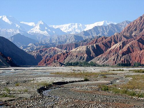
Kongur Tagh (left) and Kongur Tiube (slightly to the right) as seen from the Karakoram Highway
-
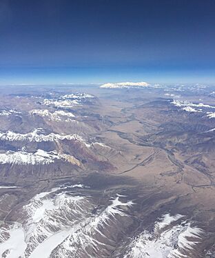
Slopes of Pamir Mountains on the Chinese side and Muztagh Ata
-
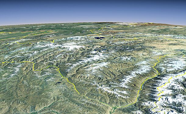
Pamir Mountains from a NASA satellite image, April 2012


Tallest Mountains
The Pamir Mountains have some very high peaks. The three tallest in the main Pamir range are:
- Ismoil Somoni Peak, which is 7,495 meters (24,590 feet) tall. It used to be called Stalin Peak and then Communism Peak.
- Ibn Sina Peak, which is 7,134 meters (23,406 feet) tall. Many people still call it Lenin Peak.
- Peak Korzhenevskaya, which is 7,105 meters (23,310 feet) tall.
In the Eastern Pamirs, China's Kongur Tagh is the highest at 7,649 meters (25,095 feet).
Here are some of the important peaks in the Pamir Mountains:
| Name | Height in meters |
Country |
|---|---|---|
| Kongur | 7,649 | |
| Kongur Jiubie | 7,530 | |
| Muztagh Ata | 7,509 | |
| Ismoil Somoni Peak | 7,495 | |
| Lenin Peak | 7,134 | |
| Peak Korzhenevskaya | 7,105 | |
| Independence Peak | 6,940 | |
| Russia Peak | 6,875 | |
| Moscow Peak | 6,785 | |
| Karl Marx Peak | 6,726 |
Note: Some experts consider the Kongur and Muztagata peaks to be part of the Kunlun Mountains. If so, Ismoil Somoni Peak would be the highest in the Pamir range itself.

Glaciers
The Pamir Mountains have many glaciers. One of the most famous is the Fedchenko Glacier, which is 77 kilometers (48 miles) long. It is the longest glacier outside the North and South Poles.
About 10% of the Pamir Mountains are covered by glaciers. Glaciers in the southern Pamirs are melting quickly. However, glaciers in the northwestern Pamirs are more stable.
Climate

The Pamir Mountains are covered in snow for most of the year. They have very long and cold winters. The summers are short and cool. This type of weather is called a tundra climate. Above the snow line, it's an ice cap climate, meaning it's always frozen.
The area gets about 130 millimeters (5 inches) of precipitation each year. This is enough for grasslands to grow, but not many trees.
Economy
Coal is mined in the western part of the Pamirs. However, raising sheep in the high meadowlands is the main way people earn money in the region.
Exploration
.jpg)
The Pamir Mountains have been important for trade and travel for a very long time. For example, lapis lazuli stones found in ancient Egyptian tombs are thought to have come from the Pamir area in Afghanistan.
Many explorers and travelers have passed through the Pamirs over the centuries. In 138 BCE, Zhang Qian reached the area. Later, Marco Polo may have traveled along the Panj River. In the 1800s, British and Russian explorers mapped much of the region. This led to agreements about the borders between Afghanistan, Russia, and British India.
Discoveries
In the early 1980s, a valuable gemstone called clinohumite was found in the Pamir Mountains. For a long time, this was the only place in the world where gem-quality clinohumite was known to exist.
Transport

The Pamir Highway is a very important road in the region. It is the world's second highest international road. It connects Dushanbe in Tajikistan to Osh in Kyrgyzstan. This highway is the main way supplies reach the isolated areas of the Pamirs.
The ancient Silk Road, a famous trade route, also crossed parts of the Pamir Mountains.
Tourism
The Pamir Mountains are becoming a popular place for tourists. In 2009, the New York Times wrote about the chances for tourism in the Tajik part of the Pamirs. Tourism has been growing quickly in the region.

Strategic Importance

Historically, the Pamir Mountains were a key trade route. They connected important cities like Kashgar and Kokand on the Northern Silk Road. Because of this, many groups have tried to control the area.
In more recent times, the mountains have been important for other reasons. There have been border disagreements and military bases set up by different countries. Today, there is new interest in trade and finding natural resources in the Pamirs.
Religious Meaning
Some researchers believe the Pamir Mountains are linked to Mount Meru or Sumeru. Mount Meru is a sacred five-peaked mountain in Buddhist and Jain beliefs. It is seen as the center of all physical and spiritual universes.
See also
- Tajik National Park
- Pamir languages
- Pamiris
- List of mountain ranges
- List of highest mountains
- Soviet Central Asia
- Central Asia
- Mount Imeon
- Ak-Baital Pass
- China–Tajikistan border
- Karachukar Valley
