Roaring Creek (Pennsylvania) facts for kids
Quick facts for kids Roaring Creek |
|
|---|---|

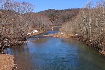
Roaring Creek looking downstream near its mouth
|
|
| Native name | Popemetang |
| Physical characteristics | |
| Main source | Catawissa Mountain in Roaring Creek Township, Columbia County, Pennsylvania between 1,660 and 1,680 feet (510 and 510 m) |
| River mouth | Susquehanna River on the border between Mayberry Township, Montour County, Pennsylvania and Franklin Township, Columbia County, Pennsylvania 453 ft (138 m) 40°56′22″N 76°31′44″W / 40.9395°N 76.5289°W |
| Length | 20 mi (32 km) |
| Basin features | |
| Progression | Susquehanna River → Chesapeake Bay |
| Basin size | 87.3 sq mi (226 km2) |
| Tributaries |
|
Roaring Creek is a stream in Pennsylvania. It flows into the Susquehanna River. The creek is about 20 miles (32 km) long. It runs through parts of Columbia County and Montour County.
The area around the creek, called its watershed, covers 87.3 square miles (226 km2). Roaring Creek has three main smaller streams, or tributaries. These are South Branch Roaring Creek, Lick Run, and Mill Creek. The creek is healthy and not harmed by coal mining. However, human activities have affected its watershed.
Contents
Where Roaring Creek Flows
Roaring Creek starts high up on Catawissa Mountain. This is in Roaring Creek Township, Columbia County. It flows west, then south, then west again. The creek passes through several townships. These include Roaring Creek, Locust, Catawissa, Cleveland, and Franklin Townships in Columbia County. It also flows through Mayberry Township in Montour County.
As it flows, Roaring Creek meets its first named tributary, Mill Creek. Then it meets Lick Run. The creek continues northwest, passing through Slabtown. It crosses Pennsylvania Route 42. Further along, it flows past Lake Glory. Near Pennsyl's Mill, it receives South Branch Roaring Creek. This is its last named tributary.
When the creek reaches the Montour County line, it turns north. It flows along the border between Franklin and Mayberry Townships. Here, it goes through a deep, narrow valley called a gorge. Sharp Ridge is on one side of this gorge. After leaving the gorge, Roaring Creek joins the Susquehanna River. This meeting point is about 142 miles (229 km) upstream from the Susquehanna's mouth.
Roaring Creek's Tributaries
Roaring Creek has three important tributaries. They are South Branch Roaring Creek, Lick Run, and Mill Creek.
- South Branch Roaring Creek joins Roaring Creek about 4.28 miles (6.89 km) from its mouth. Its watershed is 35.9 square miles (93 km2).
- Lick Run joins about 14.08 miles (22.66 km) from the mouth. Its watershed is 5.97 square miles (15.5 km2).
- Mill Creek joins about 15.02 miles (24.17 km) from the mouth. Its watershed is 4.98 square miles (12.9 km2).
Water Quality and Health
Roaring Creek is a healthy stream. Many nearby streams have been damaged by acid from coal mines. This acid can kill aquatic life. But Roaring Creek has not been affected by this problem.
However, human activities have impacted the creek. Things like sediment and siltation from farms can get into the water. Only one small, unnamed stream in the watershed has a water quality problem. It is affected by silt. Overall, Roaring Creek's water is not very rich in nutrients.
The water's pH in Roaring Creek is usually between 7.0 and 7.2. This means it is mostly neutral. The water's hardness varies. The amount of water flowing, called discharge, also changes along the creek.
Land and Climate Around the Creek
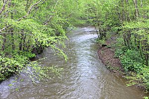
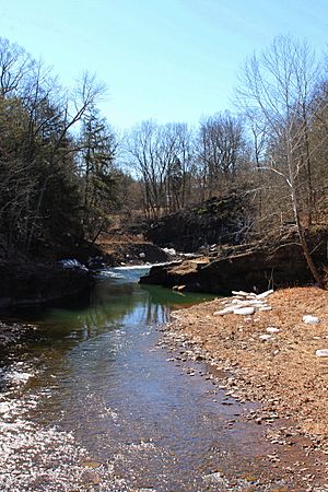
The land around Roaring Creek changes a lot. Near where it starts, the land is mountainous. But much of the watershed is hilly. The creek flows through a valley with broken hills. For its last 3 miles (4.8 km), it flows through a narrow gorge. In this gorge, the creek passes by cliffs and over small waterfalls.
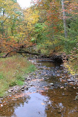
The creek's path is curvy. Some parts have rocky rapids. There are wet limestone cliffs along the creek called the Roaring Creek Bluffs. These bluffs are in Franklin Township and Montour County.
Roaring Creek is in the Ridge-and-Valley Appalachians area. This region has long, parallel ridges and valleys. The rocks in the watershed are mostly sandstone and shale. There are also claystones and conglomerates. Some areas even have coal.
The Roaring Creek area gets about 35 to 50 inches (89 to 127 cm) of rain each year. The water temperature in the creek usually ranges from 58.5°F (14.7°C) to 66.9°F (19.4°C).
Roaring Creek's Watershed
The watershed of Roaring Creek covers 87.3 square miles (226 km2). Most of it is in Columbia County. Smaller parts are in Montour, Northumberland, and Schuylkill Counties. The creek generally flows northwest. For its last 2 miles (3.2 km), it forms the border between Montour and Columbia Counties.
More than 40 percent of the watershed is covered by forests. Nearly 40 percent is farmland. There are also state forests and Pennsylvania State Game Lands in the watershed. A large forest area along South Branch Roaring Creek was bought by the state in 2003.
About 3,500 people lived in the watershed in 2000. Many parts of the creek flow through a quiet farm valley. Major roads like Pennsylvania Route 487, Pennsylvania Route 54, and Pennsylvania Route 42 are in or near the watershed.
History of Roaring Creek
Roaring Creek has been known by different names. The Lenape people called it Popemetang. This name means "Roaring Creek" in English. It probably came from the rapids and waterfalls on the creek. By the late 1700s, maps started calling it Roaring Creek.
Settlers, including Quakers, arrived in the valley in the 1770s. Farms began to appear along the creek after the American Revolutionary War.
In the 1800s, many mills and furnaces were built on the creek. The second-oldest watermill in Columbia County was built near the creek's mouth in the 1780s. The first iron furnace in Montour County was built near the creek's mouth in 1839 or 1840. It was called the Roaring Creek Anthracite Water Power Furnace.
In the early 1900s, farming was a big industry in the watershed. The creek also provided water power for a small gristmill. There were even plans to use the creek as a water supply for the town of Danville.
Many bridges have been built over Roaring Creek. Some of these are historic covered bridges.
- The Davis Covered Bridge was built in 1875. It is 86.9 feet (26.5 m) long and is on the National Register of Historic Places.
- The Snyder Covered Bridge No. 17 was built in 1876. It is 60.0 feet (18.3 m) long and is also on the National Register of Historic Places.
- The Esther Furnace Covered Bridge was built in 1905. It is 95.1 feet (29.0 m) long and is also on the National Register of Historic Places.
Other modern bridges were built throughout the 1900s to carry roads over the creek. In 2006, the Roaring Creek Valley Conservation Association was formed. This group works to protect the creek's natural and cultural resources.
Animals and Plants of Roaring Creek
The Roaring Creek watershed is a great place for fish. Upstream of Lick Run, it's a "High-Quality Coldwater Fishery." This means the water is cold and clean enough for fish that need it. It's also a "Migratory Fishery," meaning fish travel through it. Downstream, it's a "Trout Stocked Fishery." This means trout are added to the creek for fishing.
Wild trout naturally reproduce in most of Roaring Creek. They also reproduce in all of its named tributaries. The Pennsylvania Fish and Boat Commission calls part of the creek "Class A Wild Trout Waters" for brown trout. This is a special designation for excellent trout streams.
In 2003 and 2004, scientists found 31 different kinds of fish in the watershed. The most common fish were Eastern blacknose dace, white suckers, and brown trout. Other fish found include longnose dace and cutlips minnows. Some fish like redside dace were seen for the first time during these surveys. The creek is home to game fish like brown trout, brook trout, and rainbow trout. Some brown trout in the creek can grow up to 22 inches (56 cm) long!
Many small macroinvertebrates (bugs without backbones) live in Roaring Creek. These creatures are important for the creek's ecosystem. They are also a food source for fish.
The valley slopes of Roaring Creek have hardwood trees and hemlocks. Hemlocks also grow in the creek's gorge. The Roaring Creek Bluffs are a special natural area. They are home to the Jeweled shooting-star, a plant that is threatened in Pennsylvania. Other plants like hydrangea and different types of ferns also grow there.
Fun Activities at Roaring Creek
Roaring Creek is a great place for outdoor fun! You can canoe on about 13 miles (21 km) of the creek. This is best after heavy rain or when snow is melting. The canoeing difficulty is easy to moderate. The scenery is described as "fair to good."
Roaring Creek is also one of the main fishing spots in Columbia County. Many people come here to fish for trout and other species.
Knoebels Amusement Park is located in the western part of the creek's watershed. This makes the area a popular spot for both nature and family entertainment. In the 1990s, Roaring Creek was considered for "Pennsylvania Scenic Rivers" status, showing how beautiful and special it is.
 | Dorothy Vaughan |
 | Charles Henry Turner |
 | Hildrus Poindexter |
 | Henry Cecil McBay |


