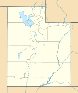
Rush Lake (Tooele County, Utah) facts for kids
Quick facts for kids Rush Lake |
|
|---|---|
| Rush Reservoir | |
| Location | Tooele County, Utah |
| Coordinates | 40°26′28″N 112°23′04″W / 40.44111°N 112.38444°W |
| Type | Endorheic |
| Primary outflows | None |
| Basin countries | United States (Rush-Tooele Valleys Watershed) |
| Surface area | 5 sq mi (13 km2) |
| Max. depth | 20 feet (6.1 m) |
| Surface elevation | 4,951 ft (1,509 m) |
| Frozen | never |
| Islands | Depends on lake level |
| Settlements | Stockton, Tooele, Rush Valley |
Rush Lake is also known as Rush Reservoir. It is a shallow, salty lake in Tooele County, Utah, in the U.S.. This lake is a small part of what was once a huge ancient lake called Lake Bonneville. Lake Bonneville covered a large area of the western U.S. during the Ice Ages.
Rush Lake was formed naturally from a stream. This stream usually flows into the Great Salt Lake. The size of Rush Lake changes a lot. About 2 feet (0.61 m) of water evaporates from it each year. But don't worry, big floods sometimes refill the lake. The average height of the lake's surface is 4,951 feet (1,509 m) above sea level.
Contents
Where is Rush Lake Located?
Rush Lake sits in a wide area called Rush Valley. It is close to the town of Stockton and a few miles south of Tooele. Six different mountain ranges provide water to the lake. This water comes from melting snow.
Mountains Near Rush Lake
The mountains that feed Rush Lake include:
- The Sheeprock Mountains to the south.
- The East Tintic Mountains to the southeast.
- The Oquirrh Mountains to the east.
- South Mountain to the north.
- The Stansbury Mountains to the northwest and west.
- The Onaqui Mountains to the southwest.
Water from these mountains mostly reaches the lake through groundwater. This means the water soaks into the ground and then seeps into the lake. The highest point in this area is Lowe Peak, which is 10,590 feet (3,230 m) tall. Most of the water leaves the lake by evaporating. A tiny bit also seeps through a sandy strip of land that separates it from the main Great Salt Lake valley.
How Rush Lake Formed
Rush Lake became separate from Lake Bonneville a very long time ago. This happened about 15,000 to 17,000 years ago. At that time, Lake Bonneville's water level dropped. It went below a natural barrier called the Stockton Bar. During the Ice Ages, Rush Valley was just one of many arms of the huge Lake Bonneville. After Lake Bonneville dried up, Rush Valley had several smaller lakes. These were called Shambip, Smelter, and Rush. Today, only Rush Lake remains.
Climate and Nature Around Rush Lake
The area around Rush Lake has two main types of plants. One type is sagebrush and grass. This grows in the lower areas and on the valley floor. The other type is pinyon and juniper trees. These are found higher up on the mountains. Other mountain plants also grow there.
Weather and Seasons
The amount of rain and snow each year is about 10 to 40 inches (250 to 1,020 mm). The time of year when there is no frost around the lake lasts for 100 to 140 days. This means plants have a good growing season.
Animals and Farming
Most of the land around the lake is used for cattle and sheep to graze. This means farmers let their animals eat grass there.
Fish in Rush Lake
Rush Lake is home to several kinds of fish. The most common fish are:
- Utah chub
- Carp
- Green sunfish
- Bluegill
- Largemouth bass
- Channel catfish
- Yellow perch
- Black crappie
- Black bullhead
The lake has not had new fish added by people since 1988. That year, 71,000 baby largemouth bass were released into the lake.
 | Victor J. Glover |
 | Yvonne Cagle |
 | Jeanette Epps |
 | Bernard A. Harris Jr. |


