
Río Negro (Uruguay) facts for kids
Quick facts for kids Río Negro |
|
| River | |
 The Río Negro river at Paso del Puerto.
|
|
| Countries | |
|---|---|
| Tributaries | |
| - left | Yí |
| - right | Tacuarembó |
| Source | |
| - location | Bagé, Rio Grande do Sul, Brazil |
| - coordinates | 33°25′34″S 58°24′32″W / 33.42611°S 58.40889°W |
| Confluence | Uruguay |
| - coordinates | ACoordinates: Missing longitude Invalid arguments have been passed to the {{#coordinates:}} function |
| Length | 750 km (466 mi) |
| Basin | 70,714 km² (27,303 sq mi) |
| Discharge | for Palmar Dam |
| - average | 722 m³/s (25,497 cu ft/s) |
The Río Negro (which means Black River) is the most important river in Uruguay. It's a river that flows into the Uruguay River. The Río Negro starts in southern Brazil and flows west, all the way across Uruguay, until it reaches the Uruguay River.
This river is so big that it actually divides Uruguay into two main parts: the northern side and the southern side.
Contents
Understanding the Río Negro River
The Río Negro is about 750 kilometres (466.0 miles) long. Imagine a river that stretches for 750 kilometers! Its drainage basin (the area of land where all the rain and melted snow drain into the river) covers a huge 70,714 km2 (27,303 sq mi). Most of this area is in Uruguay, with only a small part (2,500 km2 (965 sq mi)) in Brazil.
How Much Water Flows?
The average amount of water that flows through the river each year is about 226 m3/s (8,000 cu ft/s). This measurement was taken at the Palmar dam, which is about 72 km (45 mi) east of the city of Mercedes. This shows just how much water moves through the Río Negro!
Journey of the Río Negro
The Río Negro begins its journey in the Bagé municipality in the Rio Grande do Sul state of Brazil. From there, it flows from the northeast to the southwest through Uruguay. As it crosses the country, it creates a natural border, splitting Uruguay into two main sections.
River Borders and Departments
The river forms the border for several departments in Uruguay:
- On its northern (right) side, you'll find the Rivera, Tacuarembó, and Río Negro departments.
- On its southern (left) side, it borders the Cerro Largo, Durazno, Flores, and Soriano departments.
Where the River Ends
The Río Negro eventually flows into the Uruguay River. This happens south of the city of Fray Bentos in the Río Negro department. It's like a smaller river joining a bigger one!
The river has many bends and curves, called meanders. Along its path, three large hydroelectric dams have been built. These dams create three artificial lakes, also known as reservoirs. They are, from northeast to southwest:
- The Rincón del Bonete Reservoir, sometimes called the Gabriel Terra Reservoir or the Río Negro Reservoir.
- The Baygorria Dam.
- The Palmar or Constitution Dam.
Cities Along the River
Some important cities and towns are located along the Río Negro:
- In the Tacuarembó department:
- In the Soriano department:
- Mercedes, which is the capital of the department.
- Villa Soriano, one of the oldest towns in Uruguay, located close to where the Río Negro meets the Uruguay River.
Main Rivers Joining the Río Negro
Rivers that flow into a larger river are called tributaries. The Río Negro has two main tributaries:
|
Rivers Joining from the Left:
|
Rivers Joining from the Right:
|
Gallery
-
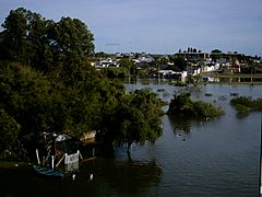
Flooding of the Mercedes city.
-
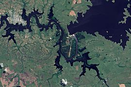
Flooding along the Rio Negro.
-
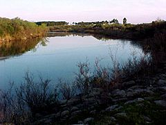
The Yí river.
-
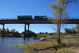
Tacuarembó river.


Images for kids
-
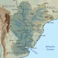
Map of the Rio de la Plata Basin, showing the Río Negro joining the Uruguay River north of Buenos Aires

See also
 In Spanish: Río Negro (Uruguay) para niños
