Sandy, Bedfordshire facts for kids
Quick facts for kids Sandy |
|
|---|---|
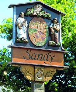 The town sign in Sandy |
|
| Population | 12,171 (Parish, 2021) 11,375 (Built up area, 2021) |
| OS grid reference | TL1649 |
| • London | 43 miles (69 km) S |
| Civil parish |
|
| Unitary authority | |
| Ceremonial county | |
| Region | |
| Country | England |
| Sovereign state | United Kingdom |
| Post town | SANDY |
| Postcode district | SG19 |
| Dialling code | 01767 |
| Police | Bedfordshire |
| Fire | Bedfordshire and Luton |
| Ambulance | East of England |
| EU Parliament | East of England |
| UK Parliament |
|
Sandy is a town and civil parish located in Central Bedfordshire, England. It's about 8 miles (13 km) east of Bedford and 43 miles (69 km) north of Central London. In 2021, about 12,171 people lived there.
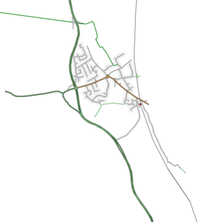
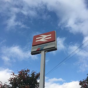
The town gets its name from the low, sandy hills on its eastern side. These hills are part of the Bedfordshire Greensand Ridge. The main part of Sandy sits between these hills and the River Ivel to the west. The A1 road, a major highway, runs along the western edge of the town. Sandy railway station is on the Great Northern route, connecting London and Peterborough. The railway line runs along the eastern side of the town. The area also includes the small village of Beeston, which is south-west of Sandy.
The main office for the Royal Society for the Protection of Birds (RSPB) is at The Lodge. This nature reserve is in the sandy hills east of the town. The RSPB has been based there since 1961.
Contents
Exploring Sandy's Past
The area around Sandy has been lived in for a very long time. People have found signs of settlements from before 250 BC! Sandy was an important place during Roman times. It was likely a busy trading spot and a place where travelers could stop. An old hill fort, now covered in trees, still looks over the town. People sometimes call it Caesar's Camp, but it's more commonly known as "the sand hills" or "the lookout."
Sandy in the Domesday Book
Sandy is mentioned in the Domesday Book from 1086. This famous book was a survey of England ordered by William the Conqueror. In the book, Sandy is called "Sandeia," which comes from an old English word meaning "sand-island." At that time, it was part of an area called Weneslawe.
The Domesday Book also listed two water-powered mills in Sandy. One of these was probably at Sandy Mill on the River Ivel. There had been a mill on this spot since the Norman era. The last mill building there was built in 1857. Milling continued for many years, but the buildings were taken down in 1977.
Growth and Changes
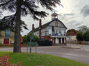
Sandy was a village for a long time, even into the 1900s. The main public area is called Market Square, but Sandy wasn't officially a market town until 1925. The original Sandy Town Hall was built in 1906. It was a large hall for public events, not a council building.
The town grew quickly in the 1970s. Many new homes were built for people moving from London. This growth continued into the 1990s with more new housing areas.
How Sandy is Governed
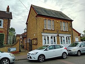
Sandy has two levels of local government. There's the Sandy Town Council, which looks after local town matters. Then there's the Central Bedfordshire Council, which handles bigger regional issues. The Town Council's main office is at 10 Cambridge Road.
Council History
Sandy used to be an "ancient parish." In 1894, a parish council was set up. This council first met in a room at the fire station on Cambridge Road.
In 1927, Sandy became an "urban district," which meant it had more control over its own affairs. The council moved to Boyne House in 1946. Later, in 1974, Sandy became part of the Mid Bedfordshire District. The parish council was re-established and decided to call Sandy a "town." This allowed them to have a "town council" and a mayor. In 1978, the town council moved back to 10 Cambridge Road, taking over the whole building.
Political Representation
Sandy is part of the North Bedfordshire area for national elections. This means people in Sandy vote for a Member of Parliament (MP) to represent them in the UK Parliament.
Sandy's Location and Landscape
Sandy is about 43 miles (69 km) north of Central London. The county town of Bedford is 8 miles (13 km) to the west. Nearby towns include St Neots (7 miles (11 km) north) and Biggleswade (3 miles (4.8 km) south).
The River Ivel, a smaller river that flows into the River Great Ouse, runs through Sandy. Some parts of the town near the river are in a Flood Warning Area. The Bedfordshire Greensand Ridge, a line of hills, runs to the south and east of Sandy.
East of the town, you can see the Sandy Heath transmitting station. This is a very tall, 244-meter mast that broadcasts television signals.
Getting Around Sandy
Roads
Sandy is located right next to the A1, a major road that goes along the western side of the town. The A603 road goes west towards Bedford. The B1042 road goes east towards Potton and Cambridge.
The A1 used to go through the Girtford area of Sandy. But in the 1950s, a bypass was built to take the main road around the town. This bypass included a new bridge over the River Ivel.
Trains
Sandy railway station is on the East Coast Main Line. You can catch trains south to central London and even to Horsham. Trains also go north to Peterborough. A trip to London usually takes about 40 minutes. The station is managed by Thameslink and Great Northern.
Past and Future Train Lines
The Varsity Line, which used to connect Oxford and Cambridge, ran through Sandy until 1967. The old railway line from Bedford to Sandy has now been turned into part of the NCR 51 cycle path.
There are plans to bring back a railway link between Bedford and Cambridge. However, the new route will go around Sandy, with a new station planned near Tempsford.
Buses
The no.73 Stagecoach East bus service runs every half-hour from Monday to Saturday. It connects Biggleswade, Sandy, and Bedford. There is no bus service on Sundays.
Sports and Fun in Sandy
Sandy has its own amateur football team called Sandy F.C. They play in Division One of the Bedfordshire County Football League.
There's also an athletics track at Sandy Secondary School. This track is home to the Biggleswade Athletic Club.
News and Media
Local news and TV shows for Sandy are provided by BBC East and ITV Anglia. Television signals come from the nearby Sandy Heath TV transmitter.
Sandy has several local radio stations. You can listen to BBC Three Counties Radio on 95.5 FM and Heart East on 96.9 FM. BigglesFM is a local community radio station that broadcasts from nearby Potton on 104.8 FM and online. It started broadcasting in April 2011.
The town's local newspaper is The Biggleswade Chronicle.
Schools in Sandy
Sandy's schools used to have a "three-tier" system (lower, middle, and upper schools). But since 2018, they have changed to a "two-tier" system (primary and secondary schools). Because of this change, Sandye Place Academy, which was the middle school, closed in September 2019.
Primary Schools
- Laburnum Primary School
- Maple Tree Primary School
- Robert Peel Primary School
- St Swithun's CE Primary School
Secondary Schools
- Sandy Secondary School
Twin Towns
Sandy has a special friendship with the town of Malaunay in France. They became "twinned" in 1982, and the Sandy Twinning Association was set up because of this. The association has also recently made connections with the town of Skarszewy in Poland.
Remembering Important People
There are a few places in Sandy that remember important people.
Frederick Thomas Bidlake was a famous cyclist. There's a garden and a monument dedicated to him at Girtford Bridge. It was officially opened in 1934. The garden has a stone wall and a sundial that says, "He measured time." A special milestone is also there, saying, "F. T. B. Few have known this road as he. London 48 – York 148."
Girtford Bridge itself was built between 1780 and 1782.
There's a statue of William Peel inside St Swithun's Church. William Peel was a brave soldier who received the Victoria Cross, the highest award for bravery. Across the High Street from the church, there's even a pub named "Sir William Peel."
See also
 In Spanish: Sandy (Bedfordshire) para niños
 | Laphonza Butler |
 | Daisy Bates |
 | Elizabeth Piper Ensley |


