
Sardinia facts for kids
Quick facts for kids
Sardinia
|
|||
|---|---|---|---|
 |
|||
|
|||
| Anthem: "Su patriotu sardu a sos feudatarios" (Sardinian) (English: "The Sardinian Patriot to the Lords") |
|||
 Sardinia within Italy Sardinia within Italy Location of Sardinia in Europe (green and dark grey) and Italy (green) Location of Sardinia in Europe (green and dark grey) and Italy (green) The island of Sardinia as seen from the International Space Station The island of Sardinia as seen from the International Space Station |
|||
| Country | Italy | ||
| Capital | Cagliari | ||
| Government | |||
| • Type | Consiglio Regionale | ||
| Area | |||
| • Total | 24,090 km2 (9,300 sq mi) | ||
| Population
(2020)
|
|||
| • Total | |||
| • Languages | Italian | ||
| • Minority languages | Sardinian Sassarese Gallurese Ligurian (Tabarchino) Catalan (Algherese) |
||
| Demonyms | English: Sardinian or Sard Italian: Sardo (man) Italian: Sarda (woman) Sardinian: Sardu (man) Sardinian: Sarda (woman) Catalan: Sard (man) Catalan: Sarda (woman) |
||
| Citizenship | |||
| • Italian | 97% | ||
| Time zone | UTC+1 (CET) | ||
| • Summer (DST) | UTC+2 (CEST) | ||
| ISO 3166 code | IT-88 | ||
| GDP (nominal) | €34.9 billion (2018) | ||
| GDP per capita | €21,200 (2018) | ||
| HDI (2018) | 0.858 very high · 16th of 21 |
||
| NUTS Region | ITG | ||


Sardinia (Italian: Sardegna, Sardinian: Sardigna) is a large island in the Mediterranean Sea. It is the second largest island in this sea. Sardinia is an autonomous region of Italy. This means it has special powers to govern itself.
The official name of the region in Italian is Regione Autonoma della Sardegna. The biggest city and capital of Sardinia is Cagliari.
Contents
Exploring Sardinia's Geography


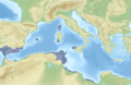
Sardinia is a big island, covering about 24,100 square kilometers. Only Sicily is larger in the Mediterranean Sea. Sardinia is located between 38° 51' and 41° 18' north latitude and 8° 8' and 9° 50' east longitude. To its west is the Sea of Sardinia. To its east is the Tyrrhenian Sea. Both are parts of the Mediterranean Sea.

The closest lands to Sardinia are Corsica to the north, the Italian Peninsula to the east, Sicily to the southeast, Tunisia to the south, the Balearic Islands to the west, and Provence (France) to the northwest. The Strait of Bonifacio is a narrow waterway north of Sardinia. It separates Sardinia from the French island of Corsica.
Sardinia's coastline is about 1,849 kilometers long. It often has high, rocky cliffs. There are many long, straight beaches and impressive headlands. You can also find wide, deep bays and many smaller islands nearby.
Mountains, Rivers, and Lakes
Sardinia is a very old island geologically. Unlike Sicily and mainland Italy, it does not have many earthquakes. Its rocks are up to 500 million years old. Over a long time, erosion has shaped the island's mountains and plateaus. These areas are usually between 300 and 1,000 meters high.
The highest point is Punta La Marmora, which is 1,834 meters tall. It is part of the Gennargentu mountain range in the center of the island. Other mountain ranges include Monte Limbara in the northeast and the Sulcis Mountains in the southwest. Large flat areas and valleys separate these mountains. The main flat areas are the Campidano in the southwest and the Nurra in the northwest.
Sardinia has a few important rivers. The longest is the Tirso, which is 151 kilometers long. It flows into the Sea of Sardinia. Other rivers are the Coghinas (115 km) and the Flumendosa (127 km).
The island has 54 artificial lakes and dams. These are used to provide water and electricity. The largest are Lake Omodeo and Lake Coghinas. The only natural freshwater lake is Lago di Baratz. Along the coast, there are also many large, shallow, salty lagoons and pools.
Sardinia's Climate

The weather in Sardinia changes depending on the area. This is because of the island's size and how high different places are. Generally, Sardinia has a Mediterranean climate. This means it has wet winters and dry summers.
Most of the rain falls in winter and autumn. There can be heavy showers in spring. Snow falls in the higher mountain areas. The average temperature is between 11 and 17 degrees Celsius. Coastal areas have mild winters (9 to 11°C in January) and warm summers (23 to 26°C in July). In the mountains, winters are colder (-2 to 4°C in January) and summers are cooler (16 to 20°C in July).
Summers are usually very dry. However, sometimes there are short but strong thunderstorms. These storms can cause sudden flash floods. The climate is also affected by the nearby Gulf of Genoa and the Atlantic Ocean.
Images for kids
-
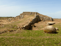
The prehistoric megalithic temple of Monte d'Accoddi.
-
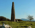
Monte Corru Tundu Menhir in Villa Sant'Antonio (5.75 meters high)
-
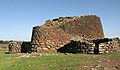
Nuraghe Losa.
-
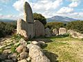
Giants' grave in Dorgali (Bronze Age).
-
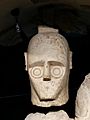
Head of one of the so-called Giants of Mont'e Prama
-
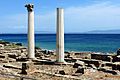
The Phoenician and subsequently Roman town of Tharros.
-
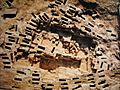
Necropolis of Tuvixeddu, Cagliari
-
Carthage and its dependencies in 264 BC; A region of Sardinia was a part of Carthage
-
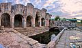
Roman thermae of Forum Traiani, in what is now Fordongianus.
-
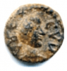
A Vandal-period coin found in Sardinia depicting Godas. Latin legend : REX CVDA.
-
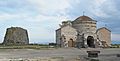
Santa Sabina Byzantine church and nuraghe in Silanus
-
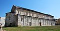
The medieval Basilica of San Gavino in Porto Torres
-
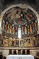
12th century frescoes in the Basilica di Saccargia in Codrongianos
-
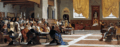
The proclamation of the Republic of Sassari. The Sassarese republic lasted from 1272 until 1323, when it sided with the new born Kingdom of Sardinia.
-
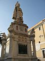
Statue of the Juighissa Eleanor of Arborea in Oristano.
-
Flag of the Kingdom of Sardinia (center) at the funeral of Charles I of Spain
-
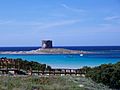
Spanish era coastal tower in Stintino called Torre della Pelosa
-
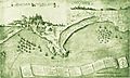
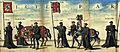
The French siege of Cagliari and Quartu
-
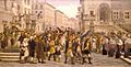
GM. Angioy entry into Sassari.
-
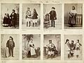
Sardinians wearing traditional ethnic garments, 1880s.
-
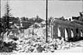
Effect of Allied bombing on Cagliari during the Second World War.
-
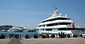
Super Yachts anchored at Porto Cervo port, Costa Smeralda
-
Santo Stefano's former NATO naval base
-
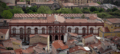
Main Building of the University of Sassari (which started the university courses in 1562)
-
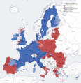
Economic classification of European regions according to Eurostat
-
Exports of Sardinia in 2012–13
-
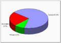
Percentage distribution of employees in different economic sectors in Sardinia: 8.7% the primary sector (fishing, agriculture, farming), 23.5% the secondary sector (industry, machinery, manufacturing), and 67.8% the tertiary sector (tourism, services, finance)
-
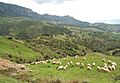
Sheep grazing around Lula, Nuoro
-
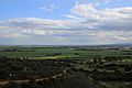
Campidano near Cagliari
-
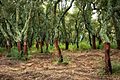
Peeled trunks of cork oaks in Tempio Pausania
-
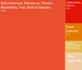
Petrochemical and Green Chemical industries in Porto Torres
-
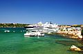
Yachts in Porto Cervo. Luxury tourism represents an important source of income in Sardinia since the 1960s.
-
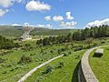
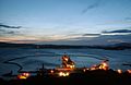
Sardinia Radio Telescope
-
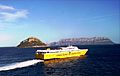
A high-speed ferry in the Gulf of Olbia
-
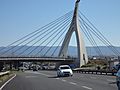
Cable-stayed bridge of the Monserrato University Campus interchange SS 554
-
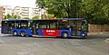
A bus of Sardinia public transport authorities (Arst) in Sassari
-
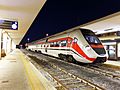
ATR 365 owned by the Autonomous Region of Sardinia in Cagliari
-
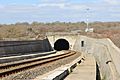
7 km-long railway tunnel of Campeda
-
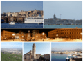
Cagliari, Alghero, Sassari, Nuoro, Oristano, Olbia
-
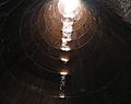
Santa Cristina holy well of Paulilatino, tholos
-
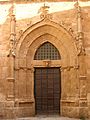
Gothic portal of the Cathedral of Alghero
-
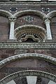
Facade of Nostra Signora di Tergu (SS)
-
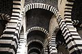
Interior of San Pietro di Sorres, Borutta (SS)
-
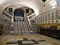
Crypt of the Cagliari Cathedral
-
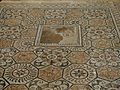
Roman mosaic in Nora
-
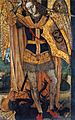
Archangel Michael by the Master of Castelsardo
-
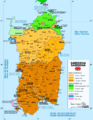
Linguistic map of Sardinia
-
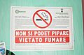
A 'no smoking' sign in both Sardinian and Italian
-
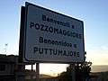
A bilingual road sign in Italian and Sardinian at Pozzomaggiore
-
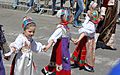
Costume from Ovodda
-
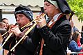
Launeddas players
-
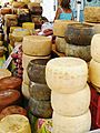
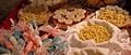
Cheeses and sausages in Alghero's city market
-
A range of different cakes, pastries, meals, dishes and sweets which are common elements of Sardinian cuisine
-
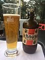
Beer produced in Sardinia
-
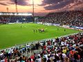
Unipol Domus in Cagliari.
-
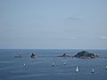
Regatta at Santa Maria Navarrese
-
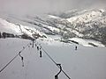
Skilifts on the Bruncu Spina
-
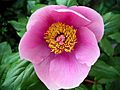
Paeonia mascula
-
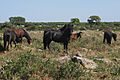
Giara horses
-
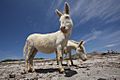
Albino donkeys in Asinara
-
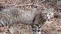
The Sardinian feral cat, long considered a subspecies of the African wildcat, are descended from domesticated cats
-
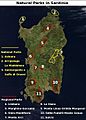
National and regional parks of Sardinia
-
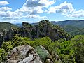
Sulcis Regional Park, the largest Mediterranean evergreen forest in Europe


._Emory_S._Land_is_the_only_forward_deployed_submarine_tender_in_the_Western_hemisphere.jpg)


.jpg)


.jpg)
.JPG)


.jpg)

.JPG)


.JPG)


See also
 In Spanish: Cerdeña para niños
