
Springfield Township, Burlington County, New Jersey facts for kids
Quick facts for kids
Springfield Township, New Jersey
|
||
|---|---|---|
|
Township
|
||
.jpg)
Arneys Mount, the highest point in Burlington County, in Springfield Township
|
||
|
||

Location of Springfield Township in Burlington County highlighted in red (right). Inset map: Location of Burlington County in New Jersey highlighted in red (left).
|
||

Census Bureau map of Springfield Township, Burlington County, New Jersey
|
||

Springfield Township, New Jersey
Location in Burlington County, New Jersey

Springfield Township, New Jersey
Location in New Jersey

Springfield Township, New Jersey
Location in the United States
|
||
| Country | ||
| State | ||
| County | Burlington | |
| Formed | November 6, 1688 | |
| Royal charter | January 13, 1713 | |
| Incorporated | February 21, 1798 | |
| Government | ||
| • Type | Faulkner Act (council–manager) | |
| • Body | Township Council | |
| Area | ||
| • Total | 29.57 sq mi (76.58 km2) | |
| • Land | 29.51 sq mi (76.44 km2) | |
| • Water | 0.06 sq mi (0.15 km2) 0.19% | |
| Area rank | 92nd of 565 in state 10th of 40 in county |
|
| Elevation | 69 ft (21 m) | |
| Population
(2020)
|
||
| • Total | 3,245 | |
| • Estimate
(2023)
|
3,251 | |
| • Rank | 438th of 565 in state 32nd of 40 in county |
|
| • Density | 110.0/sq mi (42.5/km2) | |
| • Density rank | 534th of 565 in state 37th of 40 in county |
|
| Time zone | UTC−05:00 (Eastern (EST)) | |
| • Summer (DST) | UTC−04:00 (Eastern (EDT)) | |
| ZIP Code | ||
| Area code(s) | 609 | |
| FIPS code | 3400569990 | |
| GNIS feature ID | 0882106 | |
| Website | ||

Springfield Township is a community located in Burlington County, New Jersey. It is called a township, which is a type of local government area. In 2020, about 3,245 people lived here. Springfield Township is part of a larger area that includes cities like Philadelphia, Reading, and Camden.
Contents
History of Springfield Township
Springfield Township has a long history. It was first formed on November 6, 1688. Later, it was officially recognized by a special document called a Royal charter on January 13, 1713. The township became an official local government on February 21, 1798. This was part of a law that created many townships in New Jersey.
A small part of Springfield Township was used to create New Hanover Township in 1723. The name "Springfield" comes from the many natural springs and small streams found in the area.
Geography of Springfield Township
Springfield Township covers an area of about 29.57 square miles (76.58 square kilometers). Most of this area is land, with only a small part being water.
Communities in Springfield Township
Several smaller communities are located within or partly within Springfield Township:
- Juliustown is a community entirely inside Springfield Township. In 2010, about 429 people lived there.
- Fort Dix is a larger community that is partly in Springfield Township. It is also in New Hanover Township and Pemberton Township.
- Other smaller places include Arneys Mount, Chambers Corner, Ellis, Folwell, Jacksonville, Jobstown, Pine Lane, and Powell.
Nearby Areas
Springfield Township shares its borders with several other townships in Burlington County. These include Burlington Township, Chesterfield Township, Eastampton Township, Florence Township, Mansfield Township, North Hanover Township, Pemberton Township, and Wrightstown.
Pinelands National Reserve
Springfield Township is also part of the New Jersey Pinelands National Reserve. This is a large, protected natural area with unique plants and animals. It covers over 1.1 million acres and was set up by the U.S. Congress in 1978. The Pinelands are known for their special environment and are a very important natural resource.
Population and People
| Historical population | |||
|---|---|---|---|
| Census | Pop. | %± | |
| 1810 | 1,500 | — | |
| 1820 | 1,568 | 4.5% | |
| 1830 | 1,534 | −2.2% | |
| 1840 | 1,632 | 6.4% | |
| 1850 | 1,827 | 11.9% | |
| 1860 | 1,810 | −0.9% | |
| 1870 | 1,761 | −2.7% | |
| 1880 | 1,886 | 7.1% | |
| 1890 | 1,670 | −11.5% | |
| 1900 | 1,382 | −17.2% | |
| 1910 | 1,278 | −7.5% | |
| 1920 | 1,223 | −4.3% | |
| 1930 | 1,326 | 8.4% | |
| 1940 | 1,299 | −2.0% | |
| 1950 | 1,562 | 20.2% | |
| 1960 | 1,956 | 25.2% | |
| 1970 | 2,244 | 14.7% | |
| 1980 | 2,691 | 19.9% | |
| 1990 | 3,028 | 12.5% | |
| 2000 | 3,227 | 6.6% | |
| 2010 | 3,414 | 5.8% | |
| 2020 | 3,245 | −5.0% | |
| 2023 (est.) | 3,251 | −4.8% | |
| Population sources: 1810–2000 1810–1920 1840 1850–1870 1850 1870 1890–1910 1910–1930 1940–2000 2000 2010 2020 |
|||
In 2010, there were 3,414 people living in Springfield Township. Most residents were White (about 90.6%). There were also Black or African American (3.8%), Asian (2.5%), and Native American (0.2%) residents. About 3.7% of the population identified as Hispanic or Latino.
The average age in the township was about 44.3 years old. Around 23% of the people were under 18 years old. The median household income was about $85,417. This means half of the households earned more than this, and half earned less.
Parks and Recreation
The Burlington County Fairgrounds are located in Springfield Township. This is where the annual Farm Fair takes place. It opened in 2011 and is a popular spot for community events.
Education in Springfield Township
Students in Springfield Township attend public schools based on their age.
Elementary School
Younger students, from pre-kindergarten through sixth grade, go to the Springfield Township School. In the 2018–19 school year, this school had 226 students and about 23 teachers. This means there were about 10 students for every teacher.
Middle and High School
Students in seventh through twelfth grades attend schools in the Northern Burlington County Regional School District. This district also serves students from nearby Chesterfield, Mansfield, and North Hanover townships. Children of military families from Joint Base McGuire–Dix–Lakehurst also attend these schools.
The high school district has two schools:
- Northern Burlington County Regional Middle School (grades 7–8)
- Northern Burlington County Regional High School (grades 9–12)
Both of these schools are located in the Columbus section of Mansfield Township. In 2018–19, the district had about 2,190 students and 163 teachers. This means there were about 13 students for every teacher.
Vocational and Technical Education
Students from Springfield Township can also attend the Burlington County Institute of Technology. This county-wide school offers vocational and technical training for high school students and adults. It has campuses in Medford and Westampton.
Transportation
Springfield Township has many roads that help people get around. As of 2010, there were over 72 miles of roadways.
Major Highways
Two major highways pass through the western part of the township:
- The New Jersey Turnpike
- Interstate 295
While these highways run through Springfield, there are no direct exits within the township itself. You would use exits in nearby towns to access them.
Other Important Roads
- U.S. Route 206 runs through the middle of the township.
- Route 68 is in the eastern part.
- County roads like County Route 537 and County Route 545 also pass through.
Currently, there is no public transportation available within Springfield Township.
Places to Visit
- Old Upper Springfield Friends Burying Ground: This historic cemetery and meeting house were added to the New Jersey and National Registers of Historic Places in 1979.
- Columbus Farmers Market: Located on Route 206, this is a large market where people can buy many different things.
- Pandora Diner: This diner is a popular spot at the intersection of Route 206 and County Route 537.
Notable People from Springfield Township
Many interesting people have lived in or are connected to Springfield Township:
- Reading Wood Black (1830–1867): He founded the city of Uvalde, Texas.
- Irving Fryar (born 1962): A famous former professional football player.
- Phil Haines (born 1950): A judge and former state senator in New Jersey.
- Reuben Moon (1847–1914): A Congressman who represented Pennsylvania.
- Thomas Newbold (1760–1823): He served in the United States House of Representatives for New Jersey.
- Joe Ohl (1888–1951): A professional baseball pitcher.
- Daniel Trotter (1747–1800): A furniture maker from Philadelphia.
- Barclay White (1821–1906): He was in charge of Indian Affairs for President Ulysses S. Grant.
- Walter Livingston Wright (1872–1946): A math professor and president of Lincoln University.
Images for kids
-
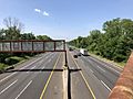
The New Jersey Turnpike in Springfield Township
_from_the_overpass_for_Burlington_County_Route_670_(Burlington-Jacksonville_Road)_in_Springfield_Township,_Burlington_County,_New_Jersey.jpg)
See also
 In Spanish: Municipio de Springfield (condado de Burlington) para niños
