
Tonawanda (town), New York facts for kids
Quick facts for kids
Tonawanda
Tahnawáteh (Tuscarora)
|
|
|---|---|
| Town of Tonawanda | |
|
|
|
| Nickname(s):
Ken-Ton (with Kenmore)
|
|
_highlighted.svg)
Location in Erie County and the state of New York
|
|
| Country | |
| State | |
| County | Erie |
| Settlement | 1805 |
| Named for | Swift Waters in Eriechronon |
| Government | |
| • Type | Town council |
| Area | |
| • Total | 20.3 sq mi (52.5 km2) |
| • Land | 18.7 sq mi (48.5 km2) |
| • Water | 1.5 sq mi (4.0 km2) |
| Elevation | 617 ft (188 m) |
| Population
(2020)
|
|
| • Total | 72,636 |
| • Density | 3,927/sq mi (1,516.1/km2) |
| Time zone | UTC-5 (Eastern (EST)) |
| • Summer (DST) | UTC-4 (EDT) |
| Area code(s) | 716 |
| FIPS code | 36-75000 |
| GNIS feature ID | 0979551 |


Tonawanda, officially known as the Town of Tonawanda, is a town in Erie County, New York, United States. The name Tahnawáteh comes from the Erie language and means "Swift Waters." In 2020, about 72,636 people lived here.
The town is located at the northern edge of Erie County. It is a suburb just north of Buffalo. Sometimes, people call Tonawanda and its nearby village of Kenmore by the nickname "Ken-Ton." The town was created in 1836. Until 1903, it also included the area that is now the city of Tonawanda.
Contents
History of Tonawanda
The Town of Tonawanda sits where the edge of an ancient lake, called Lake Tonawanda, used to be. This lake drained away when the water from Lake Erie started flowing over Niagara Falls.
The area was controlled by France from the 1600s until the British took over after the French and Indian War.
The first European settlers arrived around 1805. The town grew quickly after the Erie Canal was finished in 1825. Tonawanda is in the northwest part of Erie County. It is bordered on the north by the Erie Canal, which follows Tonawanda Creek here.
The Town of Tonawanda was officially formed in 1836. It was separated from the larger town of Buffalo. At that time, Tonawanda included land that later became part of Grand Island (in 1852) and the entire city of Tonawanda (in 1904).
In 1899, Kenmore became a village within the town. It was the main area for homes and businesses until the rest of the town developed with many new houses in the 1940s and 1950s.
Geography of Tonawanda
The Town of Tonawanda covers about 52.5 square kilometers (20.3 square miles). About 48.5 square kilometers (18.7 square miles) is land, and 4.0 square kilometers (1.5 square miles) is water.
The northern border of the town is the city of Tonawanda and Tonawanda Creek, which is part of the Erie Canal. The western border is the Niagara River. Ellicott Creek flows near Tonawanda Creek in the northern part of the town. It joins the Niagara River just to the east. The eastern border is U.S. Route 62 (Niagara Falls Boulevard), which separates it from the town of Amherst. To the south, Tonawanda borders the village of Kenmore and the city of Buffalo.
Nearby Cities and Towns
- Fort Erie, Ontario - southwest
- City of Buffalo - south
- Town of Amherst - east
- City of North Tonawanda, Niagara County - north
- City of Tonawanda - north
- Town of Grand Island - northwest
Main Roads in Tonawanda
 Interstate 190 (Niagara Section) goes through the western part of town. It connects from Buffalo to Grand Island and then north to Niagara Falls, NY and Niagara Falls, Ontario.
 Interstate 290 (Youngmann Expressway) crosses the town from I-190 to US 62 and continues into Amherst.
 U.S. Route 62 is a north-south road that forms the eastern border of the town as Niagara Falls Boulevard.
 New York State Route 265 (Military Road) is a north-south road in the western part of town.
 New York State Route 266 (River Road) runs north-south alongside the Niagara River.
 New York State Route 324 (Sheridan Drive, Grand Island Boulevard) is an east-west road that crosses the South Grand Island Bridge.
 New York State Route 325 (Sheridan Drive) is a north-south road that connects to NY 324.
 New York State Route 384 (Delaware Avenue) is a north-south road from Kenmore to the city of Tonawanda.
 New York State Route 425 (Twin Cities Memorial Highway) is a north-south road in the northern part of town.
Population of Tonawanda
| Historical population | |||
|---|---|---|---|
| Census | Pop. | %± | |
| 1840 | 1,261 | — | |
| 1850 | 2,072 | 64.3% | |
| 1860 | 2,489 | 20.1% | |
| 1870 | 3,039 | 22.1% | |
| 1880 | 4,969 | 63.5% | |
| 1890 | 521 | −89.5% | |
| 1900 | 1,205 | 131.3% | |
| 1910 | 2,175 | 80.5% | |
| 1920 | 5,505 | 153.1% | |
| 1930 | 25,006 | 354.2% | |
| 1940 | 32,155 | 28.6% | |
| 1950 | 55,270 | 71.9% | |
| 1960 | 105,032 | 90.0% | |
| 1970 | 107,282 | 2.1% | |
| 1980 | 91,269 | −14.9% | |
| 1990 | 82,464 | −9.6% | |
| 2000 | 78,155 | −5.2% | |
| 2010 | 73,567 | −5.9% | |
| 2020 | 72,636 | −1.3% | |
| Historical Population Figures | |||
In 2010, there were 78,155 people living in Tonawanda. Most people (93.01%) were White. About 1.41% were Black or African American, and 0.30% were Native American. About 2.70% of the population was Hispanic or Latino.
Environmental Efforts
.jpg)
In 2009, people living in Tonawanda noticed air quality problems. This led the United States Environmental Protection Agency (EPA) to investigate a company called Tonawanda Coke Corporation (TCC). This company made a type of fuel called coke.
Earlier, in 1998, TCC had caused oil spills that polluted the nearby Niagara River. The investigations into air quality found that TCC was releasing harmful gases into the air without reporting them. They were also not properly controlling pollution from their operations and were improperly disposing of hazardous waste.
In 2013, TCC was found responsible for breaking several rules of the Clean Air Act and the Resource Conservation and Recovery Act. In 2014, TCC was ordered to pay a large amount of money to help the community and fix the environment. An environmental manager from TCC was also held responsible for these issues.
In July 2014, another company, DuPont, was also fined for breaking Clean Air Act rules at its plant in Tonawanda. The EPA found that this plant did not have proper pollution control equipment and was not reporting all its air pollution.
Culture and Landmarks

One of the most famous landmarks in the Town of Tonawanda is a blue Korean War-era jet. It's a Grumman F9F-6P Cougar Naval aircraft. This "blue jet" has been on display in Walter M. Kenney Field since 1959.
Right behind the jet is the Town of Tonawanda Veterans Memorial. This memorial was dedicated on August 18, 2009. A famous general and former U.S. Secretary of State, Colin L. Powell, spoke at the dedication ceremony.
The Town of Tonawanda Historical Society has a museum in an old German Evangelical Church built in 1849. This building is the oldest public building in the town.
Notable People from Tonawanda
- Tom Askey, former professional hockey player
- Wolf Blitzer, a well-known journalist and author
- Edward Gibson, a former astronaut who went to space on Skylab 4
- Joe McCarthy, a famous baseball manager for the Yankees and a Hall of Famer
- Joe Mesi, a former professional boxer
- Van Miller, a retired sports announcer
Education in Tonawanda
Most of Tonawanda is part of the Kenmore-Tonawanda Union Free School District. A smaller part is in the Sweet Home Central School District.
Tonawanda has two public high schools: Kenmore West Senior High School and Kenmore East High School. Both are in the Kenmore-Tonawanda UFSD.
The town is also home to several private schools: St. Joseph's Collegiate Institute, Mount Saint Mary Academy, and Cardinal O'Hara High School.
Communities and Locations in Tonawanda
- Brighton – a neighborhood near the eastern town line.
- Brighton Park – a park and golf course in the northeast part of town.
- Ellicott Creek Park – a large park managed by Erie County.
- Green Acres – a neighborhood in the northeast corner of town.
- Kenilworth – a neighborhood in the southeast corner of town.
- Kenmore – a village located entirely within the town.
- Lincoln Park – a park in the southeast corner of town.
- Old Town – a neighborhood on the western edge of town, near the Niagara River.
- Parkview – a neighborhood in the northeast corner of town, next to Ellicott Creek Park.
- Sheridan Park – a park and golf course in the western part of town.
- Sheridan Parkside – a neighborhood in the western part of town, east of Sheridan Park.
- Tonawanda – a specific area within the town that is counted separately for census purposes.
Images for kids
-
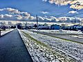
A trail in Tonawanda.
-
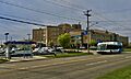
A bus near Kenmore Mercy Hospital.
-
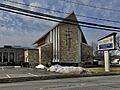
First Trinity Lutheran Church.
See also
 In Spanish: Tonawanda (pueblo) para niños
