West Branch Little Muncy Creek facts for kids
Quick facts for kids West Branch Little Muncy Creek |
|
|---|---|

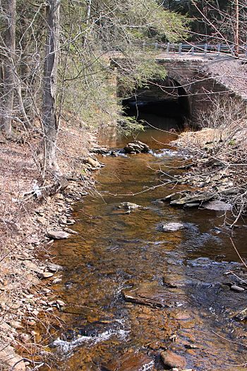
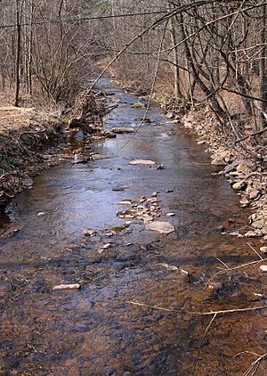
West Branch Little Muncy Creek looking upstream
|
|
| Physical characteristics | |
| Main source | Huckleberry Mountain in Davidson Township, Sullivan County, Pennsylvania 1,853 ft (565 m) |
| River mouth | Little Muncy Creek in Franklin Township, Lycoming County, Pennsylvania at Biggerstown 971 ft (296 m) 41°15′05″N 76°31′58″W / 41.25132°N 76.53267°W |
| Length | 3.5 mi (5.6 km) |
| Basin features | |
| Progression | Little Muncy Creek → Muncy Creek → West Branch Susquehanna River → Chesapeake Bay |
| Basin size | 4.33 sq mi (11.2 km2) |
| Tributaries |
|
The West Branch Little Muncy Creek is a smaller stream that flows into Little Muncy Creek. You can find it in Sullivan County and Lycoming County, in Pennsylvania.
This creek is about 3.5 miles (5.6 kilometers) long. It flows through Davidson Township in Sullivan County, and Franklin and Jordan Townships in Lycoming County. The area of land that drains water into the creek, called its watershed, is about 4.33 square miles (11.2 square kilometers). The creek has one named stream that flows into it, called West Creek. The ground around the creek has different types of soil and rocks, like alluvium (river deposits) and bedrock. West Branch Little Muncy Creek is known as a good place for cold-water fish and fish that travel. It is even being considered for a special list of wild trout waters by the Pennsylvania Fish and Boat Commission.
Where Does the Creek Flow?
West Branch Little Muncy Creek starts high up on Huckleberry Mountain in Sullivan County. It flows southwest for a short distance. Then, it enters Lycoming County and crosses Pennsylvania Route 42. After that, it turns to flow south-southeast, following along Pennsylvania Route 42.
The creek passes through a small pond before turning southeast. It then turns south-southeast again. Here, it enters Jordan Township and meets its only named smaller stream, West Creek, which joins from the left side. The creek continues flowing south-southwest next to Pennsylvania Route 42. Finally, it turns south-southeast and then south-southwest one last time before joining Little Muncy Creek.
What Streams Join It?
West Branch Little Muncy Creek has one main stream that flows into it: West Creek. West Creek joins West Branch Little Muncy Creek about 1.36 miles (2.19 kilometers) before the main creek ends. West Creek itself drains an area of about 1.56 square miles (4.0 square kilometers).
The Land and Rocks Around the Creek
The land where West Branch Little Muncy Creek meets Little Muncy Creek is about 971 feet (296 meters) above sea level. Where the creek begins, its source, the elevation is much higher, about 1853 feet (565 meters) above sea level.
Near the lower parts of the creek, the ground is mostly made of alluvium, which is sand, silt, and clay left by flowing water. There's also some fill (material used to raise ground levels) at the creek's mouth. The sides of the creek's valley have bedrock made of sandstone and shale.
Further upstream, you'll find a lot of Till, which is a mix of clay, sand, and rocks left behind by glaciers. This till can be clayey silt or clayey sand, depending on the bedrock. It also contains rocks like cobbles and boulders made of sandstone and conglomerate. Higher up the creek, on Huckleberry Mountain, the ground has many large boulders, mostly of quartz, sandstone, or conglomerate.
The path of West Branch Little Muncy Creek shows where glaciers reached their furthest point during the Wisconsinan Glaciation, a very cold period in Earth's history.
The Creek's Watershed
The watershed of West Branch Little Muncy Creek covers an area of about 4.33 square miles (11.2 square kilometers). This entire area is located within the Sonestown quadrangle, which is a map section used by the United States Geological Survey.
There's a plan for a natural gas pipeline to cross West Branch Little Muncy Creek and many other streams in the area.
Wildlife in the Creek
West Branch Little Muncy Creek is being considered as a special place for wild trout by the Pennsylvania Fish and Boat Commission. Experts checked the stream in 2013, and it was listed in 2015 as a possible wild trout water.
The creek is officially known as a Coldwater Fishery and a Migratory Fishery. This means it's a good habitat for fish that prefer cold water and for fish that travel, like those that might move between different parts of the creek or even to larger rivers.


