Anderson Creek (Pennsylvania) facts for kids
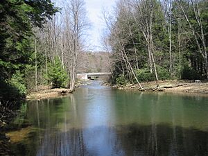
Anderson Creek is a 23.6-mile (38.0 km) long stream in Clearfield County, Pennsylvania. It flows into the West Branch Susquehanna River.
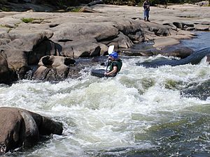
The upper part of Anderson Creek is a special conservation area. It starts high up on Rockton Mountain, near Interstate I-80. Anderson Creek is known as a fun whitewater stream, perfect for kayaking. It's even a part of the Eastern Continental Divide, which separates waters flowing to the Atlantic from those flowing to the Gulf of Mexico. Brown Springs, located in the Moshannon State Forest, is a popular starting point for kayakers heading towards the West Branch Susquehanna River.
Contents
A Historic Pathway: The Great Shamokin Path
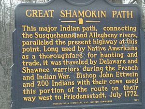
The area around Anderson Creek was once part of an important Native American trail called the Great Shamokin Path. This path connected the village of Shamokin on the Susquehanna River to Kittanning, Pennsylvania on the Allegheny River.
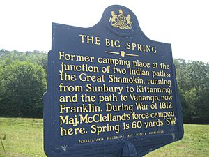
The trail followed the steep Anderson Creek Gorge for several miles. Then, it turned west towards what is now Chestnut Grove in Bloom Township, Clearfield County, Pennsylvania. From there, it continued to a place called The Big Spring near Luthersburg.
Ancient History at Bilger's Rocks
The Anderson Creek area is home to the Bilger's Rocks prehistoric site. This site shows that people from the McFate culture lived here long ago. They were here during the Late Woodland Period, between the years 1000 and 1580.
Bilger's Rocks is located in Bloom Township, Clearfield County, Pennsylvania, near the town of Grampian, Pennsylvania. A group called the Bilger's Rocks Association now owns and takes care of this 175-acre area. They also offer educational programs for visitors.
Other McFate sites have been found in Clearfield and Elk counties. One site near DuBois, Pennsylvania, called the Hickory Kingdom "Kalgren site," was a fort built on a high point of the Eastern Continental Divide. It was also close to ancient trail systems.
Early Native American Life
Evidence found near Curwensville, Pennsylvania, shows that different groups of Native Americans lived near Anderson Creek for over 10,000 years! Between the years 1000 and 1600, several groups called this area home. These included the Clemson Island, Owasco, Shenks Ferry, Monongahela, and McFate (or Black Minquas) peoples. The McFate people were the last tribal group to live in the Anderson Creek area. Their presence ended around 1650.
The French and Indian War and Anderson Creek
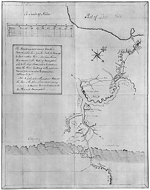
During the French and Indian War (1757–1758), hundreds of French and Native American soldiers used the Great Shamokin Path. Their goal was to attack Fort Augusta, a major English fort on the Susquehanna River.
This army came from French forts like Duquesne and Kittanning. They gathered at the mouth of Anderson Creek. Here, they built simple boats and rafts to travel down the Susquehanna River. They even brought two small cannons. However, they realized the fort was too far away for their cannons to reach. The defenses at Fort Augusta were also very strong. Because of this, the attack was called off. If the British had lost Fort Augusta, it could have changed the outcome of the French and Indian War.
Moravian Journeys
The Anderson Creek area was known by Native Americans as "the place where there is a mountain halfway on the other side." This meant it was a natural boundary between two big river systems: the Susquehanna River and the Ohio River.
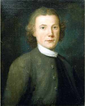
In the early 1700s, the villages of Shamokin and Kittanning were very important Native American centers in Pennsylvania. One of the most famous uses of the path was by Moravian Bishop John Ettwein in 1772. He led about 200 Lenape and Mohican Christians west along the path. They were moving from their village of Friedenshütten (meaning Cabins of Peace) to a new village called Friedensstadt (City of Peace).
A missionary named Rev. Johann Roth also traveled along Anderson Creek in 1772. In his diary, he described the area using Native American names. He mentioned a night camp in a place the Native Americans called "Wachtschunglelawi awossijaje." This phrase means "place where there is a mountain halfway on the other side." It perfectly described the divide between the Susquehanna and Ohio River systems.
The War of 1812
During the War of 1812, a group of soldiers led by Major William McClelland marched along Anderson Creek. On March 4, 1814, they left Fort Loudoun and headed towards The Big Spring in Brady Township. This group of 221 soldiers, with their wagons and cannons, camped near Thunderbird Spring.
Their march from Fort Loudoun to Erie took 28 days. Major McClelland's soldiers helped American forces at Lake Erie. They later fought bravely in important battles like the Battle of Chippewa and the Battle of Lundy's Lane.
The Underground Railroad
The Underground Railroad was a secret network of routes and safe places. It helped enslaved people escape to freedom in the North. In western Pennsylvania, routes started at the Maryland–Pennsylvania border. They passed through Bedford, Pennsylvania, and then joined the Great Shamokin Path at the mouth of Anderson Creek.
From there, the route led to The Big Spring near Luthersburg. It then continued on to Lake Erie and finally into Canada. Quaker settlers living along the Great Shamokin Path in Clearfield County helped the escaped slaves. The natural hills and forests of the Eastern Continental Divide provided good hiding places and many different paths to keep the "Railroad" secret.
Anderson Creek Today
The historic Anderson Creek area was later used for railroads. These trains carried passengers, logs, coal, and stone. Early settlers built logging mills and towns along the creek. A railroad from DuBois, Pennsylvania to Curwensville was finished in 1893.
The village of Home Camp was once a busy logging town. It had sawmills, dams, and places for lumbermen to stay. The creek had enough water to float logs down to the West Branch Susquehanna River. The last time logs were floated down Anderson Creek was in 1901.
This area is also rich in more recent history. During the "Golden Age" of railroads, trains carried people to school and soldiers to war. Millions of tons of coal, stone, and clay were transported along this route. These resources helped power the nation's industries. Today, this old rail trail is a valuable place for recreation and enjoying nature.
The Bickford Railroad Line
In 1881, the Buffalo, Rochester and Pittsburgh Railway wanted a way to ship goods to the east. So, the Clearfield & Mahoning Railroad Company built a line. Construction started in June 1892, and the first passenger train ran on June 1, 1893.
This line was 17.4 miles long and was named after the Bickford junction. It followed the Eastern Continental Divide along Anderson Creek, from Rockton to Bridgeport. The line is no longer active, and the tracks have been removed. The last passenger train ride on the Bickford Line was on June 15, 1954. Today, the old rail line is a popular spot for ATV riders.
Du Bois Reservoir
The Du Bois Reservoir is located in Union Township, near the start of Anderson Creek. It covers 210 acres and can hold 615 million gallons of water. This reservoir is a PA DCNR Conservation Area. It provides drinking water for the City of Du Bois and is also known as the Anderson Creek Reservoir. The dam at the reservoir helps control the flow of water from the creek's headwaters.
The Village of Rockton
Rockton is a small village in Union Township, Clearfield County. It sits along Anderson Creek, close to Brown Springs in the Moshannon State Forest. The village got its name from a story about stagecoach passengers arguing over the weight of a large rock.
In the past, Rockton was a busy place. It had its own school, a newspaper, several stores, three churches, and mills for grinding grain and cutting lumber. There was even an emergency landing field for air mail pilots.
Rockton was once divided into "upper" and "lower" sections. What is now Rockton began with lumbering businesses. In 1885, Jason E. Kirk and David W. Kirk built a steam-powered feed mill. Lower Rockton started in 1837 with a saw mill and grist mill.
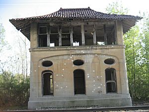
Rockton also had train service on the Bickford Line. The Buffalo, Rochester & Pittsburgh Rockton Station, built in 1898, was taken apart in the 1970s and moved to Kane, Pennsylvania.
A big tornado hit Rockton on September 14, 1945. It started in the Coal Hill area and destroyed many buildings. The storm created a path about 100 feet wide and eight miles long. Luckily, no one was hurt.
Today, Rockton has a post office, one church (St. John's Lutheran), an auto repair shop, and a fire department.
David S. Ammerman Trail
The Clearfield and Grampian Trail was renamed the David S. Ammerman Trail in 2011. This was done to honor David S. Ammerman, who worked hard to turn the old abandoned rail line into a fun recreational trail. The David S. Ammerman Trail crosses Anderson Creek in Curwensville, Pennsylvania. It connects to Grampian, Pennsylvania and Clearfield, Pennsylvania.
Anderson Creek Watershed Association
The Anderson Creek Watershed Association works to protect and improve the creek's environment. They partner with groups like the Western Pennsylvania Conservancy Watershed Restoration Project. Clearfield County has more land affected by old, abandoned mines than any other county in Pennsylvania. This makes the work of the Watershed Association very important for keeping Anderson Creek clean and healthy.
See Also
|


