
Arcadia, Florida facts for kids
Quick facts for kids
Arcadia, Florida
|
||
|---|---|---|
| City of Arcadia | ||

Arcadia Historic District
|
||
|
||

Location of Arcadia in DeSoto County, Florida....
|
||
| Country | United States of America | |
| State | Florida | |
| County | DeSoto | |
| Incorporated | 1886 | |
| Named for | Arcadia Albritton | |
| Government | ||
| • Type | Mayor-Council | |
| Area | ||
| • Total | 4.43 sq mi (11.48 km2) | |
| • Land | 4.43 sq mi (11.47 km2) | |
| • Water | 0.01 sq mi (0.02 km2) | |
| Elevation | 60 ft (20 m) | |
| Population
(2020)
|
||
| • Total | 7,420 | |
| • Density | 1,675.70/sq mi (647.01/km2) | |
| Time zone | UTC-5 (EST) | |
| • Summer (DST) | UTC-4 (EDT) | |
| ZIP codes |
34265, 34266, 34269
|
|
| Area code(s) | 863 | |
| FIPS code | 12-01750 | |

Arcadia is a city in Florida, United States. It is the main city and county seat of DeSoto County, Florida. The city's Historic District is a special area listed on the National Register of Historic Places. In 2020, about 7,420 people lived in Arcadia.
Contents
History of Arcadia
How Arcadia Got Its Name
The city of Arcadia was named by Reverend James Madison Hendry. He named it after Arcadia Albritton, a young pioneer girl. She had baked him a birthday cake, and he was so thankful that he decided to name the new city after her.
Railroads and Growth
In 1886, transportation in Arcadia got much better. The Florida Southern Railway was built through the city. This railway connected Arcadia to other towns like Bartow and Punta Gorda. Because of the railway, Arcadia grew a lot. It officially became a city a year later.
More train lines were built over time, helping Arcadia connect to even more places. These railways were very important for the city's growth and trade.
Arcadia as a County Center
In the late 1800s, Arcadia was the main town for a very large area. This area later became several different counties. In 1921, new laws were made. These laws kept Arcadia as the county seat of DeSoto County. They also created new counties like Charlotte and Hardee. Before this, Arcadia had grown quite a bit, with over 1,000 people living there. There was also a lot of land used for ranching.
The Great Fire of 1905
On Thanksgiving Day in 1905, a big fire destroyed much of Arcadia. The fire started in a stable in the middle of town. It spread quickly because the city did not have a good water system or a fire department. The fire caused about $250,000 in damage. Luckily, no one died. Most of the downtown business area was destroyed. It took many years for the town to fully recover.
Historic Buildings and Downtown
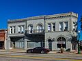
Oak Street is the main street in Arcadia. The downtown area is very special. It has many beautiful old buildings. Arcadia is older than some nearby towns. It used to be the main center for them. The city also has many homes, churches, and public buildings from the early 1900s. About 3,400 acres, including the downtown, are part of the Arcadia Historic District.
Carlstrom Field: A Training Airfield
From 1917 to 1922, Arcadia was home to Carlstrom Field. This was a grass airfield used by the U.S. Army Air Service. It was named after Victor Carlstrom, a pilot who had passed away. Carlstrom Field was used to train pilots during and after World War I. Later, in 1941, it became an airfield again for military flight training. It even trained pilots for the Royal Air Force until 1945.
Challenges Faced by a Family
In 1986, a family in Arcadia faced difficulties when their children were not allowed to attend school. The family later moved from Arcadia after their home was damaged.
Arcadia in the 21st Century
Hurricane Charley's Impact (2004)
In 2004, Hurricane Charley caused a lot of damage in Arcadia. The storm's center passed right over the city. Winds reached up to 109 miles per hour. The city's main shelter, the Turner Agri Civic Center, was built to withstand strong winds. However, it collapsed during the storm. People inside had to move to safer areas.
The hurricane badly damaged downtown Arcadia. Many businesses on Oak Street and Polk Street were hit. The city's water tower fell down. The only hospital in the city was also heavily damaged. Hurricane Charley destroyed or badly damaged 3,600 homes. It caused 16,000 people to leave their homes. The total damage was in the millions of dollars. Two people died in DeSoto County, and 150 were injured. Many residents left Arcadia and did not return.
Rebuilding and Recovery
After Hurricane Charley, the National Guard came to help. They started cleaning up and set a strict curfew. The people of Arcadia worked together to help each other. They provided food and helped rebuild homes. Even though the Great Recession started during this time, the community worked hard. They rebuilt their homes and brought new ones to the city. Downtown Arcadia was rebuilt. However, some parts of the county still show damage from Hurricane Charley, even years later.
Later Hurricanes
In 2017, Hurricane Irma passed over Arcadia as a Category 1 hurricane. It did not cause as much damage as Charley. Some downtown areas were affected, and the Oak Park Inn was closed for four months. Parts of DeSoto County flooded, especially near the Peace River. The storm brought a lot of rain, causing the river to overflow.
On September 28, 2022, Hurricane Ian hit Florida as a very strong Category 4 hurricane. It passed over Arcadia as a Category 3 storm. This hurricane caused major flooding along the Peace River. Homes and roads near the river were flooded. SR-72 collapsed, and many buildings and homes in Arcadia were damaged.
COVID-19 Pandemic
In March 2020, Arcadia declared a local state of emergency because of the COVID-19 pandemic. DeSoto County has had over 10,000 cases of COVID-19.
Geography of Arcadia
Where is Arcadia Located?
Arcadia is located slightly northwest of the center of DeSoto County. The Peace River flows along the west side of the city. This river goes southwest to Punta Gorda. Nearby, Southeast Arcadia is a larger area of land with a similar number of people.
Elevation and Roads
Most of Arcadia is more than 40 feet above sea level. Some parts near the city center are as high as 65 feet above sea level. This makes Arcadia one of the highest cities in Florida.
U.S. Route 17 goes through the middle of Arcadia. It leads north to Bartow and southwest to Punta Gorda. Florida State Road 70 crosses US 17 in Arcadia. It goes east to Okeechobee and west to South Bradenton. Another road, SR 72, connects Arcadia to South Sarasota.
City Area
According to the United States Census Bureau, Arcadia covers a total area of about 4.43 square miles (11.48 square kilometers). Only a very small part of this area is water.
Climate in Arcadia
Arcadia has a humid subtropical climate. This means it has hot, humid summers. The winters are warm and usually drier.
| Climate data for Arcadia, Florida, 1991–2020 normals, extremes 1899–2021 | |||||||||||||
|---|---|---|---|---|---|---|---|---|---|---|---|---|---|
| Month | Jan | Feb | Mar | Apr | May | Jun | Jul | Aug | Sep | Oct | Nov | Dec | Year |
| Record high °F (°C) | 88 (31) |
92 (33) |
95 (35) |
98 (37) |
103 (39) |
104 (40) |
101 (38) |
101 (38) |
98 (37) |
98 (37) |
93 (34) |
89 (32) |
104 (40) |
| Mean maximum °F (°C) | 83.7 (28.7) |
85.0 (29.4) |
87.7 (30.9) |
91.3 (32.9) |
94.4 (34.7) |
95.5 (35.3) |
95.3 (35.2) |
95.2 (35.1) |
93.9 (34.4) |
90.9 (32.7) |
87.1 (30.6) |
84.5 (29.2) |
96.6 (35.9) |
| Mean daily maximum °F (°C) | 73.5 (23.1) |
76.1 (24.5) |
80.0 (26.7) |
84.2 (29.0) |
89.1 (31.7) |
90.7 (32.6) |
91.4 (33.0) |
91.6 (33.1) |
89.9 (32.2) |
85.6 (29.8) |
79.5 (26.4) |
75.4 (24.1) |
83.9 (28.8) |
| Daily mean °F (°C) | 60.3 (15.7) |
63.1 (17.3) |
66.5 (19.2) |
71.1 (21.7) |
76.4 (24.7) |
80.0 (26.7) |
81.3 (27.4) |
81.6 (27.6) |
80.1 (26.7) |
74.8 (23.8) |
67.6 (19.8) |
63.1 (17.3) |
72.2 (22.3) |
| Mean daily minimum °F (°C) | 47.1 (8.4) |
50.1 (10.1) |
53.1 (11.7) |
58.0 (14.4) |
63.8 (17.7) |
69.4 (20.8) |
71.2 (21.8) |
71.6 (22.0) |
70.4 (21.3) |
64.0 (17.8) |
55.7 (13.2) |
50.8 (10.4) |
60.4 (15.8) |
| Mean minimum °F (°C) | 30.4 (−0.9) |
33.6 (0.9) |
37.6 (3.1) |
44.7 (7.1) |
53.9 (12.2) |
65.4 (18.6) |
68.7 (20.4) |
68.8 (20.4) |
65.8 (18.8) |
51.2 (10.7) |
41.2 (5.1) |
34.9 (1.6) |
28.4 (−2.0) |
| Record low °F (°C) | 18 (−8) |
21 (−6) |
26 (−3) |
32 (0) |
39 (4) |
52 (11) |
61 (16) |
60 (16) |
55 (13) |
38 (3) |
23 (−5) |
18 (−8) |
18 (−8) |
| Average precipitation inches (mm) | 2.31 (59) |
2.00 (51) |
2.44 (62) |
2.72 (69) |
3.78 (96) |
9.55 (243) |
8.19 (208) |
8.93 (227) |
7.77 (197) |
2.58 (66) |
1.83 (46) |
1.82 (46) |
53.92 (1,370) |
| Average precipitation days (≥ 0.01 in) | 5.3 | 4.8 | 4.9 | 5.1 | 6.4 | 14.1 | 15.2 | 15.9 | 12.6 | 6.3 | 4.4 | 5.1 | 100.1 |
| Source 1: NOAA | |||||||||||||
| Source 2: XMACIS2 | |||||||||||||
People of Arcadia
| Historical population | |||
|---|---|---|---|
| Census | Pop. | %± | |
| 1900 | 799 | — | |
| 1910 | 1,736 | 117.3% | |
| 1920 | 3,479 | 100.4% | |
| 1930 | 4,082 | 17.3% | |
| 1940 | 4,055 | −0.7% | |
| 1950 | 4,764 | 17.5% | |
| 1960 | 5,889 | 23.6% | |
| 1970 | 5,658 | −3.9% | |
| 1980 | 6,002 | 6.1% | |
| 1990 | 6,488 | 8.1% | |
| 2000 | 6,604 | 1.8% | |
| 2010 | 7,637 | 15.6% | |
| 2020 | 7,420 | −2.8% | |
| U.S. Decennial Census | |||
Population and Households
As of the 2020 United States census, Arcadia had 7,420 people. There were 2,953 households and 1,755 families living in the city.
Age and Diversity
In 2020, about 5.1% of the people were under 5 years old. About 26.2% were under 18. And 13.7% were 65 or older. Almost half of the population (49.9%) were female. About 14.7% of the people living in Arcadia were born outside the United States.
| Race | Pop 2010 | Pop 2020 | % 2010 | % 2020 |
|---|---|---|---|---|
| White (NH) | 3,062 | 2,905 | 40.09% | 39.15% |
| Black or African American (NH) | 1,876 | 1,825 | 24.56% | 24.60% |
| Native American or Alaska Native (NH) | 10 | 12 | 0.13% | 0.16% |
| Asian (NH) | 51 | 67 | 0.67% | 0.90% |
| Pacific Islander or Native Hawaiian (NH) | 0 | 0 | 0.00% | 0.00% |
| Some other race (NH) | 8 | 23 | 0.10% | 0.31% |
| Two or more races/Multiracial (NH) | 96 | 232 | 1.26% | 3.13% |
| Hispanic or Latino (any race) | 2,534 | 2,356 | 33.18% | 31.75% |
| Total | 7,637 | 7,420 |
Education and Income
In 2020, about 80.9% of people aged 25 and older had finished high school. About 15.2% of them had a college degree or higher. The average household income was $34,003. About 30.2% of the population lived below the poverty threshold.
Transportation in Arcadia
Arcadia Municipal Airport
The Arcadia Municipal Airport is a public airport. It is located about 1 mile southeast of the city center. The city of Arcadia manages the airport every day. This airport has a long history in aviation. It used to be home to the Carlstrom and Dorr training fields. The airport is known for its low fuel prices. It also has a place called Aviation City where pilots can fly in and camp.
The Arcadia Municipal Airport holds an annual Aviation Day event in March. This event features displays of aircraft, rides on biplanes and helicopters, and skydiving shows.
Fun Things to Do in Arcadia
Exploring the Peace River
Arcadia is located on the Peace River. This river is the main waterway that flows into the Charlotte Harbor estuary. The river is a great place for canoeing. You can also hunt for shark teeth there. The river is home to many natural habitats. There are tours, gear rentals, and places to stay nearby.
Annual Fair and Rodeos
Arcadia hosts DeSoto County's annual fair, usually in January. The fair has traditional carnival rides and games. It also features livestock shows with pigs and cattle. These shows are put on by local FFA and 4-H groups.
Arcadia is also home to three rodeos each year. These events are held in March, on the Fourth of July holiday, and in the fall. The money raised from these rodeos helps many local charities and provides college scholarships.
Antique Shopping and Fairs
Arcadia has one of the largest groups of antique dealers in Florida. All of them are conveniently located in the downtown area. The local antique dealers' association hosts a "4th Saturday Antique Fair" every month. This event brings in 60 to 120 more independent dealers.
Parades and Celebrations
Arcadia has many parades throughout the year. These include:
- A Martin Luther King Jr. Day parade
- A March rodeo parade
- A Cinco de Mayo parade
- An Independence Day parade
- An October Homecoming parade
- A Veterans Day parade
- A Christmas parade
Media in Arcadia
- WCXS (1480 Classic Country)
- WSRQ-FM (106.9 SRQ)
- WZSP-FM (105.3 La Zeta)
- The Arcadian, local print newspaper
Notable People from Arcadia
- Al Alberts - lead singer of The Four Aces
- Christina Bohannan, Iowa House of Representatives and Candidate for Congress in Iowa's 1st Congressional District in 2022
- Chris Clemons - professional National Football League player for the Miami Dolphins and Arizona Cardinals
- James L. Dozier - retired US Army general
- Brian Labrie - reality TV star and world record holder from the Science Channel’s Punkin’ Chunkin’ TV show
- T. J. Luther - professional football player in the NFL
- Bitsy Mott - born in Arcadia, Major League Baseball player
- Ray brothers - HIV activists
- Joey Redner - founder of Cigar City Brewing Company
- John Paul Riddle - co-founder of Embry-Riddle Aeronautical University
- Brad Scott - former coach at Clemson Tigers
- Jeff Scott - head football coach of the South Florida Bulls
- Chesterfield Smith - president of the American Bar Association in 1973–1974
Images for kids
-
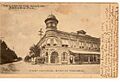
First National Bank of Arcadia in 1905
-
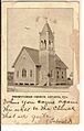
Presbyterian Church in 1907
-
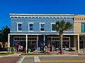
Vintage clothing store in Arcadia's main street
-
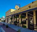
The Yellow Deli
-
Oak Park Inn
-
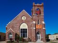
Heritage Baptist Church


See also
 In Spanish: Arcadia (Florida) para niños
