Bartow, Florida facts for kids
Quick facts for kids
Bartow, Florida
|
|||
|---|---|---|---|
| City of Bartow | |||
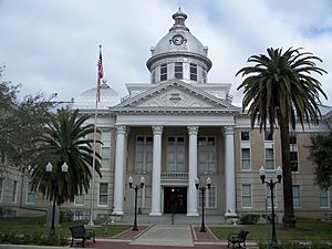
Old Polk County Courthouse
|
|||
|
|||
| Nickname(s):
City of Oaks and Azaleas
|
|||
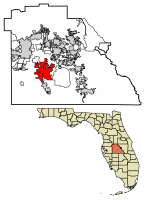
Location of Bartow in Polk County, Florida.
|
|||
| Country | |||
| State | |||
| County | Polk | ||
| First Settled | Pre-Columbian Era | ||
| Nearby Black Seminole settlement | Late 1810s | ||
| Resettled | 1851 | ||
| Incorporated | July 1, 1882 | ||
| Area | |||
| • City | 52.78 sq mi (136.71 km2) | ||
| • Land | 46.42 sq mi (120.23 km2) | ||
| • Water | 6.36 sq mi (16.48 km2) | ||
| Elevation | 118 ft (36 m) | ||
| Population
(2020)
|
|||
| • City | 19,309 | ||
| • Density | 415.95/sq mi (160.60/km2) | ||
| • Metro | 787,404 | ||
| Time zone | UTC-5 (Eastern (EST)) | ||
| • Summer (DST) | UTC-4 (EDT) | ||
| ZIP codes |
33830-33831
|
||
| Area code(s) | 863 | ||
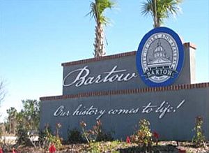
| Slogan(s) | Our History Comes to Life | ||
| FIPS code | 12-03675 | ||
| GNIS feature ID | 2403163 | ||
Bartow (/ˈbɑːrtoʊ/ BAR-toh) is a city in Florida, United States. It is the main city and county seat of Polk County. This means it's where the county government offices are located.
Bartow was first settled in 1851 and was called Fort Blount. Later, it was renamed to honor Francis S. Bartow. He was a commander in the Confederate Army during the American Civil War and the first one to die in battle.
The city is part of a larger area called the Lakeland−Winter Haven Metropolitan Statistical Area. This area had about 787,404 people in 2022. Bartow itself had a population of 19,309 people in 2020.
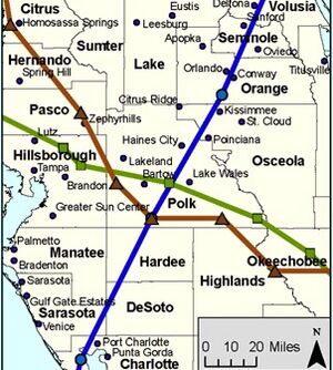
Bartow is located near the start of the Peace River. It's about 39 miles (63 km) east of Tampa, Florida and 50 miles (80 km) southwest of the Orlando area. The city is in a spot known as "Lightning Alley," so it gets lots of thunderstorms in the summer. But its winters are usually sunny and mild.
The main jobs in Bartow are in government, mining, and farming. Major roads like U.S. Route 17, U.S. Route 98, and State Road 60 help people travel around Central Florida.
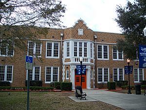
Bartow's official nickname is the "City of Oaks and Azaleas." Many of its old buildings are listed on the National Register of Historic Places. These include the Old Polk County Courthouse from 1909 and Bartow High School. Even though other cities in Polk County like Lakeland and Winter Haven have grown bigger, Bartow still keeps its small-town feel and Southern culture. The city is expected to grow a lot in the future, possibly reaching over 45,000 people by 2030.
Contents
History of Bartow
Long ago, a Spanish map from 1527 showed a native village called Rio de la Paz near where Bartow is today. We don't know much about these early Native Americans. It's likely that many of them got sick from European diseases like smallpox. The people who survived probably joined the Creek Indians who came from the north, forming the Seminole Indian tribe.
The first non-Native American settlement was a group of Black Seminole people. These were free Black people and enslaved people who had escaped. They built a village called Minatti south of Lake Hancock in the late 1810s. These "maroons" (escaped enslaved people) came from Georgia and the Carolinas. The Black Seminoles of Minatti were friends with the Red Stick Creek people in Talakchopko, a village near present-day Fort Meade. A famous Seminole leader named Osceola had strong ties to Talakchopko. Many events leading up to the Second Seminole War involved Osceola and the Minatti war chief Harry. By the end of this war in 1842, both Minatti and Talakchopko were destroyed by U.S. forces.
In the 1840s, a law called the Armed Occupation Act helped European-Americans settle in Florida. This law said people couldn't settle near the Peace River because it was Seminole land. But people moved there anyway. As more settlers arrived, they started planting citrus trees and building schools and churches.
In 1851, a settlement called Fort Blount was started by Redding Blount. Bartow grew to the east of this spot. Later in the 1850s, Fort Blount was renamed Peace Creek or Peas Creek. This was a translation of the Spanish name Rio de la Paz.
About a month after Florida left the United States in 1861, Polk County was created. A few months later, the American Civil War began. Because of the war, the county didn't have an official county seat for six years. During the war, the area mainly provided food, especially cattle, to the Confederacy. The Union army controlled Florida's west coast, so many cattle ranchers moved inland. They formed the "Cow Cavalry" to protect themselves from Union troops.
One of the richest members of the Cow Cavalry was Jacob Summerlin. In 1862, Summerlin bought the Blount property. He gave a large piece of land to build a county courthouse, two churches, and a school. Later that year, the town, which had been called Fort Blount, Peace Creek, Peas Creek, and briefly Reidsville, was officially named Bartow. This was in honor of Francis S. Bartow, the first Confederate commander to die in the war.
Bartow slowly recovered after the war. The first Polk County Courthouse was built in 1867, making Bartow the official county seat. Florida rejoined the United States in 1868, but the Reconstruction era didn't end until 1877.
The 1880s and 1890s were a time of growth for Bartow. From 1880 to 1900, the city's population grew from 386 to 1,983 people. On July 1, 1882, Bartow officially became a city. In 1885, the Florida Southern Railroad opened a route through Bartow. A year later, another railroad connecting Tampa and Orlando was finished. These railroads helped the area grow a lot. During the Spanish–American War, Bartow's train yards were very important for sending supplies to U.S. troops in Cuba. In 1887, Summerlin Institute, the first brick schoolhouse south of Jacksonville, was built.
By 1900, Bartow was the biggest city south of Tampa in Florida. It was even larger than Miami or West Palm Beach.
As the city grew, new businesses came to Bartow. In the early 1900s, companies bought thousands of acres of land around the city for the phosphate industry. Bartow became the center of the largest phosphate industry in the United States.
Polk County was the top citrus-producing county in the U.S. for much of the 20th century. Bartow still has several large citrus groves. In 1941, the city built an airport. The government took over the airport during World War II and used it to train many Army Air Corps pilots. The airport was given back to the city in 1967 and renamed Bartow Municipal Airport.
For most of the 20th century, Bartow grew slowly. Other cities in Polk County grew much faster. This was partly because Bartow's government was careful about growth. Also, much of the land around Bartow was owned by phosphate mining companies, which made it hard to build new homes. By 1910, Lakeland had more people than Bartow. Bartow was the second-largest city in the county until the 1950s, when Winter Haven became larger.
In the late 1990s, phosphate mining moved south. This made a lot of former mining land available for sale. In 1999, a businessman named Stanford Phelps bought 18,000 acres (73 km²) of former Clear Springs phosphate land near Bartow. He announced plans for a huge development. After some delays, the plan was approved in 2009. The Clear Springs Development includes plans for over 11,000 new homes, shops, three schools, and a golf course. Experts believe Bartow's population could grow to over 25,000 by 2015 and over 45,000 by 2030.
Geography and Climate
Bartow's Location
Bartow is located in the middle of Florida, a bit southwest of the center of Polk County. It's about 39 miles (63 km) east of Tampa and 51 miles (82 km) southwest of Orlando. Bartow, Lakeland, and Winter Haven form a triangle shape, with Bartow at the bottom point.
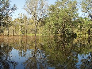
The city is near where the Peace River begins, at Lake Hancock. Bartow is in an area of Central Florida that has flat land mixed with gentle hills.
In 2000, Bartow covered about 11.4 square miles (29.5 km²). Most of this was land, with a small amount of water. Since then, the city has grown a lot by adding over 26,000 acres (105 km²) of undeveloped land, mostly from the Clear Springs area. This has made the city's total area more than four times bigger, now over 52 square miles (135 km²).
Land and Soil
Bartow is on the South Central Florida Ridge. Most of the soil in the Bartow area is sandy. Some areas have sandy top layers with clay underneath. The eastern edge of town has a clay-rich floodplain where the Peace River flows. The soil drains well in most places, except for a poorly drained area in the northern part of town. Much of Bartow is built on "Fort Meade soil," which is good for gardening because it drains well and has lots of nutrients.
Weather in Bartow
Bartow, like most of Florida, has a humid subtropical climate. This means it has hot, humid summers with many afternoon thunderstorms, and drier, milder winters. Because Bartow is further from the coast than many other Florida cities, it tends to have hotter daytime temperatures and cooler nights.
Hurricanes don't hit Polk County very often, usually less than once every ten years. However, in 2004, three hurricanes hit the area within just 44 days! Before 2004, the last hurricane to bring strong winds to Bartow was Hurricane Donna in 1960.
Even though hurricanes get a lot of attention, lightning is a more common danger in Polk County. The area is in the center of "lightning alley," which is where the most lightning strikes happen in the United States. Thunderstorms can also bring tornadoes, but Florida tornadoes are usually not as big as those in other parts of the U.S. Sometimes, hail can even fall; in March 1996, one storm caused a foot of hail to pile up in parts of Bartow.
Freezes sometimes happen in Bartow, which can be a problem if temperatures stay below freezing for a long time. On average, the coldest temperature each year is around 32°F (0°C). Snow is very rare, maybe happening only a few times every century.
| Climate data for Bartow, Florida, 1991–2020 normals, extremes 1892–present | |||||||||||||
|---|---|---|---|---|---|---|---|---|---|---|---|---|---|
| Month | Jan | Feb | Mar | Apr | May | Jun | Jul | Aug | Sep | Oct | Nov | Dec | Year |
| Record high °F (°C) | 90 (32) |
91 (33) |
97 (36) |
99 (37) |
101 (38) |
103 (39) |
102 (39) |
100 (38) |
98 (37) |
97 (36) |
96 (36) |
90 (32) |
103 (39) |
| Mean maximum °F (°C) | 83.2 (28.4) |
85.4 (29.7) |
87.9 (31.1) |
91.3 (32.9) |
94.6 (34.8) |
96.2 (35.7) |
96.3 (35.7) |
95.9 (35.5) |
94.4 (34.7) |
91.5 (33.1) |
87.4 (30.8) |
83.7 (28.7) |
97.3 (36.3) |
| Mean daily maximum °F (°C) | 72.9 (22.7) |
75.9 (24.4) |
79.7 (26.5) |
84.2 (29.0) |
88.7 (31.5) |
90.9 (32.7) |
91.9 (33.3) |
91.7 (33.2) |
89.7 (32.1) |
85.2 (29.6) |
79.0 (26.1) |
74.7 (23.7) |
83.7 (28.7) |
| Daily mean °F (°C) | 61.2 (16.2) |
64.0 (17.8) |
67.7 (19.8) |
72.5 (22.5) |
77.6 (25.3) |
81.1 (27.3) |
82.3 (27.9) |
82.3 (27.9) |
80.7 (27.1) |
75.5 (24.2) |
68.3 (20.2) |
63.6 (17.6) |
73.1 (22.8) |
| Mean daily minimum °F (°C) | 49.5 (9.7) |
52.1 (11.2) |
55.7 (13.2) |
60.8 (16.0) |
66.4 (19.1) |
71.3 (21.8) |
72.6 (22.6) |
72.9 (22.7) |
71.8 (22.1) |
65.9 (18.8) |
57.5 (14.2) |
52.6 (11.4) |
62.4 (16.9) |
| Mean minimum °F (°C) | 34.1 (1.2) |
37.2 (2.9) |
42.4 (5.8) |
50.2 (10.1) |
58.8 (14.9) |
67.8 (19.9) |
70.3 (21.3) |
70.5 (21.4) |
67.4 (19.7) |
53.2 (11.8) |
44.1 (6.7) |
37.6 (3.1) |
32.3 (0.2) |
| Record low °F (°C) | 18 (−8) |
22 (−6) |
23 (−5) |
34 (1) |
45 (7) |
56 (13) |
60 (16) |
61 (16) |
55 (13) |
32 (0) |
25 (−4) |
18 (−8) |
18 (−8) |
| Average precipitation inches (mm) | 2.66 (68) |
2.10 (53) |
2.84 (72) |
2.72 (69) |
2.95 (75) |
8.28 (210) |
7.56 (192) |
7.78 (198) |
7.31 (186) |
3.03 (77) |
1.49 (38) |
2.16 (55) |
50.88 (1,292) |
| Average precipitation days (≥ 0.01 in) | 6.0 | 5.2 | 5.5 | 4.8 | 6.5 | 13.0 | 15.0 | 15.7 | 12.3 | 7.0 | 4.4 | 5.5 | 100.9 |
| Source: NOAA | |||||||||||||
People of Bartow
| Historical population | |||
|---|---|---|---|
| Census | Pop. | %± | |
| 1880 | 386 | — | |
| 1890 | 1,386 | 259.1% | |
| 1900 | 1,983 | 43.1% | |
| 1910 | 2,662 | 34.2% | |
| 1920 | 4,101 | 54.1% | |
| 1930 | 5,269 | 28.5% | |
| 1940 | 6,158 | 16.9% | |
| 1950 | 8,694 | 41.2% | |
| 1960 | 12,849 | 47.8% | |
| 1970 | 12,891 | 0.3% | |
| 1980 | 14,780 | 14.7% | |
| 1990 | 14,716 | −0.4% | |
| 2000 | 15,340 | 4.2% | |
| 2010 | 17,298 | 12.8% | |
| 2020 | 19,309 | 11.6% | |
| Population 1890-2000. | |||
In 2020, Bartow had 19,309 people living in 6,546 households. About 4,378 of these were families.
Here's a look at the different groups of people living in Bartow:
| Race | Pop 2010 | Pop 2020 | % 2010 | % 2020 |
|---|---|---|---|---|
| White (NH) | 10,216 | 10,576 | 59.06% | 54.77% |
| Black or African American (NH) | 4,023 | 4,245 | 23.26% | 21.98% |
| Native American or Alaska Native (NH) | 36 | 33 | 0.21% | 0.17% |
| Asian (NH) | 187 | 284 | 1.08% | 1.47% |
| Pacific Islander or Native Hawaiian (NH) | 10 | 6 | 0.06% | 0.03% |
| Some other race (NH) | 21 | 103 | 0.12% | 0.53% |
| Two or more races/Multiracial (NH) | 259 | 645 | 1.50% | 3.34% |
| Hispanic or Latino (any race) | 2,546 | 3,417 | 14.72% | 17.70% |
| Total | 17,298 | 19,309 |
In 2010, there were 5,909 households. About 67.4% of these were families. About 35.6% of households had children under 18. The average household had 2.57 people, and the average family had 3.12 people. Most homes (63.5%) were owned by the people living in them.
The average age in Bartow in 2010 was 36.2 years old. About 25.8% of the people were under 18.
Religion in Bartow
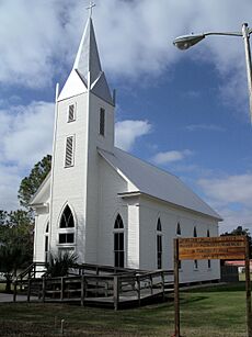
The first two churches in Bartow, First Baptist and First Methodist, were built on land given by the city's founder, Jacob Summerlin, in 1867. These churches are still active today, though in different buildings.
In 1919, over 8,000 people came to Bartow to hear Billy Sunday preach. This was twice the population of Bartow at the time! As of 2010, there are more than 70 churches in the Bartow area.
Like many places in the Bible Belt (a region in the Southern United States where Protestant Christianity is very important), Bartow has many people who belong to evangelical Protestant churches. About 62% of churchgoers in Bartow are part of these groups. The largest group is the Southern Baptist Convention. The Roman Catholic church is the second largest. Other churches like Pentecostal/Charismatic churches, the United Methodist Church, and Episcopal and Lutheran churches also have a presence.
While there are no synagogues in Bartow for Jewish people, there is one nearby in Lakeland. There are also two Muslim mosques and a Hindu temple in Polk County.
Bartow's Economy
Bartow's economy relies on four main areas: government, mining, agriculture, and tourism. Even though Bartow is a smaller city, it's close to many larger cities, with about 8 million people living within 100 miles (160 km).
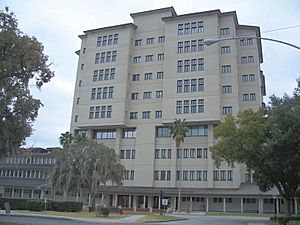
The biggest part of Bartow's economy is government. Since it's the county seat, many city, county, and state government offices are located here. Nine of the seventeen largest employers in Bartow are government groups. The biggest is the Polk County School Board, which employs over 12,000 people. Other county offices like the sheriff's department also employ many people. The Florida Department of Transportation's main office for southwest Florida is also in Bartow.
Some big businesses that started in Bartow now have their main offices elsewhere. The large international law firm Holland & Knight began in Bartow in 1929. The well-known Burdines and Sons department store chain also started in Bartow in 1896.
Phosphate mining has been very important to Bartow's economy since phosphate rock was found here in 1881. Polk County is part of the Bone Valley, which has the richest phosphate rock in the world. About 75% of the U.S. supply and 25% of the world's supply comes from this area. Mosaic is the largest employer in the phosphate industry, with over 3,000 workers.
Polk County has about 600,000 acres (2,400 km²) used for farming. It's the top county in Florida for growing citrus fruits. Polk County is also second in the state for honey production and fourth for the number of cattle. Since 1997, blueberries have become a big crop. From 2000 to 2007, blueberry production more than doubled, making up over 35% of Florida's total. Bartow's blueberries are special because they are ready from March to May, when other areas aren't producing.
While Bartow doesn't have huge tourist attractions itself, it's less than 50 miles (80 km) from Walt Disney World Resort and Busch Gardens Tampa Bay. It's also close to Legoland Florida in Winter Haven and Bok Tower Gardens in Lake Wales. With its many historic sites, Bartow is also interesting for people who like history.
Culture and Events
Yearly Festivals and Events
Bartow has several fun yearly events. Many of these are big and bring people from other towns to the city. For example, the Cricket Club Halloween Parade and Carnival has been held every year since 1942. There's also an annual Fourth of July Celebration at Mosaic Park. The Bloomin' Arts Festival is an art show held in early March. Every February, the Annual L.B. Brown Festival takes place at the L.B. Brown House.
A unique tradition in Bartow is the annual New Year's Eve bonfire. Discarded Christmas trees are piled around a telephone pole and set on fire. This tradition has been going on for over 70 years and has even been featured in national news!
The Polk County Arts Alliance, based in Bartow, helps promote the performing arts in the county. The Bartow Performing Arts Series puts on five shows each year. The Imperial Symphony Orchestra, made up of ninety volunteer musicians, performs several times a year, including an outdoor concert. Bartow also has a volunteer band, the Bartow Adult Concert Band. On the third Friday of every month, Main Street is closed for "Friday Fest" at 6 p.m., which features live music and entertainment. Locals sometimes call it "Tow Jam."
Historic Buildings and Places
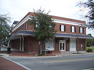
Bartow has a special board that works to protect and promote its historic buildings and areas. Three parts of the city are officially recognized as historic districts: the Bartow Downtown Commercial District, the Northeast Bartow Residential District, and the South Bartow Residential District. New buildings in these areas are carefully reviewed to make sure they fit the neighborhood's historic look.
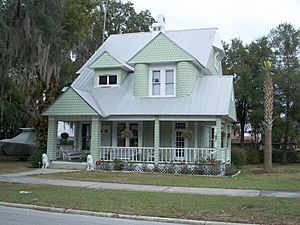
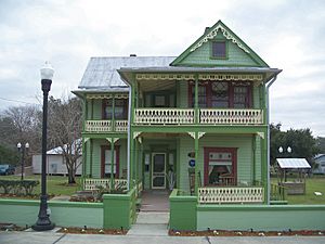
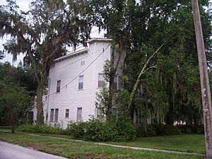
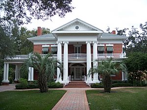
Many of Bartow's historic buildings have a Southern feel, with tall oak trees and azalea bushes. But you can also see different styles of architecture. The historic homes often feature simple masonry (brick or stone) or various "revival" styles that bring back older designs. Downtown Bartow has many wooden buildings and classical revival styles.
Other buildings on the National Register of Historic Places include the Thompson and Company Cigar Factory, built in a Mission Revival Style. The L.B. Brown House is special because it might be the only house still standing in Florida that was built by a freedman (a formerly enslaved person). The Old Polk County Courthouse, which is on Bartow's city seal, was built in 1909 in a neoclassical style. Inside, the Polk County Historical Museum shows local history from ancient times to today, and has a library for history and family research.
Florida Senator Spessard L. Holland was born in Bartow. His home is on South Broadway. He helped start the Holland and Knight Law Firm.
Other interesting buildings in Bartow include the Wonder House at 1075 Mann Road. It has natural air-conditioning and hidden outdoor bathtubs. The current owners are fixing it up to open a museum. The Thomas Lee Wilson House, also called the Stanford Inn, was used in the movie My Girl. The house at 935 South Oak Avenue, known as "Windsweep," was used in the movie China Moon.
Sports and Fun Activities
Many fun things to do in Bartow involve being outdoors, thanks to the warm climate. The City of Bartow Department of Parks and Recreation has eighteen parks. Mary Holland Park, named after a former Florida governor's wife, is a large park with three lakes, a playground, and a skateboard park. The Bartow Civic Center has meeting rooms, concert areas, and a public pool. Bartow Park is a big complex with fields for softball, baseball, and soccer, plus a track for remote control cars. The Bartow Golf Course is a 72-par course designed by a famous architect, Donald Ross.
The Tour de Tow is a bike ride held every September. The Fort Fraser Trail is a 7.7-mile (12.4 km) path that goes from Bartow to South Lakeland. This path used to be a railroad line and is popular for biking, jogging, and skating. There are plans to build a copy of the historic Fort Fraser along the path and add historical markers. The trail also has picnic areas and rest stops.
Polk County has over 550 lakes. Most of these were once mining areas. Only 88 lakes are open to the public for boating. The area is famous for largemouth bass fishing, and tournaments happen almost every week. Some lakes on the east side of Bartow are known for catching many largemouth bass in a single day.
Education
The schools in Bartow are run by the Polk County School Board. However, some of them are older than the school board itself. Bartow High School, which was once called Summerlin Institute, is the oldest high school in the county and one of the oldest in Florida.
In 1923, Union Academy became the first high school for African-American students in Polk County. In 1969, schools in Bartow began to integrate (mix students of all races). Union Academy then became a middle school. In 1971, Summerlin Institute officially became Bartow High School.
Currently, there are seven elementary schools and two middle schools that feed into Bartow High School. On the Bartow High School campus, there is also the International Baccalaureate School of Polk County, which offers challenging academic programs. The Summerlin Academy provides a military-focused education.
With the expected growth from the Clear Springs development, at least two new elementary schools and a middle school will likely be built in the next 20 years. A new Polk State College campus, called The PSC Advanced Technology Center at Clear Springs, is also planned to open by 2012.
While Bartow doesn't have its own colleges or universities right now, there are several within 20 miles (32 km). The closest is University of South Florida Polytechnic in Lakeland, which shares a campus with Polk State College. Florida Southern College and Southeastern University are also in Lakeland. Warner University is located east of Bartow in Lake Wales.
Media
Bartow is part of the Tampa/St. Pete television market, which is the 13th largest in the country. There are two AM radio stations in the city: WQXM (1460 AM) and WWBF (1130 AM). These are part of the local Lakeland/Winter Haven radio market. People in Bartow can also listen to radio stations from Tampa Bay and Orlando.
The Polk County Democrat is the only newspaper published in Bartow. It comes out twice a week and started in 1931. The main daily newspaper for the area is The Ledger from Lakeland. Other newspapers like the Tampa Tribune, the News Chief from Winter Haven, Florida, and the Orlando Sentinel are also read in Bartow.
Transportation
Bartow's streets are set up in a grid, like a checkerboard. Main Street runs east-west, and Broadway Avenue runs north-south. Broadway Avenue is also part of U.S. Route 98. Main Street is the old State Road 60.
The main roads that go through Bartow are State Road 60, U.S. Route 17, and U.S. Route 98. State Road 60 is a big highway that connects to both the Gulf and Atlantic coasts. It's the main east-west road through town. It used to go through downtown, but now it follows Van Fleet Drive, bypassing the center of town. This is often called "the 60 Bypass" by locals. Going east on State Road 60 leads to Lake Wales, and going west leads to Tampa.
U.S. 17 is the main north-south road on the east side of town. It's a four-lane highway that goes north to Winter Haven and south to Fort Meade. U.S. 98 joins U.S. 17 for a bit, then briefly joins State Road 60, and then turns north onto Broadway Avenue towards Lakeland. State Road 570, also known as the Polk Parkway, is a toll road about 6 miles (10 km) north of Bartow on U.S. 98. The Polk Parkway connects to Interstate 4, which leads to Tampa and Orlando.
Because Bartow is expected to grow a lot, new road plans are being made. The Central Polk Parkway is a proposed highway that would connect the Polk Parkway with U.S. 17 and State Road 60. The Northern Bartow Connector was planned to go around the north part of town, but it was put on hold. However, the part connecting U.S. 98 and U.S. 17 was finished in 2013.
For air travel, Bartow Executive Airport is available. It has a control tower and three runways. It also has a restaurant with airfield views and an industrial park. Both Tampa International Airport (TPA) and Orlando International Airport (MCO) are within 60 miles (97 km) of Bartow.
Bartow has its own bus system called the Bartow Shuttle, which runs Monday through Friday. The Citrus Connection has buses that serve downtown Bartow from Lakeland. Winter Haven Area Transit also connects Bartow to Winter Haven and Fort Meade.
Library
The Bartow Public Library is part of the Polk County Library Cooperative. It is located at 2150 S. Broadway Ave. The library first opened on May 19, 1897, above the Polk County National Bank. After getting a special grant, the public library opened in its own building on February 8, 1915. It moved to its current location in 1998.
The Polk County Historical and Genealogical Library is inside the Polk County Historical Museum, which is in the historic Old Polk County Courthouse. This library has over 40,000 items about the history and family trees of the eastern United States.
Famous People from Bartow
Since Bartow is the county seat, many government leaders and politicians have lived or worked here. One of the most famous is Spessard Holland, who was a Florida governor and U.S. Senator. He led the state during World War Two and helped create the Twenty-fourth Amendment to the United States Constitution, which stopped the use of poll taxes in federal elections. An elementary school, Spessard L. Holland Elementary, was named after him.
Other important people who grew up or went to school in Bartow include:
- Stephen Grimes, a former Chief Justice of the Florida Supreme Court.
- Katherine Harris, a former Florida Secretary of State who played a key role in the 2000 U.S. Presidential election.
- Adam Putnam, a former U.S. congressman.
A notable military officer from Bartow is four-star general James Van Fleet. He was the commanding officer of the United Nations forces during the Korean War. Other generals connected to Bartow include Albert H. Blanding, who served in World War One, and Confederate General Evander M. Law, who lived in Bartow for 40 years.
Many professional athletes have also been born or lived in Bartow. Some were born at Polk General Hospital, which closed in 1995. Athletes born in Bartow but raised elsewhere in the county include:
- Ray Lewis, an NFL linebacker.
- Tracy McGrady, an NBA guard.
- James "Bubba" Stewart, a motocross star.
Other athletes who grew up and went to school in Bartow include:
- Ken Riley, a former NFL defensive back (who was inducted into the Hall of Fame in 2023).
- Marcus Floyd, another former NFL defensive back.
- Frank Baker, a former Cleveland Indians outfielder.
- Rick Wilson, a former NASCAR driver.
Images for kids
See also
 In Spanish: Bartow (Florida) para niños
 | Isaac Myers |
 | D. Hamilton Jackson |
 | A. Philip Randolph |


