
Ashtabula, Ohio facts for kids
Quick facts for kids
Ashtabula, Ohio
|
|
|---|---|

Bridge Street in Ashtabula Harbor
|
|
| Nickname(s):
Bula, 'Bula
|
|

Ashtabula, Ohio
Location in Ohio

Ashtabula, Ohio
Location in the United States
|
|
| Country | United States |
| State | Ohio |
| County | Ashtabula |
| Government | |
| • Type | Council-manager |
| Area | |
| • Total | 7.92 sq mi (20.53 km2) |
| • Land | 7.77 sq mi (20.11 km2) |
| • Water | 0.16 sq mi (0.41 km2) |
| Elevation | 640 ft (200 m) |
| Population
(2020)
|
|
| • Total | 17,975 |
| • Estimate
(2023)
|
17,785 |
| • Density | 2,314.58/sq mi (893.67/km2) |
| Time zone | UTC-5 (Eastern (EST)) |
| • Summer (DST) | UTC-4 (EDT) |
| ZIP Codes |
44004, 44005
|
| Area code(s) | 440 |
| FIPS code | 39-02638 |
| GNIS feature ID | 2394002 |
Ashtabula is a city in Ashtabula County, Ohio, United States. It is the largest city in the county. The city is located where the Ashtabula River meets Lake Erie. It is about 53 miles (85 km) northeast of Cleveland. In 2020, about 17,975 people lived there. Like many cities in the Rust Belt, its population has decreased since the 1960s. This is due to a decline in factory jobs.
In the mid-1800s, Ashtabula was an important stop on the Underground Railroad. This was a secret network that helped enslaved people escape to freedom in Canada. Later, in the late 1800s, it became a major port for shipping coal on Lake Erie. Coal and iron were brought here from places like the Mesabi Range in Minnesota. Many immigrants from Finland, Sweden, and Italy came to Ashtabula for industrial jobs. Today, Ashtabula holds an annual "Blessing of the Fleet" celebration. This event usually happens in late May or early June at Ashtabula Harbor.
Contents
History
.jpg)
Native American people lived in this area for a long time. After the American Revolutionary War, the United States fought wars to move Native Americans out of the Midwest. This allowed more European Americans to settle in Ohio.
European Americans first settled the area of Ashtabula in 1803. The city officially became a city in 1891. Because it was right on Lake Erie, Ashtabula became an important trading port. It also had several secret safe houses for the Underground Railroad. This was a hidden system that helped enslaved African Americans escape to freedom in Canada. Even though Ohio was a free state, many escaped slaves still felt unsafe. This was especially true after the Fugitive Slave Law of 1850 was passed. This law made people in free states help return escaped slaves.
One of the surviving Underground Railroad sites in Ashtabula is Hubbard House. Escaped slaves would hide in its basement near the lake. Then, they would take a safe boat across Lake Erie to Ontario, Canada, where they would be free.
The city's harbor has been a big port for iron ore and coal since the late 1800s. This was very important for making steel around the Great Lakes. Large ships called 'lakers' brought iron ore from Minnesota. Ashtabula is still a coal port today. You can see a long coal ramp in the harbor. Ore shipments are unloaded from these ships and sent to steel mills in Pennsylvania. However, many industrial jobs have been lost since the late 1900s.
An electric street railroad was built in 1883. But in 1890, the city council took control of it. Soon after, many men tore up the tracks at night.
Many immigrants from Europe came to Ashtabula for factory jobs. These included people from Finland, Sweden, and Italy. They could find work even if they didn't speak much English. In the past, rivalries between these groups affected politics and daily life.
In 1915, Ashtabula was the first city in the U.S. to use a special voting method called proportional representation. This system helped minority groups win political offices. Voters stopped using this system in 1929.
Many people living in Ashtabula today are descendants of these early 20th-century immigrants. The city's population grew until 1970. It has gone down recently because of job losses. Since the late 1900s, more Hispanic or Latino immigrants have moved to the city.
Tragedies

Railroads helped Ashtabula become a successful port. On December 29, 1876, a terrible train accident happened. It was called the Ashtabula River railroad disaster. A train called The Pacific Express was crossing the Ashtabula River bridge. The bridge collapsed, sending the train cars into the frozen creek 150 feet (46 m) below. A fire started from the train's stoves. Out of 159 people, 92 were killed and 64 were hurt.
A rail ferry named Ashtabula used to travel from Ashtabula to Port Burwell, Ontario. The ferry started in 1906 and ran for many years. It sank in September 1959 after hitting another ship.
On August 10, 1958, a natural gas leak caused an explosion in Andover, a nearby town. It destroyed a restaurant and five other buildings. Twenty-one people died, and 15 were injured.
Geography
Ashtabula covers about 7.91 square miles (20.5 km²). Most of this area is land, and a small part is water.
Lake Erie borders Ashtabula to the north. The city has a large harbor where the Ashtabula River flows into the lake. This harbor was mainly used for coal shipping. Ashtabula has two public beaches: Walnut Beach and Lake Shore Park. Lake Shore Park was built during the Great Depression.
The Ashtabula area gets a lot of snow in winter. The average snowfall is about 68 inches (173 cm). Much of this snow comes from "lake-effect snow" bands from the Great Lakes. This happens when cold air moves over warmer lake water.
Demographics
| Historical population | |||
|---|---|---|---|
| Census | Pop. | %± | |
| 1830 | 229 | — | |
| 1840 | 704 | 207.4% | |
| 1850 | 821 | 16.6% | |
| 1860 | 1,418 | 72.7% | |
| 1870 | 1,999 | 41.0% | |
| 1880 | 4,445 | 122.4% | |
| 1890 | 8,338 | 87.6% | |
| 1900 | 12,949 | 55.3% | |
| 1910 | 18,266 | 41.1% | |
| 1920 | 22,082 | 20.9% | |
| 1930 | 23,301 | 5.5% | |
| 1940 | 21,405 | −8.1% | |
| 1950 | 23,696 | 10.7% | |
| 1960 | 24,559 | 3.6% | |
| 1970 | 24,313 | −1.0% | |
| 1980 | 23,354 | −3.9% | |
| 1990 | 21,633 | −7.4% | |
| 2000 | 20,962 | −3.1% | |
| 2010 | 19,124 | −8.8% | |
| 2020 | 17,975 | −6.0% | |
| 2023 (est.) | 17,785 | −7.0% | |
| U.S. Decennial Census | |||
2010 Census Details
In 2010, there were 19,124 people living in Ashtabula. There were 7,746 households, with 4,724 of them being families. The population density was about 2,471 people per square mile (954 per km²).
Most of the people (82.0%) were White. About 8.9% were African American, and 9.3% were Hispanic or Latino.
The average age in the city was 37 years old. About 26.4% of residents were under 18. About 14.7% were 65 or older.
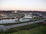
Port
.jpg)

In the 20th century, Ashtabula grew quickly as a major shipping center. This was because of its access to Lake Erie and its long shoreline.
In the 1950s, the area grew with more chemical industries and port activity. This made Ashtabula one of the most important port cities on the Great Lakes. Other industries included making brakes for the Space Shuttle program.
Because of these industries, there was a lot of pollution. The Ashtabula River and harbor were named a "Superfund" site by the Environmental Protection Agency. This meant they needed a big cleanup of toxic waste. The cleanup finished in 2012–2014.
Ashtabula Harbor hosts an annual "Blessing of the Fleet" festival. This tradition started with Catholic fishermen and tugboat workers. They would ask a priest to bless their boats. By 1974, it became a community event. All religious groups and harbor workers in Ashtabula take part.
The United States Coast Guard Station is in Ashtabula. The Ashtabula Maritime & Surface Transportation Museum is also there. It is in the old lighthouse keeper's home and helps preserve the city's history with the lake.
Norfolk Southern used the port for one of its coal piers. This coal pier stopped being used in 2016 because people needed less coal.
Education
The Ashtabula Area School District serves the city. Its high school is Lakeside High School. Kent State University at Ashtabula is also in the city. It is a local campus of Kent State University.
For private schools, Saint John School is a K–12 school. It is part of the Diocese of Youngstown.
Ashtabula has two public libraries. These are the Harbor Topky Memorial Library and a branch of the Ashtabula County District Library.
Media
Ashtabula and Ashtabula County get radio stations from both Cleveland and Erie. There are many different types of radio stations.
Music stations play Soft adult contemporary, Classic rock, country, Classic hits, and oldies.
There are also NPR stations for news and public radio.
Religious stations play Christian worship, Christian talk and teaching, and Urban gospel. There is one ESPN sports station. One Spanish language station also serves the area.
Medical care

Ashtabula County Medical Center (ACMC) is a hospital in Ashtabula County, Ohio. It serves people in the county and nearby areas. ACMC is connected to the Cleveland Clinic system.
The hospital has the county's only unit for mental health care. It also has a sleep disorders lab and many other special services. The "Ashtabula Clinic" next to the hospital offers outpatient care. This includes care for kids, internal medicine, family medicine, heart problems, and many other specialties. In 2008, ACMC added the first heart catheterization lab in Ashtabula County.
Notable people
- Isaac Arthur, board of elections chairman and science communicator
- Jarrod Bunch, National Football League player
- Charles E. Burchfield, watercolor painter
- Edwin Cowles, newspaperman
- William R. Daley, former owner of MLB's Cleveland Indians
- Charles DeBarber, a cyber intelligence analyst on CBS's Hunted (2017 TV series)
- Edward Mason Eggleston, painter and commercial illustrator
- Wallace Wilson Graham. Wisconsin legislator and lawyer
- Robert Lighthizer, 18th United States Trade Representative
- Jesse Fuller McDonald, 16th Governor of Colorado
- Urban Meyer, football coach at the University of Florida and Ohio State University
- Danielle Nicolet, actress
- Don Novello, actor and comedian
- Maila Nurmi, Hollywood actress
- Charles F. Osborn, Wisconsin politician, lawyer and jurist
- Babe Parnell, National Football League player
- Karl A. Peckol, lost in the sinking of the Edmund Fitzgerald
- Paul M. Rippa, lost in the sinking of the Edmund Fitzgerald
- Connie Schultz, Pulitzer Prize-winning author
- Louis C. Shepard, Civil War Medal of Honor recipient
- T-Bone Slim, author and activist
- Freddie Smith, Daytime Emmy Award-winning actor
- John Spano, former owner of the New York Islanders
- Andrew Tombes, Hollywood actor
- Decius Wade, prominent Montana lawyer
- Mark Wagner, Major League Baseball player
Gallery
-
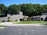
Ashtabula Arts Center
-
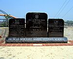
American Merchant Marine Veterans Memorial
-
Ashtabula Lift Bridge viewed from Point Park
-
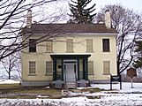
Hubbard House Underground Railroad Museum
-
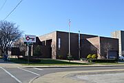
Ashtabula City Hall


See also
 In Spanish: Ashtabula (Ohio) para niños
