
Broad Street (Philadelphia) facts for kids
.jpeg)
View down South Broad Street. City Hall is visible at the vanishing point.
|
|
| Maintained by | PennDOT and City of Philadelphia |
|---|---|
| Length | 12.4 mi (20.0 km) |
| Component highways |
|
| Location | Philadelphia |
| South end | Admiral Peary Way in Navy Yard |
| Major junctions |
South Penn Square/JFK Boulevard at Philadelphia City Hall |
| North end | |
| Construction | |
| Commissioned | 1682 |
_p18_BROAD_STREET,_NORTH_FROM_WALNUT.jpg)


Broad Street is a very important road in Philadelphia, Pennsylvania. It stretches for about 13 miles (21 km). The street starts at Cheltenham Avenue in North Philadelphia. It goes all the way south to the Navy Yard.
Most of Broad Street is part of Pennsylvania Route 611. It runs straight north and south. You can find it between 13th and 15th Streets. Philadelphia City Hall stands right in the middle of Broad Street. This is where Broad Street would normally cross Market Street.
Broad Street is one of the oldest planned streets in the United States. It was designed by Thomas Holme in 1681. It is even listed on the National Register of Historic Places. Many public transportation routes use Broad Street. This includes SEPTA's Broad Street Line subway.
Contents
Broad Street's History: How It Grew

Broad Street has changed a lot since colonial times. Thomas Holme first drew the city plan in 1687. He designed Broad Street to be about 100 feet (30 meters) wide. It was planned to be 13 miles (21 km) long. William Penn wanted City Hall to be in the center square.
During the American Revolution, soldiers often used the street. As Philadelphia grew, Broad Street got longer. It stretched north to Vine Street and south to Dickinson Street. Eventually, it reached the Delaware Waterfront. Today, it is one of the longest straight city roads in the U.S.
Broad Street in the 1800s
In the early 1800s, many rich families lived on Broad Street. Their homes were built in fancy Victorian and Gothic styles. South Broad Street became a hub for the arts. The Academy of Music opened there in 1857. Other important buildings followed. These included a Masonic Temple and the Pennsylvania Academy of the Fine Arts.
Banks and offices also grew around the city center. Tall buildings started to appear. The Baldwin Locomotive Works was on Spring Garden Street. This company, started by Matthias W. Baldwin in 1825, made many steam locomotives. A big change came with the building of Philadelphia City Hall. It stands where Broad and Market Streets meet.
The Industrial Revolution made Philadelphia a trade center. Transportation improved with the Broad Street Station in 1881. Social life was lively on the street. Grand hotels like the Divine Lorraine Hotel were popular. Private clubs were also busy during the Gilded Age.
Broad Street in the 1900s and Beyond
In the 1900s, Broad Street became a cultural hotspot. The first Mummers Parade happened on January 1, 1901. This parade is now a big part of Philadelphia's culture. Jazz and gospel music became popular. This was partly due to the Great Migration.
The Uptown Theater, built in 1927, was a famous spot for jazz and blues. By the 1950s, skyscrapers replaced many homes. Since the 1970s, the street has been updated. Millions of dollars were spent on new lights and sidewalks. Old theaters were restored, and new restaurants opened. In 2015, Mayor Michael Nutter added 41 new light masts to North Broad Street.
Cultural Landmarks on Broad Street
Broad Street has many famous Philadelphia landmarks. The section between Spruce and Market Streets is called the Avenue of the Arts. Here you can find art galleries and theaters. These include the Academy of Music and the Kimmel Center. The Pennsylvania Academy of the Fine Arts is north of City Hall.
The South Philadelphia Sports Complex is at the south end of Broad Street. It has Citizens Bank Park, Lincoln Financial Field, and the Wells Fargo Center. These are home to Philadelphia's sports teams. Older stadiums like JFK Stadium used to be here. The Philadelphia Flyers hockey team is even nicknamed the "Broad Street Bullies."
South of the sports complex, Broad Street ends at the Philadelphia Naval Shipyard. The old offices for The Philadelphia Inquirer newspaper are on Broad Street. The historic Divine Lorraine Hotel is also on North Broad Street. Further north, Broad Street goes through Temple University's campus.
At Clearfield Street, Broad Street crosses the 40th Parallel. This is an important line of latitude around the Earth. The former gym of boxing champion Joe Frazier is also on Broad Street. It is now a furniture store.
Broad Street's Traditions and Events
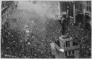
Broad Street is often the route for Philadelphia sports parades. When the Eagles won the Super Bowl LII, the parade was here. For the Phillies' 2008 World Series win, about 2 million people lined the street. The biggest parade was for the Flyers in 1974.
The street is also shut down for the annual Broad Street Run. This 10-mile (16 km) race passes by famous landmarks. Over 35,000 people run it each year. Also, the Mummers Parade takes place on Broad Street every New Year's Day. It goes from Marconi Plaza to City Hall.
Public Transportation on Broad Street

Many public transportation options use Broad Street. The SEPTA Broad Street Line subway runs underneath it. About 137,000 people ride it each weekday. The subway starts at the Fern Rock Transportation Center in North Philadelphia. It goes south through Center City to NRG station in South Philadelphia.
Several SEPTA City Bus routes also run along Broad Street. Routes 4 and 16 follow Broad Street for most of their journeys. The Route 4 bus goes from Pattison Avenue in South Philadelphia to Rising Sun Avenue. The Route 16 bus goes from Philadelphia City Hall north to Cheltenham Avenue.
Other Names for Broad Street
Broad Street has a few other names for different sections:
- Avenue of the Arts: This part is from Glenwood Avenue to Washington Avenue. It has many theaters and concert halls. You can see "AA" lights along the way, which stands for Avenue of the Arts.
- Avenue of the States: From Washington Avenue to Oregon Avenue. Here, you can see flags of all 50 U.S. states flying.
- Southern Boulevard Parkway: This section goes from Oregon Avenue south to Pattison Avenue. It connects Marconi Plaza and FDR Park. This area was designed for the 1926 Sesquicentennial Exposition world's fair.
- C. A. Tindley Boulevard: From South Street to Washington Avenue. This name honors Charles Albert Tindley, who was a pioneer of gospel music. His church, Tindley Temple, is at Broad and Fitzwater Streets.
- Georgie Woods Boulevard: From Diamond Street to York Street.
Major Intersections
The entire street is in Philadelphia, Philadelphia County.
|- |colspan=5 align=center bgcolor="#f2f2f2"|1.000 mi = 1.609 km; 1.000 km = 0.621 mi
| Navy Yard | 0.0 | Admiral Peary Way | This is the very south end of Broad Street. |
| Sports Complex | 0.9 | Exit 17 on I-95; this is where PA 611 officially begins on Broad Street. | |
| 1.1 | You can only exit southbound and enter northbound here. | ||
| 1.3 | |||
| Packer Park | 1.7 | You cannot go southbound to I-76 west here; this is Exit 349 on I-76. | |
| Center City | 4.6 | Penn Square; this is the east end of PA 3. | |
| Chinatown–Callowhill | 5.0 | You can get to these roads using Vine Street. | |
| Hunting Park– Fern Rock |
9.2 | No left turns allowed here. | |
| 9.4 | You can get on and off US 1 via St. Lukes Street and Cayuga Street. | ||
| West Oak Lane– East Oak Lane |
11.8 | PA 611 continues north along Old York Road from here. | |
| 12.4 | This is the very north end of Broad Street. |
Historic Buildings and Places
See also
 In Spanish: Broad Street (Filadelfia) para niños
