Burns, Oregon facts for kids
Quick facts for kids
Burns, Oregon
|
|
|---|---|
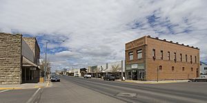
North Broadway Avenue (2008)
|
|
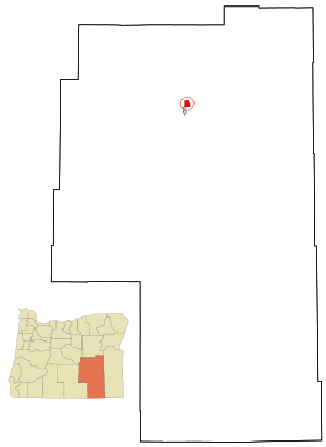
Location within Harney County and Oregon
|
|
| Country | United States |
| State | Oregon |
| County | Harney |
| Incorporated | 1891 |
| Area | |
| • Total | 3.55 sq mi (9.20 km2) |
| • Land | 3.55 sq mi (9.20 km2) |
| • Water | 0.00 sq mi (0.00 km2) |
| Elevation | 4,147 ft (1,264 m) |
| Population
(2020)
|
|
| • Total | 2,730 |
| • Density | 769.01/sq mi (296.90/km2) |
| U.S. Census | |
| Time zone | UTC-8 (Pacific) |
| • Summer (DST) | UTC-7 (Pacific) |
| ZIP code |
97720
|
| Area code | 541 |
| FIPS code | 41-09800 |
| GNIS feature ID | 1118337 |
| Website | City of Burns Oregon |
Burns is a city in Oregon, United States. It is the main town, or county seat, of Harney County. In 2020, about 2,730 people lived there. Burns and the nearby city of Hines are home to most people in this large, quiet county. Harney County is the biggest county in Oregon.
The area around Burns has a dry, desert-like climate now. But long ago, it was much wetter. A huge ancient lake once covered the Harney Basin. Parts of this old lake are now the Malheur National Wildlife Refuge, south of Burns.
For thousands of years, Northern Paiute people lived here. They were hunter-gatherers. When settlers from Europe arrived in the 1800s, cattle ranching became very important. In the 1930s, the timber industry grew, leading to the creation of Hines. Today, ranching and other businesses support the economy. Burns also hosts fun yearly events like a bird festival and a country music jamboree.
Contents
History of Burns, Oregon
Who Lived Here First?
Scientists have found signs that people lived near Burns up to 18,000 years ago. The Burns Paiute Tribe of Harney County are descendants of the Wadatika band of Paiutes. They were hunter-gatherers across central and southern Oregon. The Wadatikas got their name from wada seeds they gathered near Malheur Lake.
Their land stretched from the Cascade Range to near Boise. It also went from the southern Blue Mountains to south of Steens Mountain. In the 1800s, many Paiutes were forced to leave their homes. But some eventually returned to Harney County.
In the 1930s, the Burns Paiute Tribe began buying land near Burns. They also started holding tribal elections. By the late 1960s, the tribe had its own rules and government. In 1972, the Burns Paiute became an independent tribe. This meant they could make agreements with other governments. The tribe owns the Burns Paiute Reservation, which is about 770 acres north of Burns. In 1991, about 200 of the 350 tribal members lived on the reservation.
How Burns and Ranches Grew
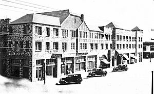
European settlers arrived in the 1800s. Burns was founded in the 1880s. It became an official city after Harney County was created in 1889. George McGowan, an early settler, named the city after the Scottish poet Robert Burns. By 1891, Burns had stores, a post office, and hotels.
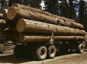
In the 1920s, the timber industry brought many new people. In 1928, the Edward Hines Lumber Company bought rights to cut trees in the Blue Mountains. The company built a 52-mile railroad between Burns and Seneca. Edward Hines also built a large lumber mill and a company town. This town became the City of Hines in 1930. The timber industry was important until the 1990s. Then, the last lumber mill closed because there were not enough trees.
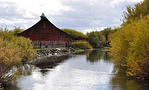
Cattle ranching started in the region as early as the 1860s. It grew after the Desert Land Act of 1877. This law helped people get land in the western United States. They could get 320 acres if they agreed to farm and water the land. Some ranches from the 1800s are still active today. In 2011, farming in Harney County made about $84 million. Most of this money came from selling cattle and alfalfa hay.
Geography of Burns, Oregon
Where is Burns Located?
Harney County is the largest county in Oregon. It covers about 10,000 square miles. But only about 7,600 people live there. Most of these people live in Burns or Hines. Hines is about 2 miles southwest of Burns. In 2010, Burns had about 2,800 residents and Hines had about 1,600. Together, they made up nearly 60 percent of the county's population.
Burns is about 132 miles east of Bend. It is also 132 miles west of Ontario, Oregon. It sits on U.S. Route 20 where it meets U.S. Route 395. Burns is about 200 miles south of Pendleton. Other highways connect Burns to places like the Malheur National Wildlife Refuge.
The city of Burns covers about 3.55 square miles of land. There is no water within the city limits.
What is the Climate Like?
Burns has a dry, semi-arid climate. It gets about 99 days of rain or snow each year. The weather is usually clearest in July and cloudiest in January. On average, Burns gets about 11 inches of rain and 34 inches of snow each year.
The average temperature changes a lot. In December, it's about 24°F (–4°C). In July, it's about 67°F (19°C). High temperatures reach 90°F (32°C) about 24 days a year. Lows drop to 0°F (–18°C) about 11 nights a year. The growing season for plants is about 72 days long.
In January 1950, Burns had about 32 inches of snow during a big storm. The coldest temperature ever recorded in Oregon was –54°F (–48°C) in February 1933. This happened in Seneca, about 45 miles north of Burns. In Burns itself, temperatures have ranged from –30°F (–34°C) to 107°F (42°C).
| Climate data for Burns, Oregon (1991–2020 normals, extremes 1939–present) | |||||||||||||
|---|---|---|---|---|---|---|---|---|---|---|---|---|---|
| Month | Jan | Feb | Mar | Apr | May | Jun | Jul | Aug | Sep | Oct | Nov | Dec | Year |
| Record high °F (°C) | 58 (14) |
67 (19) |
76 (24) |
86 (30) |
94 (34) |
102 (39) |
107 (42) |
104 (40) |
102 (39) |
91 (33) |
71 (22) |
61 (16) |
107 (42) |
| Mean maximum °F (°C) | 47.9 (8.8) |
52.1 (11.2) |
66.4 (19.1) |
75.0 (23.9) |
84.7 (29.3) |
91.8 (33.2) |
98.2 (36.8) |
97.2 (36.2) |
91.4 (33.0) |
79.9 (26.6) |
63.5 (17.5) |
49.1 (9.5) |
99.3 (37.4) |
| Mean daily maximum °F (°C) | 36.7 (2.6) |
41.7 (5.4) |
51.1 (10.6) |
58.1 (14.5) |
68.2 (20.1) |
76.7 (24.8) |
88.7 (31.5) |
87.2 (30.7) |
78.2 (25.7) |
63.1 (17.3) |
47.3 (8.5) |
36.4 (2.4) |
61.1 (16.2) |
| Daily mean °F (°C) | 26.5 (−3.1) |
31.0 (−0.6) |
38.7 (3.7) |
43.9 (6.6) |
52.8 (11.6) |
59.7 (15.4) |
68.6 (20.3) |
66.5 (19.2) |
57.8 (14.3) |
45.6 (7.6) |
34.7 (1.5) |
25.9 (−3.4) |
46.0 (7.8) |
| Mean daily minimum °F (°C) | 16.3 (−8.7) |
20.2 (−6.6) |
26.3 (−3.2) |
29.8 (−1.2) |
37.4 (3.0) |
42.6 (5.9) |
48.6 (9.2) |
45.8 (7.7) |
37.4 (3.0) |
28.0 (−2.2) |
22.1 (−5.5) |
15.5 (−9.2) |
30.8 (−0.7) |
| Mean minimum °F (°C) | −5.0 (−20.6) |
2.6 (−16.3) |
11.7 (−11.3) |
17.4 (−8.1) |
21.6 (−5.8) |
28.2 (−2.1) |
36.3 (2.4) |
32.7 (0.4) |
23.6 (−4.7) |
12.0 (−11.1) |
2.6 (−16.3) |
−6.0 (−21.1) |
−12.7 (−24.8) |
| Record low °F (°C) | −27 (−33) |
−28 (−33) |
−14 (−26) |
10 (−12) |
13 (−11) |
21 (−6) |
25 (−4) |
22 (−6) |
17 (−8) |
−7 (−22) |
−17 (−27) |
−30 (−34) |
−30 (−34) |
| Average precipitation inches (mm) | 1.33 (34) |
0.95 (24) |
0.96 (24) |
0.94 (24) |
1.27 (32) |
0.73 (19) |
0.29 (7.4) |
0.25 (6.4) |
0.38 (9.7) |
0.77 (20) |
1.02 (26) |
1.52 (39) |
10.41 (265.5) |
| Average snowfall inches (cm) | 5.6 (14) |
6.7 (17) |
3.8 (9.7) |
0.7 (1.8) |
0.2 (0.51) |
0.0 (0.0) |
0.0 (0.0) |
0.0 (0.0) |
0.0 (0.0) |
0.4 (1.0) |
6.0 (15) |
10.6 (27) |
34.0 (86) |
| Average precipitation days (≥ 0.01 in) | 10.4 | 10.0 | 10.7 | 9.5 | 9.2 | 5.2 | 2.7 | 2.4 | 3.3 | 6.1 | 10.1 | 11.8 | 91.4 |
| Average snowy days (≥ 0.1 in) | 6.0 | 5.6 | 4.3 | 1.4 | 0.4 | 0.0 | 0.0 | 0.0 | 0.0 | 0.8 | 5.3 | 7.3 | 31.1 |
| Source 1: NOAA | |||||||||||||
| Source 2: NOAA NCEI (snow/snow days 1981–2010) | |||||||||||||
People of Burns
| Historical population | |||
|---|---|---|---|
| Census | Pop. | %± | |
| 1890 | 264 | — | |
| 1900 | 547 | 107.2% | |
| 1910 | 904 | 65.3% | |
| 2000 | 3,064 | — | |
| 2010 | 2,806 | −8.4% | |
| 2020 | 2,730 | −2.7% | |
| source: | |||
In 2010, Burns had 2,806 people living in 1,280 homes. About 24% of homes had children under 18. About 41% were married couples. The average age in Burns was 44.5 years. About 21.5% of residents were under 18.
Arts and Culture in Burns
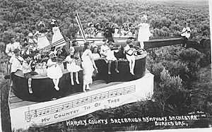
The Harney County Arts in Education Foundation (HCAEF) helps support arts in Burns. They want to build a performing arts center. It would have a 600-seat theater and an art gallery. The Portland Youth Philharmonic, which started in Burns, has performed there.
Each April, Burns hosts the John Scharff Migratory Bird Festival. This event celebrates the many birds that stop in the Harney Basin wetlands. These wetlands are part of the Pacific Flyway, a path for birds. The festival includes tours of the wetlands and classes on bird watching and local history.
In June, the High Desert Fiddlers host a Country Music Jamboree. It takes place at the Harney County Fairgrounds. Musicians of all skill levels can play. Admission is free. There is also food, camping, and dancing. The Fiddlers also have public music sessions on Fridays. They play folk, country, and bluegrass music.
The Harney County Fair happens every September. It lasts about a week. The fair includes a rodeo, a carnival, and horse races. There are also events for groups like 4-H and Future Farmers of America.
The Harney County Historical Museum in Burns shows items from the past. It has old tools, documents, and photos. The museum opened in 1960. It is open from April to September.
Education in Burns
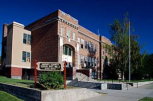
Harney County School District 3 runs the public schools in Burns and Hines. These include Henry L. Slater Grade School, Hines Middle School, and Burns High School.
There is also a branch of Silvies River Charter School in Burns. It is called the Burns Learning Center.
Burns is not in a community college district. However, Treasure Valley Community College has an outreach center in Burns.
The Harney County Library is in Burns. It started in 1903 with only 12 books. By 2013, it had over 30,000 items. The library offers public computers, Wi-Fi, and meeting spaces. It also has books, magazines, and movies.
Media in Burns
The weekly Burns Times-Herald is the only newspaper in the city. In 2006, the newspaper staff bought the paper from its previous owners. This was the first time staff bought a newspaper in Oregon. Two radio stations, KZHC-FM (92.7 FM) and KZHC (1230 AM), broadcast from Burns.
Transportation in Burns
Burns Municipal Airport offers services for small planes. The airport has a 5,100-foot lighted runway. It is 6 miles east of the city. Pony Express provides air freight services.
The Haney County Senior & Community Services Center runs a local bus route. It is called Dial-A-Ride and goes between Burns and Hines. Public Oregon Intercity Transit (POINT) is a bus system that connects cities. It has service between Bend and Ontario. This bus stops in Burns once a day in each direction. The buses are wheelchair friendly and can carry up to 20 passengers.
Notable People from Burns
- Kellen Clemens – a former NFL quarterback
- Norma Paulus – a former Oregon Secretary of State
- Susannah Scaroni – a Paralympic athlete
- Robert Smith – a former member of the United States House of Representatives
- Gene Timms – a former Oregon State Senator
Images for kids
See also
 In Spanish: Burns (Oregón) para niños


