
Camilla, Georgia facts for kids
Quick facts for kids
Camilla, Georgia
|
|
|---|---|

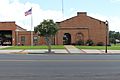
Camilla City Hall
|
|

Location in Mitchell County and the state of Georgia
|
|
| Country | United States |
| State | Georgia |
| County | Mitchell |
| Area | |
| • Total | 6.62 sq mi (17.13 km2) |
| • Land | 6.60 sq mi (17.10 km2) |
| • Water | 0.01 sq mi (0.03 km2) |
| Elevation | 177 ft (54 m) |
| Population
(2020)
|
|
| • Total | 5,187 |
| • Density | 785.67/sq mi (303.34/km2) |
| Time zone | UTC-5 (Eastern (EST)) |
| • Summer (DST) | UTC-4 (EDT) |
| ZIP code |
31730
|
| Area code(s) | 229 |
| FIPS code | 13-12624 |
| GNIS feature ID | 0331312 |
Camilla is a city located in Mitchell County, Georgia, in the United States. It is the main city and the county seat of Mitchell County. According to the 2020 United States census, Camilla had a population of 5,187 people.
Contents
History of Camilla
Camilla became an official city in 1858. It was named after the granddaughter of Henry Mitchell. Henry Mitchell was a general who fought in the American Revolutionary War. Mitchell County itself was named after him.
Early Land and Settlement
Before it became a county, the area where Camilla is now was home to the Creek people. They gave up this land to the United States in 1814. Georgia then used a system called land lotteries to give away plots of land. The lottery in 1820 included the area that would later become Mitchell County. Even though land was free, not many people moved there at first. It took about 40 years, from 1820 to 1857, for enough people to settle there for it to become a separate county. After that, Camilla was chosen as the county seat.
Tornadoes in Camilla
In the early 2000s, Camilla was hit by two strong tornado outbreaks. Both happened very early in the morning while it was still dark. The first one was on February 14, 2000, and the second on March 20, 2003. Both tornadoes affected similar parts of the city.
Camilla's Role in Civil Rights
Camilla has a significant history related to the civil rights movement.
The Camilla Incident of 1868
On September 19, 1868, Camilla was the site of a serious event involving racial tensions. A group of 150 to 300 freedmen (formerly enslaved people) and Republican political leaders marched towards the town's courthouse for a rally. They wanted to promote political and social changes. The local sheriff and a group of white citizens warned the marchers about possible violence. They asked the marchers to give up their guns, even though carrying weapons was common at the time. The marchers refused and continued to the courthouse. There, a group of local white residents, who had been made deputies by the sheriff, fired at them. This attack caused the marchers to run away, and some were chased into nearby swamps. It is estimated that nine to fifteen Black participants were killed, and 40 others were injured. For the next two weeks, white residents went through the countryside, threatening Black people to stop them from voting in the upcoming election. This event was part of a larger pattern of violence in southwest Georgia after the American Civil War.
Marion King's Experience
On July 23, 1962, a group of civil rights activists tried to visit other activists who were jailed in Camilla. During a rally, Marion King, who was the wife of Slater King (a leader in the Albany Movement), was badly hurt by Camilla police guards. She was pregnant and had her young children with her. A song called "Camilla" by Caroline Herring, released in 2012, honors Marion King.
Geography
Camilla is located in the middle of Mitchell County. Its exact location is 31°13′49″N 84°12′33″W / 31.23028°N 84.20917°W.
Roads and Highways
U.S. Route 19 is the main highway that goes through Camilla. It passes east of the downtown area. US 19 goes north about 27 miles to Albany and southeast about 32 miles to Thomasville.
State Routes 37 and 112 both go through the center of Camilla as Broad Street. Route 37 goes east about 27 miles to Moultrie and northwest about 10 miles to Newton. Route 112 goes northeast about 32 miles to Sylvester and south about 26 miles to Cairo. State Route 97 goes southwest from Camilla about 35 miles to Bainbridge.
Area and Water
According to the United States Census Bureau, Camilla covers a total area of about 6.6 square miles. Only a very small part of this area, about 0.01 square miles, is water.
Climate
Camilla has a climate with hot, humid summers and generally mild to cool winters. This type of climate is known as a humid subtropical climate. Camilla gets a good amount of rain throughout the year, which is common for the eastern United States. Because it is located in the southern part of Georgia, its winters are very mild compared to places like Atlanta.
| Climate data for Camilla, Georgia | |||||||||||||
|---|---|---|---|---|---|---|---|---|---|---|---|---|---|
| Month | Jan | Feb | Mar | Apr | May | Jun | Jul | Aug | Sep | Oct | Nov | Dec | Year |
| Mean daily maximum °C (°F) | 17 (62) |
19 (66) |
23 (73) |
27 (80) |
31 (87) |
33 (91) |
33 (92) |
33 (92) |
31 (88) |
27 (81) |
22 (72) |
18 (64) |
26 (79) |
| Mean daily minimum °C (°F) | 4 (39) |
6 (42) |
9 (48) |
12 (54) |
17 (62) |
21 (69) |
22 (71) |
22 (71) |
19 (67) |
13 (55) |
8 (46) |
4 (40) |
13 (55) |
| Average precipitation mm (inches) | 120 (4.6) |
110 (4.5) |
140 (5.5) |
100 (4.1) |
91 (3.6) |
130 (5.1) |
150 (5.9) |
120 (4.8) |
99 (3.9) |
56 (2.2) |
76 (3) |
100 (4) |
1,310 (51.4) |
| Source: Weatherbase | |||||||||||||
Population and Demographics
| Historical population | |||
|---|---|---|---|
| Census | Pop. | %± | |
| 1870 | 289 | — | |
| 1880 | 672 | 132.5% | |
| 1890 | 866 | 28.9% | |
| 1900 | 1,051 | 21.4% | |
| 1910 | 1,827 | 73.8% | |
| 1920 | 2,136 | 16.9% | |
| 1930 | 2,025 | −5.2% | |
| 1940 | 2,588 | 27.8% | |
| 1950 | 3,745 | 44.7% | |
| 1960 | 4,753 | 26.9% | |
| 1970 | 4,987 | 4.9% | |
| 1980 | 5,414 | 8.6% | |
| 1990 | 5,008 | −7.5% | |
| 2000 | 5,669 | 13.2% | |
| 2010 | 5,360 | −5.5% | |
| 2020 | 5,187 | −3.2% | |
| U.S. Decennial Census 1850-1870 1870-1880 1890-1910 1920-1930 1940 1950 1960 1970 1980 1990 2000 2010 |
|||
| Race | Num. | Perc. |
|---|---|---|
| White (non-Hispanic) | 1,148 | 22.13% |
| Black or African American (non-Hispanic) | 3,781 | 72.89% |
| Native American | 6 | 0.12% |
| Asian | 38 | 0.73% |
| Other/Mixed | 103 | 1.99% |
| Hispanic or Latino | 111 | 2.14% |
As of the 2020 United States census, there were 5,187 people living in Camilla. These people lived in 1,926 households, which included 1,325 families.
Education
Camilla is part of the Mitchell County School District. This district serves students from pre-school all the way through twelfth grade.
Mitchell County Schools
The Mitchell County School District has several schools:
- South Mitchell County Elementary School
- North Mitchell County Elementary School
- Mitchell County Middle School
- Mitchell County High School
The district has about 176 full-time teachers and more than 2,855 students. The Mitchell County Head Start Center, which helps young children, opened in 2001.
Other Schools
- Baconton Community Charter School (a public school with more freedom in how it operates)
- Westwood Schools (a private school)
Higher Education
Andersonville Theological Seminary has its main office in Camilla. This seminary offers distance education, meaning students can learn from anywhere. It is accredited by the Association of Independent Christian College and Seminaries.
Government
The City of Camilla is governed by a six-member Council. These council members are elected to serve for four years. Three members are chosen by voters from Council District No. 1, and three members are chosen by voters from Council District No. 2.
The city's mayor is:
- Mayor Kelvin Owens (his term ends on December 31, 2023)
The current council members are:
- W.D. Palmer, III (District 2; term ends December 31, 2025)
- Raymond Dewayne Burley (District 1; term ends December 31, 2025)
- Corey Morgan (District 1; term ends December 31, 2023)
- Steve Collins (District 2; term ends December 31, 2023)
- Venterra Pollard (District 1; term ends December 31, 2025)
- Laura Beth Tucker (District 2; term ends December 31, 2025)
Transportation
Several important roads and highways connect Camilla to other cities in Georgia:
- U.S. Highway 19 is a major route. It links Camilla to Albany to the north and Thomasville to the south.
- Georgia State Route 112 connects Camilla to Cairo in the south and Sylvester to the northeast.
- Georgia State Route 37 connects Camilla to Moultrie to the east.
- Georgia State Route 311 and Georgia State Route 97 connect Camilla to Bainbridge to the southeast.
Notable People
Many interesting people have connections to Camilla:
- Kathryn Stripling Byer (1944–2017), a poet and teacher. She was the Poet Laureate of North Carolina from 2005 to 2009.
- Oscar Branch Colquitt (1861–1940), a former governor of Texas.
- Danny Copeland (born 1966), a former NFL player. He was a defensive back and won the Super Bowl with the Washington Redskins.
- Tiger Flowers (1895–1927), the first Black middleweight boxing champion in the world.
- James Griffin (born 1961), a former NFL safety who played for the Detroit Lions.
- Krysta Harden, who served as the U.S. Deputy Secretary of Agriculture.
- Jumaine Jones (born 1979), a professional basketball forward. He played for Bnei HaSharon in Israel.
- Fred Nixon (born 1958), a former NFL player for the Green Bay Packers.
- Grover Stewart, an NFL defensive tackle.
- Orson Swindle (born 1937), a colonel in the US Marine Corps. He was a POW in Vietnam along with John McCain.
Images for kids
-
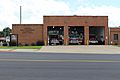
Camilla Fire Department
-
City of Camilla Public Safety Complex, which is attached to the fire station


See also
 In Spanish: Camilla (Georgia) para niños
- Impact of the 2019–20 coronavirus pandemic on the meat industry in the United States
