Canaan facts for kids
Quick facts for kids
|
|
|---|---|
|
region
|
|
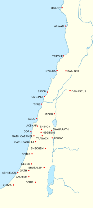
The major Canaanite city states in the Bronze Age
|
|
| Polities and peoples |
|
| Canaanite languages |
|
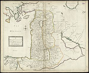
Canaan was an ancient land in the Middle East. It was located in the area we now call the Levant. In the Bible, it is known as the land God promised to Abraham and his family. The Canaanite people lived here from about 2000 BCE. This region today includes parts of Israel, Palestine, Syria, and Lebanon.
Contents
What Was Ancient Canaan?
Canaan included what is now Lebanon, Israel, northwestern Jordan, and some western parts of Syria. Many different groups lived in this area. These included the Ammonites, Moabites, Israelites, and Phoenicians. Even though they had their own cultures, they were all considered Canaanites. These groups were descendants of people who settled in farming villages around 8000 BCE.
Historians are not fully sure what the name Canaan meant. It might have referred to a specific group of people who spoke Semitic languages. Or it could have been the name for their homeland. It might also have been a region controlled by these people. It could even be a mix of all these ideas.
Life in Canaan
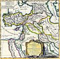
Canaanite civilization grew during long periods of stable weather. Short periods of climate change would sometimes interrupt this. During good times, Canaanites benefited from their location. They were in the middle of major ancient civilizations like Ancient Egypt, Mesopotamia, the Hittites, and Minoan Crete.
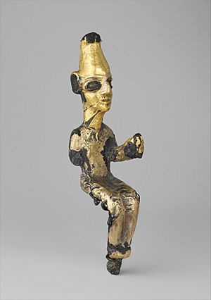
This allowed them to become important city-states. These cities were often run by rich merchants along the coast. Smaller kingdoms in the middle of the land focused on farming. This difference between coastal towns and farming areas was seen in their stories. For example, Canaanite mythology tells of a struggle between the storm god Ba'al Hadad and Yam, the god of the sea.
Early Canaanite cities were often small and surrounded by walls. Farmers grew local plants, olives, grapes for wine, and pistachios. They also grew lots of grain, mainly wheat and barley. In early summer, after the harvest, shepherds would move their flocks. They would graze them on the leftover crops, closer to water. This farming and herding cycle is seen in ancient texts like the Gezer calendar.
Changes in Canaan
Periods of quick climate change often caused problems for this mixed farming system. Instead of growing crops to sell, people would switch to growing just enough food to survive. Herding became a year-round nomadic activity. Tribal groups would travel with their flocks, sometimes north to the Euphrates River or south to the Egyptian delta.
Sometimes, tribal leaders would rise up. They would raid enemy settlements and share the loot with their followers. Or they would charge fees to merchants. If cities fought back, or if a leader lost power, allies would leave. Fighting between tribes would start again. Some historians think the stories of the Patriarchs in the Bible show these kinds of social groups.
During times when big empires like the Akkadian Empire or Ancient Egypt were weak, trade in Canaan slowed down. When the climate became stable again, trade would pick up. First, it would happen along the coast in cities like those of the Philistines and Phoenicians. As trade grew, new routes appeared to avoid high taxes on the coast. These routes went through places like Jerusalem, Samaria, and Galilee. New Canaanite cities grew along these routes.
Later, another trade route developed from Eilath through Edom and Moab to the Arameans in Damascus. Different kingdoms, like Judah and Israel, often tried to control these inland trade routes. But they were usually not very successful.
Eventually, the wealth from this trade attracted powerful neighbors. These included Ancient Egypt, Assyria, the Babylonians, Persians, Greeks, and Romans. These empires would take control of Canaan. They would demand tribute, taxes, and fees. Often, too much grazing by animals would lead to climate problems again. This would cause the cycle to repeat.
Canaanite civilization eventually ended when the area became part of the Greco-Roman world. Later, it became part of the Muslim Arab world. One of the main languages of Canaan, Western Aramaic, is still spoken in some Syrian villages. However, Phoenician disappeared as a spoken language around 100 AD.
Tel Kabri: A Canaanite City
Tel Kabri holds the remains of a Canaanite city from the Middle Bronze Age (2000–1550 BC). This city was the most important in the Western Galilee during that time. It had a large palace in its center. Tel Kabri is special because it's the only Canaanite city that can be fully dug up. This is because no other city was built on top of its ruins after it was abandoned. What's also interesting is that the palace has Minoan-style paintings, showing outside cultural influence.
Who Ruled Canaan?
This is a list of some Canaanite kings and leaders. Some are known from archaeological finds, and others from ancient writings like the Hebrew Bible.
|
Confirmed by Archaeology
|
From the Hebrew Bible and Other Writings
|
Rulers of Tyre
|
Images for kids
-
The name "Canaan" in hieroglyphs on the Merneptah Stele
See also
 In Spanish: Canaán para niños
 | Selma Burke |
 | Pauline Powell Burns |
 | Frederick J. Brown |
 | Robert Blackburn |


